Safety Score: 2,7 of 5.0 based on data from 9 authorites. Meaning we advice caution when travelling to United States.
Travel warnings are updated daily. Source: Travel Warning United States. Last Update: 2024-08-13 08:21:03
Delve into Poplar
Poplar in Mitchell County (North Carolina) is located in United States about 350 mi (or 564 km) south-west of Washington DC, the country's capital town.
Current time in Poplar is now 01:24 PM (Tuesday). The local timezone is named America / New York with an UTC offset of -5 hours. We know of 8 airports close to Poplar, of which 5 are larger airports. The closest airport in United States is Tri Cities Regional Tn Va Airport in a distance of 28 mi (or 45 km), North. Besides the airports, there are other travel options available (check left side).
There is one Unesco world heritage site nearby. It's Great Smoky Mountains National Park in a distance of 35 mi (or 57 km), South. Also, if you like playing golf, there are some options within driving distance. We encountered 1 points of interest near this location. If you need a hotel, we compiled a list of available hotels close to the map centre further down the page.
While being here, you might want to pay a visit to some of the following locations: Erwin, Burnsville, Bakersville, Jonesborough and Elizabethton. To further explore this place, just scroll down and browse the available info.
Local weather forecast
Todays Local Weather Conditions & Forecast: -3°C / 27 °F
| Morning Temperature | -4°C / 24 °F |
| Evening Temperature | -8°C / 17 °F |
| Night Temperature | -9°C / 16 °F |
| Chance of rainfall | 2% |
| Air Humidity | 65% |
| Air Pressure | 1035 hPa |
| Wind Speed | Light breeze with 4 km/h (2 mph) from South-East |
| Cloud Conditions | Overcast clouds, covering 98% of sky |
| General Conditions | Snow |
Tuesday, 3rd of December 2024
6°C (42 °F)
4°C (39 °F)
Light rain, gentle breeze, few clouds.
Wednesday, 4th of December 2024
-1°C (30 °F)
-8°C (17 °F)
Rain and snow, fresh breeze, broken clouds.
Thursday, 5th of December 2024
2°C (35 °F)
-4°C (25 °F)
Few clouds, light breeze.
Hotels and Places to Stay
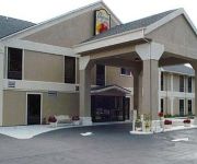
SUPER 8 ERWIN
Videos from this area
These are videos related to the place based on their proximity to this place.
2014 AT Hike Sam's Gap To Erwin (Uncle Johnny's)
Sam's Gap to Noluchucky (Erwin, TN), ~24 MI (2 Days): Day 1. Sam's Gap to Big Bald Shelter, ~8 MI Big Bald is great. Reached the bald in the afternoon. Hiked down to the Bald Mtn Shelter,...
Pleasant Hill Band - Them Blues
Tom Horton on guitar, sings Them Blues along with Beverly Horton on bass and vocals, Terry Barnes on fiddle and vocals and Edison Wallin on banjo. For more information on the Pleasant Hill...
Nolichucky River Whitewater Rafting with NOC
http://noc.com/plan-your-trip/nolichucky-river Watch this video to discover why white water rafting on the Nolichucky River is an experience that challenges rafters with wavy rapids in an...
The Dream Achievers Avon Team
More Information Visit The Dream Achievers: http://tinyurl.com/3kne4x5 As an Avon Representative, you will partner with Avon and be in business for yourself, but not by yourself. The Dream...
Where on Earth is the Nolichucky Gorge?
Get dropped from outer space right into the nasty rapids of the Nolichucky River. This video uses Google Maps to show the exact location of the gorge just downstream from Poplar, North Carolina....
1901 Country Club Dr., Hendersonville, NC
Country Club home for sale, 2400 sq. ft., two levels, Donald Ross designed course Hendersonville, NC, WNC, always 10-20 degrees cooler than were your at, come enjoy the good life in the mountains.
Milligan Cross Country: Nationals Update
The Milligan Cross Country team is slated to run in the 2011 NAIA Cross Country National Championships on Saturday, Nov. 19. Head Coach Chris Layne discussed...
Jing 1st animation -Box Car!
a conclusion of intense self-learning from Sep 3rd to Sep 5th, 2010. hope this skill can be used for traffic planning.
Videos provided by Youtube are under the copyright of their owners.
Attractions and noteworthy things
Distances are based on the centre of the city/town and sightseeing location. This list contains brief abstracts about monuments, holiday activities, national parcs, museums, organisations and more from the area as well as interesting facts about the region itself. Where available, you'll find the corresponding homepage. Otherwise the related wikipedia article.
Unaka Range
The Unaka Range is a mountain range on the border of Tennessee and North Carolina, in the southeastern United States. It is a subrange of the Appalachian Mountains and is part of the Blue Ridge Mountains physiographic province. The Unakas stretch approximately from the Nolichucky River to the south to the Watauga River to the north. The Unakas include the prominent Roan Highlands, where several summits rise above 6,000 feet.


