Safety Score: 2,7 of 5.0 based on data from 9 authorites. Meaning we advice caution when travelling to United States.
Travel warnings are updated daily. Source: Travel Warning United States. Last Update: 2024-08-13 08:21:03
Discover Ephraim Place
Ephraim Place in Mitchell County (North Carolina) is a town in United States about 352 mi (or 567 km) south-west of Washington DC, the country's capital city.
Current time in Ephraim Place is now 09:07 AM (Thursday). The local timezone is named America / New York with an UTC offset of -5 hours. We know of 8 airports near Ephraim Place, of which 5 are larger airports. The closest airport in United States is Tri Cities Regional Tn Va Airport in a distance of 27 mi (or 43 km), North. Besides the airports, there are other travel options available (check left side).
There is one Unesco world heritage site nearby. It's Great Smoky Mountains National Park in a distance of 35 mi (or 57 km), South. Also, if you like playing golf, there are a few options in driving distance. We discovered 1 points of interest in the vicinity of this place. Looking for a place to stay? we compiled a list of available hotels close to the map centre further down the page.
When in this area, you might want to pay a visit to some of the following locations: Erwin, Burnsville, Jonesborough, Bakersville and Elizabethton. To further explore this place, just scroll down and browse the available info.
Local weather forecast
Todays Local Weather Conditions & Forecast: 3°C / 37 °F
| Morning Temperature | 0°C / 33 °F |
| Evening Temperature | 1°C / 34 °F |
| Night Temperature | -1°C / 31 °F |
| Chance of rainfall | 0% |
| Air Humidity | 70% |
| Air Pressure | 1010 hPa |
| Wind Speed | Fresh Breeze with 14 km/h (9 mph) from East |
| Cloud Conditions | Broken clouds, covering 55% of sky |
| General Conditions | Rain and snow |
Thursday, 21st of November 2024
2°C (35 °F)
3°C (37 °F)
Rain and snow, moderate breeze, overcast clouds.
Friday, 22nd of November 2024
5°C (42 °F)
1°C (34 °F)
Overcast clouds, gentle breeze.
Saturday, 23rd of November 2024
13°C (55 °F)
5°C (41 °F)
Scattered clouds, light breeze.
Hotels and Places to Stay
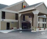
MOUNTAIN INN AND SUITES
SUPER 8 ERWIN
Videos from this area
These are videos related to the place based on their proximity to this place.
Northbound departing Erwin, Tn. (1990)
A CSX northbound freight departing the Erwin, Tn terminal. copyright © 2011 do not use without permission...
2014 AT Hike Sam's Gap To Erwin (Uncle Johnny's)
Sam's Gap to Noluchucky (Erwin, TN), ~24 MI (2 Days): Day 1. Sam's Gap to Big Bald Shelter, ~8 MI Big Bald is great. Reached the bald in the afternoon. Hiked down to the Bald Mtn Shelter,...
Erwin TN Downtown Revitalization Phase 1
Time Lapse of Erwin Downtown Revitalization 5/30/2013 to 10/8/2013.
Remembering Red Peterson
This video goes back a ways, to August 28, 1990. My dad and me visiting Red Peterson at his home in Erwin, TN., and pickin' a few.
05/12/13 - God's Kingdom: The Law of Limitless Love
A sermon presented at First Christian Church in Erwin, TN.
01/04/15 - The Good and Beautiful Community: A Peculiar People
A sermon presented at First Christian Church in Erwin, TN.
02/22/15 - The Good and Beautiful Community: The Worshiping Church
A sermon presented at First Christian Church in Erwin, TN.
Videos provided by Youtube are under the copyright of their owners.
Attractions and noteworthy things
Distances are based on the centre of the city/town and sightseeing location. This list contains brief abstracts about monuments, holiday activities, national parcs, museums, organisations and more from the area as well as interesting facts about the region itself. Where available, you'll find the corresponding homepage. Otherwise the related wikipedia article.
Unicoi County, Tennessee
Unicoi County is a county located in the U.S. state of Tennessee. As of the 2010 census, the population was 18,313. Its county seat is Erwin. Unicoi is a Cherokee word meaning "white," "hazy," "fog-like," or "fog draped. " Unicoi County is part of the Johnson City Metropolitan Statistical Area, which is a component of the Johnson City–Kingsport–Bristol, TN-VA Combined Statistical Area – commonly known as the "Tri-Cities" region.
Banner Hill, Tennessee
Banner Hill is a census-designated place (CDP) in Unicoi County, Tennessee, United States. The population was 1,497 at the 2010 census. It is part of the Johnson City Metropolitan Statistical Area, which is a component of the Johnson City–Kingsport–Bristol, TN-VA Combined Statistical Area – commonly known as the "Tri-Cities" region.
Unaka Range
The Unaka Range is a mountain range on the border of Tennessee and North Carolina, in the southeastern United States. It is a subrange of the Appalachian Mountains and is part of the Blue Ridge Mountains physiographic province. The Unakas stretch approximately from the Nolichucky River to the south to the Watauga River to the north. The Unakas include the prominent Roan Highlands, where several summits rise above 6,000 feet.
Lost Cove, North Carolina
Lost Cove is a ghost town in Yancey County North Carolina. Located on the gorge above the Nolichucky River on the Tennessee - North Carolina border, a boundary dispute and its isolation reportedly made it attractive to moonshiners in the 19th century. It was settled shortly before the Civil War and the last family left in 1958.


