Safety Score: 2,7 of 5.0 based on data from 9 authorites. Meaning we advice caution when travelling to United States.
Travel warnings are updated daily. Source: Travel Warning United States. Last Update: 2024-08-13 08:21:03
Explore Parkwood Estates
The district Parkwood Estates of Tramway in Lee County (North Carolina) is located in United States about 267 mi south-west of Washington DC, the country's capital.
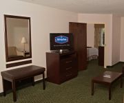
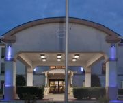
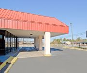
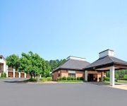
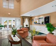
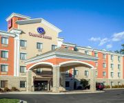
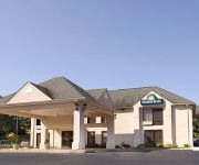
If you need a place to sleep, we compiled a list of available hotels close to the map centre further down the page.
Depending on your travel schedule, you might want to pay a visit to some of the following locations: Sanford, Carthage, Pittsboro, Lillington and Raeford. To further explore this place, just scroll down and browse the available info.
Local weather forecast
Todays Local Weather Conditions & Forecast: 14°C / 58 °F
| Morning Temperature | 6°C / 43 °F |
| Evening Temperature | 12°C / 54 °F |
| Night Temperature | 12°C / 53 °F |
| Chance of rainfall | 0% |
| Air Humidity | 60% |
| Air Pressure | 1017 hPa |
| Wind Speed | Light breeze with 5 km/h (3 mph) from South |
| Cloud Conditions | Overcast clouds, covering 100% of sky |
| General Conditions | Overcast clouds |
Thursday, 28th of November 2024
18°C (65 °F)
11°C (52 °F)
Heavy intensity rain, moderate breeze, overcast clouds.
Friday, 29th of November 2024
11°C (53 °F)
5°C (40 °F)
Light rain, moderate breeze, few clouds.
Saturday, 30th of November 2024
8°C (47 °F)
3°C (37 °F)
Sky is clear, light breeze, clear sky.
Hotels and Places to Stay
Hampton Inn Sanford
Holiday Inn Express & Suites SANFORD
Americas Best Value Inn
Econo Lodge Sanford
BAYMONT INN & SUITES SANFORD
Comfort Suites Sanford
DAYS INN OF SANFORD
Videos from this area
These are videos related to the place based on their proximity to this place.
Tornado in Sanford, NC April 16th 1011
Tornado that hit Sanford, NC on April 16th as it ripped through Sanford...
1996 Toyota Paseo Used Cars Sanford NC
http://www.2ndchanceautonc.com This 1996 Toyota Paseo is available from 2nd Chance Auto NC. For details, call us at 919-356-6338.
1990 Lincoln Town Car Used Cars Sanford NC
http://www.2ndchanceautonc.com This 1990 Lincoln Town Car is available from 2nd Chance Auto NC. For details, call us at 919-356-6338.
1995 Chrysler New Yorker Used Cars Sanford NC
http://www.2ndchanceautonc.com This 1995 Chrysler New Yorker is available from 2nd Chance Auto NC. For details, call us at 919-356-6338.
2001 Chrysler Town & Country Used Cars Sanford NC
http://www.sanfordautobrokers.com This 2001 Chrysler Town & Country is available from Sanford Auto Brokers. For details, call us at 919-708-5443.
2000 Volkswagen Passat Wagon Used Cars Sanford NC
http://www.sanfordautobrokers.com This 2000 Volkswagen Passat Wagon is available from Sanford Auto Brokers. For details, call us at 919-708-5443.
2003 Ford F-150 Used Cars Sanford NC
http://www.sanfordautobrokers.com This 2003 Ford F-150 is available from Sanford Auto Brokers. For details, call us at 919-708-5443.
Videos provided by Youtube are under the copyright of their owners.
Attractions and noteworthy things
Distances are based on the centre of the city/town and sightseeing location. This list contains brief abstracts about monuments, holiday activities, national parcs, museums, organisations and more from the area as well as interesting facts about the region itself. Where available, you'll find the corresponding homepage. Otherwise the related wikipedia article.
Lee County, North Carolina
Lee County is a county located in the U.S. state of North Carolina. As of 2000, the population was 49,040. Its county seat is Sanford.
Sanford, North Carolina
Sanford is a city in Lee County, North Carolina, United States. The population was 23,220 at the 2000 census. It is the county seat of Lee County.
Cameron, North Carolina
Cameron is a town in Moore County, North Carolina in the United States. The population was 151 at the 2000 census.
Broadway, North Carolina
Broadway is a town in Lee County, North Carolina, United States.
Carbonton, North Carolina
Carbonton is an unincorporated community in southwestern Chatham County, North Carolina, United States, along the Deep River. The community lies near the point where Chatham, Lee, and Moore counties come together. The community got its name from the local coal industry that thrived nearby until the early 20th century.
Johnsonville, North Carolina
Johnsonville is an unincorporated community located in the Johnsonville Township of Harnett County, North Carolina. It is located at the intersection of NC 24 and NC 27. It is a part of the Dunn Micropolitan Area, which is also a part of the greater Raleigh–Durham–Cary Combined Statistical Area (CSA) as defined by the United States Census Bureau. Residences in the community typically have a Cameron or Sanford, North Carolina address.
WDCC
WDCC is a college radio station broadcasting a Rhythmic Contemporary Hit Radio format. Licensed to Sanford, North Carolina, USA, the station serves the North Carolina college area. The station is currently owned by Central Carolina Community College.
Gulf, North Carolina
Gulf is an unincorporated community in southwestern Chatham County, North Carolina, United States, south of the town of Goldston. It is located on the Deep River. The community is home to a general store and several historical homes. It received its name from its location, at a wide bend in the Deep River. Gulf is the geographical center of North Carolina.
Lee County High School (Sanford, North Carolina)
Lee County High School is one of two high schools in Sanford, North Carolina. The high school is located on 1708 Nash Street in Sanford and serves grades 9–12. The school mascot is the yellow jacket and the school's colors are navy and gold.
Union Pines High School
50x40pxThis article does not cite any references or sources. Please help improve this article by adding citations to reliable sources. Unsourced material may be challenged and removed. Union Pines High School Location Cameron, North Carolina,, United States Information Type Public 4-year Motto Do it the Viking way Established 1964 Principal Robin Lea Enrollment 1200+ Color(s) Columbia Blue, Navy Blue & White Mascot Viking Information (910) 947-5511 Website http://schoolcenter. mcs.k12. nc.
Coal Glen mine disaster
The Coal Glen Mine Disaster was a coal mine explosion that occurred on May 27, 1925, in Coal Glen, Oakland Township, Chatham County, North Carolina, USA. It is located just north of the city of Sanford, North Carolina. Fifty-three miners died. Attempts at re-opening the mine were made sporadically until the 1950s, but were never financially viable. The mine was permanently closed in 1951.
The Sanford Herald
The Sanford Herald is a newspaper published Tuesdays through Sundays in Sanford, North Carolina. The Sanford Herald has a daily circulation of just over 9,000 and is published every day except Mondays, and has published continuously since 1930. The Herald is a member of the Audit Bureau of Circulations and of the North Carolina Press Association. It is published by the Paxton Media Group of Paducah, Kentucky.
Johnsonville Township, Harnett County, North Carolina
Johnsonville Township is one of thirteen townships in Harnett County, North Carolina, USA. The township had a population of 6,927 according to the 2000 census. It is a part of the Dunn Micropolitan Area, which is also a part of the greater Raleigh–Durham–Cary Combined Statistical Area (CSA) as defined by the United States Census Bureau. Geographically, Johnsonville Township occupies 65.17 square miles in southwestern Harnett County.
Barbecue Township, Harnett County, North Carolina
Barbecue Township is one of thirteen townships in Harnett County, North Carolina, USA. The township had a population of 9,174 according to the 2000 census. It is a part of the Dunn Micropolitan Area, which is also a part of the greater Raleigh–Durham–Cary Combined Statistical Area (CSA) as defined by the United States Census Bureau. Geographically, Barbecue Township occupies 59.66 square miles in southwestern Harnett County.
Olivia, North Carolina
Olivia is an unincorporated community centered in the Barbecue Township of Harnett County, North Carolina but also covering parts of Anderson Creek Township near the Lee County line. It is a part of the Dunn Micropolitan Area, which is also a part of the greater Raleigh–Durham–Cary Combined Statistical Area (CSA) as defined by the United States Census Bureau.
Pineview, North Carolina
Pineview is an unincorporated community located in the Barbecue Township of Harnett County, North Carolina, United States. It is a part of the Dunn Micropolitan Area, which is also a part of the greater Raleigh–Durham–Cary Combined Statistical Area (CSA) as defined by the United States Census Bureau. The community is centered around the intersection of North Carolina Highway 87 and North Carolina Highway 27.
Seminole, North Carolina
Seminole is an unincorporated community located along U.S. Highway 421 in the Upper Little River Township of Harnett County, North Carolina near the county line with Lee County just outside the town of Broadway {{#invoke:Footnotes | harvard_citation }}. It is a part of the Dunn Micropolitan Area, which is also a part of the greater Raleigh–Durham–Cary Combined Statistical Area (CSA) as defined by the United States Census Bureau.
Barbecue, North Carolina
Barbecue is an unincorporated community located in the Barbecue Township of Harnett County, North Carolina. It is a part of the Dunn Micropolitan Area, which is also a part of the greater Raleigh–Durham–Cary Combined Statistical Area (CSA) as defined by the United States Census Bureau.
WWGP
WWGP is a radio station broadcasting a Country music format. Licensed to Sanford, North Carolina, USA, its primary market covers Lee County, Chatham County, Moore County, and Harnett County. The station is currently owned by WWGP Broadcasting and is the AM sister station of WFJA. HISTORY OF W W G P- A M WWGP-AM signed on the air in 1946. It was co-owned by close friends Waldo W. Primm, manager/engineer, and Walter W. Gregory, Rocky Mount, NC, financier, for whom the call letters stand. W. W.
WXKL
WXKL is a radio station broadcasting a Gospel format. Licensed to Sanford, North Carolina, USA. The station is currently owned by Thomas Broadcasting.
WFJA
WFJA "Classic Hits and Oldies 105.5 FM" is a radio station licensed to Sanford, North Carolina, USA. The station is currently owned by WWGP Broadcasting Corporation.
Cumnock, North Carolina
Cumnock is an unincorporated community in northwestern Lee County, North Carolina, United States. It lies on Cumnock Road, about a mile north of U.S. Route 421, and at an elevation of 292 feet (89 m). Endor Iron Furnace is located near the community.
Lemon Springs, North Carolina
Lemon Springs is an unincorporated community in southern Lee County, North Carolina, United States. It lies south of Sanford, and southeast of Tramway. The community is centered around The Fastop Convenience store, the business shares a building with the Fastop Grill. The Greenwood Elementary School is the only one in the Lemon Springs community, before there were closer Middle and High schools, Greenwood was for grades K-12.
Tramway, North Carolina
Tramway, North Carolina, is an area of Lee County, North Carolina which politically forms part of Sanford. It is located on U.S. 1/15/501, north of the road's intersection with North Carolina Highway 78. Its elevation is 499 feet or 152 meters.
Southern Lee High School
Southern Lee High School is one of two high schools in Sanford, North Carolina. The high school is located on 2301 Tramway Road, in Sanford and serves grades 9-12. The school mascot is the cavalier and the school's colors are blue & orange.


