Safety Score: 2,7 of 5.0 based on data from 9 authorites. Meaning we advice caution when travelling to United States.
Travel warnings are updated daily. Source: Travel Warning United States. Last Update: 2024-08-13 08:21:03
Discover Fairfield
The district Fairfield of Smithfield in Johnston County (North Carolina) is a district in United States about 244 mi south of Washington DC, the country's capital city.
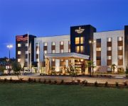
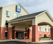
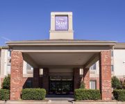
Looking for a place to stay? we compiled a list of available hotels close to the map centre further down the page.
When in this area, you might want to pay a visit to some of the following locations: Goldsboro, Raleigh, Wilson, Lillington and Clinton. To further explore this place, just scroll down and browse the available info.
Local weather forecast
Todays Local Weather Conditions & Forecast: 7°C / 44 °F
| Morning Temperature | -1°C / 30 °F |
| Evening Temperature | 5°C / 41 °F |
| Night Temperature | 5°C / 42 °F |
| Chance of rainfall | 0% |
| Air Humidity | 31% |
| Air Pressure | 1028 hPa |
| Wind Speed | Moderate breeze with 12 km/h (8 mph) from North-East |
| Cloud Conditions | Clear sky, covering 1% of sky |
| General Conditions | Sky is clear |
Thursday, 5th of December 2024
13°C (55 °F)
-1°C (31 °F)
Sky is clear, fresh breeze, clear sky.
Friday, 6th of December 2024
5°C (41 °F)
-0°C (32 °F)
Sky is clear, gentle breeze, clear sky.
Saturday, 7th of December 2024
6°C (43 °F)
3°C (37 °F)
Broken clouds, light breeze.
Hotels and Places to Stay
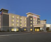
Fairfield Inn & Suites Smithfield Selma/I-95
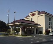
Hampton Inn Selma I-95
Holiday Inn Express & Suites SMITHFIELD - SELMA I-95
BAYMONT INN & SUITES SMITHFIEL
Quality Inn Selma
DAYS INN SELMA
NC Smithfield Country Inn and Suites by Radisson
Comfort Inn Smithfield
Sleep Inn & Suites
BEST WESTERN INN OF SMITHFIELD
Videos from this area
These are videos related to the place based on their proximity to this place.
Big Mike Bail Bonds Smithfield, NC
(919) 934-5656 http://www.bigmikebailbonds.com Sometimes, bad things happen to good people. A small mistake, like having one last drink before closing time at the bar, can land you in the...
Italian Country Farm Abruzzo Rosciano Pescara 8mm Film 1970s
Vintage 8mm film from Italy and Australia - Country Italian Farm life Vinyard Tractor http://www.previewfilms.com.au.
2000 Chevrolet Tahoe Limited/Z71 Used Cars Smithfield NC
http://www.boykinmotors.com This 2000 Chevrolet Tahoe Limited/Z71 is available from Boykin Motors. For details, call us at (919)989-8686.
bicycling the East Coast, entering North Carolina to SmithField
I encountered some bad weather in North Carolina. During the trip north from Key West the weather had been pretty darn near perfect. The average temperture was 80. I got up to Smithfield...
SSS - Spartan Regiment Smithfield Christmas Parade 2012
December 13, 2012 - Kimberly performs with the Smithfield Selma Senior High School Regiment in the Smithfield, NC 2012 Christmas Parade.
2003 GMC Yukon Denali Used Cars Smithfield NC
http://www.boykinmotors.com This 2003 GMC Yukon Denali is available from Boykin Motors. For details, call us at (919)989-8686.
Italy Abruzzo Pescara - 1980's Film 8mm - Small Country town
Vintage 8mm film of Rosciano, Abruzzo Italy - Famly life http://www.previewfilms.com.au.
Old 1970s 8mm Film Country New South Wales Ebor Dorigo Coffs Harbour
Rare 1970s 1980s Footage around country farm Ebor Falls Northern New South Wales http://www.previewfilms.com.au.
6 Afton Lane, Smithfield, NC Presented by Don Anthony.
Click to see more: http://www.searchallproperties.com/listings/2049860/6-Afton-Lane-Smithfield-NC/auto?reqpage=video 6 Afton Lane Smithfield, NC 27577 Contact Don Anthony for more information....
2010 BMW 7-Series Used Cars Smithfield NC
http://www.boykinmotors.com This 2010 BMW 7-Series is available from Boykin Motors. For details, call us at 919-989-8686.
Videos provided by Youtube are under the copyright of their owners.
Attractions and noteworthy things
Distances are based on the centre of the city/town and sightseeing location. This list contains brief abstracts about monuments, holiday activities, national parcs, museums, organisations and more from the area as well as interesting facts about the region itself. Where available, you'll find the corresponding homepage. Otherwise the related wikipedia article.
Johnston County, North Carolina
Johnston County is a county located in the U.S. state of North Carolina. As of the 2010 census the population was 168,878 (a 34% increase since 2000) making it the 77th fastest growing U.S. county with a population of 10,000 or more. Its county seat is Smithfield. The US Office of Management and Budget also includes Johnston County as a part of the Raleigh-Durham-Chapel Hill Combined Statistical Area, which has a population of 1,998,808 as of U.S. Census 2012 Population Estimates .
Four Oaks, North Carolina
Four Oaks is a town in Johnston County, North Carolina, United States. The population was 1,818 at the 2007 census. Four Oaks is the home of the Acorn Festival.
Micro, North Carolina
Micro is a town in Johnston County, North Carolina, United States. The 2008 estimated population was 537. http://www. bestplaces. net/city/Micro_NC-53742620010. aspx
Pine Level, Johnston County, North Carolina
Pine Level Charted 1872 is a town in Johnston County, North Carolina, United States. The population was 1,677 at the 2007 census. http://www. city-data. com/city/Kenly-North-Carolina. html Pine Level is located 35 miles east of Raleigh, the state capital.
Princeton, North Carolina
Princeton is a town in Johnston County, North Carolina, United States. In 2006, the estimated population was 1,093. http://www. city-data. com/housing/houses-Princeton-North-Carolina. html
Selma, North Carolina
Selma is a town in Johnston County, North Carolina, United States. In 2007, the estimated population was 7,008. Selma is part of the Raleigh-Durham-Cary Combined Statistical Area, and the Raleigh-Cary Metropolitan Statistical Area. The area has a population over 1.7 million residents, though the town of Selma is able to maintain its rural character.
Smithfield, North Carolina
Smithfield is a town in Johnston County, North Carolina, United States. In 2010, the estimated population was 12,965. It is the county seat of Johnston County. The city is home to the Ava Gardner Museum and is situated along the Neuse River, where visitors enjoy the annual Smithfield Ham & Yam Festival, walks along the Buffalo Creek Greenway and the historic downtown district.
Wilson's Mills, North Carolina
Wilson's Mills is a town in Johnston County, North Carolina, United States. In 2008, the population was estimated to be 1,598. http://www. city-data. com/city/Wilson-s-Mills-North-Carolina. html
West Smithfield, North Carolina
West Smithfield is an unincorporated community in Johnston County, North Carolina, United States. The population was 59 as of the 2000 census, at which time it was erroneously listed as a census designated place.
Clayton High School (North Carolina)
Clayton High School is a public high school in Clayton, North Carolina.
Ava Gardner Museum
The Ava Gardner Museum is located at 325 East Market Street in historic downtown Smithfield, North Carolina and holds an extensive collection of artifacts from Ava Gardner's career and private life. The original collection was started in 1941 by a fan, Tom Banks, who, at age 12, met Ava on the campus of Atlantic Christian College where she was studying to become a secretary.
WTSB
WTSB is a radio station licensed by the FCC to serve the community of Selma, North Carolina. The station is owned by Lamm Media Group. The station is daytime only, and is a "full service" AM station, providing local news, traffic reports and typical small town full service programming along with country, bluegrass and gospel music.
WMPM
WMPM is an AM station in Smithfield, North Carolina broadcasting at 1270. The station is heavily focused on Johnston County and originally had a traditional country format, with an occasional gospel song thrown in every now and then. That has since changed. WMPM is owned by broadcaster Carl Lamm, who has held onto the station for nearly a half-century and continues to host a weekday afternoon show on sister station WTSB to this day.
North Johnston High School
North Johnston High School Principal Tim Harrell School type Public Location 5915 Us Hwy 301 N ]]Kenly, North Carolina, USA Founded 1965 Grades 9-12 Enrollment 704 School colors Red, Black School mascot Panther North Johnston High School is a public high school in Kenly, North Carolina.
Johnston Community College
Johnston Community College (JCC) is a public, two-year, post-secondary college located at 245 College Road, Smithfield, North Carolina, USA. JCC is located 30 miles east of Raleigh, near the junction of I-95 and US 70. The 175-acre main campus has 11 student buildings, an auditorium capable of seating 1,011 people, a 4,800-square-foot multi-use/banquet hall, four vocational shops/labs, an 16-acre arboretum, and three ponds.
Smithfield-Selma High School
Smithfield-Selma High School is a public high school located in Smithfield, North Carolina. It is locally referred to as simply "SSS" (pronounced 'Triple S'). The school is part of Johnston County Schools.
Clayton Middle School
Clayton Middle School is a school in Johnston County, North Carolina. It teaches students in grades 6-8, aging between 10–14 years old.
Flowers, North Carolina
Flowers is an unincorporated community in Johnston County, North Carolina, west of Jordan, and southeast of Archer Lodge. It lies at an elevation of 289 feet (88 m). While the borders of the community are not well defined, the intersection of Buffalo Road and North Carolina Highway 42 is generally considered the center of the community. Flowers Plantation, a mixed use community being developed on land that once belonged to moonshining kingpin Percy Flowers encompasses much of the community.
Jordan, North Carolina
Jordan is an unincorporated community in Johnston County, North Carolina, off NC 42, and NC 96, east of Flowers. It lies at an elevation of 266 feet (81 m).
Powhatan, North Carolina
Powhatan is an unincorporated community in Johnston County, North Carolina, on U.S. Route 70 Business. It lies at an elevation of 305 feet (93 m).
Stancils Chapel, North Carolina
Stancils Chapel is an unincorporated community in Johnston County, North Carolina on North Carolina Highway 42, and North Carolina Highway 222, east-southeast of Emit. It lies at an elevation of 239 feet (73 m).
WARZ-LD
WARZ-LD is a religious Class-A television station in Smithfield, North Carolina, part of the Raleigh/Durham television market, carrying religious programming from Local, World Harvest Television and Gospel Music Television. It broadcasts on UHF channel 34 digital. WARZ TV34 reaches over 1/2 million people in Johnston, Wake, Wilson, Wayne, Harnett, and Sampson counties in N.C.. The station is a Class-A operation, and switched to digital broadcasting on September 3 2010.
The Clayton Center
The Clayton Center is a performing arts and conference center in Clayton, North Carolina. The center is managed by the Town of Clayton and is located in the same complex as Town Hall at 111 East 2nd Street, Clayton. The venue serves patrons in Johnston County, North Carolina and beyond, drawing heavily from the Triangle area. The building is the former Clayton Elementary School, which closed in 1997.
Princeton High School (North Carolina)
Princeton High School is a public high school located in Princeton, North Carolina, United States. It serves grades 6-12 and is part of the Johnston County Schools district. Princeton High School has 1465 students. Princeton Elementary School, grades K-5, located a few miles away, became a separate school at the start of the 2008-2009 school year. The elementary school's principal is Rhonda Ward, who was promoted during the 2010-2011 school year.
WWPL
WWPL is a radio station licensed to Smithfield, North Carolina broadcasting a contemporary hit radio format. The station is owned by Curtis Media Group.


