Safety Score: 2,7 of 5.0 based on data from 9 authorites. Meaning we advice caution when travelling to United States.
Travel warnings are updated daily. Source: Travel Warning United States. Last Update: 2024-08-13 08:21:03
Discover Sunny Side
Sunny Side in Dare County (North Carolina) is a city in United States about 218 mi (or 351 km) south of Washington DC, the country's capital city.
Local time in Sunny Side is now 07:23 AM (Sunday). The local timezone is named America / New York with an UTC offset of -5 hours. We know of 8 airports in the vicinity of Sunny Side, of which 3 are larger airports. The closest airport in United States is Billy Mitchell Airport in a distance of 48 mi (or 77 km), South. Besides the airports, there are other travel options available (check left side).
Also, if you like golfing, there are a few options in driving distance. We discovered 2 points of interest in the vicinity of this place. Looking for a place to stay? we compiled a list of available hotels close to the map centre further down the page.
When in this area, you might want to pay a visit to some of the following locations: Manteo, Columbia, Currituck, Camden and Elizabeth City. To further explore this place, just scroll down and browse the available info.
Local weather forecast
Todays Local Weather Conditions & Forecast: 12°C / 53 °F
| Morning Temperature | 11°C / 52 °F |
| Evening Temperature | 15°C / 59 °F |
| Night Temperature | 13°C / 56 °F |
| Chance of rainfall | 0% |
| Air Humidity | 68% |
| Air Pressure | 1021 hPa |
| Wind Speed | Fresh Breeze with 16 km/h (10 mph) from South-East |
| Cloud Conditions | Few clouds, covering 11% of sky |
| General Conditions | Few clouds |
Sunday, 24th of November 2024
14°C (57 °F)
15°C (59 °F)
Few clouds, moderate breeze.
Monday, 25th of November 2024
16°C (61 °F)
13°C (55 °F)
Light rain, fresh breeze, scattered clouds.
Tuesday, 26th of November 2024
10°C (50 °F)
12°C (53 °F)
Few clouds, fresh breeze.
Hotels and Places to Stay
White Doe Inn
Cameron House Inn
BEST WESTERN OCEAN REEF SUITE
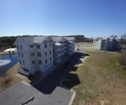
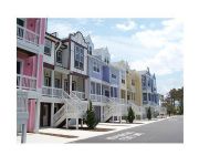
Hamilton Cay at Bermuda Bay by Kees Vacations
Cambridge Cove At Bermuda Bay By Kees Vacations
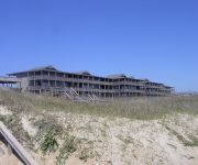
Outer Banks Beach Club I
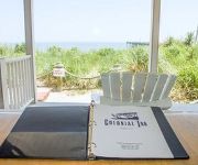
COLONIAL INN
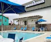
Outer Banks Inn
ELIZABETHAN INN
KEES VACATION HOME COLLECTION
Videos from this area
These are videos related to the place based on their proximity to this place.
Deep Sea Fishing on Rigged Up July 2010 - Manteo, NC
Chartered "Rigged Up" out of Manteo, North Carolina on July 7th, 2010. We had an amazing time, caught a literal boat-load, and claimed bragging rights on the dock that night.
Manteo Skateboarding (A ManteoCity Production)
all the homies at the manteo park just throwing down bangers at the park.
White Doe Inn, Manteo NC
Enjoy this video tour of White Doe Inn, a beautiful bed and breakfast located in the Outer Banks of Manteo, North Carolina.
Shannon & Tony 108 Budleigh Manteo Wedding Photography
Wedding photography by Outer Banks Productions Photography and Video. Wedding is at 108 Budleigh in Manteo, NC on the Outer Banks Roanoke Island. Michelle Haber and Doug Haber are a ...
Piper Arrow landing Manteo, Roanoke Island, NC
Piper Arrow landing KMQI. Manteo, Roanoke Island, NC Dare County. Aug 2007.
Dare County Regional Airport
The Dare County Regional Airport (MQI) is owned by the County of Dare and operated under a nine member Airport Authority. The facility was originally opened as a Naval Auxiliary Air Station...
The Lost Colony outdoor drama -- a 400 year-old mystery
Get lost! See America's #1 outdoor drama, the world's longest running symphonic drama playing since 1937 from June-August in Manteo, NC nestled in the Outer Banks. The 2009 season runs May...
Departure - Dare County Regional Airport (KMQI)
Departure from Dare County Regional Airport - Manteo, North Carolina - Runway 23 (KMQI)
Videos provided by Youtube are under the copyright of their owners.
Attractions and noteworthy things
Distances are based on the centre of the city/town and sightseeing location. This list contains brief abstracts about monuments, holiday activities, national parcs, museums, organisations and more from the area as well as interesting facts about the region itself. Where available, you'll find the corresponding homepage. Otherwise the related wikipedia article.
Roanoke Colony
The Roanoke Colony on Roanoke Island in Dare County, present-day North Carolina, United States was a late 16th-century attempt by Queen Elizabeth I to establish a permanent English settlement. The enterprise was financed and organized originally by Sir Humphrey Gilbert, who drowned in 1583 during an aborted attempt to colonize St. John's, Newfoundland.
Manteo, North Carolina
Manteo is a town in Dare County, North Carolina, United States, located on Roanoke Island. The population was 1,434 at the 2010 census. It is the county seat of Dare County.
Manteo High School
Manteo High School is one of two high schools located in Dare County. The school is located on Roanoke Island at 829 Wingina Avenue, Manteo, North Carolina. Manteo was named after Chief Manteo who assisted the Roanoke Colony, which became known later as the Lost Colony. Renovations were completed on the school in 2007.
Dare County Regional Airport
Dare County Regional Airport is a public airport located one mile (2 km) northwest of the central business district (CBD) of Manteo, a town in Dare County, North Carolina, USA. This general aviation airport covers 340 acres and has two runways. The airport offers a small museum chronicling the history of aviation on the outer banks. The airport is adjacent to the North Carolina Aquarium on Roanoke Island. Although most U.S.
Manteo Cemetery
The Manteo Cemetery is located in Manteo, North Carolina. In 1870, Stephen Wescott was buried in what is today the Manteo Cemetery. He was the first burial at this site. Wescott, along with seven others, were the only burials prior to the turn of the century. The other burials were the fallowing. Frances Dough 1845–1895 Alma Raper Evans August 21, 1896–September 29, 1897 Rosa A. Brinkley Evans December 15, 1842–September 21, 1898 C.E.


