Safety Score: 2,7 of 5.0 based on data from 9 authorites. Meaning we advice caution when travelling to United States.
Travel warnings are updated daily. Source: Travel Warning United States. Last Update: 2024-08-13 08:21:03
Explore Woodville
Woodville in Cherokee County (North Carolina) is a city in United States about 456 mi (or 734 km) south-west of Washington DC, the country's capital.
Local time in Woodville is now 01:00 PM (Thursday). The local timezone is named America / New York with an UTC offset of -5 hours. We know of 8 airports in the vicinity of Woodville, of which 6 are larger airports. The closest airport in United States is McGhee Tyson Airport in a distance of 43 mi (or 70 km), North. Besides the airports, there are other travel options available (check left side).
There is one Unesco world heritage site nearby. It's Great Smoky Mountains National Park in a distance of 79 mi (or 128 km), East. Also, if you like golfing, there are multiple options in driving distance. If you need a place to sleep, we compiled a list of available hotels close to the map centre further down the page.
Depending on your travel schedule, you might want to pay a visit to some of the following locations: Robbinsville, Hayesville, Murphy, Hiawassee and Blairsville. To further explore this place, just scroll down and browse the available info.
Local weather forecast
Todays Local Weather Conditions & Forecast: 7°C / 45 °F
| Morning Temperature | 3°C / 37 °F |
| Evening Temperature | 1°C / 34 °F |
| Night Temperature | -1°C / 31 °F |
| Chance of rainfall | 0% |
| Air Humidity | 44% |
| Air Pressure | 1009 hPa |
| Wind Speed | Moderate breeze with 12 km/h (7 mph) from East |
| Cloud Conditions | Clear sky, covering 1% of sky |
| General Conditions | Sky is clear |
Thursday, 21st of November 2024
5°C (42 °F)
3°C (37 °F)
Light snow, moderate breeze, broken clouds.
Friday, 22nd of November 2024
10°C (49 °F)
3°C (38 °F)
Broken clouds, gentle breeze.
Saturday, 23rd of November 2024
16°C (60 °F)
7°C (44 °F)
Few clouds, calm.
Hotels and Places to Stay
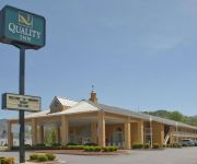
Quality Inn Andrews
Videos from this area
These are videos related to the place based on their proximity to this place.
Ban 18-Wheelers On The Dragon at Deals Gap, NC.
U.S. 129 a.k.a. "The Dragon" is a road connecting Tennessee and North Carolina. A favorite of motorcylists & sports car drivers, it has 318 hairpin turns & switchbacks in 11 miles, making...
Riding The Tail Of The Dragon Hwy 129 South
Riding South on Hwy 129 on the Tail of the Dragon on a 2013 Harley-Davidson Road Glide Custom. See ride to the North at http://youtu.be/A9naL7ntG4U.
RAILROAD SPEEDER RUN ON THE GSMRR #6
IN JUNE 2011 WE RODE FROM ANDREWS TO DILLSBORO NC AND BACK ON THE GREAT SMOKEY MOUNTAIN RR. THE MOTORCAR IS EX -SOUTHERN RR FAIRMONT M9 C-439. IT HAS A 8HP ...
Oil Portrait Painting Demo by Jon Houglum Step 3 (2)
Jon Houglum Demonstrates Oil Portrait Painting Step-by-Step at the FCAC Workshop from Photo of Lincoln Presenter.
Cow Domination
flippin a cow over at snowbird wilderness outfitters aka the most happenest place ever im the one who looks like a freak (i dont usually dress like that)but it was really fun.
My Highlands House, Vacation Home Rental
Nestled in the mountains of Highlands, NC, this lovely vacation cabin has everything to make your friends and family feel at home away from home. Get away from it all and plunge into natural...
1094 Daylily Drive, Marble, NC Presented by Mountain Living Team.
Click to see more: http://www.searchallproperties.com/listings/2050615/1094-Daylily-Drive-Marble-NC/auto?reqpage=video 1094 Daylily Drive Marble, NC 28906 Contact Mountain Living Team for...
Videos provided by Youtube are under the copyright of their owners.
Attractions and noteworthy things
Distances are based on the centre of the city/town and sightseeing location. This list contains brief abstracts about monuments, holiday activities, national parcs, museums, organisations and more from the area as well as interesting facts about the region itself. Where available, you'll find the corresponding homepage. Otherwise the related wikipedia article.
Western Carolina Regional Airport
Western Carolina Regional Airport is a county-owned public-use airport located two nautical miles (3.7 km) west of the central business district of Andrews, in Cherokee County, North Carolina, United States. It was formerly known as Andrews-Murphy Airport. Although many U.S. airports use the same three-letter location identifier for the FAA and IATA, this facility is assigned RHP by the FAA and has no assignment from the IATA. The airport's ICAO identifier is KRHP.
Woodville, Cherokee County, North Carolina
Woodville is an unincorporated community in Cherokee County, North Carolina. It lies at an elevation of 1686 feet (514 m).


