Safety Score: 2,7 of 5.0 based on data from 9 authorites. Meaning we advice caution when travelling to United States.
Travel warnings are updated daily. Source: Travel Warning United States. Last Update: 2024-08-13 08:21:03
Discover Pebble Beach
The district Pebble Beach of New Visitors Center in Carteret County (North Carolina) is a district in United States about 293 mi south of Washington DC, the country's capital city.
Looking for a place to stay? we compiled a list of available hotels close to the map centre further down the page.
When in this area, you might want to pay a visit to some of the following locations: Jacksonville, Beaufort, New Bern, Trenton and Bayboro. To further explore this place, just scroll down and browse the available info.
Local weather forecast
Todays Local Weather Conditions & Forecast: 9°C / 47 °F
| Morning Temperature | 4°C / 40 °F |
| Evening Temperature | 8°C / 47 °F |
| Night Temperature | 8°C / 46 °F |
| Chance of rainfall | 0% |
| Air Humidity | 40% |
| Air Pressure | 1007 hPa |
| Wind Speed | Fresh Breeze with 13 km/h (8 mph) from East |
| Cloud Conditions | Clear sky, covering 5% of sky |
| General Conditions | Sky is clear |
Saturday, 23rd of November 2024
14°C (56 °F)
8°C (47 °F)
Broken clouds, moderate breeze.
Sunday, 24th of November 2024
14°C (56 °F)
11°C (52 °F)
Sky is clear, light breeze, clear sky.
Monday, 25th of November 2024
15°C (60 °F)
13°C (56 °F)
Sky is clear, gentle breeze, clear sky.
Hotels and Places to Stay
Hamp Ste Swansboro Near Camp Lejeun
OCEANVIEW INN
Parkerton Inn
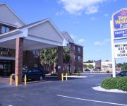
BEST WESTERN PLUS SILVER CREEK
Videos from this area
These are videos related to the place based on their proximity to this place.
191 Ash St, Cedar Point, NC
Come enjoy life on the water in our little paradise.This modular home on pilings overlooking the Intracoastal Waterway,Swansboro Yacht Basin and other fantastic views has loads of room,outbuildings...
GoPro 2012 In Review
2012 was all around a great year for the Droptyne crew! We had some great experiences and learned a lot! This year we will be out all that we can both fishing king Mackerel tournaments and...
Cobia Fishing off Emerald Isle
http://www.emeraldclub2001.com Cobia fishing off the coast of Emerald Isle, NC with Mike, Rick, and Matt on the "Emerald Club 2001".
Cassimir East - Oceanfront Vacation Rental in Outer Banks, NC
Cassimir East is an oceanfront duplex located on North Carolina's Outer Banks in Emerald Isle. This 3B/3BA vacation rental is available year-round starting at $1100 per week. Reserve your...
Seahorse West Sun-Surf Realty Vacation Rental
3 Bedrooms, 2 Baths. Queen, 2 Doubles, Bunk with Double/Twin. Linens provided with beds made (weekly stays only). Central air & heat, Outside shower, Dishwasher, Full size washer & dryer, ...
Life's Gambit Sun-Surf Realty Vacation Rental
4 Bedrooms, 3 Baths. 2 Queens, 4 Twins. 3rd Row. Linens provided (weekly stays only). Central air & heat, Hot & cold enclosed outside shower, Extra den, Reverse floor plan, Dishwasher, Washer...
The Joy of STX Sun Surf Realty Vacation Rental
4 Bedrooms, 3.5 Baths. King, 2 Queens, Bunk, 2 Twins. Premier linens provided with beds made. Beautiful master suite with private balcony. Jenn-Air range. Central air & heat, Hot & cold enclosed...
Mauna Kea East Sun-Surf Vacation Rental
3 Bedrooms, 2 Baths. Queen, 2 Doubles, 2 Twins. Linens provided with beds made (weekly stays only). Central air & heat, Outside shower, Microwave, Washer & dryer, Dishwasher, 2 Color cable...
Emerald Isle Dolphins
These friendly dolphins were spotted playing in the waves in front of our Sun-Surf Realty Vacation Rental Property!! Emerald Isle is a popular destination for dolphins so be sure to visit our...
Videos provided by Youtube are under the copyright of their owners.
Attractions and noteworthy things
Distances are based on the centre of the city/town and sightseeing location. This list contains brief abstracts about monuments, holiday activities, national parcs, museums, organisations and more from the area as well as interesting facts about the region itself. Where available, you'll find the corresponding homepage. Otherwise the related wikipedia article.
Bogue, North Carolina
Bogue is a town in Carteret County, North Carolina, United States. The population was 577 in 2008.
Cape Carteret, North Carolina
Cape Carteret is a town in Carteret County, on the southern coast of North Carolina in the United States. It was incorporated in 1959 and had a population of 1,389 in 2008.
Cedar Point, North Carolina
Cedar Point is a town in Carteret County, North Carolina, United States. The population was 988 in 2007.
Emerald Isle, North Carolina
Emerald Isle is a town in Carteret County, North Carolina, United States. It is part of the Crystal Coast and is located entirely on the Bogue Banks. The population was 3,488 at the 2000 census, but as many as 50,000 visitors inhabit the area during the summer season, filling up vacant rental properties that do not count toward official census results. Today, the oceanfront is lined with both large and small homes.
Indian Beach, North Carolina
You may be looking for Indian Beach, Florida -- which is now part of Sarasota, Florida Indian Beach, North Carolina — Town — Official seal of Indian Beach, North Carolina Location of Indian Beach, North Carolina Coordinates: {{#invoke:Coordinates|coord}}{{#coordinates:34|41|16|N|76|53|29|W|region:US_type:city |primary |name= }} Country United States State North Carolina County Carteret Area • Total 1.5 sq mi (3.9 km) • Land 0.6 sq mi (1.5 km) • Water 0.9 sq mi (2.3 km) Elevation 7 ft (2 m) Population (2009) • Total 93 • Density 159.9/sq mi (61.7/km) Time zone Eastern (EST) • Summer EDT ZIP code 28512 Area code(s) 252 FIPS code 37-33460 GNIS feature ID 1017958 Website http://www.
Peletier, North Carolina
Peletier is a town in Carteret County, North Carolina, United States. The population was 487 at the 2000 census.
Croatan High School
Croatan High School is a public secondary school in Newport, North Carolina. The high school is part of the Carteret County Public Schools system. It serves the westernmost third of Carteret County, including the towns of Peletier, Cape Carteret, Cedar Point and western half of the island of Bogue Banks, which includes the town of Emerald Isle. Ethnically, Croatan's students are 92% White, 5% African-American, 2% Hispanic, and less than 1% other.
Bogue Banks
Bogue Banks form a 21-mile barrier island off the mainland of North Carolina in Carteret County. The island, separated from the mainland by Bogue Sound, runs east to west, with the ocean beaches facing due south.
Bogue Sound
Bogue Sound is a medium-sized geographic sound in the state of North Carolina. The sound separates the Bogue Banks from mainland Carteret County. Morehead City's port is accessed via the Bogue Sound. Two bridges cross the sound: NC 58 on the B. Cameron Langston Bridge and the Atlantic Beach Causeway from Morehead City to Atlantic Beach. The entire sound forms a portion of the Atlantic Intracoastal Waterway.
Gales Creek, North Carolina
The Gales Creek area of Carteret County, North Carolina is part of the greater Newport, North Carolina area. Gales Creek empties into Bogue Sound, which is separated from the Atlantic Ocean by Bogue Banks, part of North Carolina's barrier islands known as the Southern Outer Banks. A Presbyterian Church Camp, Camp Albemarle, is located near the mouth of Gales Creek at the former home of Henry Wilkins Hibbs, 1862-1942, the second mayor of St.
Bear Creek, North Carolina
Bear Creek is an unincorporated community in southwestern Chatham County, North Carolina, United States. It is named for a nearby creek that eventually flows into the Rocky River. The community lies along Old US Highway 421 and is situated between Siler City and Goldston. Bear Creek is home to Chatham Central High School, one of three high schools in the county. It is also home to Southern Supreme, a mail-order gourmet foods company best known for manufacturing fruitcakes.
Broad Creek, North Carolina
The Broad Creek area of Carteret County, North Carolina is part of the greater Newport, North Carolina area. It currently shares the Newport zip code of 28570.
Broad Creek (Bogue Sound)
Broad Creek is a water body bordering the community of Broad Creek, North Carolina. The creek empties into Bogue Sound, which is separated from the Atlantic Ocean by Bogue Banks, part of North Carolina's barrier islands known as the Southern Outer Banks. The creek also runs through the Croatan National Forest.
Gales Creek (North Carolina)
Gales Creek is a creek bordering the communities of Broad Creek and Gales Creek in the U.S. state of North Carolina. Gales Creek empties into Bogue Sound, which is separated from the Atlantic Ocean by Bogue Banks, part of North Carolina's barrier islands known as the Southern Outer Banks. The Creek also runs through the Croatan National Forest. Upstream along Gales Creek and further into the Pocosin, is a camp for youth operated by the Eckerd Youth Alternatives program, Camp E-Ma-Henwu.
Marine Corps Auxiliary Landing Field Bogue
Marine Corps Auxiliary Landing Field Bogue, also known as Bogue Field, is an 875-acre landing field located on Bogue Sound that serves as the Marine Corps’ only East Coast site for Field Carrier Landing Practice (FCLP).
Onslow Bay
Onslow Bay is an indentation of the North Carolina coast, between Cape Fear in the south and Cape Lookout in the north. Thirteen barrier islands form the shore of the bay. It is part of the open Atlantic Ocean and affords no protection from oceanic swells.
WLGP
WLGP is a radio station broadcasting a Christian Radio format as an affiliate of Good News Network. Licensed to Harkers Island, North Carolina, USA, it serves the Greenville-New Bern area. The station is currently owned by Augusta Radio Fellowship Institute, Inc. Programs heard on WLGP include; Grace to You with John MacArthur, In Touch with Charles Stanley, Thru the Bible with J.
Stella, North Carolina
Stella is an unincorporated community in Carteret County, North Carolina, United States.


