Safety Score: 2,7 of 5.0 based on data from 9 authorites. Meaning we advice caution when travelling to United States.
Travel warnings are updated daily. Source: Travel Warning United States. Last Update: 2024-08-13 08:21:03
Delve into West Haven
West Haven in Buncombe County (North Carolina) is located in United States about 386 mi (or 621 km) south-west of Washington DC, the country's capital town.
Current time in West Haven is now 10:41 PM (Monday). The local timezone is named America / New York with an UTC offset of -5 hours. We know of 8 airports close to West Haven, of which 5 are larger airports. The closest airport in United States is Asheville Regional Airport in a distance of 3 mi (or 5 km), South-East. Besides the airports, there are other travel options available (check left side).
There is one Unesco world heritage site nearby. It's Great Smoky Mountains National Park in a distance of 9 mi (or 14 km), North. Also, if you like playing golf, there are some options within driving distance. We encountered 5 points of interest near this location. If you need a hotel, we compiled a list of available hotels close to the map centre further down the page.
While being here, you might want to pay a visit to some of the following locations: Asheville, Hendersonville, Brevard, Marshall and Waynesville. To further explore this place, just scroll down and browse the available info.
Local weather forecast
Todays Local Weather Conditions & Forecast: 14°C / 57 °F
| Morning Temperature | 12°C / 54 °F |
| Evening Temperature | 14°C / 57 °F |
| Night Temperature | 14°C / 57 °F |
| Chance of rainfall | 1% |
| Air Humidity | 98% |
| Air Pressure | 1023 hPa |
| Wind Speed | Light breeze with 3 km/h (2 mph) from North-West |
| Cloud Conditions | Overcast clouds, covering 100% of sky |
| General Conditions | Light rain |
Tuesday, 5th of November 2024
20°C (68 °F)
16°C (61 °F)
Light rain, light breeze, overcast clouds.
Wednesday, 6th of November 2024
24°C (75 °F)
16°C (60 °F)
Light rain, light breeze, broken clouds.
Thursday, 7th of November 2024
23°C (74 °F)
17°C (62 °F)
Sky is clear, light breeze, clear sky.
Hotels and Places to Stay
Hilton Asheville Biltmore Park
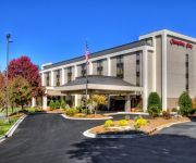
Hampton Inn Asheville I-26 Biltmore Area NC
Quality Inn & Suites Biltmore South
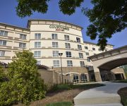
Courtyard Asheville Airport
Holiday Inn ASHEVILLE - BILTMORE WEST
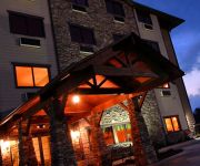
BROOKSTONE LODGE
Brookstone Lodge
Hampton Inn - Suites Asheville - I-26
Fairfield Inn Asheville Airport
Asheville at Asheville Outlet Country Inn Suites
Videos from this area
These are videos related to the place based on their proximity to this place.
Clarion Inn Airport Fletcher NC Hotel Coupon & Discounts
http://freehotelcoupons.com/Fletcher/Clarion%20Inn%20Airport/64418 Clarion Inn hotel in Fletcher NC near Asheville Regional Airport Enjoy a wealth of amenities in a prime location when choosing...
Quality Inn & Suites Arden, NC Hotel Coupon
http://freehotelcoupons.com/Arden/Quality%20Inn%20&%20Suites%20/20500 Quality Inn & Suites Biltmore South (NC358) 1 Skyland Inn Drive, Arden, NC, US, 28704 P...
green's lick trial run
1st run on this trail with some peeps we met in Asheville. Stamps/Red/Matt/Cissy.
Luxury at the Ramble at Biltmore Forest
http://ashevillerealestatehomes.com/theramblebiltmoreforest/ Just a quick look at the walk in closet of a luxury home in the Ramble at Biltmore Forest. For homes available in the Ramble...
Mission Children's Hospital Amazing Learning Garden
On June 2, parents and educators at Estes Elementary school broke ground on a new 8000 square foot Learning Garden. It's a joint venture of Tupelo Honey Cafe, Mission Children's Hospital,...
Google Earth Tour of Biltmore Park
Take a virtual tour of Biltmore Park® Town Square and surrounding Asheville, North Carolina amenities. Stops include the Asheville Regional Airport, Pisgah National Forest, Biltmore Estate,...
Landyachtz Tomahawk Longboarding Part 1
Rideing my Landyachtz Tomahawk Around Biltmore Park, Skyland, NC. Right after i stoped filming i got yelled at by the security that patrols the park.
John F.A.V. Cecil, Biltmore Farms President, on Google Fiber in Biltmore Park
Biltmore Farms President Jack Cecil discusses how Asheville and the Biltmore Park are a perfect match for Google 1 Gigabit fiber connectivity both for residents and business.
Videos provided by Youtube are under the copyright of their owners.
Attractions and noteworthy things
Distances are based on the centre of the city/town and sightseeing location. This list contains brief abstracts about monuments, holiday activities, national parcs, museums, organisations and more from the area as well as interesting facts about the region itself. Where available, you'll find the corresponding homepage. Otherwise the related wikipedia article.
Avery Creek, North Carolina
Avery Creek is a census-designated place (CDP) in Buncombe County, North Carolina, United States. The population was 1,539 in 2007. It is part of the Asheville Metropolitan Statistical Area.
Bent Creek, Buncombe County, North Carolina
Bent Creek is a census-designated place (CDP) in Buncombe County, North Carolina, United States. The population was 1,521 in 2008. Bent Creek is home to world class mountain bike trails within the Pisgah National Forest.
Asheville Regional Airport
Asheville Regional Airport is a Class C airport near Interstate 40 and Interstate 26 near the town of Fletcher, 9 miles south of the city of Asheville, in the U.S. state of North Carolina. It is owned by the city of Asheville. In 2010 it served a total of 735,760 passengers, an increase of 27% over 2009.
North Carolina Arboretum
The North Carolina Arboretum (434 acres) is an arboretum and botanical garden located within the Bent Creek Experimental Forest of the Pisgah National Forest at 100 Frederick Law Olmsted Way, southwest of Asheville, North Carolina near the Blue Ridge Parkway. It is open daily except for Christmas Day. There is no admission charge, but some parking fees do apply.
T. C. Roberson High School
T.C. Roberson is a high school in the Buncombe County Schools System in Asheville, North Carolina. It is located at 250 Overlook Road, Asheville, NC 28803. TC Roberson High School was founded when Valley Springs High School and Biltmore High School were combined to form one high school. It is named for Thomas Crawford Roberson, a former Superintendent of Buncombe County Schools and the architect of the consolidation of 21 county high schools into the 6 county high schools that exist today.


