Safety Score: 2,7 of 5.0 based on data from 9 authorites. Meaning we advice caution when travelling to United States.
Travel warnings are updated daily. Source: Travel Warning United States. Last Update: 2024-08-13 08:21:03
Discover Sunnyside Gardens
Sunnyside Gardens in Queens County (New York) is a place in United States about 209 mi (or 337 km) north-east of Washington DC, the country's capital city.
Current time in Sunnyside Gardens is now 02:24 PM (Friday). The local timezone is named America / New York with an UTC offset of -5 hours. We know of 9 airports near Sunnyside Gardens, of which 4 are larger airports. The closest airport in United States is La Guardia Airport in a distance of 3 mi (or 5 km), North-East. Besides the airports, there are other travel options available (check left side).
There are two Unesco world heritage sites nearby. The closest heritage site in United States is Statue of Liberty in a distance of 4 mi (or 7 km), South-West. Also, if you like playing golf, there are a few options in driving distance. We encountered 10 points of interest in the vicinity of this place. If you need a hotel, we compiled a list of available hotels close to the map centre further down the page.
While being here, you might want to pay a visit to some of the following locations: Manhattan, Brooklyn, Queens, The Bronx and Jersey City. To further explore this place, just scroll down and browse the available info.
Local weather forecast
Todays Local Weather Conditions & Forecast: 10°C / 49 °F
| Morning Temperature | 5°C / 41 °F |
| Evening Temperature | 13°C / 55 °F |
| Night Temperature | 9°C / 48 °F |
| Chance of rainfall | 0% |
| Air Humidity | 33% |
| Air Pressure | 1012 hPa |
| Wind Speed | Gentle Breeze with 9 km/h (5 mph) from South-East |
| Cloud Conditions | Overcast clouds, covering 100% of sky |
| General Conditions | Overcast clouds |
Friday, 15th of November 2024
13°C (55 °F)
9°C (48 °F)
Sky is clear, moderate breeze, clear sky.
Saturday, 16th of November 2024
13°C (55 °F)
11°C (52 °F)
Sky is clear, gentle breeze, clear sky.
Sunday, 17th of November 2024
12°C (54 °F)
11°C (51 °F)
Overcast clouds, moderate breeze.
Hotels and Places to Stay
Moblat Apartments 25-42
The Paper Factory Hotel
The Boro Hotel
Aloft Long Island City-Manhattan View
Hilton Garden Inn Long Island City-Manhattan View
CITY VIEW INN
Courtyard Long Island City/New York Manhattan View
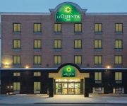
La Quinta Inn Queens (New York City)
Four Points by Sheraton Long Island City/Queensboro Bridge
Fairfield Inn & Suites New York Queens/Queensboro Bridge
Videos from this area
These are videos related to the place based on their proximity to this place.
Dog Training -Freeport Shelter Dogs
the http://www.muttmanners.com crew is training dogs for videos on www.onlinedogtrainers.com, freeport animal shelter School for dog trainers New York Academy for Dog Trainers www.NYADT.com...
Signal Problems
December 11, 2013 00:32 Signal problems on the 7 line caused major headaches to riders all day. Train service resumed, but signals had to be configured to allow trains to pass them until the...
R train at 46th Street
Manhattan-bound R train of R160As and R160Bs arriving at, stopping, and leaving 46th Street. This is a historical video as the R now consists of R46s.
Snowbirds! Train of R62A Cars Pass 46th Street on the Express Track
Under a Winter Plan 4, NYC Transit puts as many trains as possible into underground tunnels in order to prevent ice and snow from building up around critical components. This ensures the trains...
LIRR City Terminal Zone Action at Woodside 9/6/12
Trains to Penn Station, Babylon, Huntington, Long Beach, Ronkonkoma and Port Washington are seen throughout the this video. Enjoy!
LIRR pulls into Woodside
02/27/14 Heading to my friends in Queens to get some stuff again. Caught LIRR train 420 to Broadway here is a short clip of it pulling in Woodside and passing a mainline train bound for Penn...
Long Island City, Queens, NYC: an Emerging Skyline. October 2014
Long Island City, Queens, NYC: an Emerging Skyline. October 2014 MVI 7286 7289 7512.
Woodside Chiefs were a Pop Warner, multi-division, football team from 1955 thru 1965
The Woodside Chiefs, teenage boys, were self funded. Each of us bought our own uniforms and equipment and we all chipped in for our bus fees for away games. http://www.stonegreasers.com/grease.
LIRR Cannonball Express Hauling Through Woodside Station [DM30AC #515 Leading]
Seen here is the seasonal Cannonball Express "Cannonball East" Train service operated by the Long Island Rail Road this train is heading To the Hampton's and Montauk and passing through the...
Manhattan-bound R188 7 Train@Woodside/61st Street
Here's a Manhattan-bound R188 7 train in action at Woodside/61st Street Bus Transfers:Q70 Limited Bus to LaGuardia Airport Connections to LIRR Woodside Station.
Videos provided by Youtube are under the copyright of their owners.
Attractions and noteworthy things
Distances are based on the centre of the city/town and sightseeing location. This list contains brief abstracts about monuments, holiday activities, national parcs, museums, organisations and more from the area as well as interesting facts about the region itself. Where available, you'll find the corresponding homepage. Otherwise the related wikipedia article.
52nd Street (IRT Flushing Line)
52nd Street (also known as 52nd Street – Lincoln Avenue) is a local station on the IRT Flushing Line of the New York City Subway. Located at the intersection of 52nd Street and Roosevelt Avenue in Woodside, Queens, it is served by the 7 train at all times. This elevated station, opened on April 21, 1917, has two side platforms and three tracks. The center express track is used by the rush hour peak direction <7> express train.
46th Street – Bliss Street (IRT Flushing Line)
46th Street – Bliss Street is a local station on the IRT Flushing Line of the New York City Subway. Located at the intersection of 46th Street and Queens Boulevard in Sunnyside, Queens, it is served by the 7 train at all times. This elevated station, opened on April 21, 1917, has three tracks and two side platforms. The center track is used by the rush hour peak direction <7> express train. This is the easternmost station on the IRT Flushing Line's concrete viaduct above Queens Boulevard.
40th Street – Lowery Street (IRT Flushing Line)
40th Street – Lowery Street is a local station on the IRT Flushing Line of the New York City Subway. It has one center exit/entrance with dual fare control and therefore, no free transfer directions, although the station's layout could allow one. It is served by the 7 train at all times. In 1998, the name "Lowery", a former name for 40th Street in 1917 at the time of construction, was removed from the station and maps, but was restored in 2004 as part of a historical move.
Museum of the Moving Image (New York City)
For the former museum of the same name in London, please see Museum of the Moving Image (London). The Museum of the Moving Image is a media museum located in Astoria, Queens in a former building of what is now the Kaufman Astoria Studios. The museum originally opened in 1988 as the American Museum of the Moving Image. The museum began a $67 million expansion in March 2008 and reopened in January 2011. The expansion was designed by architect Thomas Leeser.
Museum for African Art
The Museum for African Art is temporarily closed in preparation for its move to Manhattan. Its former homes included Manhattan and the neighborhood of Long Island City in the borough of Queens in New York City, United States. Founded in 1984, the museum is "dedicated to increasing public understanding and appreciation of African art and culture.
Sunnyside, Queens
Sunnyside is a middle-class and commercial neighborhood in the western portion of the New York City borough of Queens. It shares borders with Hunters Point and Long Island City to the west, Astoria to the north, Woodside to the east and Maspeth to the south. The neighborhood is part of Queens Community District 2, served by Queens Community Board 2.
Sunnyside Yard
Sunnyside Yard is a large coach yard, a railroad yard for passenger cars, in Sunnyside, Queens in New York City.
Madison Square Garden Bowl
Madison Square Garden Bowl was the name of an outdoor arena in the New York City borough of Queens. Built in 1932, the arena hosted circuses and boxing matches. Its seating capacity was 72,000 spectators. It was eventually destroyed after years of disuse. It was located at 48th Street and Northern Boulevard in Long Island City. This was the site where James J. Braddock defeated Max Baer for the World Heavyweight title on June 13, 1935 that was dramatized in the film Cinderella Man.
46th Street (IND Queens Boulevard Line)
46th Street is a local station on the IND Queens Boulevard Line of the New York City Subway. Located at the intersection of 46th Street and Broadway in Astoria, Queens, it is served by the R train at all times except late nights, the M train weekdays and the E train late nights. This underground station, opened on August 19, 1933, has two tracks and two side platforms.
36th Street (IND Queens Boulevard Line)
36th Street is a local station on the IND Queens Boulevard Line of the New York City Subway. Located at the intersection of 36th Street and Northern Boulevard in Queens, it is served by the R train at all times except late nights, when the E train replaces it, and the M train weekdays. This underground station, opened on August 19, 1933, has four tracks and two side platforms. The two center express tracks are used by the F train at all times and the E during daytime hours.
Doughboy Park
Doughboy Park is a 1.71-acre New York City public park in the Woodside neighborhood of Queens. It is located on a hilly parcel of land between Skillman Avenue and Woodside Avenue, and between 54th Street and 56th Street. The park land was originally obtained by the city as a play area for local school P.S. 11 in 1893. During the first World War, local soldiers met here before shipping off to the front in Europe.
Razi School
Razi School is an Islamic school in Woodside, NY. It is in the same building as the Islamic Institute of New York. The school serves its students in grades K-12 in a a building that is rented from Alavi Foundation







!['LIRR Cannonball Express Hauling Through Woodside Station [DM30AC #515 Leading]' preview picture of video 'LIRR Cannonball Express Hauling Through Woodside Station [DM30AC #515 Leading]'](https://img.youtube.com/vi/BYtWGg8SDNo/mqdefault.jpg)


