Safety Score: 2,7 of 5.0 based on data from 9 authorites. Meaning we advice caution when travelling to United States.
Travel warnings are updated daily. Source: Travel Warning United States. Last Update: 2024-08-13 08:21:03
Discover Rockaway Point
Rockaway Point in Queens County (New York) with it's 4,096 citizens is a city in United States about 202 mi (or 325 km) north-east of Washington DC, the country's capital city.
Local time in Rockaway Point is now 03:35 PM (Friday). The local timezone is named America / New York with an UTC offset of -5 hours. We know of 8 airports in the vicinity of Rockaway Point, of which 3 are larger airports. The closest airport in United States is John F Kennedy International Airport in a distance of 9 mi (or 14 km), North-East. Besides the airports, there are other travel options available (check left side).
There are two Unesco world heritage sites nearby. The closest heritage site in United States is Statue of Liberty in a distance of 9 mi (or 15 km), North. Also, if you like golfing, there are a few options in driving distance. We discovered 10 points of interest in the vicinity of this place. Looking for a place to stay? we compiled a list of available hotels close to the map centre further down the page.
When in this area, you might want to pay a visit to some of the following locations: Brooklyn, Queens, Staten Island, Manhattan and Jersey City. To further explore this place, just scroll down and browse the available info.
Local weather forecast
Todays Local Weather Conditions & Forecast: 9°C / 48 °F
| Morning Temperature | 6°C / 43 °F |
| Evening Temperature | 14°C / 57 °F |
| Night Temperature | 10°C / 50 °F |
| Chance of rainfall | 0% |
| Air Humidity | 44% |
| Air Pressure | 1012 hPa |
| Wind Speed | Fresh Breeze with 13 km/h (8 mph) from South-East |
| Cloud Conditions | Overcast clouds, covering 100% of sky |
| General Conditions | Overcast clouds |
Friday, 15th of November 2024
12°C (53 °F)
10°C (50 °F)
Sky is clear, fresh breeze, clear sky.
Saturday, 16th of November 2024
11°C (53 °F)
12°C (54 °F)
Few clouds, moderate breeze.
Sunday, 17th of November 2024
12°C (53 °F)
11°C (52 °F)
Overcast clouds, fresh breeze.
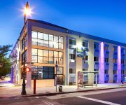
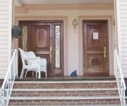
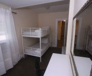
Hotels and Places to Stay
BEST WESTERN PLUS BROOKLYN BAY
Midwood Suites Brooklyn
Delz Bed & Breakfast
Eve's Place
Loralei Bed and Breakfast
Lxure Brooklyn Suites
Avenue Plaza Hotel
Midwood Suites
770Suites
Comfort Inn Brooklyn
Videos from this area
These are videos related to the place based on their proximity to this place.
Observing snowy New York and Manhattan from delta airline 2015
Observing snowy New York and Manhattan from delta airline 2015 Boeing 767 took off from JFK and fly over NYC TilTul http://tiltul.com LinksYouWantToRemember CIMG0548 observing snowy New ...
MTA Bus Nova RTS #8981 Q35 Bus@Rockaway Point Boulevard/Beach 169th Street
Here's a Nova RTS #8981 on the Q35 bus in action at Rockaway Point Boulevard and Beach 169th Street as it makes a U-turn to head towards the Marine Parkway Bridge to Brooklyn Bus Transfer:Q22.
Breezy Point, NY tornado 9-08-12
A tornado hitting Breezy Point in Queens, New York. It hits the beach first then tracks northeast damaging the Breezy Point Surf Club before continuing on across the peninsula. Time of day:...
Breezy Point Tip to Fort Tilden
Bike ride eastbound on Rockaway Point Blvd. from Breezy Point Tip to Fort Tilden. August 3, 2013.
4 Door Wrangler Going into Breezy Point Flood Water After Hurricane
Me and my dad entering Breezy Point after dropping off a stranded retired fireman and his wife to his son at the Marine Park Bridge so he could go to a family members house after his house...
Hurricane Sandy Breezy Point The Rockaways 2012
Just a brief look into their world in the aftermath of Hurricane Sandy. Original photographs and other videos can be found on my website www.cliffordpickett.com I posted a second video, just...
Hurricane Sandy Aftermath (Super Storm Sandy) - Breezy Point, NY 11.9.2012
Not for broadcast- Video shot in the small Queens town of Breezy Point a few days after Hurricane Sandy made land fall. Upon getting there I was floored when I saw first hand, just how much...
4th of July 2013 Breezy Point Rebuild Breezy...rebuilds
https://www.facebook.com/RebuildBreezyPoint.
Breezy Point Hurricane Irene -- bay meeets ocean?
A new inlet strives to connect ocean and bay at Breezy Point, Queens, NY, just a few hours after Hurricane Irene stopped by.
Videos provided by Youtube are under the copyright of their owners.
Attractions and noteworthy things
Distances are based on the centre of the city/town and sightseeing location. This list contains brief abstracts about monuments, holiday activities, national parcs, museums, organisations and more from the area as well as interesting facts about the region itself. Where available, you'll find the corresponding homepage. Otherwise the related wikipedia article.
Rockaway Inlet
Rockaway Inlet is a strait connecting Jamaica Bay, wholly within New York City, with the Atlantic Ocean. It separates the Rockaway Peninsula in Queens from the Floyd Bennett Field in Brooklyn. Rockaway Inlet is bounded by Brooklyn to the north and Rockaway Peninsula to the south. It is the entrance to Jamaica Bay, and most of the inlet is within the boundary of Gateway National Recreation Area. Its entrance is marked by a light on a jetty extending southward from Rockaway Point.
Kingsborough Community College
Kingsborough Community College (KBCC), part of the City University of New York (CUNY) system, is the only community college in Brooklyn, New York. The campus is located at Manhattan Beach, which is at the eastern end of Coney Island. The 71-acre (283,000 m²) campus overlooks Sheepshead Bay, Jamaica Bay, and the Atlantic Ocean. In its early years, it also had an annex, known as the "Mid-Brooklyn campus".
Breezy Point, Queens
Breezy Point is a neighborhood in the New York City borough of Queens, located on the western end of the Rockaway peninsula, between Rockaway Inlet and Jamaica Bay on the landward side, and the Atlantic Ocean. The neighborhood is governed by Queens Community Board 14. The community is run by the Breezy Point Cooperative, in which all residents pay the maintenance, security, and community-oriented costs involved with keeping the community private.
Dead Horse Bay
Dead Horse Bay is a small water body off Barren Island between the Gerritsen Inlet and Rockaway Inlet in the New York City borough of Brooklyn. During the seventeenth century, Dutch settlers built tide mills to grind wheat into flour. A remaining millstone can still be found along the Millstone trail.
WKRB
WKRB (90.3 MHz) is an FM station based in New York City, New York. It is a music based station based at and controlled by Kingsborough Community College in Brooklyn. It also is the official station of the Brooklyn Cyclones, and is a broadcast partner of the New York Islanders hockey club. In 2006, WKRB changed its frequency from 90.9 MHz to 90.3 MHz, but kept its call letters.
Roxbury, Queens
Roxbury is a community on the Rockaway Peninsula in the New York City borough of Queens. The neighborhood is just west of the Marine Parkway Bridge and adjoins Fort Tilden. It is an inholding within the borders of the Breezy Point Unit of Gateway National Recreation Area, of the US National Park System. Roxbury is part of the Breezy Point Cooperative, a private property owning corporation of residents.
Plumb Beach, Brooklyn
Plum Beach (sometimes spelled "Plumb") is a beach and surrounding neighborhood along the north shore of Rockaway Inlet, in the New York City borough of Brooklyn. It is located near the neighborhoods of Sheepshead Bay and Gerritsen Beach, just off the Belt Parkway. Originally an island, Hog Creek was filled in during the late 1930's.
Sheepshead Bay Maritime Service Training Station
The United States Maritime Service Training Station at Sheepshead Bay was opened on September 1, 1942. It closed on February 28, 1954. The station was the largest maritime training station during World War II and was equipped to train 30,000 merchant seamen each year. The site is now occupied by Kingsborough Community College, and has been since the mid 1960s.


