Safety Score: 2,7 of 5.0 based on data from 9 authorites. Meaning we advice caution when travelling to United States.
Travel warnings are updated daily. Source: Travel Warning United States. Last Update: 2024-08-13 08:21:03
Delve into Old Germania Heights
Old Germania Heights in Queens County (New York) is a city located in United States about 208 mi (or 334 km) north-east of Washington DC, the country's capital town.
Current time in Old Germania Heights is now 02:48 PM (Friday). The local timezone is named America / New York with an UTC offset of -5 hours. We know of 9 airports closer to Old Germania Heights, of which 4 are larger airports. The closest airport in United States is La Guardia Airport in a distance of 5 mi (or 8 km), North-East. Besides the airports, there are other travel options available (check left side).
There are two Unesco world heritage sites nearby. The closest heritage site in United States is Statue of Liberty in a distance of 3 mi (or 4 km), South-West. Also, if you like playing golf, there are some options within driving distance. We saw 10 points of interest near this location. In need of a room? We compiled a list of available hotels close to the map centre further down the page.
Since you are here already, you might want to pay a visit to some of the following locations: Brooklyn, Queens, Manhattan, The Bronx and Jersey City. To further explore this place, just scroll down and browse the available info.
Local weather forecast
Todays Local Weather Conditions & Forecast: 10°C / 49 °F
| Morning Temperature | 5°C / 41 °F |
| Evening Temperature | 13°C / 55 °F |
| Night Temperature | 9°C / 48 °F |
| Chance of rainfall | 0% |
| Air Humidity | 33% |
| Air Pressure | 1012 hPa |
| Wind Speed | Gentle Breeze with 9 km/h (5 mph) from South-East |
| Cloud Conditions | Overcast clouds, covering 100% of sky |
| General Conditions | Overcast clouds |
Friday, 15th of November 2024
13°C (55 °F)
9°C (48 °F)
Sky is clear, moderate breeze, clear sky.
Saturday, 16th of November 2024
13°C (55 °F)
11°C (52 °F)
Sky is clear, gentle breeze, clear sky.
Sunday, 17th of November 2024
12°C (54 °F)
11°C (51 °F)
Overcast clouds, moderate breeze.
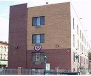
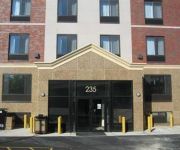
Hotels and Places to Stay
RNYNY - RED CARPET INN BROOKLYN
Kosciuszko Street Apartment
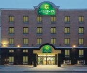
La Quinta Inn Queens (New York City)
BROOKLYN - WILLIAMSBURG
HOTEL LE JOLIE
Henry Norman Hotel
Fairfield Inn New York Long Island City/Manhattan View
CITY VIEW INN
Habitat 101
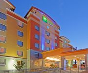
Holiday Inn Express QUEENS - MASPETH
Videos from this area
These are videos related to the place based on their proximity to this place.
ST. LUKES ROOSEVELT EMS AMBULANCE RESPONDING ON W. 40TH ST. & 8TH AVE. IN MIDTOWN, MANHATTAN, NYC.
HERE YOU WILL SEE A ST. LUKES ROOSEVELT EMS AMBULANCE RESPONDING ON WEST 40TH STREET AND 8TH AVENUE IN THE MIDTOWN AREA OF MANHATTAN IN NEW YORK CITY.
Manhattan-bound R160A M Train@Myrtle Avenue/Bway (Street Level)
Here's a wonderful screechin' symphony as the Manhattan-bound R160A M train enter the vincinity of Myrtle Avenue/Bway Train Transfers:J Train to Jamaica Center-Parsons/Archer Bus Transfers:B46.
COMPILATION 04 - SEVERAL VIDEOS OF THE FDNY ON SCENE AT VARIOUS FIRES INSIDE NEW YORK CITY.
HERE YOU WILL SEE A COMPILATION OF SEVERAL VIDEOS OF THE FDNY ON SCENE AT VARIOUS FIRES INSIDE NEW YORK CITY. IN LOVING MEMORY OF MY LITTLE ANGEL HONEY ...
BRAND NEW NYPD UNMARKED FORD FUSION RESPONDING ON W. 42ND ST. IN MIDTOWN, MANHATTAN, NEW YORK CITY.
HERE YOU WILL SEE THE BRAND NEW NYPD UNMARKED FORD FUSION RESPONDING ON WEST 42ND STREET AND MADISON AVENUE IN THE MIDTOWN AREA OF MANHATTAN IN NEW ...
RARELY SEEN FDNY MASKS SERVICES UNIT 2 ON 125TH STREET IN THE HARLEM AREA OF NEW YORK CITY.
HERE YOU WILL SEE A RARE FDNY MASKS SERVICES UNIT 2 ON 125TH STREET IN THE HARLEM AREA OF MANHATTAN IN NEW YORK CITY. IN LOVING MEMORY OF MY LITTLE ANGEL ...
BMT Myrtle Ave Line: R160A-1 M Shuttle Trains at Central Ave (Weekend)
Myrtle Ave bound R160A-1 M Shuttle Train coming from Myrtle-Wyckoff Aves and bypassing Knickerbocker Ave. Note: Due to Station work M Trains in both direction are not stopping at Knickerbocker...
BMT Myrtle Ave Line: R160A-1 M Trains at Central Ave-Myrtle Ave
Note: As you know this is the last day for Central Ave for train service. As of 3-9-13 until 8-9-13 this station will be closed for major station construction/repairs just like when Knickerbocker...
BMT Canarsie Line: R143 L Train at Halsey St-Wyckoff Ave (Weekend)
Manhattan bound R143 L Train coming from Wilson Ave station and entering at Halsey St. Then Manhattan bound L Train leaves Halsey St heading towards Myrtle Ave-Wyckoff Ave as its next station...
BMT Myrtle Ave Line: R160A-1 M Trains at Knickerbocker Ave (Re-Open & New Look)
Note: After 5 months of repair & repaint on this station. Knickerbocker Ave station has re-open but it's been a week since it re-open. Note: Come March through August of 2013 Central Ave...
Baby Mario at Fresh Pond Road
Metropolitan Avenue-bound M shuttle train of R160As arriving at, stopping, and leaving Fresh Pond Road.
Videos provided by Youtube are under the copyright of their owners.
Attractions and noteworthy things
Distances are based on the centre of the city/town and sightseeing location. This list contains brief abstracts about monuments, holiday activities, national parcs, museums, organisations and more from the area as well as interesting facts about the region itself. Where available, you'll find the corresponding homepage. Otherwise the related wikipedia article.
Myrtle–Wyckoff Avenues (New York City Subway)
Myrtle–Wyckoff Avenues is a New York City Subway station complex formed by the intersecting stations of the BMT Canarsie Line and the BMT Myrtle Avenue Line. Served by the L and M trains at all times, it is located at Myrtle Avenue and Wyckoff Avenue in the Bushwick neighborhood of Brooklyn and the Ridgewood neighborhood of Queens (since Wyckoff Avenue between Gates Avenue and Eldert Street forms the border between Brooklyn and Queens).
DeKalb Avenue (BMT Canarsie Line)
DeKalb Avenue is a station on the BMT Canarsie Line of the New York City Subway. Located at the intersection of Wyckoff and DeKalb Avenues in Bushwick, Brooklyn, it is served by the L train at all times. This underground station, opened on December 14, 1928, has two tracks and two side platforms. Each platform has blue columns are regular intervals with every other column having a standard black and white station name plate.
Seneca Avenue (BMT Myrtle Avenue Line)
Seneca Avenue is a station on the BMT Myrtle Avenue Line of the New York City Subway. Located at the intersection of Palmetto Street and Seneca Avenue in Ridgewood, Queens, it is served by the M train at all times. This elevated station, opened on August 9, 1915, has two tracks and an island platform. The platform has a steel canopy supported by black and green columns in the center. It has the unfortunate distinction of being assessed as the MTA's station most in need of repair.
Anthony Bleecker
Anthony Bleecker (October 1770 – 13 March 1827) was a lawyer and author who was friends with Washington Irving and William Cullen Bryant.
Arbitration Rock
The Arbitration Rock was set in 1769 as the boundary marker between the two Long Island townships of Newtown and Bushwick. Since Newtown was in Queens County and Bushwick in Kings County, this rock the size of a Volkswagen Beetle also served to mark the dividing line between these two colonial New York counties. An acrimonious dispute over the boundary lines between the two townships had started as far back as 1661.
Flushing Avenue
Flushing Avenue is an approximately five mile street running through northern Brooklyn and west central Queens beginning at the termination of Nassau Street, on the northern fringe of Fort Greene, Brooklyn, and ending where it merges with Grand Avenue, in Maspeth. It divides the neighborhood of Southside Williamsburg from Clinton Hill and East Williamsburg from Bushwick.
Grover Cleveland High School (New York City)
Grover Cleveland High School is a large, comprehensive high school in Ridgewood, Queens. Grover Cleveland High School, Bayside High School, Samuel J. Tilden High School, Abraham Lincoln High School, John Adams High School, Walton High School, and Andrew Jackson High School were all built during the Great Depression from one set of blueprints, in order to save money.
St. Mary & St. Antonios Coptic Orthodox Church (Ridgewood, Queens)
St Mary and St. Antonios Coptic Orthodox Church is located in Ridgewood, Queens and was the oldest Coptic Orthodox parish in Queens. It is one of over 200 Coptic Orthodox Churches in the United States.
Metropolitan Avenue
Metropolitan Avenue is a major east-west street in Queens and northern Brooklyn. Its western end is at the East River in Williamsburg, Brooklyn, and the eastern end at Jamaica Avenue in Jamaica, Queens. Metropolitan Avenue runs mainly through the neighborhoods of Williamsburg, East Williamsburg in Brooklyn and Ridgewood, Maspeth, Middle Village, Glendale, Forest Hills, Kew Gardens, Richmond Hill and Jamaica in Queens.
Wyckoff Heights, New York
Wyckoff Heights is an area of New York City along the Brooklyn-Queens border in northwest Bushwick / southwest Ridgewood. Wyckoff Heights is home to the Wyckoff Heights Medical Center at Wyckoff Avenue and Stockholm Street (originally the German Hospital of Brooklyn, renamed in 1918), and the former Wyckoff Heights Presbyterian Church at Harman Street and St. Nicholas Avenue (founded in 1895 and rebuilt after a 1928 fire, now the Ridgewood Pentecostal Church).
Famous Accountants
Famous Accountants is a contemporary art gallery located in Ridgewood, Queens near the border with the Bushwick neighborhood of Brooklyn. It was founded in October 2009 by artists Kevin Regan and Ellen Letcher, who opened the space to carry on the community spirit of Austin Thomas's closed Pocket Utopia gallery. The gallery is located in the basement of a building on Gates Avenue that was owned for nearly 15 years by performance artist Genesis P-Orridge.
Wyckoff Heights Medical Center
Wyckoff Heights Medical Center is a 350-bed teaching hospital located in the Wyckoff Heights section of Bushwick, Brooklyn in New York City. The hospital is affiliated with the Weill Cornell Medical College of Cornell University, and is a member of the NewYork-Presbyterian Healthcare System which provides access to physicians and resources.


