Safety Score: 2,7 of 5.0 based on data from 9 authorites. Meaning we advice caution when travelling to United States.
Travel warnings are updated daily. Source: Travel Warning United States. Last Update: 2024-08-13 08:21:03
Delve into Lindenwood
The district Lindenwood of in Queens County (New York) is a subburb in United States about 209 mi north-east of Washington DC, the country's capital town.
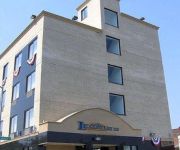
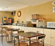
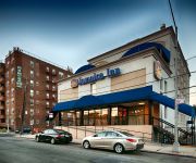
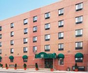
If you need a hotel, we compiled a list of available hotels close to the map centre further down the page.
While being here, you might want to pay a visit to some of the following locations: Queens, Brooklyn, Manhattan, The Bronx and Mineola. To further explore this place, just scroll down and browse the available info.
Local weather forecast
Todays Local Weather Conditions & Forecast: 9°C / 48 °F
| Morning Temperature | 5°C / 42 °F |
| Evening Temperature | 13°C / 55 °F |
| Night Temperature | 9°C / 48 °F |
| Chance of rainfall | 0% |
| Air Humidity | 36% |
| Air Pressure | 1012 hPa |
| Wind Speed | Moderate breeze with 11 km/h (7 mph) from South-East |
| Cloud Conditions | Overcast clouds, covering 100% of sky |
| General Conditions | Overcast clouds |
Saturday, 16th of November 2024
12°C (54 °F)
9°C (48 °F)
Sky is clear, moderate breeze, clear sky.
Sunday, 17th of November 2024
12°C (53 °F)
11°C (52 °F)
Sky is clear, gentle breeze, clear sky.
Monday, 18th of November 2024
12°C (53 °F)
11°C (51 °F)
Overcast clouds, moderate breeze.
Hotels and Places to Stay
Sheraton JFK Airport Hotel
Hilton New York JFK Airport
Crowne Plaza JFK AIRPORT NEW YORK CITY
LEXINGTON INN AT JFK AIRPORT
SUPER 8 JFK AIRPORT NYC
BEST WESTERN JAMAICA INN
Quality Inn Jamaica AirTrain
Hilton Garden Inn Queens-JFK Airport
LA QUINTA INN STE JFK AIRPORT
Howard Johnson Brooklyn
Videos from this area
These are videos related to the place based on their proximity to this place.
East New York , Brooklyn Slushy Lost bike ride!
After snow , sleet and icy rain an East New York Male finds himself at odds with the elements.
MTA NYCT Bus: 1998 Nova-RTS B84 Bus #4965 at Fountain-Flatlands Aves (East New York Bound)
East New York-New Lots Ave bound Nova-RTS B84 Bus #4965 on Fountain Ave coming from Spring Creek-Gateway Mall and turning from Fountain Ave to Flatlands Ave stopping at Fountain Ave bus ...
Terapia De Células Madres Utilizando Células De Grasa - Howard Beach, Ozone Park, Queens NY
Medicina Regenerativa - - Howard Beach, Ozone Park, Queens NY - Benjamin Bieber, MD http://www.crossbaypmr.com (718) 835-0100 Terapia De Células Madres Utilizando Células De Grasa Cross.
KickBoxing Martial Arts MMA Woodhaven, Howard Beach 11414, Ozone Park 11417, Richmond Hill 11418
http://www.MayoMMA.com 718-850-5500 Not all Martial arts schools are created equal. Come try a Intro class before you join. MAYO MARTIAL ARTS ACADEMY offers real martial arts kickboxing that...
Platelet Rich Plasma (PRP) - Howard beach, Ozone Park, Queens NY - Podiatrist Debra Weinstock
Platelet Rich Plasma (PRP) - Howard beach, Ozone Park, Queens NY - Podiatrist Debra Weinstock, DPM http://www.crossbayfootcarecenter.com Call Today (718) 835-0100 Dr. Debra Weinstock of...
IND Ozone Park Line: R46 A Train at 111th St-Greenwood Ave (Brooklyn Bound-Snow)
Note: This was recorded 3-8-13. Brooklyn bound R46 A Train coming from its first station stop Ozone Park-Lefferts Blvd station and entering at 111th St-Greenwood Ave (In the quiet snow)....
Boxing Sparring Mixed Martial Arts Howard Beach NY 11414 Ozone Park 11417 Richmond Hill 11418
http://MayoMMA.com Me & Coach Rico go at it..Coach Rico is 58 years old & is awesome shape!!
Far Rockaway-bound R46 A Train in Ozone Park(IND Rockaway Line)
Here's a Far Rockaway-bound R46 A train in Ozone Park as it departs Rockaway Boulevard via the IND Rockaway Line with a wicked screechin' symphony towards Aqueduct-North Conduit as its next ...
Ice Cream Ozone Park NY Mamita's Ices
Ice Cream Ozone Park NY Mamita's Ices (718) 738-3238 Are you an ice cream connoisseur? Is it a hate-love relationship? Is there always the guilty reminder of calories and fat grams lurking...
IND Ozone Park Line: R46 A Train at 111th St-Greenwood Ave (Ozone Park Bound-Snow)
Note: This was recorded 3-8-13. Ozone Park-Lefferts Blvd bound R46 A Train coming from 104th St-Oxford Ave station and entering at 111th St-Greenwood Ave (In the quiet snow). Then Ozone...
Videos provided by Youtube are under the copyright of their owners.
Attractions and noteworthy things
Distances are based on the centre of the city/town and sightseeing location. This list contains brief abstracts about monuments, holiday activities, national parcs, museums, organisations and more from the area as well as interesting facts about the region itself. Where available, you'll find the corresponding homepage. Otherwise the related wikipedia article.
Ozone Park, Queens
Ozone Park is a middle class neighborhood located in the southwestern section of the New York City borough of Queens bordering Woodhaven, Richmond Hill, South Ozone Park, Howard Beach, and City Line, Brooklyn. Different parts of the neighborhood are covered by Queens Community Board 9 and 10. The northern border is Atlantic Avenue; the southern border is South Conduit Avenue, and the eastern border is 108th Street.
Howard Beach, Queens
Howard Beach is a middle class neighborhood in the southwestern portion of the New York City borough of Queens. It is bordered in the north by the Belt Parkway and South Conduit Avenue in Ozone Park, in the south by Jamaica Bay in Broad Channel, in the east by 102nd–104th Streets, and in the west by 78th Street. The area's houses are similar to Bayside and Hollis. The neighborhood is part of Queens Community Board 10. and home to a large Italian population. The ZIP code of Howard Beach is 11414.
Aqueduct Racetrack
Aqueduct Racetrack (nicknamed the Big A) is a thoroughbred horse-racing facility and racino in South Ozone Park, Queens, New York. Its racing meets usually are from late October/early November through April.
Howard Beach – JFK Airport (IND Rockaway Line)
Howard Beach – JFK Airport is a station on the IND Rockaway Line of the New York City Subway. Located at Coleman Square between 159th Avenue and 103rd Street in Howard Beach, Queens, it is served by the A train at all times.
Shellbank Basin
Shellbank Basin runs south from 157th Avenue on the east side of Cross Bay Boulevard, in Howard Beach, Queens, New York to Jamaica Bay, 165th Avenue and the The Joseph P. Addabbo Memorial Bridge.
Old Howard Beach, Queens
Old Howard Beach is a section of Howard Beach, in the New York City borough of Queens, that lies between Shellbank Basin and Hawtree Creek, to the west of Cross Bay Boulevard. Colemans Square and Charles Park are located in Old Howard Beach. It's referred to as Old Howard Beach since it's the original place in which area founder William Howard built the area's first houses. Old Howard Beach consists of many different types of houses.
Lindenwood, Queens
Lindenwood is a section of Howard Beach in the New York City borough of Queens. This middle class area was developed in the 1950s and 1960s and sits on landfilled land. The neighborhood is part of Queens Community Board 10.
Rockwood Park, Queens
Rockwood Park is a neighborhood in Howard Beach, in the New York City borough of Queens on the west side of Cross Bay Boulevard. It mainly consist of single family homes and is considered to be a more upper class section of Howard Beach. It is commonly referred to as "New Howard" by many residents. The area is situated between 79th and 92 Streest (these are north south streets) and 156th and 164th Avenues (the east west streets). The Q41 bus line serves Rockwood Park.
Howard Park, Queens
Howard Park is a neighborhood in Howard Beach, in the New York City borough of Queens.
Bayside Acacia Cemetery, Queens
The Bayside Cemetery is a cemetery in Queens, New York. It is one of the oldest Jewish cemeteries in New York City. It was founded in the mid-nineteenth century, and among those buried there are many military veterans from the Civil War onward. It is bordered on the east by Acacia Cemetery and on the west by Mokom Sholom Cemetery. Both Acacia Cemetery and Mokom Sholom Cemetery are well maintained by their respective administrations and professional ground crews.
Aqueduct Racetrack (IND Rockaway Line)
Aqueduct Racetrack is a station on the IND Rockaway Line of the New York City Subway. Located on the west side of Aqueduct Racetrack in South Ozone Park, Queens, it is served by northbound A trains but is open only on racing days from 11 a.m. to 7 p.m. This embankment station, opened on June 28, 1956, has four tracks with only the two outer ones in revenue service. Unusually, it has only one platform, located on the northbound side, with one exit leading directly to Aqueduct Racetrack.
Rockaway Boulevard (IND Fulton Street Line)
Rockaway Boulevard is a station on the IND Fulton Street Line of the New York City Subway. Located at the intersection of Rockaway Boulevard, Woodhaven Boulevard/Cross Bay Boulevard, and Liberty Avenue in Ozone Park, Queens, it is served by the A train at all times. This station has two side platforms and three tracks with the middle track not used in revenue service. The platforms have beige windscreens and green and brown canopies.
Euclid Avenue (IND Fulton Street Line)
Euclid Avenue is an express station on the IND Fulton Street Line of the New York City Subway. At the intersection of Euclid Avenue and Pitkin Avenue in Brooklyn, it is served by the A train at all times; the southern terminal for the C train at all times except late nights; and late nights the northern terminal for the Lefferts Boulevard shuttle from Ozone Park, Queens. It is an express station, with four tracks and two island platforms.
Count Fleet Stakes
The Count Fleet Stakes is an American Thoroughbred horse race run at Aqueduct Racetrack, located in Jamaica, New York, at the beginning of January each year. It is the first stakes race of the year run in New York for three-year-olds. Named after Count Fleet, the 1943 Triple Crown winner, the race is open to three year olds willing to race one mile and seventy yards on the inner dirt track.
Aqueduct – North Conduit Avenue (IND Rockaway Line)
Aqueduct – North Conduit Avenue is a station on the IND Rockaway Line of the New York City Subway. Located at North Conduit Avenue near the intersection of Cohancy Street in Ozone Park, it is served at all times by the A train.
80th Street (IND Fulton Street Line)
80th Street (signed as 80th Street – Hudson Street) is a station on the IND Fulton Street Line of the New York City Subway. Located on Liberty Avenue at 80th Street in Ozone Park, Queens, it is served by the A train at all times. This elevated station, opened on September 25, 1915, has two side platforms and three tracks with the center track not used in revenue service. It is the northernmost station in Queens on the IND Fulton Street Line.
Grant Avenue (IND Fulton Street Line)
Grant Avenue is a station on the IND Fulton Street Line of the New York City Subway. Located at the intersection of Grant and Pitkin Avenues in City Line, Brooklyn, it is served by the A train at all times. This station, opened on April 29, 1956 after the IND Fulton Street Line was connected to the Fulton Street Elevated, is the line's southernmost stop in Brooklyn. This station has two tracks and one island platform.
88th Street (IND Fulton Street Line)
88th Street (signed as 88th Street – Boyd Avenue) is a station on the IND Fulton Street Line of the New York City Subway. Located on Liberty Avenue at 88th Street in Ozone Park, Queens, it is served by the A train at all times. This elevated station, opened on September 25, 1915, has two side platforms and three tracks with the center track not used in revenue service.
104th Street (IND Fulton Street Line)
104th Street is a station on the IND Fulton Street Line of the New York City Subway, located on Liberty Avenue at 104th Street in Ozone Park, Queens. The station is served by the A train at all times. The station has three tracks and two side platforms. The middle track is not currently used in revenue service. The exit at the northeast end of the station leads to 104th Street. At the opposite end of the station, there was formerly an exit to 102nd Street, which is now sealed.
John Adams High School (New York City)
For schools with similar names, see Adams High School. John Adams High School File:JohnAdamsJune20.
Fountain Avenue (Brooklyn)
Fountain Avenue, is a north / south street in Brooklyn, New York. Its north end is at Atlantic Avenue near Conduit Avenue. The south end is a site off the Belt Parkway, specifically named "Exit 15 Erskine Street". The area is mostly composed of landfill and has areas of swampland-like forest growth where improvements are contemplated.
Gander Stakes
The Gander Stakes is an ungraded stakes race for New York bred Thoroughbred race horses, three-years-old and older, run at Belmont Park or at Aqueduct Racetrack. The Gander serves as a prep for the $100,000 Evan Shipman Handicap running at Belmont Park which is restricted to New York breds.
Ozone Park (LIRR station)
Ozone Park is a former Long Island Rail Road station in New York City.
Conduit Boulevard
Conduit Boulevard (Conduit Avenue in Queens) is an arterial road in New York City. The divided highway runs from Atlantic Avenue in Cypress Hills, Brooklyn to Hook Creek Boulevard in Rosedale, Queens at the Nassau County border. Conduit Boulevard is named for the conduit of the Brooklyn Water Works which fed Ridgewood Reservoir and was constructed on the former right-of-way of the aqueduct.
The Hole (neighborhood)
The Hole is a small neighborhood in New York City on the border between Brooklyn and Queens. It a low-lying area, with a ground level that is 10 meters lower than the surrounding area. The area is run-down, and suffers from frequent flooding. It has been described as a "lost neigborhood", and as resembling a border town from the Wild West. The Federation of Black Cowboys has their stable there. Nearby neighborhoods include Lindenwood, Howard Beach and Ozone Park.


