Safety Score: 2,7 of 5.0 based on data from 9 authorites. Meaning we advice caution when travelling to United States.
Travel warnings are updated daily. Source: Travel Warning United States. Last Update: 2024-08-13 08:21:03
Discover Linden Hill
Linden Hill in Queens County (New York) is a town in United States about 208 mi (or 334 km) north-east of Washington DC, the country's capital city.
Current time in Linden Hill is now 12:45 PM (Friday). The local timezone is named America / New York with an UTC offset of -5 hours. We know of 9 airports near Linden Hill, of which 4 are larger airports. The closest airport in United States is La Guardia Airport in a distance of 5 mi (or 8 km), North-East. Besides the airports, there are other travel options available (check left side).
There are two Unesco world heritage sites nearby. The closest heritage site in United States is Statue of Liberty in a distance of 2 mi (or 4 km), South-West. Also, if you like playing golf, there are a few options in driving distance. We discovered 10 points of interest in the vicinity of this place. Looking for a place to stay? we compiled a list of available hotels close to the map centre further down the page.
When in this area, you might want to pay a visit to some of the following locations: Brooklyn, Manhattan, Queens, The Bronx and Jersey City. To further explore this place, just scroll down and browse the available info.
Local weather forecast
Todays Local Weather Conditions & Forecast: 10°C / 49 °F
| Morning Temperature | 5°C / 41 °F |
| Evening Temperature | 13°C / 55 °F |
| Night Temperature | 9°C / 48 °F |
| Chance of rainfall | 0% |
| Air Humidity | 33% |
| Air Pressure | 1012 hPa |
| Wind Speed | Gentle Breeze with 9 km/h (5 mph) from South-East |
| Cloud Conditions | Overcast clouds, covering 100% of sky |
| General Conditions | Overcast clouds |
Friday, 15th of November 2024
13°C (55 °F)
9°C (48 °F)
Sky is clear, moderate breeze, clear sky.
Saturday, 16th of November 2024
13°C (55 °F)
11°C (52 °F)
Sky is clear, gentle breeze, clear sky.
Sunday, 17th of November 2024
12°C (54 °F)
11°C (51 °F)
Overcast clouds, moderate breeze.
Hotels and Places to Stay
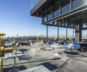
The William Vale
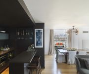
MCCARREN HOTEL AND POOL
Fairfield Inn New York Long Island City/Manhattan View
Willamsburg Apartments
Kosciuszko Street Apartment
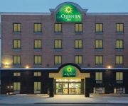
La Quinta Inn Queens (New York City)
BROOKLYN - WILLIAMSBURG
HOTEL LE JOLIE
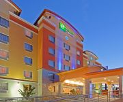
Holiday Inn Express QUEENS - MASPETH
RNYNY - RED CARPET INN BROOKLYN
Videos from this area
These are videos related to the place based on their proximity to this place.
ST. LUKES ROOSEVELT EMS AMBULANCE RESPONDING ON W. 40TH ST. & 8TH AVE. IN MIDTOWN, MANHATTAN, NYC.
HERE YOU WILL SEE A ST. LUKES ROOSEVELT EMS AMBULANCE RESPONDING ON WEST 40TH STREET AND 8TH AVENUE IN THE MIDTOWN AREA OF MANHATTAN IN NEW YORK CITY.
Teens Still Work!
Our high school students will sweep and remove litter, leaves, snow, weeds, and trash from your front yard, stairway, and sidewalks. If you own property in Bed-Stuy, Crown Heights, Prospect...
Greenpoint - New York (smieci)
W Nowym Jorku nie ma tak zwanych "alley", czyli uliczek poza budynkami mieszkalnymi, wiec nie ma gdzie wystawiac koszy na smieci. Efekt jak widac.
Manhattan-bound R160A M Train@Myrtle Avenue/Bway (Street Level)
Here's a wonderful screechin' symphony as the Manhattan-bound R160A M train enter the vincinity of Myrtle Avenue/Bway Train Transfers:J Train to Jamaica Center-Parsons/Archer Bus Transfers:B46.
COMPILATION 04 - SEVERAL VIDEOS OF THE FDNY ON SCENE AT VARIOUS FIRES INSIDE NEW YORK CITY.
HERE YOU WILL SEE A COMPILATION OF SEVERAL VIDEOS OF THE FDNY ON SCENE AT VARIOUS FIRES INSIDE NEW YORK CITY. IN LOVING MEMORY OF MY LITTLE ANGEL HONEY ...
BRAND NEW NYPD UNMARKED FORD FUSION RESPONDING ON W. 42ND ST. IN MIDTOWN, MANHATTAN, NEW YORK CITY.
HERE YOU WILL SEE THE BRAND NEW NYPD UNMARKED FORD FUSION RESPONDING ON WEST 42ND STREET AND MADISON AVENUE IN THE MIDTOWN AREA OF MANHATTAN IN NEW ...
RARELY SEEN FDNY MASKS SERVICES UNIT 2 ON 125TH STREET IN THE HARLEM AREA OF NEW YORK CITY.
HERE YOU WILL SEE A RARE FDNY MASKS SERVICES UNIT 2 ON 125TH STREET IN THE HARLEM AREA OF MANHATTAN IN NEW YORK CITY. IN LOVING MEMORY OF MY LITTLE ANGEL ...
BMT Myrtle Ave Line: R160A-1 M Shuttle Trains at Central Ave (Weekend)
Myrtle Ave bound R160A-1 M Shuttle Train coming from Myrtle-Wyckoff Aves and bypassing Knickerbocker Ave. Note: Due to Station work M Trains in both direction are not stopping at Knickerbocker...
BMT Myrtle Ave Line: R160A-1 M Trains at Central Ave-Myrtle Ave
Note: As you know this is the last day for Central Ave for train service. As of 3-9-13 until 8-9-13 this station will be closed for major station construction/repairs just like when Knickerbocker...
BMT Canarsie Line: R143 L Train at Halsey St-Wyckoff Ave (Weekend)
Manhattan bound R143 L Train coming from Wilson Ave station and entering at Halsey St. Then Manhattan bound L Train leaves Halsey St heading towards Myrtle Ave-Wyckoff Ave as its next station...
Videos provided by Youtube are under the copyright of their owners.
Attractions and noteworthy things
Distances are based on the centre of the city/town and sightseeing location. This list contains brief abstracts about monuments, holiday activities, national parcs, museums, organisations and more from the area as well as interesting facts about the region itself. Where available, you'll find the corresponding homepage. Otherwise the related wikipedia article.
Newtown Creek
Newtown Creek is a 3.5 mi estuary that forms part of the border between the boroughs of Brooklyn and Queens, in New York City, New York, United States. It derives its name from New Town (Nieuwe Stad), which was the name for the Dutch and British settlement in what is now Elmhurst, Queens.
WQEW
WQEW (1560 kHz) is a Radio Disney affiliate licensed to New York City. Its transmitter is located in Maspeth, Queens. WQEW has a transmitter power of 50,000 watts and is listed as a Clear-channel station. On some nights, WQEW can be picked up loud and clear as far West as Cleveland, Ohio, where it out performs WWMK AM 1260 in its distance areas, and as far North as Ottawa, Canada.
Morgan Avenue (BMT Canarsie Line)
Morgan Avenue is a station on the BMT Canarsie Line of the New York City Subway. Located at the intersection of Morgan Avenue and Harrison Place in East Williamsburg, Brooklyn, it is served by the L train at all times.
DeKalb Avenue (BMT Canarsie Line)
DeKalb Avenue is a station on the BMT Canarsie Line of the New York City Subway. Located at the intersection of Wyckoff and DeKalb Avenues in Bushwick, Brooklyn, it is served by the L train at all times. This underground station, opened on December 14, 1928, has two tracks and two side platforms. Each platform has blue columns are regular intervals with every other column having a standard black and white station name plate.
Jefferson Street (BMT Canarsie Line)
Jefferson Street is a station on the BMT Canarsie Line of the New York City Subway. Located in Bushwick, Brooklyn at the intersection of Jefferson Street and Wyckoff Avenue, it is served by the L train at all times. This underground station opened on December 14, 1928 as part of an eastern extension of the Canarsie Line from Montrose Avenue, which opened four years earlier, to Broadway Junction, connecting afterward to the already-operating elevated line to Canarsie – Rockaway Parkway.
Arbitration Rock
The Arbitration Rock was set in 1769 as the boundary marker between the two Long Island townships of Newtown and Bushwick. Since Newtown was in Queens County and Bushwick in Kings County, this rock the size of a Volkswagen Beetle also served to mark the dividing line between these two colonial New York counties. An acrimonious dispute over the boundary lines between the two townships had started as far back as 1661.
Fireproof Recording
Fireproof Recording is a recording studio, which became an important part of the indie music scene in New York City. In 1997, Adam Lasus moved to Brooklyn, New York and started the company. Fireproof clients include indie artists Clap Your Hands Say Yeah, PJ Harvey, Clem Snide, Daniel Johnston, Mark Mulcahy, Amy Ray and many others. Fireproof is an analog and digital recording studio relying on vintage 24 track 2 inch multitrack tape machines and 1/2 inch mixdown deck's.
Grand Street and Grand Avenue
Grand Street and Grand Avenue are the respective names of a street which runs through the boroughs of Brooklyn and Queens, New York City, United States. Originating in Williamsburg, Brooklyn, Grand Street runs roughly northeast until crossing the English Kills into Queens, whereupon Grand Street becomes Grand Avenue, continuing through Maspeth where it is a main shopping street, until reaching its northern end at Queens Boulevard, Elmhurst.
Flushing Avenue
Flushing Avenue is an approximately five mile street running through northern Brooklyn and west central Queens beginning at the termination of Nassau Street, on the northern fringe of Fort Greene, Brooklyn, and ending where it merges with Grand Avenue, in Maspeth. It divides the neighborhood of Southside Williamsburg from Clinton Hill and East Williamsburg from Bushwick.
Metropolitan Avenue
Metropolitan Avenue is a major east-west street in Queens and northern Brooklyn. Its western end is at the East River in Williamsburg, Brooklyn, and the eastern end at Jamaica Avenue in Jamaica, Queens. Metropolitan Avenue runs mainly through the neighborhoods of Williamsburg, East Williamsburg in Brooklyn and Ridgewood, Maspeth, Middle Village, Glendale, Forest Hills, Kew Gardens, Richmond Hill and Jamaica in Queens.
Maria Hernandez Park
Maria Hernandez Park is a municipal park in Bushwick, Brooklyn, New York City. It is located between Knickerbocker Avenue on the southwest to Irving Avenue on the northeast, and Starr Street on the northwest to Suydam Street on the southeast. The park is 6.87 acres and is near the Jefferson Street (BMT Canarsie Line) station and the M subway. Maria Hernandez Park also has four wheelchair accessible entrances.
Laurel Hill (LIRR station)
Laurel Hill was a railroad station on the Montauk Branch of the Long Island Rail Road in Long Island City, New York. It was located on Clifton Street south of Clinton Place, neither of which exist today. Clifton Street is now 46th Street, and is a dead end street that doesn't reach the vicinity of the Montauk Branch. Laurel Hill Station was located a few blocks west of the point where the former junction between the New York and Flushing Railroad and South Side Railroad of Long Island existed.


