Safety Score: 2,7 of 5.0 based on data from 9 authorites. Meaning we advice caution when travelling to United States.
Travel warnings are updated daily. Source: Travel Warning United States. Last Update: 2024-08-13 08:21:03
Delve into Edgemere
Edgemere in Queens County (New York) with it's 9,646 habitants is located in United States about 210 mi (or 337 km) north-east of Washington DC, the country's capital town.
Current time in Edgemere is now 03:33 PM (Friday). The local timezone is named America / New York with an UTC offset of -5 hours. We know of 8 airports close to Edgemere, of which 3 are larger airports. The closest airport in United States is John F Kennedy International Airport in a distance of 3 mi (or 5 km), North. Besides the airports, there are other travel options available (check left side).
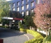
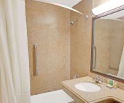
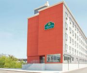
There are two Unesco world heritage sites nearby. The closest heritage site in United States is Statue of Liberty in a distance of 12 mi (or 19 km), North-West. Also, if you like playing golf, there are some options within driving distance. We encountered 9 points of interest near this location. If you need a hotel, we compiled a list of available hotels close to the map centre further down the page.
While being here, you might want to pay a visit to some of the following locations: Queens, Brooklyn, Mineola, The Bronx and Manhattan. To further explore this place, just scroll down and browse the available info.
Local weather forecast
Todays Local Weather Conditions & Forecast: 9°C / 48 °F
| Morning Temperature | 6°C / 42 °F |
| Evening Temperature | 13°C / 56 °F |
| Night Temperature | 10°C / 49 °F |
| Chance of rainfall | 0% |
| Air Humidity | 35% |
| Air Pressure | 1012 hPa |
| Wind Speed | Moderate breeze with 11 km/h (7 mph) from South-East |
| Cloud Conditions | Overcast clouds, covering 100% of sky |
| General Conditions | Overcast clouds |
Friday, 15th of November 2024
12°C (54 °F)
10°C (50 °F)
Sky is clear, moderate breeze, clear sky.
Saturday, 16th of November 2024
12°C (53 °F)
12°C (54 °F)
Sky is clear, gentle breeze, clear sky.
Sunday, 17th of November 2024
12°C (54 °F)
11°C (52 °F)
Overcast clouds, moderate breeze.
Hotels and Places to Stay
Sheraton JFK Airport Hotel
Crowne Plaza JFK AIRPORT NEW YORK CITY
Hilton New York JFK Airport
BEST WESTERN JFK AIRPORT HOTEL
Hilton Garden Inn Queens-JFK Airport
Hampton Inn NY-JFK Jamaica-Queens
Courtyard New York JFK Airport
GARDEN INN AND SUIT
HOWARD JOHNSON JAMAICA NY
La Quinta Inn and Suites Far Rockaway - JFK Airport
Videos from this area
These are videos related to the place based on their proximity to this place.
VICTIMS OF THE STORM & THEIR JOURNEYS
Over 18 Months after Hurricane Sandy for the thousands of New Yorkers who's homes were damaged or destroyed, the rebuilding process has been a nightmare, as they navigate from one municipal...
Flying Manta Ray Comes to New York City #1
First flight of the Sevylor flying Manta Ray in the Atlantic Ocean and Reynolds Channel off of Far Rockaway and Lawrence, NY.
Who Is a Servant of God?
Sabbath Day sermonette delivered by Mr. Trevor Marrast to the New York City congregation of the United Church of God on 4/11/15.
MTA Subway Budd Company R32 #3727 on the (H) arriving into Far Rockaway-Mott Avenue
MTA New York City Transit Subway Budd Company R32 #3727 on the (H) arriving into Far Rockaway-Mott Avenue. This was recorded with a Sony DSC-H70.
IND Far Rockaway Line: On Board R46 H Train to B 67th St-Arverne By The Sea (B 90th St Bound)
Note: Until further notice due to track change between Broad Channel & Howard Beach-JFK Airport from Hurricane Sandy no A or Rockaway Beach Shuttle Trains running to/from the Rocakways ...
IND Far Rockaway Line: R46 H Train at B 60th St-Straiton Ave (Weekday)
Note: Due to Hurricane Sandy A Trains are not running Between Howard Beach-JFK Airport & The Rockaways until further notice. A Shuttle Buses replaces A Trains to Far Rockaway-Mott Ave. For...
IND Far Rockaway Line: R46 H Train at B 60th St-Straiton Ave (Mott Ave Bound)
Note: Due to Hurricane Sandy A Trains are not running Between Howard Beach-JFK Airport & The Rockaways until further notice. A Shuttle Buses replaces A Trains to Far Rockaway-Mott Ave. For...
MTA Bus: 2012 New Flyer C40LF Q22 Bus #604 at B 67th St-Beach Channel Drive
Beach 116th St bound New Flyer C40LF #604 Q22 Bus on Beach Channel Dr coming from Far Rockaway-Mott Ave & B 60th St and passing B 67th St bus stop. Then Beach 116th St bound Q22 Bus ...
MTA Bus: 2007 Orion VII #3501 & 2012 New Flyer C40LF #600 Q22 Buses at B 67th St-Beach Channel Dr
Both Roxbury-B 169th St bound Orion VII #3501 & New Flyer C40LF #600 Q22 Buses on Beach Channel Dr coming from Far Rockaway-Mott Ave & B 60th St and passing and stopping at B 67th St bus ...
MTA Bus: 2012 New Flyer C40LF Q22 Bus #579 at B 67th St-Beach Channel Dr
Far Rockaway-Mott Ave bound New Flyer C40LF Q22 Bus #579 on Beach Channel Dr coming from Rocakway Beach Blvd & B 73rd St and passing B 67th St making its way towards B 60th St. Free ...
Videos provided by Youtube are under the copyright of their owners.
Attractions and noteworthy things
Distances are based on the centre of the city/town and sightseeing location. This list contains brief abstracts about monuments, holiday activities, national parcs, museums, organisations and more from the area as well as interesting facts about the region itself. Where available, you'll find the corresponding homepage. Otherwise the related wikipedia article.
Far Rockaway, Queens
Far Rockaway is a neighborhood on the Rockaway Peninsula in the New York City borough of Queens in the United States. It is the easternmost section of the Rockaways. The neighborhood starts at the Nassau County line and extends west to Beach 32nd Street. The neighborhood is part of Queens Community Board 14. The name "Rockaway" may have meant "place of sands" in the Munsee language of the Native American Lenape.
Bayswater, Queens
Bayswater is a small neighborhood in the New York City borough of Queens, on the eastern end of the Rockaway Peninsula. The community is located to the northeast of Far Rockaway, along the southeastern shore of Jamaica Bay. The neighborhood is part of Queens Community Board 14. One of Bayswater's early developers was William Trist Bailey, hence the street name Bailey Court, who had purchased the property and laid out the community circa 1878.
Bayswater Point State Park
Bayswater Point State Park is a state park located on Jamaica Bay in Queens, New York. Jamaica Bay is an attractive area for migratory birds; Bayswater Point State Park was established in order to preserve their habitat. The park comprises 12 acres at the western end of Mott Avenue in Far Rockaway and is largely built on land formerly belonging to the mansion of Louis A. Heinsheimer. The park offers hiking, birdwatching, and fishing.
Far Rockaway (LIRR station)
Far Rockaway (sometimes referred to as Far Rockaway—Nameoke Street) is the terminus of the Long Island Rail Road's Far Rockaway Branch in the Far Rockaway neighborhood of Queens in New York City. The station is located at Nameoke Street and Redfern Avenue, and is 23.0 miles (37 km) from Penn Station in Midtown Manhattan, and mean travel time is 56 minutes, although most off-peak trains require a transfer for service to Penn Station.
Edgemere, Queens
Edgemere is a neighborhood in the New York City borough of Queens, extending from Beach 32nd to Beach 52nd Street on the Rockaway Peninsula. It contains Rockaway Community Park. Arverne is to the west, and Far Rockaway to the east. Edgemere was founded in 1892 by Frederick J. Lancaster, who originally called it New Venice. The neighborhood is part of Queens Community Board 14.
Arverne, Queens
Arverne is a neighborhood in the New York City borough of Queens, on the Rockaway Peninsula. It was initially developed by Remington Vernam, whose signature "R. Vernam" inspired the name of the neighborhood. Arverne extends from Beach 56th Street to Beach 73rd Street, along its main thoroughfare Beach Channel Drive, alternatively known as Rev. Joseph H. May Drive. The neighborhood is part of Queens Community Board 14.
Beach 44th Street (IND Rockaway Line)
Beach 44th Street, sometimes referred as Beach 44th Street – Frank Avenue, is a station on the IND Rockaway Line of the New York City Subway. It is served by the A train at all times. There are two tracks and two side platforms. This station has no closed exits, and the full time fare control is at the middle of the platforms.
Beach 36th Street (IND Rockaway Line)
Beach 36th Street, sometimes referred as Beach 36th Street – Edgemere, is a station on the IND Rockaway Line of the New York City Subway. Located at the intersection of Beach 36th Street and Rockaway Freeway in Edgemere, Queens, it is served by the A train at all times. This elevated station has two tracks and two side platforms. Both platforms have beige windscreens and canopies with green support columns in the center and black waist-high steel fences at either ends.
Beach 25th Street (IND Rockaway Line)
Beach 25th Street, also known as Beach 25th Street – Wavecrest, is a station on the IND Rockaway Line of the New York City Subway, located in Queens on the Rockaway Freeway at Beach 25th Street. It is served by the A train at all times. There are two tracks and two side platforms. The station was originally opened by the Long Island Rail Road in May 1928 as Wavecrest Station, and was closed and relocated 800 feet east of the former location in August 1940 as part of a grade elevation project.
Far Rockaway – Mott Avenue (IND Rockaway Line)
Far Rockaway – Mott Avenue is the eastern terminal station on the New York City Subway's IND Rockaway Line. Originally a Long Island Rail Road station, it is the full-time southern terminal for the A train and the easternmost station on the New York City Subway. This station is the busiest of all the subway stations on the Rockaway peninsula. The station is built on a concrete viaduct. There are two tracks and an island platform.
Far Rockaway High School
Far Rockaway High School was a public high school in New York City, at 8-21 Bay 25 Street in Far Rockaway in the borough of Queens. The school was founded in 1897, with Sanford J. Ellsworth as principal for over 40 years. The last principal was Denise J. Hallett. The school, whose alumni included three Nobel Prize laureates and Bernard Madoff, stopped accepting students in 2008 as part of a planned closure because of declining grades. The doors closed on June 27, 2011.
East Rockaway Inlet
The East Rockaway Inlet is an arm of the Atlantic Ocean which separates the Rockaway Peninsula from the barrier island which includes the Nassau County, New York communities of Atlantic Beach, Long Beach and Lido Beach. According to a plaque in Long Beach, NY, the original inlet was through Long Beach directly opposite East Rockaway, NY, hence the name.


