Safety Score: 2,7 of 5.0 based on data from 9 authorites. Meaning we advice caution when travelling to United States.
Travel warnings are updated daily. Source: Travel Warning United States. Last Update: 2024-08-13 08:21:03
Explore Broad Channel
Broad Channel in Queens County (New York) with it's 2,443 inhabitants is a city in United States about 208 mi (or 334 km) north-east of Washington DC, the country's capital.
Local time in Broad Channel is now 05:52 PM (Friday). The local timezone is named America / New York with an UTC offset of -5 hours. We know of 8 airports in the vicinity of Broad Channel, of which 3 are larger airports. The closest airport in United States is John F Kennedy International Airport in a distance of 3 mi (or 5 km), North-East. Besides the airports, there are other travel options available (check left side).
There are two Unesco world heritage sites nearby. The closest heritage site in United States is Statue of Liberty in a distance of 9 mi (or 15 km), North-West. Also, if you like golfing, there are multiple options in driving distance. We found 9 points of interest in the vicinity of this place. If you need a place to sleep, we compiled a list of available hotels close to the map centre further down the page.
Depending on your travel schedule, you might want to pay a visit to some of the following locations: Queens, Brooklyn, Mineola, Manhattan and The Bronx. To further explore this place, just scroll down and browse the available info.
Local weather forecast
Todays Local Weather Conditions & Forecast: 9°C / 48 °F
| Morning Temperature | 6°C / 42 °F |
| Evening Temperature | 13°C / 56 °F |
| Night Temperature | 10°C / 49 °F |
| Chance of rainfall | 0% |
| Air Humidity | 35% |
| Air Pressure | 1012 hPa |
| Wind Speed | Moderate breeze with 11 km/h (7 mph) from South-East |
| Cloud Conditions | Overcast clouds, covering 100% of sky |
| General Conditions | Overcast clouds |
Friday, 15th of November 2024
12°C (54 °F)
10°C (50 °F)
Sky is clear, moderate breeze, clear sky.
Saturday, 16th of November 2024
12°C (53 °F)
12°C (54 °F)
Sky is clear, gentle breeze, clear sky.
Sunday, 17th of November 2024
12°C (54 °F)
11°C (52 °F)
Overcast clouds, moderate breeze.
Hotels and Places to Stay
Sheraton JFK Airport Hotel
Crowne Plaza JFK AIRPORT NEW YORK CITY
Hilton New York JFK Airport
Playland Motel
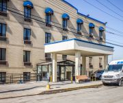
Comfort Inn JFK Airport
Fairfield Inn New York JFK Airport
JFK BED AND BREAKFAST GUESTHOUSE
GARDEN INN AND SUIT
Holiday Inn Express NEW YORK JFK AIRPORT AREA
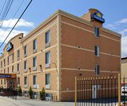
DAYS INN JAMAICA - JFK AIRPORT
Videos from this area
These are videos related to the place based on their proximity to this place.
A Trip on the Rockaway Line - August 5, 2008
August 5, 2008 A trip from Broad Channel to Rockaway Boulevard, including a trip between the two stations that are furthest apart from each other, in terms of distance.
Rockaway Park Shuttle at Beach 90th street (2012)
A Rockaway Park Shuttle R46 train leaves the Beach 90th street station, heading for Broad Channel. This is a service of the New York City Subway.
Raccoon_Attack_short_version.wmv
This is a video of wild raccoons at Jamaica Bay Wildlife Refuge, an island right near New York City. In the video first one then several raccoons dig up 5 artificial clutches of eggs that...
Backfanning on the Rockaway Park Shuttle
Looking out the rear window of the Rockaway Park Shuttle train as it makes its entire trip from Rockaway Park-Beach 116th Street to Broad Channel.
Osprey's Journey
Osprey's Journey is an osprey tracking project and website where we've been following an Osprey named C2 from his nesting site in NYC to Venezuela and back. This was our crowdfunding video...
Black-and-White Warbler
Black-and -White Warbler (Mniotilta varia) in the south garden of Jamaica Bay NWR, New York City.
NYC Subway, Rockaway Shuttle
It's hard to believe, but this is the New York City subway. It's the S train (shuttle) that goes from Broad Channel station out to Rockaway Beach, Queens. The S train is used to go south on...
Rockaway Park Shuttle train at Beach 90th Street-Holland
Rockaway Park-bound shuttle train of eight R46s leaving Beach 90th Street-Holland.
Rockaway Park Shuttle train at Beach 90th Street-Holland
Rockaway Park-bound shuttle train of R46s arriving at Beach 90th Street-Holland.
Videos provided by Youtube are under the copyright of their owners.
Attractions and noteworthy things
Distances are based on the centre of the city/town and sightseeing location. This list contains brief abstracts about monuments, holiday activities, national parcs, museums, organisations and more from the area as well as interesting facts about the region itself. Where available, you'll find the corresponding homepage. Otherwise the related wikipedia article.
Cross Bay Veterans Memorial Bridge
The Cross Bay Veterans Memorial Bridge (originally Cross Bay Bridge or Cross Bay Parkway Bridge) in New York City, is a toll bridge that carries Cross Bay Boulevard from Broad Channel in Jamaica Bay to the Rockaway Peninsula, and is located in Queens.
Rockaway, Queens
The Rockaway Peninsula, informally The Rockaways, is the name of a peninsula of Long Island, all of which is located within the New York City borough of Queens. A popular summer resort area since the 1830s, Rockaway has become a mixture of lower, middle, and upper-class neighborhoods. Its relative isolation from the urban areas of the city, especially Manhattan, has traditionally made it a popular summer retreat. The neighborhood is part of Queens Community Board 14.
Broad Channel, Queens
Broad Channel is a neighborhood in the New York City borough of Queens. It occupies the southern portion of Rulers Bar Hassock (known colloquially as "Broad Channel Island"), which is the only inhabited island (pop. about 3,000) in Jamaica Bay. The neighborhood stands on Big Egg Marsh, an area of fill approximately 20 blocks long and 4 blocks wide. The community is an inholding within the Gateway National Recreation Area, a unit of the U.
Rockaway Beach, Queens
Rockaway Beach is a neighborhood on the Rockaway Peninsula in the New York City borough of Queens. It is located on the South Shore of Long Island. The neighborhood is bounded by Arverne to the east and Rockaway Park to the west. It is named for Rockaway Beach, which is the largest urban beach in the United States, stretching for miles along the Rockaway Peninsula facing the Atlantic Ocean. The beach is run and operated by the New York City Department of Parks and Recreation.
American Airlines Flight 1
American Airlines Flight 1 was a domestic, scheduled passenger flight from New York International (Idlewild) Airport (now John F. Kennedy International Airport), New York to Los Angeles International Airport, California. On March 1, 1962, the plane flying the route crashed shortly after take-off, killing all 87 passengers and eight crew aboard.
Broad Channel (IND Rockaway Line)
Broad Channel is a station on the IND Rockaway Line of the New York City Subway. Located at Noel Road and West Road in the Broad Channel neighborhood of the borough of Queens, it is served by the A train and the Rockaway Park Shuttle at all times, the latter of which terminates here.
Beach 90th Street (IND Rockaway Line)
Beach 90th Street, sometimes called Beach 90th Street – Holland, is a station on the IND Rockaway Line of the New York City Subway. It is served by the Rockaway Park Shuttle at all times and ten daily rush-hour only A trains. The station is built on a concrete viaduct. There are two tracks and two side platforms. New lights have been installed. Template:When? There is a crossunder to the tiled mezzanine. Canopies are wood and have numerous holes and missing sections.
Hammels, Queens
Hammels is an area within Rockaway Beach on the Rockaway Peninsula in the New York City borough of Queens. It is located west of Arverne and east of Seaside, and is centered on Beach 84th Street. Its main thoroughfare is Beach Channel Drive. The A train passes through the neighborhood. The Hammel Houses, a public housing project built in 1954, is located in the neighborhood.
Beach Channel Drive
Beach Channel Drive is the main thoroughfare in the Rockaway Peninsula in the New York City borough of Queens. It extends from the Nassau County border at Inwood westward to the Marine Parkway Bridge at the end of Jacob Riis Park. From Hammels westward, it follows along Jamaica Bay on the northern side of the peninsula.
The Raunt (LIRR station)
The Raunt was a former Long Island Rail Road station on the Rockaway Beach Branch. It had no address and no station house, because it was meant strictly as a dropping-off point for fishermen using a small island in Jamaica Bay. The station was located 1300 feet west of signal station "ER" (presumably #96), and near the WU Tower. It was named for the channel on the south side of the island where it stood.


