Safety Score: 2,7 of 5.0 based on data from 9 authorites. Meaning we advice caution when travelling to United States.
Travel warnings are updated daily. Source: Travel Warning United States. Last Update: 2024-08-13 08:21:03
Explore South Highland
South Highland in Putnam County (New York) is a city in United States about 238 mi (or 383 km) north-east of Washington DC, the country's capital.
Local time in South Highland is now 10:42 PM (Thursday). The local timezone is named America / New York with an UTC offset of -5 hours. We know of 9 airports in the vicinity of South Highland, of which 4 are larger airports. The closest airport in United States is Stewart International Airport in a distance of 13 mi (or 21 km), North-West. Besides the airports, there are other travel options available (check left side).
There are two Unesco world heritage sites nearby. The closest heritage site in United States is Statue of Liberty in a distance of 48 mi (or 77 km), South. Also, if you like golfing, there are multiple options in driving distance. We found 1 points of interest in the vicinity of this place. If you need a place to sleep, we compiled a list of available hotels close to the map centre further down the page.
Depending on your travel schedule, you might want to pay a visit to some of the following locations: Carmel, New City, Poughkeepsie, White Plains and Goshen. To further explore this place, just scroll down and browse the available info.
Local weather forecast
Todays Local Weather Conditions & Forecast: 9°C / 49 °F
| Morning Temperature | 1°C / 34 °F |
| Evening Temperature | 7°C / 44 °F |
| Night Temperature | 3°C / 37 °F |
| Chance of rainfall | 0% |
| Air Humidity | 29% |
| Air Pressure | 1012 hPa |
| Wind Speed | Light breeze with 5 km/h (3 mph) from South |
| Cloud Conditions | Broken clouds, covering 58% of sky |
| General Conditions | Broken clouds |
Friday, 15th of November 2024
12°C (54 °F)
3°C (38 °F)
Sky is clear, moderate breeze, clear sky.
Saturday, 16th of November 2024
9°C (49 °F)
9°C (48 °F)
Broken clouds, light breeze.
Sunday, 17th of November 2024
15°C (58 °F)
8°C (47 °F)
Broken clouds, moderate breeze.
Hotels and Places to Stay
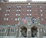
THE HISTORIC THAYER HOTEL
Holiday Inn Express & Suites WEST POINT-FORT MONTGOMERY
FAIRBRIDGE INN AND SUITES AT WEST POINT
Overlook Lodge at Bear Mountain
WEST POINT MOTEL
Videos from this area
These are videos related to the place based on their proximity to this place.
Cold Spring, NY. June 8, 2014
Testing the video capability of the Canon EOS 70D. Edited YouTube Video Editor (http://www.youtube.com/editor)
Aerial Magic of the Maloney-Florke Wedding in Cold Spring NY
This is a demo reel of the aerial footage gathered during the wedding of Congressman Shawn Patrick Maloney and Randy Flourke. This video is the property of Propellerheads Aerial Photography...
Pest Control Service Cold Spring NY 845 345 8119 Putnam County Eastern Pest Management
http://www.easternpestmanagementllc.com Eastern Pest Management are your Cold Spring NY pest control specialists. Call Joe or Glenn for expert and reliable p...
USMA at West Point Window Restoration Part 1
This documentary was produced by ESV Teleproductions for Belmont Technical College as part of a Department of Defense Legacy Presentation in 1994. It is the story of window restoration at the...
USMA at West Point Window Restoration Part 5 Constitution Island
Part five of the window restoration at the us Military Academy at West Point, New York. This segment deals with issues on Constitution Island.
Videos provided by Youtube are under the copyright of their owners.
Attractions and noteworthy things
Distances are based on the centre of the city/town and sightseeing location. This list contains brief abstracts about monuments, holiday activities, national parcs, museums, organisations and more from the area as well as interesting facts about the region itself. Where available, you'll find the corresponding homepage. Otherwise the related wikipedia article.
Garrison (Metro-North station)
The Garrison Metro-North Railroad station serves residents of Garrison, New York via the Hudson Line. Trains leave for New York City every hour on weekdays and about every 25 minutes during rush hour. It is 49.9 miles (80 km) from Grand Central Terminal and travel time to Grand Central is approximately one hour, 17 minutes. It is known for its sweeping views of West Point across the river.
Fort Clinton
Fort Clinton was an American Revolutionary War fortification in present-day Highlands, Orange County, New York. It was a companion to Fort Montgomery. Its garrison of 300 was smaller than that of Fort Montgomery, but Fort Clinton was built on a ridge at the mouth of the Popolopen Gorge, overlooking the Hudson River, and its defenses were more complete. The fort was commanded by General James Clinton, for whom it was probably named.
Garrison, New York
Garrison is a hamlet in Putnam County, New York, United States. It is part of the town of Philipstown and is on the east side of the Hudson River, across from the United States Military Academy at West Point. The Garrison Metro-North Railroad station serves the town.
Sugarloaf Hill (Hudson Highlands)
Sugarloaf Hill is a peak along the Hudson River in Putnam County, New York, part of the Hudson Highlands. It was named by the Dutch for its resemblance in outline to a sugarloaf when sailing up the river towards it.
Church of the Holy Comforter (Poughkeepsie, New York)
The Church of the Holy Comforter, built in 1860, is a Gothic Revival church located on Davies Street, near the train station in Poughkeepsie, New York, United States, a few blocks from the Hudson River. Its steeples are prominently visible to traffic passing through the city since the construction of the elevated US 9 expressway in 1965. The congregation first formed in 1854 as Christ Church.
Garrison Union Free School
Garrison Union Free School, also referred to as just Garrison School, educates students from kindergarten through eighth grade in the eponymous school district, which covers the hamlet of Garrison and nearby areas of the towns of Philipstown and Putnam Valley in Putnam County, New York, United States. It is located on NY 9D near the center of the hamlet, right across from St. Philip's Church in the Highlands, where it was originally located when established in 1793.
West Point Light (New York)
West Point Light was a lighthouse at the United States Military Academy in West Point, New York. It was located at Gee's Point and was sometimes referred to as Gee's Point Light. West Point Light would be shown on the NOAA Chart 12343 if it were still active. Today, Light 39 (USCG 1-38005), on a skeleton tower with a fixed green light characteristic, has replaced West Point Light on Gee's Point.
Saint Basil Academy (Garrison, New York)
Saint Basil Academy is a residential school for at-risk students run by the Greek Orthodox Archdiocese of America in Garrison, New York, United States. It is located at Eagle's Rest, previously the estate of Jacob Ruppert, owner of the New York Yankees in the early 20th century, between NY 9D and the Hudson River. During Ruppert's lifetime many Yankees players, including Babe Ruth, were frequent visitors.


