Safety Score: 2,7 of 5.0 based on data from 9 authorites. Meaning we advice caution when travelling to United States.
Travel warnings are updated daily. Source: Travel Warning United States. Last Update: 2024-08-13 08:21:03
Explore Taino Towers
Taino Towers in New York County (New York) is a city in United States about 211 mi (or 339 km) north-east of Washington DC, the country's capital.
Local time in Taino Towers is now 12:15 PM (Friday). The local timezone is named America / New York with an UTC offset of -5 hours. We know of 9 airports in the vicinity of Taino Towers, of which 4 are larger airports. The closest airport in United States is La Guardia Airport in a distance of 4 mi (or 6 km), South-East. Besides the airports, there are other travel options available (check left side).
There are two Unesco world heritage sites nearby. The closest heritage site in United States is Statue of Liberty in a distance of 8 mi (or 13 km), South. Also, if you like golfing, there are multiple options in driving distance. We found 10 points of interest in the vicinity of this place. If you need a place to sleep, we compiled a list of available hotels close to the map centre further down the page.
Depending on your travel schedule, you might want to pay a visit to some of the following locations: Manhattan, The Bronx, Hackensack, Brooklyn and Queens. To further explore this place, just scroll down and browse the available info.
Local weather forecast
Todays Local Weather Conditions & Forecast: 10°C / 49 °F
| Morning Temperature | 5°C / 41 °F |
| Evening Temperature | 13°C / 55 °F |
| Night Temperature | 9°C / 48 °F |
| Chance of rainfall | 0% |
| Air Humidity | 33% |
| Air Pressure | 1012 hPa |
| Wind Speed | Gentle Breeze with 8 km/h (5 mph) from South-East |
| Cloud Conditions | Overcast clouds, covering 100% of sky |
| General Conditions | Overcast clouds |
Friday, 15th of November 2024
13°C (55 °F)
9°C (48 °F)
Sky is clear, moderate breeze, clear sky.
Saturday, 16th of November 2024
13°C (55 °F)
11°C (52 °F)
Sky is clear, gentle breeze, few clouds.
Sunday, 17th of November 2024
12°C (54 °F)
11°C (51 °F)
Overcast clouds, moderate breeze.
Hotels and Places to Stay
Luxury Suites Lenox Ave
The Allen House (sleeps 5)
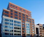
Aloft Harlem
Luxury Suites Upper West Brownstone
Empire 120
La Maison d'Art
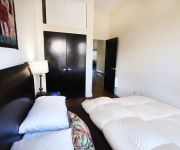
Sunny Modern Two Room Studio
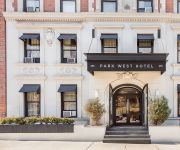
Astor on the Park
Courtyard New York Manhattan/Upper East Side
Opera House Hotel
Videos from this area
These are videos related to the place based on their proximity to this place.
Metro-North Harlem-125 St to Grand Central Terminal
Metro-North New Haven line train traveling south on last leg of journey to New York City through the Park Avenue tunnel.
MTA Metro North Rail Road Action at 125th Harlem Station
Various MNRR Equipment Rolling Through 125th Harlem Station.
Renovated NYC 2 Bed Apartment Rental @ 110th St & 3rd Ave.
110th St. & 3rd Ave, Spacious 2 bedroom, renovated, eat-in kitchen with great cabinet and counter space, huge bedrooms (QUEEN SIZE BEDS? NO PROBLEM), high ceilings, good closet space, ...
IRT Lexington Ave Line: R142 5 Train & R142A 6 Train at 103rd St (Downtown Bound)
Brooklyn bound R142 5 Train coming from 125th St station and bypassing its 3rd station 103rd St heading towards 86th St as its next station stop. Then a Brooklyn Bridge-City Hall bound R142A...
IRT Lexington Ave Line: R142A 6 Trains at 116th St-Lexington Ave
Brooklyn Bridge-City Hall bound R142A 6 Train coming from 125th St station and entering at 116th St. Then a Bronx bound Bronx Bound R142A 6 Train coming from 110th St station and entering...
IRT Lexington Ave Line: R142A 6 Train via Bronx Exp at 103rd St (Uptown Bound)
Bronx bound R142A 6 Train via Pelham Exp coming from 96th St station and entering at 103rd St. Then Bronx bound 6 Train leaves 103rd St heading towards 110th St as its next station stop. ...
2014 PSAL Outdoor City Championship - Boys 4x100 Finals
Springfield Gardens: Munir Ibrahim, Kevon White, Lejon Beckford and Nicolas Joseph - 43.62.
BEFORE we had insurance. Now INSURED Tv install wall mount Brick wall New York Choice Green
This is a video testimonial from Will on 3/23/13, who is 1 of the 2 clients we installed 2 tv's for this weekend. 4 televisions mounted WITHOUT insurance. Our reputation has been on the line...
2014 PSAL Outdoor Track City Championship - Boys 4x400
Heat 3 of 3 Springfield Gardens: Jason Jeangilles, Nicolas Joseph, Lejon Beckford and Kevon White - 3:25.03.
CSXT at Lincoln Avenue, Bronx, New York
Date: Friday, July 17, 2009 Sunrise Railroad: CSX Transportation Line: Oak Point Link Train Symbol: Q701-16 Direction of train: Southbound Train origin: Selkirk, New York Train Destination:...
Videos provided by Youtube are under the copyright of their owners.
Attractions and noteworthy things
Distances are based on the centre of the city/town and sightseeing location. This list contains brief abstracts about monuments, holiday activities, national parcs, museums, organisations and more from the area as well as interesting facts about the region itself. Where available, you'll find the corresponding homepage. Otherwise the related wikipedia article.
125th Street (IRT Lexington Avenue Line)
125th Street is an express station that has four tracks and two island platforms. It is the northernmost Manhattan station on the IRT Lexington Avenue Line of the New York City Subway. Located at Lexington Avenue and East 125th Street (also known as Dr. Martin Luther King, Jr. Boulevard) in East Harlem, it is served by the 4 and 6 trains at all times, the 5 train at all times except late nights, and the <6> during weekdays in peak direction.
Willis Avenue Bridge
The Willis Avenue Bridge is a swing bridge that carries road traffic northbound (and bicycles and pedestrians both ways) over the Harlem River between the New York City boroughs of Manhattan and the Bronx, United States. It connects First Avenue in Manhattan with Willis Avenue in the Bronx. The New York City Department of Transportation is responsible for maintaining and operating the bridge. Runners of the New York Marathon have dubbed it "the wall" because it marks the 20 mile mark on the run.
Manhattan Center for Science and Mathematics
Manhattan Center for Science and Mathematics (also known as MCSM) is a public high school in New York City, at East 116th Street between Pleasant Avenue and FDR Drive in the East Harlem neighborhood in the north-eastern part of the borough of Manhattan. Established in 1982 to replace Benjamin Franklin High School, Manhattan Center is presently a four-year high school which provides students with a rigorous curriculum that emphasizes mathematics and science.
Italian Harlem
Italian Harlem was the name that was given to East Harlem in the New York City borough of Manhattan, when it was largely inhabited by an Italian American population. It was also the first part of Manhattan to be called "Little Italy". Today most of the former Italian population is gone, and the neighborhood has become known as Spanish Harlem because of its large Hispanic population.
Pleasant Avenue
Pleasant Avenue is a north-south street in the East Harlem neighborhood of the New York City borough of Manhattan. It begins at E. 114th Street and ends at E. 120th Street. Pleasant Avenue was one of the last remaining streets in Italian Harlem, which existed in the eastern part of Harlem from the late 1890s to the 1970s. The neighborhood shrunk over the years, and the small remaining Italian population resides on Pleasant Avenue.
129th Street (IRT Third Avenue Line)
129th Street was a massive station on the IRT Third Avenue Line, shared by trains of both the Third Avenue Line and IRT Second Avenue Line in the New York City Subway system. It originally opened on December 30, 1878. In 1886 it gained a connection to the Willis Avenue Spur which took commuters to a terminal station in the Bronx that served commuters using the New York, New Haven and Hartford Railroad and later to the New York, Westchester and Boston Railway interurban lines.
125th Street (IRT Third Avenue Line)
125th Street was an express station on the demolished IRT Third Avenue Line. It opened on December 30, 1878, and had three tracks and two levels. The lower level was built first and had two tracks and two side platforms for local trains. The upper level, built as part of the Dual Contracts, had one track and two side platforms for express trains. The next stop to the north was 129th Street, a major hub among the elevated lines.
125th Street (IRT Second Avenue Line)
125th Street was a station on the demolished IRT Second Avenue Line. It had three tracks and two island platforms. The next stop to the north was 129th Street for terminating trains and 133rd Street for through trains. The next stop to the south was 121st Street for local trains and 86th Street for express trains. The station closed on June 11, 1940.
121st Street (IRT Second Avenue Line)
121st Street was a station on the demolished IRT Second Avenue Line. It had three tracks and two side platforms. The next stop to the north was 125th Street. The next stop to the south was 117th Street. The station closed on June 11, 1940.
117th Street (IRT Second Avenue Line)
117th Street was a station on the demolished IRT Second Avenue Line. It had three tracks and two side platforms. The next stop to the north was 121st Street. The next stop to the south was 111th Street. The station closed on June 11, 1940.
Patsy's Pizzeria
Patsy's Pizzeria is a historic coal-oven pizzeria in New York City and is regarded as one of New York's original pizzerias as well as for its use of traditional New York style thin crust pizza.
St. Johannes Kirche (New York City)
St. Johannes Kirche was a former Manhattan Lutheran church located at 217 East 119th Street between Second and Third Avenues. It was built in 1873 and reused as Iglesia Luterana Sion by the Lutheran Church in America: “An early masonry church for this community, then remote from the center of the city much further downtown. The church began as a home for a German-speaking congregation—today it serves those who speak Spanish. ” Appears to have been demolished.


