Safety Score: 2,7 of 5.0 based on data from 9 authorites. Meaning we advice caution when travelling to United States.
Travel warnings are updated daily. Source: Travel Warning United States. Last Update: 2024-08-13 08:21:03
Explore Stanley Isaacs Houses
The district Stanley Isaacs Houses of Manhattan in New York County (New York) is located in United States about 209 mi north-east of Washington DC, the country's capital.
If you need a place to sleep, we compiled a list of available hotels close to the map centre further down the page.
Depending on your travel schedule, you might want to pay a visit to some of the following locations: The Bronx, Brooklyn, Jersey City, Hackensack and Queens. To further explore this place, just scroll down and browse the available info.
Local weather forecast
Todays Local Weather Conditions & Forecast: 16°C / 61 °F
| Morning Temperature | 11°C / 51 °F |
| Evening Temperature | 15°C / 59 °F |
| Night Temperature | 11°C / 53 °F |
| Chance of rainfall | 0% |
| Air Humidity | 53% |
| Air Pressure | 1011 hPa |
| Wind Speed | Moderate breeze with 11 km/h (7 mph) from South-East |
| Cloud Conditions | Scattered clouds, covering 27% of sky |
| General Conditions | Scattered clouds |
Tuesday, 19th of November 2024
12°C (53 °F)
13°C (55 °F)
Scattered clouds, gentle breeze.
Wednesday, 20th of November 2024
14°C (56 °F)
13°C (55 °F)
Sky is clear, gentle breeze, clear sky.
Thursday, 21st of November 2024
9°C (47 °F)
8°C (47 °F)
Moderate rain, moderate breeze, overcast clouds.
Hotels and Places to Stay
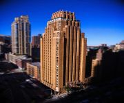
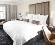
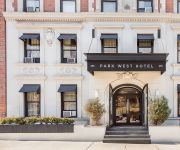
The Mark Preferred LEGEND
THE CARLYLE A ROSEWOOD HOTEL
The Allen House (sleeps 5)
The Surrey
Courtyard New York Manhattan/Upper East Side
Astor on the Park
Empire 120
Museum Mile Flat
Central Park Studios
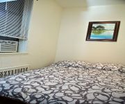
Sunny Modern Two Room Studio
Videos from this area
These are videos related to the place based on their proximity to this place.
FDNY LADDER 24 CRUISING BY E. 40TH ST. & 5TH AVE. IN THE MIDTOWN AREA OF MANHATTAN IN NEW YORK CITY.
HERE YOU WILL SEE FDNY LADDER 24 CRUISING BY EAST 40TH STREET AND 5TH AVENUE IN THE MIDTOWN AREA OF MANHATTAN IN NEW YORK CITY. IN LOVING MEMORY OF MY LITTLE ...
Powerboat on East River, New York City
This catamaran powerboat is heading north up the East River, past Roosevelt Island and the Blackwell Island Lighthouse. The boat is traveling with the current, which greatly adds to the boat's...
Vanmoof Electrified 3 Video Review - Elegant City Style Electric Bike, Minimalist Design
http://electricbikereview.com/vanmoof/electrified-3/ The Vanmoof Electrified 3 features a 250 watt geared hub motor in the front and a Shimano Automatix (auto shifting) geared hub in the rear....
BRAND NEW FDNY EMS AMBULANCE RESPONDING W. 58TH ST. IN MIDTOWN, MANHATTAN, NEW YORK CITY.
HERE YOU WILL SEE A BRAND NEW FDNY EMS AMBULANCE RESPONDING WEST 58TH STREET AND WEST END AVENUE IN THE MIDTOWN AREA OF MANHATTAN IN NEW YORK CITY.
Jeet Kune Do Class. WESTERN BOXING
Dawadah's Totally Complete JKD - A NonTraditional Modified Martial Art based on Bruce Lee's Jeet Kune Do - Franklin Plaza 106th st between 1st & 2nd Ave - El Barrio Harlem New York City.
New York Christmas 2008
Christmas vacation in New York, New York, 2009. We stayed in the Upper East Side this year at the Franklin Hotel. It was really nice, clean, bigger than the last hotel slightly, good location...
Traffic on FDR Drive, New York City
The FDR Drive is a highway in Manhattan that runs along the East River. Here you see the traffic lanes squeezed into the available space by stacking the lanes on top of each other, with the...
NYPD POLICE CRUISER RESPONDING ON CANAL STREET IN THE CHINATOWN AREA OF MANHATTAN IN NEW YORK CITY.
HERE YOU WILL SEE A NYPD POLICE CRUISER RESPONDING ON CANAL STREET IN THE CHINATOWN AREA OF MANHATTAN IN NEW YORK CITY. IN LOVING MEMORY OF MY LITTLE ANGEL ...
Security Academy of New York
Find your new career at the Security Academy of New York, a licensed Security Guard Training School that has been successfully training and preparing security guards throughout the New York...
Spacious NYC 1 Bedroom @ 87th St & York Ave.
87th St & York Ave, Charming 1 bedroom, great space for the money, decorative fireplace, hardwood floors, high ceilings, Extra Large bedroom, quiet residential tree-lined block, close to Carl...
Videos provided by Youtube are under the copyright of their owners.
Attractions and noteworthy things
Distances are based on the centre of the city/town and sightseeing location. This list contains brief abstracts about monuments, holiday activities, national parcs, museums, organisations and more from the area as well as interesting facts about the region itself. Where available, you'll find the corresponding homepage. Otherwise the related wikipedia article.
American Society for the Prevention of Cruelty to Animals
The American Society for the Prevention of Cruelty to Animals (ASPCA) is a non-profit organization dedicated to preventing cruelty towards animals. Based in New York City since its inception in 1866, the organization's mission is "to provide effective means for the prevention of cruelty to animals throughout the United States."
Yorkville, Manhattan
Yorkville is a neighborhood in the greater Upper East Side, in the Borough of Manhattan in New York City. Yorkville's boundaries include: the East River on the east, 96th Street on the north, Third Avenue on the west and 72nd Street to the south. However, its southern boundary is a subject of debate. What is certain is that Yorkville's boundaries have changed over time. Its western half was referred to as "Irishtown.
96th Street (IRT Lexington Avenue Line)
96th Street is a local station on the IRT Lexington Avenue Line of the New York City Subway. Located at the intersection of Lexington Avenue and 96th Street in the Carnegie Hill & East Harlem neighborhoods of Manhattan, it is served by the 6 train at all times, the <6> during weekdays in peak direction, and the 4 train during late nights.
Carl Schurz Park
Carl Schurz Park is a 14.9 acre (6 hectare) public park on the Upper East Side of New York City, named for German-born Secretary of the Interior Carl Schurz in 1910, at the edge of what was then a solidly German-American community of Yorkville.
92nd Street Y
92nd Street Y (92Y) is a multifaceted cultural institution and community center located on the Upper East Side of Manhattan in New York City, USA, at the corner of E. 92nd Street and Lexington Avenue. Its full name is 92nd Street Young Men's and Young Women's Hebrew Association. It is not part of the YMCA.
Mill Rock
Mill Rock is a small unpopulated island between Manhattan and Queens in New York City, in the U.S. state of New York. It lies about 1,000 feet off Manhattan's East 96th Street, south of Randall's and Wards Island where the East River and Harlem River converge. The island forms Census Block 9000 of Census Tract 238 in New York County. (Except for Mill Rock Island, Census Tract 238 consists entirely of Roosevelt Island. ) Its official area is 16,173 square meters, or 3.996 acres .
Chapin School
The Chapin School is an American all-girls, private day school located in the Manhattan borough of New York City.
86th Street (Manhattan)
86th Street is a major two-way street in the Upper East Side and Upper West Side of the New York City borough of Manhattan.
East End Avenue
East End Avenue in Manhattan is the easternmost avenue on the Upper East Side. Principally residential in character, it only runs from E 79th to E 90th Street through the Yorkville neighborhood. Carl Schurz Park, the location of Gracie Mansion, is adjacent to the avenue.
East Side Middle School
East Side Middle School (ESMS) is a public school at 331 East 91st Street on the Upper East Side of Manhattan.
99th Street (IRT Third Avenue Line)
99th Street was a local station on the demolished IRT Third Avenue Line in New York City. It had two levels. The lower level serving local trains was built first, and had two tracks and two side platforms. The upper level, built as part of the Dual Contracts had one track that bypassed the station and served express trains. The next stop to the north was 106th Street. The next stop to the south was 89th Street. The station closed on May 12, 1955.
89th Street (IRT Third Avenue Line)
89th Street was a local station on the demolished IRT Third Avenue Line. It was originally built on December 9, 1878 and had two levels. The lower level, built first, was served by local trains and had two tracks and two side platforms. The upper level was built as part of the Dual Contracts, had one track that bypassed the station and served express trains. The next stop to the north was 99th Street. The next stop to the south was 84th Street. The station closed on May 12, 1955.
99th Street (IRT Second Avenue Line)
99th Street was a station on the demolished IRT Second Avenue Line. It had three tracks and two side platforms. The next stop to the north was 105th Street. The next stop to the south was 92nd Street. The station closed on June 13, 1942.
86th Street (IRT Second Avenue Line)
86th Street was a station on the demolished IRT Second Avenue Line. It had two levels. The lower level had two tracks and two side platforms, and was served by local trains. The upper level was built as a part of the Dual Contracts and had one track and two side platforms for express trains. The next stop to the north was 92nd Street for local trains and 125th Street for express trains. The next stop to the south was 80th Street for local trains and 57th Street for express trains.
92nd Street (IRT Second Avenue Line)
92nd Street was a station on the demolished IRT Second Avenue Line. It had three tracks and two side platforms. The next stop to the north was 99th Street. The next stop to the south was 86th Street. The station closed on June 11, 1940.
Metropolitan Hospital Center
Metropolitan Hospital Center (MHC) is a hospital in East Harlem, New York City. It has been affiliated with New York Medical College since it was founded in 1875, representing the oldest partnership between a hospital and a private medical school in the United States. MHC is part of the New York City Health and Hospitals Corporation (HHC), the largest municipal hospital and healthcare system in the country.
Islamic Cultural Center of New York
The Islamic Cultural Center of New York is a mosque and Islamic cultural center in the borough of Manhattan in New York City, United States. It is located at 1711 Third Avenue, between East 96th and 97th Streets. The Islamic Cultural Center was the first mosque built in New York City. The mosque's older dwelling in a townhouse at 1 Riverside Drive, is still in continual prayer use as a satellite location.
93rd Street (Manhattan)
93rd Street runs from Riverside Drive, overlooking the Hudson River, to the East River, through the New York City borough of Manhattan. It traverses the neighborhoods of the Upper West Side, Upper East Side, Carnegie Hill, and Yorkville; the street is interrupted by Central Park. A notable monument to Joan of Arc by Anna Hyatt Huntington stands at the street's western terminus at Riverside Park.
Holmes Towers
The John Haynes Holmes Towers are two public housing buildings on the Upper East Side of Manhattan in New York City. The project is located between 92nd and 93rd Streets, spanning from 1st Avenue to York Avenue. The two buildings, completed in 1969, are 25 stories tall and contain 537 apartments. Architects Eggers and Higgins designed the buildings. The development was named for the founder of the Community Church of New York.
St. Lucy's Church (Manhattan)
St. Lucy’s Church is a Roman Catholic parish located in Manhattan, New York City under the authority of the Archdiocese of New York. The church and school address is 338-342 East 104th Street, New York, New York 10029; the school occupied 336 East 104th Street.
96th Street (IND Second Avenue Line)
The 96th Street is a planned station, under construction on the IND Second Avenue Line of the New York City Subway. It is the planned northern terminus for the Q during Phase 1 of the Second Avenue Subway. The station is expected to open in December 2016, and it will have two tracks and an island platform. Just south of the platform will be a diamond crossover for terminating trains.
86th Street (IND Second Avenue Line)
The 86th Street is a planned station, under construction on the IND Second Avenue Line of the New York City Subway. It will feature two tracks and an island platform. It is expected to open in December 2016.
Elaine's
Elaine's was an Upper East Side bar and restaurant, located near the corner of 2nd Avenue and East 88th Street in Manhattan which shut its doors for the last time on May 26, 2011.
Our Lady of Good Counsel Church (Manhattan)
The Church of Our Lady of Good Counsel is a Roman Catholic parish church in the Roman Catholic Archdiocese of New York, located at 230 East 90th Street, Manhattan, New York City. The parish was established in 1886. The church was completed in 1892 to the designs by Thomas H. Poole. The address listed in 1892 was 236 East 90th Street.
Church of the Holy Agony (New York City)
The Church of the Holy Agony is a Roman Catholic parish church in the Roman Catholic Archdiocese of New York, located at 1834 Third Avenue and 101st Street, East Harlem, Manhattan, New York City, New York. The parish was established in 1930 as a mission of Our Lady of the Miraculous Medal. The parish is staffed by the Vincentian Fathers.


