Safety Score: 2,7 of 5.0 based on data from 9 authorites. Meaning we advice caution when travelling to United States.
Travel warnings are updated daily. Source: Travel Warning United States. Last Update: 2024-08-13 08:21:03
Touring Franklin Houses
The district Franklin Houses of Manhattan in New York County (New York) is a subburb located in United States about 210 mi north-east of Washington DC, the country's capital place.
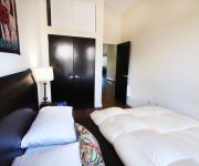
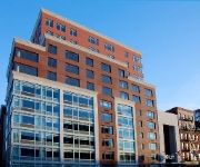
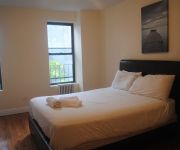
Need some hints on where to stay? We compiled a list of available hotels close to the map centre further down the page.
Being here already, you might want to pay a visit to some of the following locations: The Bronx, Hackensack, Brooklyn, Jersey City and Queens. To further explore this place, just scroll down and browse the available info.
Local weather forecast
Todays Local Weather Conditions & Forecast: 16°C / 61 °F
| Morning Temperature | 11°C / 51 °F |
| Evening Temperature | 15°C / 59 °F |
| Night Temperature | 11°C / 53 °F |
| Chance of rainfall | 0% |
| Air Humidity | 53% |
| Air Pressure | 1011 hPa |
| Wind Speed | Moderate breeze with 11 km/h (7 mph) from South-East |
| Cloud Conditions | Scattered clouds, covering 27% of sky |
| General Conditions | Scattered clouds |
Tuesday, 19th of November 2024
12°C (53 °F)
13°C (55 °F)
Scattered clouds, gentle breeze.
Wednesday, 20th of November 2024
14°C (56 °F)
13°C (55 °F)
Sky is clear, gentle breeze, clear sky.
Thursday, 21st of November 2024
9°C (47 °F)
8°C (47 °F)
Moderate rain, moderate breeze, overcast clouds.
Hotels and Places to Stay
The Allen House (sleeps 5)
Luxury Suites Lenox Ave
Aloft Harlem
Upper East Side Apartments
Guggenheim Flat
Astor on the Park
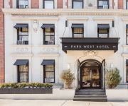
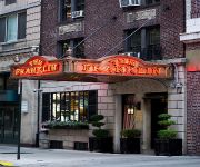
The Franklin Hotel
The Park Ave North
Museum Mile Duplex
The International Cozy Inn
Videos from this area
These are videos related to the place based on their proximity to this place.
Midtown Manhattan seen from the East River 1 Collage Video
Powered by http://www.tanmarket.com - The border of Midtown Manhattan is nebulous and further confused by the fact that the term "Midtown Manhattan" can be used to refer either to a district...
Soccer Resort NYC
Check out Soccer Resort NYC, 2012 in HD. This is NYC's biggest adult soccer tournament, brought to you by the Nation's largest network of adult tournaments.
Living Large in New York City and saving $$$ in the Bronx.
BRONXNOFEE.COM TRYAX MANAGEMENT 718-654-5555 About this Apartment: Magnificiently renovated 2 bedroom apt. w/large eat in kitchen. Near Fordham University and Fordham shopping area ...
Harlem, New York City - Video tour of a vacation rental on West 119th Street (Uptown Manhattan)
Welcome to another video tour of a vacation rental in New York City by New York Habitat ( http://www.nyhabitat.com ). Today, we will be touring a great one-bedroom vacation rental located at...
Raptors in New York City
A Central Park outing with the staff from Hawk Creek wildlife center. A Great time in the City.
Chic & Cozy Apartment Rental in New York City
Chic & Cozy Apartment Rental in New York City Charming Renovated Studio Apartment Near Harlem Hospital! Professional Stainless Steel Appliances. Hardwood Polished Floors Throughout ...
Large 3 Bedroom Bronx, NY University Ave Just 10 Mins from Manhattan
TRYAX MANAGEMENT- 718-654-5555- BRONXNOFEE.COM About this Apartment: Beautiful spacious 3 bedroom apt. in the west bronx. Polished hardwood floors throughout apt. New Kitchen ...
Renovated NYC 2 Bed Apartment Rental @ 110th St & 3rd Ave.
110th St. & 3rd Ave, Spacious 2 bedroom, renovated, eat-in kitchen with great cabinet and counter space, huge bedrooms (QUEEN SIZE BEDS? NO PROBLEM), high ceilings, good closet space, ...
Jeet Kune Do Class. WESTERN BOXING
Dawadah's Totally Complete JKD - A NonTraditional Modified Martial Art based on Bruce Lee's Jeet Kune Do - Franklin Plaza 106th st between 1st & 2nd Ave - El Barrio Harlem New York City.
Margie Ruddick Inspiration
I met Margie Ruddick Landscape Architect at the Central Park Woodlands Stewardship conference on October 5th. There I was the subway musician, amidst architect students, landscape architects...
Videos provided by Youtube are under the copyright of their owners.
Attractions and noteworthy things
Distances are based on the centre of the city/town and sightseeing location. This list contains brief abstracts about monuments, holiday activities, national parcs, museums, organisations and more from the area as well as interesting facts about the region itself. Where available, you'll find the corresponding homepage. Otherwise the related wikipedia article.
East Harlem
East Harlem, also known as Spanish Harlem and El Barrio, is a section of Harlem located in the northeastern extremity of the borough of Manhattan in New York City, USA. East Harlem is one of the largest predominantly Latino communities in New York City, mostly made up of Puerto Ricans, as well as a rising number of Dominican and Mexican immigrants. It includes the area formerly known as Italian Harlem, in which the remnants of a once predominantly Italian community remain.
103rd Street (IRT Lexington Avenue Line)
103rd Street is a local station on the IRT Lexington Avenue Line of the New York City Subway. Located at the intersection of Lexington Avenue and 103rd Street in East Harlem, it is served by the 6 train at all times, the <6> during weekdays in peak direction, and the 4 train during late nights. This underground station, opened on July 17, 1918, has four tracks and two side platforms. The two center express tracks are used by the 4 and 5 trains during daytime hours.
116th Street (IRT Lexington Avenue Line)
116th Street is a local station on the IRT Lexington Avenue Line of the New York City Subway. Located at the intersection of Lexington Avenue and 116th Street in East Harlem, it is served by the 6 train at all times, the <6> during weekdays in peak direction and the 4 train during late nights. There are two side platforms serving the two local tracks. The express tracks are on a lower level and are not visible from the platforms.
110th Street (IRT Lexington Avenue Line)
110th Street is a local station on the IRT Lexington Avenue Line of the New York City Subway. Located in East Harlem at the intersection of 110th Street and Lexington Avenue, it is served by the 6 train at all times, the <6> train weekdays in the peak direction and the 4 train during late nights. This underground station, opened on July 17, 1918, has four tracks and two side platforms. The two center express tracks are used by the 4 and 5 trains during daytime hours.
Rao's
Rao's is a Southern Italian restaurant founded in 1896 and located at 455 East 114th Street (at Pleasant Avenue) in East Harlem, New York City, with a sister restaurant in Las Vegas, NV. The restaurant was started in 1896 by Charles Rao, who moved with his parents from Italy to the United States. He bought a small shop in Italian Harlem, once a very large Italian-American community, and ran the restaurant until his death in 1909. Louis Rao took over the business.
Lexington Avenue bombing
The Lexington Avenue bombing was the July 4, 1914 explosion of a bomb in an apartment at 1626 Lexington Avenue New York City, killing four people and injuring dozens.
Wards Island Bridge
The Wards Island Bridge, also known as the 103rd Street Footbridge, is a pedestrian bridge crossing the Harlem River between Manhattan Island and Wards Island in New York City. The vertical lift bridge has a total of twelve spans consisting of steel towers and girders. It carries only pedestrian and bicycle traffic. On the Manhattan side of the river, the bridge is located at East 103rd Street, between Exits 14 and 15 of the FDR Drive.
Metropolitan Park (New York City)
Metropolitan Park is a former baseball ground located in New York, New York. The ground was the part-time home to the New York Metropolitans of the American Association in 1884. The wooden ballpark was built a few blocks east and south from their first home, the original Polo Grounds, on a piece of land bounded by 109th Street (north), the East River (east), 107th Street (south), and First Avenue (west).
Cristo Rey New York High School
Cristo Rey New York High School is a college preparatory Catholic high school located in East Harlem, in New York, New York. Students spend one day out of the week interning with multinational corporations such as Pfizer, American Express, JP Morgan, and McKinsey. The school's founder and principal is Bill Ford, whose aunt is the martyr Ita Ford.
La Marqueta (East Harlem)
La Marqueta is a marketplace under the elevated Metro North railway tracks between 111th Street and 116th Street on Park Avenue in East Harlem. Its official address is 1590 Park Avenue. In its heyday in the 1950s and 1960s, over 500 vendors operated out of La Marqueta, and it was an important social and economic venue for Hispanic New York. The New York Times called it "the most visible symbol of [the the] neighborhood. " It has since dwindled in size.
116th Street (IRT Third Avenue Line)
116th Street was a local station on the demolished IRT Third Avenue Line. It had three tracks on two levels. The lower level had two tracks and two side platforms for local trains, and was built first. The upper level, built as part of the Dual Contracts, had one track for express trains. The next stop to the north was 125th Street. The next stop to the south was 106th Street. The station closed on May 12, 1955.
106th Street (IRT Third Avenue Line)
106th Street was an express station on the IRT Third Avenue Line in New York City. The station was opened on December 30, 1878, and had two levels. The lower level had two tracks and two side platforms and served local trains. The upper level had one track and two side platforms over the local tracks on the lower level and served express trains. It was built as part of the Dual Contracts. The next stop to the north was 116th Street for local trains and 125th Street for express trains.
99th Street (IRT Third Avenue Line)
99th Street was a local station on the demolished IRT Third Avenue Line in New York City. It had two levels. The lower level serving local trains was built first, and had two tracks and two side platforms. The upper level, built as part of the Dual Contracts had one track that bypassed the station and served express trains. The next stop to the north was 106th Street. The next stop to the south was 89th Street. The station closed on May 12, 1955.
117th Street (IRT Second Avenue Line)
117th Street was a station on the demolished IRT Second Avenue Line. It had three tracks and two side platforms. The next stop to the north was 121st Street. The next stop to the south was 111th Street. The station closed on June 11, 1940.
111th Street (IRT Second Avenue Line)
111th Street was a station on the demolished IRT Second Avenue Line. It had three tracks and two side platforms. The next stop to the north was 117th Street. The next stop to the south was 105th Street. The station closed on June 11, 1940.
99th Street (IRT Second Avenue Line)
99th Street was a station on the demolished IRT Second Avenue Line. It had three tracks and two side platforms. The next stop to the north was 105th Street. The next stop to the south was 92nd Street. The station closed on June 13, 1942.
105th Street (IRT Second Avenue Line)
105th Street was a station on the demolished IRT Second Avenue Line. It had three tracks and two side platforms. The next stop to the north was 111th Street. The next stop to the south was 99th Street. The station closed on June 11, 1940.
Metropolitan Hospital Center
Metropolitan Hospital Center (MHC) is a hospital in East Harlem, New York City. It has been affiliated with New York Medical College since it was founded in 1875, representing the oldest partnership between a hospital and a private medical school in the United States. MHC is part of the New York City Health and Hospitals Corporation (HHC), the largest municipal hospital and healthcare system in the country.
Carver Houses
Carver Houses, or George Washington Carver Houses, is a public housing development built and maintained by the New York City Housing Authority (NYCHA) in Spanish Harlem, a neighborhood of Manhattan, at {{#invoke:Coordinates|coord}}{{#coordinates:40.7906|N|73.9506|W||||| |primary |name= }}.
St. Lucy's Church (Manhattan)
St. Lucy’s Church is a Roman Catholic parish located in Manhattan, New York City under the authority of the Archdiocese of New York. The church and school address is 338-342 East 104th Street, New York, New York 10029; the school occupied 336 East 104th Street.
106th Street (IND Second Avenue Line)
The 106th Street is a planned Phase 2 station along the Second Avenue Subway. Phase 1 is under construction and expected to open in the late 2010s.
St. Ann's Roman Catholic Church (Manhattan)
The Church of St. Ann is a Roman Catholic parish church in the Roman Catholic Archdiocese of New York, located at 312 East 110th Street, in East Harlem, Manhattan, New York City. The parish was established in 1852 and is currently staffed by the PIME Missionaries (Pontifical Institute for Foreign Missions)
St. Paul's Church (New York City)
The Church of St. Paul is a Roman Catholic parish church in the Roman Catholic Archdiocese of New York, located at 113 East 117th Street, Manhattan, New York City.
Church of the Holy Agony (New York City)
The Church of the Holy Agony is a Roman Catholic parish church in the Roman Catholic Archdiocese of New York, located at 1834 Third Avenue and 101st Street, East Harlem, Manhattan, New York City, New York. The parish was established in 1930 as a mission of Our Lady of the Miraculous Medal. The parish is staffed by the Vincentian Fathers.
Church of Our Lady Queen of Angels (New York City)
The Church of Our Lady Queen of Angels is a former Roman Catholic parish church under the authority of the Roman Catholic Archdiocese of New York, located at 228 East 113th Street in Manhattan, New York City. The parish was established in 1886 and was staffed by the Capuchin Friars; the parish closed in 2007. The Archdiocese announced on January 19, 2007 the church's closure.


