Safety Score: 2,7 of 5.0 based on data from 9 authorites. Meaning we advice caution when travelling to United States.
Travel warnings are updated daily. Source: Travel Warning United States. Last Update: 2024-08-13 08:21:03
Touring Dyckman Houses
The district Dyckman Houses of Inwood in New York County (New York) is a subburb located in United States about 214 mi north-east of Washington DC, the country's capital place.
Need some hints on where to stay? We compiled a list of available hotels close to the map centre further down the page.
Being here already, you might want to pay a visit to some of the following locations: The Bronx, Manhattan, Hackensack, Queens and Jersey City. To further explore this place, just scroll down and browse the available info.
Local weather forecast
Todays Local Weather Conditions & Forecast: 10°C / 49 °F
| Morning Temperature | 5°C / 41 °F |
| Evening Temperature | 13°C / 55 °F |
| Night Temperature | 9°C / 47 °F |
| Chance of rainfall | 0% |
| Air Humidity | 29% |
| Air Pressure | 1012 hPa |
| Wind Speed | Gentle Breeze with 7 km/h (5 mph) from South-East |
| Cloud Conditions | Overcast clouds, covering 100% of sky |
| General Conditions | Overcast clouds |
Saturday, 16th of November 2024
13°C (55 °F)
9°C (48 °F)
Sky is clear, moderate breeze, clear sky.
Sunday, 17th of November 2024
13°C (55 °F)
11°C (51 °F)
Sky is clear, light breeze, clear sky.
Monday, 18th of November 2024
12°C (53 °F)
11°C (51 °F)
Overcast clouds, moderate breeze.
Hotels and Places to Stay
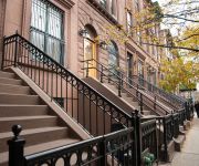
Luxury Suites Upper West Brownstone
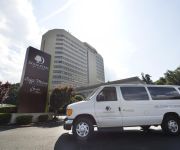
DoubleTree by Hilton Fort Lee - George Washington Bridge
Opera House Hotel
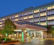
Holiday Inn GW BRIDGE-FORT LEE NYC AREA
The Sylvan Guest House
BEST WESTERN FORT LEE
Mi Casa Tu Casa
Sugar Hill Harlem Inn
Market Rentals Downtown Apartments
Market Rentals Uptown
Videos from this area
These are videos related to the place based on their proximity to this place.
New York City Subway: Snowy Elevated Trains in Manhattan and Bronx
Today's film leaves the underground and shows the only elevated stretches of the subway system that exist today in Manhattan. There are two such stretches, both along the IRT Seventh Avenue...
Dyckman Basketball Special Events Game Recap.m4v
Dyckman Basketball Tournament Presents the 2011 Speical Events Game. East vs West. Brandon Jennings vs 2 Hard 2 Guard. Demar Derozen vs Corey "Homicide" Williams. THE GAME vs THE ...
Dyckman Street Time Lapse (HD)
Intersection of Dyckman Street & Broadway. Shot with 10-22mm Sigma Wide Angle Lens. Canon 40D. Around 800 3 second Exposures.
Kevin Durant crossover and dunk on Michael Beasley at Dyckman Park
2011 Dyckman Summer League, Kevin Durant of Team Nike put crossover on Michael Beasley and gets to rim for powerful one handed dunk.
Kevin Durant has his first shot at Dyckman Park blocked.
2011 Dyckman Summer League, Kevin Durant of Team Nike gets his first shot blocked. Welcome to Dyckman KD!!!
Kevin Durant crossover and layup on Michael Beasley at Dyckman Park
2011 Dyckman Summer League, Kevin Durant of Team Nike puts crossover on Michael Beasley of Team 914 and goes to rim for layup.
Kevin Durant 2nd Alley Oop at Dyckman Park
2011 Dyckman Summer League, Kevin Durant of Team Nike catches his 2nd alley oop of the night.
Kevin Durant aka The Durantula at Dyckman Park
2011 Dyckman Summer League, Kevin Durant of Team Nike gets to basket against Michael Beasley of Team 914 for and 1 layup.
Kevin Durant Alley Oop 1 of 2 at Dyckman Park
2011 Dyckman Summer League, Kevin Durant of Team Nike catches his first alley oop of the night.
Videos provided by Youtube are under the copyright of their owners.
Attractions and noteworthy things
Distances are based on the centre of the city/town and sightseeing location. This list contains brief abstracts about monuments, holiday activities, national parcs, museums, organisations and more from the area as well as interesting facts about the region itself. Where available, you'll find the corresponding homepage. Otherwise the related wikipedia article.
The Cloisters
The Cloisters is a museum located in Fort Tryon Park, Washington Heights, New York City. The building, which is a branch of the Metropolitan Museum of Art, was built in the 1930s resembling architectural elements of several European medieval abbeys. It is used to exhibit art and architecture from Medieval Europe. The Cloisters, which is near the northern tip of Manhattan island on a hill overlooking the Hudson River, incorporates parts from five French cloistered abbeys.
University Heights (Metro-North station)
The University Heights (also known as University Heights – West 207th Street) Metro-North Railroad station serves residents of the University Heights neighborhood of the Bronx, New York City, via the Hudson Line. Trains leave for Manhattan every 25 to 35 minutes on weekdays. It is 8.69 miles from Grand Central Terminal, and travel time to Grand Central is approximately 19 minutes. It is located between the Harlem River and the Major Deegan Expressway.
Morris Heights (Metro-North station)
The Morris Heights (also known as Morris Heights – West 177th Street) Metro-North station serves the residents of the Morris Heights neighborhood of the Bronx, New York via the Hudson Line. Trains leave for New York City every 25 to 35 minutes during peak hours, and every hour at other times and on weekends. It is 8.1 miles from Grand Central Terminal and travel time to Grand Central is approximately 17 minutes.
WaHI
WaHI stands for "Washington Heights and Inwood," two neighborhoods of Upper Manhattan in New York City. The term was coined by Eduardo Gómez, founder of the WaHI Online community web site, in 2002. The term is commonly used and understood within WaHI Online, but has not caught on widely elsewhere (as opposed to, for example, Hudson Heights, which was chosen by a group of neighborhood activistsand is widely cited).
Inwood – 207th Street (IND Eighth Avenue Line)
Inwood – 207th Street (formerly Washington Heights – 207th Street) is the northern terminal station of the IND Eighth Avenue Line of the New York City Subway. Located at the intersection of 207th Street and Broadway in the Manhattan neighborhood of Inwood, near Inwood Hill Park, it is served by the A train at all times.
Dyckman Street (IND Eighth Avenue Line)
Dyckman Street is a station on the IND Eighth Avenue Line of the New York City Subway, located at the intersection of Dyckman Street and Broadway in the Inwood neighborhood of Manhattan. It is served by the A train at all times. This underground station opened as Dyckman Street – 200th Street on September 10, 1932 along with the rest of the Eighth Avenue Line from 207th Street to Chambers Street/Hudson Terminal.
191st Street (IRT Broadway – Seventh Avenue Line)
191st Street is a station on the IRT Broadway – Seventh Avenue Line of the New York City Subway. Located at the intersection of St. Nicholas Avenue and 191st Street in Manhattan, it served by the 1 train at all times. At approximately 180 feet (55 m) below street level, this is the deepest station in the New York City Subway system. It has two tracks and two side platforms.
207th Street (IRT Broadway – Seventh Avenue Line)
207th Street is a local station on the IRT Broadway – Seventh Avenue Line of the New York City Subway. Located at the intersection of 207th Street and 10th Avenue in the Manhattan neighborhood of Inwood, it is served by the 1 train at all times. This elevated station, opened on March 16, 1906, has two side platforms and three tracks with the center track not used in revenue service.
George Washington High School (New York City)
George Washington High School is a public high school located in the Fort George neighborhood of the Washington Heights section of Manhattan in New York City, New York. The original school, which was operated by the New York City Department of Education, was built February 2, 1917. The school's name derives from the Revolutionary War battle fought on the hill of the building site. The school was once an annex of Morris High School.
WNYU-FM
WNYU-FM is a college radio station owned and operated by New York University. Until 2004, it served lower Manhattan and surrounding areas, but thanks to a new booster, it now broadcasts to the tri-state region. The station can be heard on 89.1 FM at 8,300 watts from 4pm until 1am on weekdays, and on the Internet 24 hours a day, 7 days a week at wnyu. org. The stream can also be found in iTunes Radio under the Eclectic genre. WNYU is run entirely by university students.
Roberto Clemente State Park
Roberto Clemente State Park is a state park in the South Bronx, New York in the USA. The park is in the northern part of New York City, adjacent to the Harlem River, the Major Deegan Expressway and the Morris Heights station on Metro-North's Hudson Line. Roberto Clemente was a baseball player, who was killed in an air crash while trying to assist relief efforts after the 1972 Nicaragua earthquake.
Marsha Stern Talmudical Academy
The Marsha Stern Talmudical Academy, also known as Yeshiva University High School for Boys (YUHSB), MTA (Manhattan Talmudical Academy) or TMSTA, is an Orthodox Jewish day school, the boys' prep school of Yeshiva University (YU) in the Washington Heights neighborhood in the New York City borough of Manhattan.
Dyckman Street (IRT Broadway – Seventh Avenue Line)
Dyckman Street is a station on the IRT Broadway – Seventh Avenue Line of the New York City Subway. Located roughly at the intersection of Dyckman Street and Nagle Avenue in the neighborhood of Inwood, Manhattan, it is served by the 1 train at all times. This embankment station, opened on March 16, 1906, has two side platforms, two tracks and maintains a level grade.
University Heights Bridge
The University Heights Bridge crosses the Harlem River, connecting West 207th Street in the Inwood neighborhood of Manhattan to West Fordham Road in the University Heights section of the Bronx. The bridge is operated and maintained by the New York City Department of Transportation. The bridge carries two lanes of traffic in each direction, along with a sidewalk on the south side of the bridge. It may have once carried the now-decommissioned New York State Route 9X.
University Woods
University Woods is a small woodland park in the University Heights neighborhood in the borough of the Bronx, overlooking the Harlem River crested between Sedgwick and Cedar Avenues in New York City. After having been named "the city's worst park" by the New Yorkers for Parks in the years 2003–2006, a restoration project was begun in 2008 by the Friends of the Woods organization, with a $500,000 grant from Mayor Michael Bloomberg.
Bogardus Place
Bogardus Place is located in the Inwood section of New York City borough of Manhattan. It was opened in 1912, and runs one block (641.7 feet) between Hillside Avenue and Ellwood Street, and is named for the family who previously owned much of the land that forms both Fort Tryon Park, and the Fort Tryon section. The Bogardus family in America started in 1633, when Reverend Everardus Bogardus arrived in New Amsterdam to become that community's second clergyman.
Dyckman Street
Dyckman Street is a street in the Inwood neighborhood of Manhattan, New York City. It is commonly considered to be a crosstown street because it runs from the Hudson River to the Harlem River and intersects Broadway. However, in its true geographical orientation, Dyckman Street runs roughly from north-northwest to south-southeast, and the majority of the street that lies southeast of Broadway runs closer to a north-south direction than east-west.
Isham Park
Isham Park is a 20-acre historic park located in the Inwood section of Manhattan in New York City. The park was created through a gift of the Isham family in 1912-1916 and later expanded by New York City in 1925 and 1927. Its western border once extended to the Harlem River but after the development of Inwood Hill Park and reconfiguration of area streets the boundary became, for all practical purposes, Seaman Avenue. Isham Park has its southern boundary at Isham Street.
The Equity Project
The Equity Project (TEP) is a New York charter school, that opened in September 2009. The school will instruct students in fifth through eighth grades, and will pay its teachers a starting salary of $125,000 per year, more than double the national average. However, they must also work double the hours a typical teacher works.
Mount Washington Church (New York City)
Mount Washington Church was a former Manhattan church located on Broadway and Dyckman Street, New York City. It was built in 1844 and enlarged 1856. It was a fine example of a timber Carpenter Gothic church with crenelated tower and spire. The church was demolished sometime before its publication (1967) in Lost New York.
Messiah Mission Church (New York City)
Messiah Mission Church, also known as Messiah Evangelical Lutheran Church, was a Lutheran church in the Inwood neighborhood of Manhattan. The congregation was founded in 1916 and a two-storey brick school and chapel was built 1926 to designs by George W. Conable 46 West 24th Street, at 198-200 Sherman Avenue. The pastor who built the 1926 school church was Frederick P. Wilhem of 609 West 204th Street. Messiah merged in 1945 with St.
Our Lady Queen of Martyrs Church (New York City)
The Church of Our Lady Queen of Martyrs is a Roman Catholic parish church in the Roman Catholic Archdiocese of New York, located at 91 Arden Street, south of Broadway, Inwood, Manhattan. It was established in 1927 and built in 1928 to designs by Gustave E. Steinback of 157 West 74th Street for $160,000. A $400,000 four-story brick school was built in 1949, also to designs by Gustave E. Steinback, now of Hunting Ridge, Stamford, Connecticut.
St. Jude's Church (New York City)
The Church of St. Jude is a Catholic parish church in the Archdiocese of New York, located at 481 West 204th Street and Tenth Avenue in Manhattan, New York City. It was established in 1949. The church was built 1951 to designs by the architectural firm of Voorhees, Walker, Foley & Smith of 101 Park Avenue for $600,000. A three-storey convent at 411 West 204th Street was built 1954 to designs by the same firm for $200,000.
Church of the Good Shepherd (New York City)
The Church of the Good Shepherd is a Roman Catholic parish church in the Roman Catholic Archdiocese of New York, located at 608 Isham Street, Manhattan, New York City.
Sherman Creek Generating Station
The Sherman Creek Generating Station was a coal fired power plant constructed by the United Electric Light and Power Company. The station was located in New York City, NY on Manhattan Island at 201st Street and the Harlem River. The station supplied power to many customers, including the New York, New Haven and Hartford Railroad via the West Farms Substation. The station site was bounded by 201st Street to the north, the Harlem River to the East, and Sherman Creek to the South.


