Safety Score: 2,7 of 5.0 based on data from 9 authorites. Meaning we advice caution when travelling to United States.
Travel warnings are updated daily. Source: Travel Warning United States. Last Update: 2024-08-13 08:21:03
Delve into Sunset Park
The district Sunset Park of Brooklyn in Kings County (New York) is a subburb in United States about 201 mi north-east of Washington DC, the country's capital town.
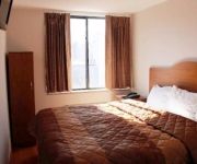
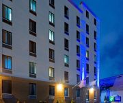
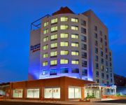
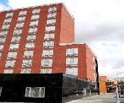
If you need a hotel, we compiled a list of available hotels close to the map centre further down the page.
While being here, you might want to pay a visit to some of the following locations: Jersey City, Manhattan, Staten Island, Queens and Newark. To further explore this place, just scroll down and browse the available info.
Local weather forecast
Todays Local Weather Conditions & Forecast: 14°C / 58 °F
| Morning Temperature | 11°C / 52 °F |
| Evening Temperature | 15°C / 59 °F |
| Night Temperature | 12°C / 53 °F |
| Chance of rainfall | 0% |
| Air Humidity | 64% |
| Air Pressure | 1011 hPa |
| Wind Speed | Fresh Breeze with 13 km/h (8 mph) from South-East |
| Cloud Conditions | Few clouds, covering 24% of sky |
| General Conditions | Few clouds |
Tuesday, 19th of November 2024
10°C (51 °F)
13°C (55 °F)
Broken clouds, moderate breeze.
Wednesday, 20th of November 2024
13°C (55 °F)
13°C (55 °F)
Sky is clear, moderate breeze, clear sky.
Thursday, 21st of November 2024
9°C (48 °F)
9°C (48 °F)
Moderate rain, fresh breeze, broken clouds.
Hotels and Places to Stay
Union Hotel Brooklyn
WYNDHAM GARDEN BROOKLYN SUNSET
Hotel Le Bleu
Eve's Place
an Ascend Hotel Collection Member Red Hook The LOOK Hotel
Loralei Bed and Breakfast
RED CARPET INN BROOKLYN CONEY ISLAND
RED LION INN AND SUITES BROOKLYN
Fairfield Inn & Suites New York Brooklyn
BW PLUS PROSPECT PARK
Videos from this area
These are videos related to the place based on their proximity to this place.
FDNY: 4/13/14 Brooklyn: 3 Alarm Box 1456 4324 4th Ave.
4/13/14 Brooklyn: 3 Alarm Box 1456 4324 4th Ave.
SPECIAL LOT OF NEW YORK CITY PUBLIC & PRIVATE SCHOOL BUSES AT EVENT ON RANDALLS ISLAND.
HERE YOU WILL SEE A SPECIAL LOT OF NEW YORK CITY PUBLIC AND PRIVATE SCHOOL BUSES AT EVENT ON RANDALLS ISLAND IN NEW YORK CITY. IN LOVING MEMORY OF MY LITTLE ...
Bargain Shopping New York City
Real Shoppers talk about real bargains at Century 21 in New York City. The store is one of the most popular shopping destinations for New Yorkers, tourists and visitors. It is housed in a massive...
Ikea disclosure Choice Green New York City Handyman Bay Ridge Brooklyn
Showing people just what goes into the assembly of Ikea pieces that can get complicated. http://www.nyctvmountingikea.com Call or text 347-992-1870 We are in...
MTA Subway - 2012-13 MotivePower R-156 Diesel-Electric Locomotive #OL913
Shot at the South Brooklyn Railway Right-of-Way in the Sunset Park Neighborhood of Brooklyn, #OL913 is the newest work locomotive in the MTA Subway fleet. Trevor Logan Video, All Rights ...
B63 bus at 36th Street and 4th Avenue
Red Hook-bound B63 bus of the now retired 1999-2000 New Flyer C40 low floor compressed natural gas model arriving at, stopping, and leaving 36th Street and 4th Avenue. The B63 now consists...
Brooklyn Sewer Line - New Drain System In Dyker Heights
http://www.balkanplumbing.com/brooklyn-sewer-line-repair-replacement-highest-quality-service New drain system installed in Dyker Heights, Brooklyn. Call Balkan @ 718 849-0900 for expert sewer...
BMT West End Line: Manhattan-bound R160B Alstom N Train via D Line in Sunset Park
Due to midday construction, all Manhattan-bound N trains operated via the D line in Brooklyn between Coney lsland and 36th Street during the midday construction. For immediate screechin' symphony.
Coney Island-bound R160B N Train/Bronx-bound R68 D Train@4th Avenue Portal
Here is a double screechin' symphony as the Coney Island-bound R160B N train hauls ass around this 90 degree turn and the Bronx-bound R68 D train enters towards the 4th Avenue portal in Sunset...
Videos provided by Youtube are under the copyright of their owners.
Attractions and noteworthy things
Distances are based on the centre of the city/town and sightseeing location. This list contains brief abstracts about monuments, holiday activities, national parcs, museums, organisations and more from the area as well as interesting facts about the region itself. Where available, you'll find the corresponding homepage. Otherwise the related wikipedia article.
Sunset Park, Brooklyn
Sunset Park is a neighborhood in the western section of the New York City borough of Brooklyn, USA, on Long Island. It is bounded by Greenwood Heights to the north, Borough Park to the east, Bay Ridge to the south, and Upper New York Bay to the west. Sunset Park is served by the NYPD's 72nd Precinct. There is a namesake city park within the neighborhood, located between 41st and 44th Streets and 5th and 7th Avenues. The "main drag" of the neighborhood is 5th Avenue.
Basilica of Our Lady of Perpetual Help, Brooklyn
The Basilica of Our Lady of Perpetual Help is an architectural landmark in the New York City borough of Brooklyn. It is located on 5th Avenue between 59th and 60th streets in the Sunset Park neighborhood and occupies about half the square block extending back to 6th Avenue, with the rectory and ancillary buildings occupying the remainder. The Basilica is visible for some distance, particularly from the Gowanus Expressway. It is popularly referred to by its initials, OLPH.
59th Street (BMT Fourth Avenue Line)
59th Street is an express station on the BMT Fourth Avenue Line of the New York City Subway. Located at 59th Street and Fourth Avenue, in the Brooklyn neighborhood of Sunset Park, it is served by the N and R trains at all times. This is the southernmost four-track express station with two island platforms. The local tracks continue along Fourth Avenue to Bay Ridge – 95th Street while the express tracks turn east to become the tracks of the BMT Sea Beach Line.
36th Street (BMT Fourth Avenue Line)
36th Street is an express station on the BMT Fourth Avenue Line of the New York City Subway, located at 36th Street and Fourth Avenue in Sunset Park, Brooklyn. This is an express station with four tracks and two island platforms. The R train provides local service, while the D and N trains run express (except during late nights, when all trains provide local service). During late nights, this station is the northern terminal for the R shuttle to Bay Ridge – 95th Street.
Bay Ridge Avenue (BMT Fourth Avenue Line)
Bay Ridge Avenue is a station on the BMT Fourth Avenue Line of the New York City Subway, located at the intersection of Bay Ridge Avenue and Fourth Avenue in Bay Ridge, Brooklyn. It is served by the R train at all times. This station has two tracks and two side platforms with space for an additional trackway under the northbound platform. The station's mezzanine is above the platforms with two staircases leading to each.
45th Street (BMT Fourth Avenue Line)
45th Street is a local station on the BMT Fourth Avenue Line of the New York City Subway, located at 45th Street and Fourth Avenue in Sunset Park, Brooklyn. It is served by the R train at all times except late nights northbound and the N train late nights only. This underground station, opened on September 13, 1915, has four tracks and two side platforms. The two center tracks are used by N trains during daytime hours as well as late-night northbound R trains.
Maimonides Medical Center
Maimonides Medical Center is a non-profit, non-sectarian hospital located in Borough Park, in the New York City borough of Brooklyn, in the U.S. state of New York. Maimonides is both a treatment facility and academic medical center with 705 beds, and more than 70 primary care and sub-specialty programs. With a staff of nationally renowned physicians, Maimonides Medical Center strives to conduct quality research, care and education.
53rd Street (BMT Fourth Avenue Line)
53rd Street is a local station on the BMT Fourth Avenue Line of the New York City Subway. Located at 53rd Street and Fourth Avenue in Sunset Park, Brooklyn, it is served by the R train at all times except late nights northbound and the N train late nights only. This underground station, opened on September 13, 1915, has four tracks and two side platforms. The two center tracks are used by N trains during daytime hours as well as late-night northbound R trains.
Metropolitan Detention Center, Brooklyn
The Metropolitan Detention Center, Brooklyn (MDC Brooklyn) is a United States federal administrative detention facility in Brooklyn, New York which holds male and female prisoners of all security levels. It is operated by the Federal Bureau of Prisons, a division of the United States Department of Justice. Most prisoners held at MDC Brooklyn have pending cases in the United States District Court for the Eastern District of New York. MDC Brooklyn also holds prisoners serving brief sentences.
Eighth Avenue (BMT Sea Beach Line)
Eighth Avenue is a local station on the BMT Sea Beach Line of the New York City Subway, located in Sunset Park, Brooklyn at the intersection of Eighth Avenue and 62nd Street. It is served by the N train at all times. This open cut station, opened on June 22, 1915, has two side platforms and four tracks. The two center express tracks are not normally used. The Coney Island-bound track has been disconnected from the line and the Manhattan-bound track is signaled for trains in both directions.
Fort Hamilton Parkway (BMT Sea Beach Line)
Fort Hamilton Parkway is a local station on the BMT Sea Beach Line of the New York City Subway, located in Brooklyn at the intersection of Fort Hamilton Parkway and 62nd Street. It is served by the N train at all times. The northbound platform has metal canopies while the southbound platform has concrete walls and roof. Each end has a crossover. The full-time north exit leads to Fort Hamilton Parkway and 62nd Street while the HEET south exit leads to 11th Avenue and 62nd–63rd Streets.
Ninth Avenue (BMT West End Line)
Ninth Avenue is a bi-level express station on the BMT West End Line of the New York City Subway, located at the intersection of Ninth Avenue and 39th Street in Brooklyn. Each level has three tracks and two island platforms. The upper level serves the BMT West End Line while the lower level formerly served the BMT Culver Line. Only the upper level is still in service and is served by the D train at all times. The center express track is not normally used.
Fort Hamilton Parkway (BMT West End Line)
Fort Hamilton Parkway is a local station on the BMT West End Line of the New York City Subway, located in Brooklyn at the intersection of Fort Hamilton Parkway and New Utrecht Avenue, in the neighborhood of Borough Park. It is served by the D train at all times. It has three tracks and two side platforms. There was formerly a booth on the north side of the station, at 44th Street. The mezzanine and stairs still remain, as does evidence of removed windows.
Lapskaus Boulevard
Lapskaus Boulevard is the nickname of 8th Avenue, located in a historically Norwegian working-class neighborhood in Bay Ridge, Brooklyn, New York City. The name Lapskaus was derived from a Northern European stew that was a staple food of lower to middle income families. In Norway, lapskaus most often refers to a variation of beef stew.
Fourth Avenue (Brooklyn)
Fourth Avenue is a major thoroughfare in the New York City borough of Brooklyn. It stretches for 6 miles south from Times Plaza, which is the triangle intersection created by Atlantic and Flatbush Avenues in Downtown Brooklyn, to Shore Road and the Belt Parkway in Bay Ridge. While southwestern Brooklyn is well served by expressways, Fourth Avenue provides an alternate for local traffic as it directly links the neighborhoods of Park Slope, Sunset Park and Bay Ridge with Downtown Brooklyn.
Bush Terminal – Industry City
Bush Terminal, now known as Industry City, is a historic intermodal shipping, warehousing, and manufacturing complex on the waterfront in the Greenwood Heights neighborhood of Brooklyn, New York City. Bush Terminal was the first facility of its kind in New York and the largest multi-tenant industrial property in the United States.
36th Street (BMT Fifth Avenue Line)
36th Street was a station on the demolished section of the BMT Fifth Avenue Line. It was served by trains of the BMT Culver Line and BMT Fifth Avenue Line. It had four tracks and two island platforms. The next stop to the north was 25th Street. The next stop to the south was Ninth Avenue for Culver Line trains and 40th Street for Fifth Avenue Line trains. The station closed on May 31, 1940.
40th Street (BMT Fifth Avenue Line)
40th Street was a station on the now demolished BMT Fifth Avenue Line. It was served by trains of the BMT Fifth Avenue Line. It had two tracks and one island platform. The next stop to the north was 36th Street. The next stop to the south was 46th Street. The station closed on May 31, 1940.
46th Street (BMT Fifth Avenue Line)
46th Street was a station on the demolished BMT Fifth Avenue Line. It was served by trains of the BMT Fifth Avenue Line. It had 2 tracks and 1 island platform. The next stop to the north was 40th Street. The next stop to the south was 52nd Street. It closed on May 31, 1940.
52nd Street (BMT Fifth Avenue Line)
52nd Street was a station on the demolished section of the BMT Fifth Avenue Line. It was served by trains of the BMT Fifth Avenue Line. It had 2 tracks and 1 island platform. The next stop to the north was 46th Street. The next stop to the south was 59th Street. It closed on May 31, 1940.
59th Street (BMT Fifth Avenue Line)
59th Street was a station on the demolished section of the BMT Fifth Avenue Line. It was served by trains of the BMT Fifth Avenue Line. It had two tracks and one island platform. The next stop to the north was 52nd Street. The next stop to the south was 65th Street Terminal. It closed on May 31, 1940.
65th Street Terminal (BMT Fifth Avenue Line)
65th Street Terminal was a station on the demolished section of the BMT Fifth Avenue Line. It was served by trains of the BMT Fifth Avenue Line. It had two tracks and one island platform. The next stop to the north was 59th Street. It closed on May 31, 1940. Today, the Gowanus Expressway and Belt Parkway have an interchange there.
St. Michael's Church (Brooklyn, New York)
The Church of St. Michael is a Catholic parish church under the authority of the Roman Catholic Diocese of Brooklyn, located in the Sunset Park neighborhood of Brooklyn, New York City.
John J. Pershing Intermediate School 220
{{#invoke:Coordinates|coord}}{{#coordinates:40|38|26.83|N|74|0|3.54|W|region:US |primary |name= }} John J Pershing I. S 220Established 1970sType PublicPrincipal Loretta M. WitekStudents 1,292Grades 6-8Location 4812 9th Avenue Brooklyn, NY 11220,Brooklyn, New York, United StatesYearbook 'The Eagles'Website http://schools. nycenet. edu/region7/is220 John J.
65th Street Yard
The 65th Street Yard, also Bay Ridge Rail Yard, is a rail yard at the Brooklyn shore equipped with two ferry slips which allow rail cars to be loaded and unloaded onto car float barges. Located adjacent to the Brooklyn Army Terminal, it provided a major link in the city's rail freight network in the first half of the twentieth century. It was later used as a conventional railroad yard at the end of the LIRR/NY&A Bay Ridge Branch.


