Safety Score: 2,7 of 5.0 based on data from 9 authorites. Meaning we advice caution when travelling to United States.
Travel warnings are updated daily. Source: Travel Warning United States. Last Update: 2024-08-13 08:21:03
Discover Manhattan Beach
The district Manhattan Beach of Brooklyn in Kings County (New York) is a district in United States about 201 mi north-east of Washington DC, the country's capital city.
Looking for a place to stay? we compiled a list of available hotels close to the map centre further down the page.
When in this area, you might want to pay a visit to some of the following locations: Queens, Staten Island, Jersey City, Manhattan and Newark. To further explore this place, just scroll down and browse the available info.
Local weather forecast
Todays Local Weather Conditions & Forecast: 14°C / 58 °F
| Morning Temperature | 11°C / 52 °F |
| Evening Temperature | 15°C / 59 °F |
| Night Temperature | 12°C / 54 °F |
| Chance of rainfall | 0% |
| Air Humidity | 65% |
| Air Pressure | 1011 hPa |
| Wind Speed | Fresh Breeze with 13 km/h (8 mph) from South-East |
| Cloud Conditions | Few clouds, covering 24% of sky |
| General Conditions | Few clouds |
Tuesday, 19th of November 2024
10°C (50 °F)
13°C (55 °F)
Broken clouds, moderate breeze.
Wednesday, 20th of November 2024
13°C (55 °F)
13°C (55 °F)
Sky is clear, moderate breeze, clear sky.
Thursday, 21st of November 2024
9°C (48 °F)
9°C (48 °F)
Moderate rain, strong breeze, broken clouds.
Hotels and Places to Stay
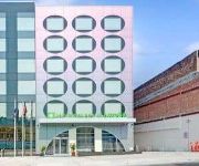
WYNDHAM GARDEN BROOKLYN SUNSET
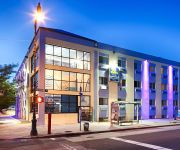
BEST WESTERN PLUS BROOKLYN BAY
Lefferts Manor Bed & Breakfast
Midwood Suites Brooklyn
Gabbs Apartment
Serenity at Home Guest House
Eve's Place
Loralei Bed and Breakfast
Lxure Brooklyn Suites
RED CARPET INN BROOKLYN CONEY ISLAND
Videos from this area
These are videos related to the place based on their proximity to this place.
1. MTA New York City Subway R-32 B train Brighton Beach to Kings Hwy
R-32 B train 3520 Brighton Beach to Kings Hwy Part 1. R-32 B train Starting Brighton Beach to get off 47-50 Sts-Rockefeller Ctr because My videos not full long time. Please enter internet YouTube.c...
Chabad Neshama Hebrew School Manhattan Beach 08
Chabad Neshama Hebrew School of Manhattan Beach offers a stimulating yet friendly environment where children embrace their Jewish roots and gain a true sense of Jewish pride.
24 Hour Plumber Manhattan Beach Brooklyn 718-925-4052 Brooklyn NY Plumbing Service
24 Hour Plumber Manhattan Beach Brooklyn 718-925-4052 Brooklyn Repairs, Installation, Maintenance We offer a wide range of services to handle your large or small plumbing, drain cleaning,...
2nd Quarter Manhatten Real Estate report 2012 Brooklyn - South Beach
Quick update on Manhattan Real Estate 2nd quarter market report for 2012 and a preview of 296 West End Ave in Manhattan Beach in Brooklyn. Ariel Tirosh from Prudential Douglas Elliman presenting.
MTA NYCT Bus: 1998 Nova-RTS B49 Bus #9420 at Kingsborough CC-Oriental Blvd
Bay Ridge-4th Ave bound Nova-RTS B1 Bus #9420 on Oriental Blvd (Manhattan Beach) at its first bus stop at Kingsborough Community College and leaving its first bus stop heading towards Shore...
B train above Coney Island and Brighton Beach Avenues
Manhattan-bound B train of R68As running above Coney Island and Brighton Beach Avenues.
R160 Q Express - Entering and leaving Brighton Beach. [Car # 8888]
Siemens car # 8888 Leaving Brighton beach on the express track. Due to track work Q trains ran Express to Coney Island. Filmed 7-1-2012 Camera: Sony Nex5n.
Sandy Hurricane 10.29.2012 Jeep Wrangler SCARY
We were rescued by the Jeep wrangler! Water started to rise at 7.20 and streets became completely flooded in 30-35 minutes! Cars are floating! If you wish to licence this footage please contact...
B68 bus at Coney Island and Brighton Beach Avenues
Coney Island-bound B68 bus of New Flyer C40LF Compressed Natural Gas model turning from Coney Island Avenue to Brighton Beach Avenue.
Videos provided by Youtube are under the copyright of their owners.
Attractions and noteworthy things
Distances are based on the centre of the city/town and sightseeing location. This list contains brief abstracts about monuments, holiday activities, national parcs, museums, organisations and more from the area as well as interesting facts about the region itself. Where available, you'll find the corresponding homepage. Otherwise the related wikipedia article.
Brighton Beach
Brighton Beach is an oceanside neighborhood in the southern parts of New York City borough of Brooklyn. As of 2007, it has a population of 75,692 with a total of 31,228 households. It is known for its high population of Russian-speaking immigrants and as a summer destination for New York City residents due to its beaches along the Atlantic Ocean and its proximity to the amusement parks in Coney Island.
Gerritsen Beach, Brooklyn
Gerritsen Beach is a small town/community in the New York City borough of Brooklyn, located between Sheepshead Bay to the west and Marine Park to the east. The area is served by Brooklyn Community Board 15.
Sheepshead Bay, Brooklyn
Sheepshead Bay is a bay separating the mainland of Brooklyn, New York City, from the eastern portion of Coney Island, the latter originally a barrier island but now effectively an extension of the mainland with peninsulas both east (the neighborhood of Manhattan Beach) and west (the neighborhoods of Coney Island and Sea Gate). The mouth of the bay is about a mile (1.6 km) southwest of Marine Park, Brooklyn.
Manhattan Beach, Brooklyn
Manhattan Beach is a residential neighborhood in the New York City borough of Brooklyn. It is bounded by the Atlantic Ocean to the south and east, by Sheepshead Bay on the north, and Brighton Beach to the west. Traditionally known as an Italian and Ashkenazi Jewish neighborhood, it is also home to a sizable community of Sephardi Jews and a large Russian Jewish immigrant presence.
Kingsborough Community College
Kingsborough Community College (KBCC), part of the City University of New York (CUNY) system, is the only community college in Brooklyn, New York. The campus is located at Manhattan Beach, which is at the eastern end of Coney Island. The 71-acre (283,000 m²) campus overlooks Sheepshead Bay, Jamaica Bay, and the Atlantic Ocean. In its early years, it also had an annex, known as the "Mid-Brooklyn campus".
Brighton Beach (BMT Brighton Line)
Brighton Beach is an express/terminal station on the BMT Brighton Line of the New York City Subway. It is located over Brighton Beach Avenue at Brighton Sixth Street in the community of Brighton Beach on Coney Island in Brooklyn.
Breezy Point, Queens
Breezy Point is a neighborhood in the New York City borough of Queens, located on the western end of the Rockaway peninsula, between Rockaway Inlet and Jamaica Bay on the landward side, and the Atlantic Ocean. The neighborhood is governed by Queens Community Board 14. The community is run by the Breezy Point Cooperative, in which all residents pay the maintenance, security, and community-oriented costs involved with keeping the community private.
Ocean Parkway (BMT Brighton Line)
Ocean Parkway is an express station on the New York City Subway's BMT Brighton Line. Located at Brighton Beach Avenue and Ocean Parkway in Brighton Beach, Brooklyn, it is served by the Q train at all times.
Sheepshead Bay (BMT Brighton Line)
Sheepshead Bay is an express station on the BMT Brighton Line of the New York City Subway. It is located in the Sheepshead Bay neighborhood of Brooklyn. It is served by the Q train at all times and by the B train on weekdays. The station has four tracks and two island platforms. It was renovated by New York City Transit’s in-house MOW forces in 1997-98.
Neck Road (BMT Brighton Line)
Neck Road is a local station on the BMT Brighton Line of the New York City Subway. Served by the Q train at all times, it is located at Gravesend Neck Road between East 15th and East 16th Streets in Homecrest, Brooklyn. This station opened in 1908, has two side platforms and four tracks. The center tracks are used by the B express train when it operates on weekdays. Like the rest of the Brighton Line between Avenue H and Sheepshead Bay, it is situated on an embankment.
Avenue U (BMT Brighton Line)
Avenue U is a local station on the BMT Brighton Line of the New York City Subway, located at Avenue U between East 15th and East 16th Streets in Sheepshead Bay, Brooklyn. It is served by the Q train at all times. This station, opened in 1908 and completely rebuilt in 2008-2010, is situated on an embankment and has four tracks and two side platforms. The center tracks are used by the B express train when it operates on weekdays.
Abraham Lincoln High School (Brooklyn)
Abraham Lincoln High School is a public high school located at 2800 Ocean Parkway, Coney Island, Brooklyn, New York, and is part of Region 7 in the New York City Department of Education. The principal is Ari Hoogenboom, and the school has 2581 students in grades nine through twelve. Built in 1929, Lincoln has graduated several Nobel Prize laureates and famous doctors, scientists, engineers, politicians, and other notable alumni. Abraham Lincoln High School, Bayside High School, Samuel J.
Homecrest, Brooklyn
Homecrest is a neighborhood situated in the New York City borough of Brooklyn. It borders Kings Highway to the north, Avenue X to the south, Coney Island Avenue to the west, and Ocean Avenue to the east. Homecrest uses the ZIP Code, 11229. The area is served by Brooklyn Community Board 15. Homecrest is served by the NYPD's 61st Precinct.
WKRB
WKRB (90.3 MHz) is an FM station based in New York City, New York. It is a music based station based at and controlled by Kingsborough Community College in Brooklyn. It also is the official station of the Brooklyn Cyclones, and is a broadcast partner of the New York Islanders hockey club. In 2006, WKRB changed its frequency from 90.9 MHz to 90.3 MHz, but kept its call letters.
Coney Island Hospital
Coney Island Hospital is a public hospital located in Brooklyn, New York City. It is owned by the New York City Health and Hospitals Corporation.
Lundy's Restaurant
Lundy's Restaurant, also known as Lundy Brothers Restaurant, was an historic American seafood restaurant in the Sheepshead Bay neighborhood of the New York City borough of Brooklyn. A local institution, it operated from 1934 or 1935 (accounts vary) to 1977 or 1979 (accounts vary), and then again from 1997 to early 2007.
The Leon M. Goldstein High School for the Sciences
The Leon M. Goldstein High School for the Sciences at Kingsborough Community College, CUNY, formerly Kingsborough High School for the Sciences at Kingsborough Community College, CUNY from 1993 to 1999 is a four year high school (grades 9 -12), located in Manhattan Beach, Brooklyn, New York. Leon M. Goldstein High School is a public school under the administration of the New York City Department of Education. LMGHS was opened in September 1993 by Mayor David Dinkins and Leon M.
Sheepshead Bay High School
Sheepshead Bay High School is a public high school in Brooklyn, New York City, New York.
St. Edmund Preparatory High School (Brooklyn)
St. Edmund Preparatory High School is a private, Roman Catholic high school in Brooklyn, New York. It is located within the Roman Catholic Diocese of Brooklyn.
Sheepshead Bay Houses
The Sheepshead Bay/Nostrand Houses housing projects are located in the Sheepshead Bay section of Brooklyn, New York, bounded by Nostrand Avenue, Bragg St. , Avenue V and Avenue X. Avenue W and Batchelder Street run through the development to divide it into a four block complex. All of its 34 buildings are six stories high. Some have lobbies, others do not.
Sheepshead Bay Maritime Service Training Station
The United States Maritime Service Training Station at Sheepshead Bay was opened on September 1, 1942. It closed on February 28, 1954. The station was the largest maritime training station during World War II and was equipped to train 30,000 merchant seamen each year. The site is now occupied by Kingsborough Community College, and has been since the mid 1960s.
Big Daddy's Restaurants
Big Daddy's Restaurants were a chain of restaurants located in New York, Florida and the Bahamas, local landmarks in Brooklyn and competitor to the better-known Nathan's Famous also in Coney Island. Big Daddy's was founded in 1964, and the last location closed circa 1991.
William E. Grady CTE High School
William E. Grady Career and Technical Education High School is a public, Career and Technical Education (CTE) high school located at 25 Brighton 4th Road, Brighton Beach, Brooklyn, New York, USA. It is a part of region 7 in the New York City Department of Education. Grady High School was established in 1941.
Amalgamated Warbasse Houses
Amalgamated Warbasse Houses is a limited equity housing cooperative in Coney Island, Brooklyn, New York City.
Rachel Carson High School for Coastal Studies
Rachel Carson High School for Coastal Studies is a public high school in Coney Island, Brooklyn, New York City. It is a part of the New York City Department of Education.







!['R160 Q Express - Entering and leaving Brighton Beach. [Car # 8888]' preview picture of video 'R160 Q Express - Entering and leaving Brighton Beach. [Car # 8888]'](https://img.youtube.com/vi/8_1lA2wJcJ4/mqdefault.jpg)


