Safety Score: 2,7 of 5.0 based on data from 9 authorites. Meaning we advice caution when travelling to United States.
Travel warnings are updated daily. Source: Travel Warning United States. Last Update: 2024-08-13 08:21:03
Delve into Greenwood
The district Greenwood of Brooklyn in Kings County (New York) is a subburb in United States about 202 mi north-east of Washington DC, the country's capital town.
If you need a hotel, we compiled a list of available hotels close to the map centre further down the page.
While being here, you might want to pay a visit to some of the following locations: Jersey City, Manhattan, Queens, Staten Island and Newark. To further explore this place, just scroll down and browse the available info.
Local weather forecast
Todays Local Weather Conditions & Forecast: 15°C / 59 °F
| Morning Temperature | 11°C / 52 °F |
| Evening Temperature | 15°C / 59 °F |
| Night Temperature | 12°C / 53 °F |
| Chance of rainfall | 0% |
| Air Humidity | 61% |
| Air Pressure | 1011 hPa |
| Wind Speed | Moderate breeze with 13 km/h (8 mph) from South-East |
| Cloud Conditions | Scattered clouds, covering 25% of sky |
| General Conditions | Scattered clouds |
Tuesday, 19th of November 2024
11°C (51 °F)
13°C (55 °F)
Broken clouds, moderate breeze.
Wednesday, 20th of November 2024
13°C (55 °F)
13°C (55 °F)
Sky is clear, gentle breeze, clear sky.
Thursday, 21st of November 2024
9°C (48 °F)
8°C (47 °F)
Moderate rain, fresh breeze, broken clouds.
Hotels and Places to Stay
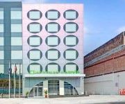
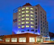
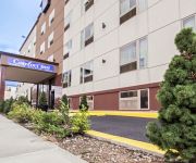
Hotel Le Bleu
Hilton Brooklyn New York
WYNDHAM GARDEN BROOKLYN SUNSET
Union Hotel Brooklyn
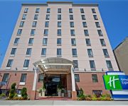
Holiday Inn Express NEW YORK-BROOKLYN
Lxure Brooklyn Suites
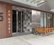
NU HOTEL BROOKLYN
RED LION INN AND SUITES BROOKLYN
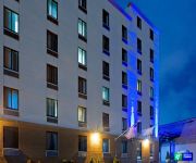
Fairfield Inn & Suites New York Brooklyn
an Ascend Hotel Collection Member Red Hook The LOOK Hotel
Videos from this area
These are videos related to the place based on their proximity to this place.
FDNY: 1/4/2013 Brooklyn 3 Alarm Fire 1029 42nd St.
1/4/2013 Brooklyn 3 Alarm Fire 1029 42nd St. Fire was in a 3 sty 20x40.
Bone Flexing in Brooklyn' s Battle Fest - New York Post
A body twisting dance turns into a bone splintering battle. http://video.nypost.com.
FDNY: 4/13/14 Brooklyn: 3 Alarm Box 1456 4324 4th Ave.
4/13/14 Brooklyn: 3 Alarm Box 1456 4324 4th Ave.
Tornado in Brooklyn 9.16.2010
Footage of Tornado, heavy rain & winds, going through South Park Slope, Brooklyn NY. Most intense footage between 0:45 and 1:15 © Adrian Mueller / fabrik studios. http://www.fabrik-studios.com.
Hurricane Sandy, Park Slope Brooklyn 10/29/12 2:30PM
Hurricane Sandy, Park Slope Brooklyn 10/29/12 2:30PM.
KinderHaus Brooklyn - Introduction to the School
Language acquisition and usage is reinforced in an environment where children are able to speak to their peers in the immersion language. As the first german immersion full time KinderGarten...
Associated Fire - Park Slope, NY: 11pm New2 11.12.10
Our neighborhood...this is down the block from my apart. It wasn't completely OUT until the early morning hours....
Videos provided by Youtube are under the copyright of their owners.
Attractions and noteworthy things
Distances are based on the centre of the city/town and sightseeing location. This list contains brief abstracts about monuments, holiday activities, national parcs, museums, organisations and more from the area as well as interesting facts about the region itself. Where available, you'll find the corresponding homepage. Otherwise the related wikipedia article.
Aaron Ward (sailor)
Rear Admiral Aaron Ward (October 10, 1851 – July 5, 1918) was an officer in the United States Navy during the Spanish-American War.
36th Street (BMT Fourth Avenue Line)
36th Street is an express station on the BMT Fourth Avenue Line of the New York City Subway, located at 36th Street and Fourth Avenue in Sunset Park, Brooklyn. This is an express station with four tracks and two island platforms. The R train provides local service, while the D and N trains run express (except during late nights, when all trains provide local service). During late nights, this station is the northern terminal for the R shuttle to Bay Ridge – 95th Street.
45th Street (BMT Fourth Avenue Line)
45th Street is a local station on the BMT Fourth Avenue Line of the New York City Subway, located at 45th Street and Fourth Avenue in Sunset Park, Brooklyn. It is served by the R train at all times except late nights northbound and the N train late nights only. This underground station, opened on September 13, 1915, has four tracks and two side platforms. The two center tracks are used by N trains during daytime hours as well as late-night northbound R trains.
Prospect Avenue (BMT Fourth Avenue Line)
Prospect Avenue is a local station on the BMT Fourth Avenue Line in Brooklyn of the New York City Subway. Located at Prospect Avenue and Fourth Avenue near the border of Sunset Park and Park Slope, it is served by the R train at all times except late nights, when the D and N assume local service along Fourth Avenue. This station has four tracks and two side platforms with a full curtain wall separating the local and express tracks.
25th Street (BMT Fourth Avenue Line)
25th Street is a local station on the BMT Fourth Avenue Line of the New York City Subway. Located at the intersection of 25th Street and Fourth Avenue in Sunset Park, Brooklyn, it is served by the R train at all times except late nights, when the D and N trains assume local service along Fourth Avenue. This underground station, opened on September 13, 1915, has four tracks and two side platforms. The two center tracks are used by the D and N trains during daytime hours.
Metropolitan Detention Center, Brooklyn
The Metropolitan Detention Center, Brooklyn (MDC Brooklyn) is a United States federal administrative detention facility in Brooklyn, New York which holds male and female prisoners of all security levels. It is operated by the Federal Bureau of Prisons, a division of the United States Department of Justice. Most prisoners held at MDC Brooklyn have pending cases in the United States District Court for the Eastern District of New York. MDC Brooklyn also holds prisoners serving brief sentences.
Ninth Avenue (BMT West End Line)
Ninth Avenue is a bi-level express station on the BMT West End Line of the New York City Subway, located at the intersection of Ninth Avenue and 39th Street in Brooklyn. Each level has three tracks and two island platforms. The upper level serves the BMT West End Line while the lower level formerly served the BMT Culver Line. Only the upper level is still in service and is served by the D train at all times. The center express track is not normally used.
Fort Hamilton Parkway (BMT West End Line)
Fort Hamilton Parkway is a local station on the BMT West End Line of the New York City Subway, located in Brooklyn at the intersection of Fort Hamilton Parkway and New Utrecht Avenue, in the neighborhood of Borough Park. It is served by the D train at all times. It has three tracks and two side platforms. There was formerly a booth on the north side of the station, at 44th Street. The mezzanine and stairs still remain, as does evidence of removed windows.
Greenwood Heights, Brooklyn
Greenwood Heights is a neighborhood in the New York City borough of Brooklyn that takes part of its name from the neighborhood proximity to the Green-Wood Cemetery. The much-debated borders are, roughly, the Prospect Expressway to the north, Gowanus Bay to the west, Eighth Avenue to the east, and 39th Street to the south (southern boundary of The Green-Wood Cemetery and train yards).
Bishop Ford Central Catholic High School
Bishop Ford Central Catholic High School is a private, Roman Catholic high school in the Park Slope section of Brooklyn, New York. It is located within the Roman Catholic Diocese of Brooklyn.
South Slope, Brooklyn
The South Slope, originally South Park Slope, is a neighborhood in Brooklyn, New York City, which is located between Sunset Park and Park Slope. Because there are no official borders to neighborhoods in New York City, definitions of the boundaries of the South Slope can differ significantly.
Fourth Avenue (Brooklyn)
Fourth Avenue is a major thoroughfare in the New York City borough of Brooklyn. It stretches for 6 miles south from Times Plaza, which is the triangle intersection created by Atlantic and Flatbush Avenues in Downtown Brooklyn, to Shore Road and the Belt Parkway in Bay Ridge. While southwestern Brooklyn is well served by expressways, Fourth Avenue provides an alternate for local traffic as it directly links the neighborhoods of Park Slope, Sunset Park and Bay Ridge with Downtown Brooklyn.
Parker Building, New York City
The Parker Building was a 12-story office and loft structure completed in 1900 at the southeast corner of Fourth Avenue and 19th Street, in Manhattan (New York). The edifice occupied ground which was formerly the site of the Gettysburg Cyclorama structure.
Hellenic Classical Charter School
The Hellenic Classical Charter School is a Brooklyn, New York City Ethnic-culture based charter school that focuses on the "“classical study of the Greek and Latin languages, as well as history, art and other cultural studies. ” The modern Greek language is part of the curriculum. Funding from Greece directly pays the salaries of five teachers, a donation worth $275,000 in 2007, and a Greek minister of education helps develop curricula.
16th Street (BMT Fifth Avenue Line)
16th Street was a station on the demolished section of the BMT Fifth Avenue Line. It was served by trains of the BMT Culver Line and BMT Fifth Avenue Line. It had 2 tracks and 1 island platform. The next stop to the north was Ninth Street. The next stop to the south was 20th Street. It closed on May 31, 1940.
20th Street (BMT Fifth Avenue Line)
20th Street was a station on the demolished section of the BMT Fifth Avenue Line. It was served by trains of the BMT Culver Line and BMT Fifth Avenue Line. It had 2 tracks and 1 island platform. The next stop to the north was 16th Street. The next stop to the south was 25th Street. It closed on May 31, 1940.
25th Street (BMT Fifth Avenue Line)
25th Street was a station on the now demolished BMT Fifth Avenue Line. It was served by trains of the BMT Culver Line and BMT Fifth Avenue Line. It had two tracks and one island platform. The next stop to the north was 20th Street. The next stop to the south was 36th Street. The station closed on May 31, 1940.
36th Street (BMT Fifth Avenue Line)
36th Street was a station on the demolished section of the BMT Fifth Avenue Line. It was served by trains of the BMT Culver Line and BMT Fifth Avenue Line. It had four tracks and two island platforms. The next stop to the north was 25th Street. The next stop to the south was Ninth Avenue for Culver Line trains and 40th Street for Fifth Avenue Line trains. The station closed on May 31, 1940.
40th Street (BMT Fifth Avenue Line)
40th Street was a station on the now demolished BMT Fifth Avenue Line. It was served by trains of the BMT Fifth Avenue Line. It had two tracks and one island platform. The next stop to the north was 36th Street. The next stop to the south was 46th Street. The station closed on May 31, 1940.
Fort Hamilton Parkway (BMT Culver Line)
Fort Hamilton Parkway was a station on the demolished section of the BMT Culver Line. It originally had three tracks and 2 side platforms, although near the end of its life only utilized one track and 1 of the side platforms, due to the other 2 tracks being removed. It opened on November 11, 1919, but when the IND South Brooklyn Line was extended to Ditmas Avenue and converted most of the line to the Independent Subway System, the station's service was replaced by the Culver Shuttle.
Lone Star Cafe
The Lone Star Cafe was a cafe and club in New York City at the corner of Fifth Avenue and 13th Street, from 1976 to 1989. The Texas-themed cafe opened in February 1976 and became the premier country music venue in New York and booked big names and especially acts from Texas, like Asleep at the Wheel and Roy Orbison. Willie Nelson, Kinky Friedman, Roy Orbison, Delbert McClinton, Freddy Fender, Doug Sahm and Jerry Jeff Walker, were among Texas musicians who frequented the Lone Star Cafe.
St. Michael's Church (Brooklyn, New York)
The Church of St. Michael is a Catholic parish church under the authority of the Roman Catholic Diocese of Brooklyn, located in the Sunset Park neighborhood of Brooklyn, New York City.
John J. Pershing Intermediate School 220
{{#invoke:Coordinates|coord}}{{#coordinates:40|38|26.83|N|74|0|3.54|W|region:US |primary |name= }} John J Pershing I. S 220Established 1970sType PublicPrincipal Loretta M. WitekStudents 1,292Grades 6-8Location 4812 9th Avenue Brooklyn, NY 11220,Brooklyn, New York, United StatesYearbook 'The Eagles'Website http://schools. nycenet. edu/region7/is220 John J.
Karl Hoschna
Karl Hoschna (1876–1911) was a Tin Pan Alley-era composer most noted for his songs "Cuddle up a Little Closer, Lovey Mine", "Every Little Movement" and "Yama Yama Man", and for a string of successful Broadway musicals. Hoschna was born on 16 August 1876 in Kuschwarda, Bohemia, and educated in Austria at the Vienna Conservatory of Music, specializing in the oboe. He graduated with honors and became an oboist in the Austrian army band.
Battle Hill (Brooklyn)
Battle Hill, which is 220 feet tall, is the highest natural point in Brooklyn, New York in the United States America. The hill is part of the Harbor Hill Moraine, a terminal moraine formed during the last glacial period. Battle Hill, located in what is today Green-wood Cemetery, received its name from the battle which occurred on its slopes between American troops under the immediate command of General Samuel Holden Parsons and British troops under the command of General James Grant.


