Safety Score: 2,7 of 5.0 based on data from 9 authorites. Meaning we advice caution when travelling to United States.
Travel warnings are updated daily. Source: Travel Warning United States. Last Update: 2024-08-13 08:21:03
Discover Crown Heights
The district Crown Heights of Brooklyn in Kings County (New York) is a district in United States about 205 mi north-east of Washington DC, the country's capital city.
Looking for a place to stay? we compiled a list of available hotels close to the map centre further down the page.
When in this area, you might want to pay a visit to some of the following locations: Queens, Manhattan, Jersey City, The Bronx and Staten Island. To further explore this place, just scroll down and browse the available info.
Local weather forecast
Todays Local Weather Conditions & Forecast: 15°C / 59 °F
| Morning Temperature | 11°C / 52 °F |
| Evening Temperature | 15°C / 59 °F |
| Night Temperature | 12°C / 53 °F |
| Chance of rainfall | 0% |
| Air Humidity | 61% |
| Air Pressure | 1011 hPa |
| Wind Speed | Moderate breeze with 13 km/h (8 mph) from South-East |
| Cloud Conditions | Scattered clouds, covering 25% of sky |
| General Conditions | Scattered clouds |
Tuesday, 19th of November 2024
11°C (51 °F)
13°C (55 °F)
Broken clouds, moderate breeze.
Wednesday, 20th of November 2024
13°C (55 °F)
13°C (55 °F)
Sky is clear, gentle breeze, clear sky.
Thursday, 21st of November 2024
9°C (48 °F)
8°C (47 °F)
Moderate rain, fresh breeze, broken clouds.
Hotels and Places to Stay
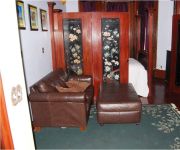
THE MISSING LANTERN
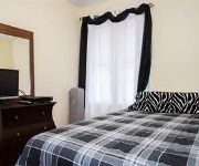
Gabbs Apartment
Lefferts Manor Bed & Breakfast
Condor Hotel
Kosciuszko Street Apartment
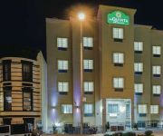
La Quinta Inn and Suites Brooklyn East
Serenity at Home Guest House
Pointe Plaza Hotel
BEST WESTERN PLUS ARENA HOTEL
Arlington Place Bed & Breakfast
Videos from this area
These are videos related to the place based on their proximity to this place.
Video Tour of a 1-Bedroom Furnished Apartment in Crown Heights, Brooklyn
Hello and welcome to another New York Habitat (www.nyhabitat.com) furnished apartment video tour! Today we take you to a breathtaking 1-bedroom accommodation in Crown Heights, Brooklyn near.
Video Tour of a 2-Bedroom Furnished Apartment in Crown Heights, Brooklyn
Hello and welcome to another New York Habitat (www.nyhabitat.com) furnished apartment video tour! Today we take you to a classic 2-bedroom prewar apartment in Crown Heights, Brooklyn. For more ...
Yellow Devil / July 21, 2014 / Crown Heights, Brooklyn
Filmed by Anatoli Ulyanov & Natasha Masharova for Yellow Devil of http://looo.ch Yellow Devil: https://www.facebook.com/yellovvdevil.
End of a Long Journey
Almost a year after the U.S District Court ordered that books taken from the Chabad Library be returned to Agudas Chasidei Chabad, they were finally brought back. 2 Cheshvan, 5748 -- November...
MTA NYCT Bus: 2011 New Flyer XD40 Xcelsior B15 Bus #4815 (Ex. Ulmer Park) at East New York Ave
Bedford-Stuyvesant-Woodhull Hospital bound New Flyer XD40 Xcelsior B15 Bus #4815 on Ralph Ave coming from E98th St and at East New York Ave bus stop departing and passing E New York Ave ...
New Lots Avenue-bound R62 3 Train@Eastern Parkway Portal
Here's a New Lots Avenue-bound R62 3 train as it exits the Eastern Parkway Portal towards the IRT Livonia Avenue Line to Sutter Avenue-Rutland Road as its next stop.
IRT Eastern Parkway Line: R142A 4 Train at Kingston Ave (Manhattan Bound)
Manhattan bound R142A 4 Train coming from Crown Heights-Utica Ave station and bypassing its 1st station Kingston Ave heading towards Franklin Ave as its next station stop. No Bus or Train...
IRT Eastern Parkway Line: R142 5 Train & R62 3 Train at Crown Heights-Utica Ave (PM Rush Hour)
Manhattan bound R142 5 Train on the via 4 Line departing at its first station stop Crown Heights-Utica Ave heading towards Franklin Ave as its next station. Then Manhattan bound R62 3 Train...
Manhattan-bound R62 3 Train@Eastern Parkway Portal
Here's a cool sightin' of a Manhattan-bound R62 3 train as it screeches its way towards the Eastern Parkway Portal to Crown Heights/Utica Avenue as it next stop!
Videos provided by Youtube are under the copyright of their owners.
Attractions and noteworthy things
Distances are based on the centre of the city/town and sightseeing location. This list contains brief abstracts about monuments, holiday activities, national parcs, museums, organisations and more from the area as well as interesting facts about the region itself. Where available, you'll find the corresponding homepage. Otherwise the related wikipedia article.
Crown Heights, Brooklyn
Crown Heights is a neighborhood in the central portion of the New York City borough of Brooklyn. The main thoroughfare through this neighborhood is Eastern Parkway, a tree-lined boulevard designed by Frederick Law Olmsted extending two miles (3 km) east-west. Originally, the area was known as Crow Hill. It was a succession of hills running east and west from Utica Avenue to Classon Avenue, and south to Empire Boulevard and New York Avenue.
Medgar Evers College
Medgar Evers College is a senior college of The City University of New York. Medgar Evers College was officially established in 1970 through cooperation from educators and community leaders in central Brooklyn.
Nostrand Avenue (IRT Eastern Parkway Line)
Nostrand Avenue is a local station on the IRT Eastern Parkway Line of the New York City Subway. Located at the intersection of Nostrand Avenue and Eastern Parkway in Crown Heights, Brooklyn, it is served by the 3 train at all times except late nights, when it is replaced by the 4. There is also occasional 2 train service here during rush hours. This underground station, opened on August 23, 1920, has two levels.
Kingston Avenue (IRT Eastern Parkway Line)
Kingston Avenue is a local station on the IRT Eastern Parkway Line of the New York City Subway. Located at the intersection of Kingston Avenue and Eastern Parkway in Brooklyn, it is served by the 3 train at all times except late nights, when it is replaced by the 4. There is also occasional 2 train service here during rush hours. This underground station, opened on August 23, 1920, has two levels.
President Street (IRT Nostrand Avenue Line)
President Street is a station on the IRT Nostrand Avenue Line of the New York City Subway. Located at the intersection of President Street and Nostrand Avenue in Brooklyn, it is served by the 2 train at all times and the 5 train weekdays. This deep underground station, opened August 23, 1920, is the northernmost on the IRT Nostrand Avenue Line and the only one that has one island platform and two tracks. All stations to the south are set up as two track and two side platforms.
Sterling Street (IRT Nostrand Avenue Line)
Sterling Street is a station on the IRT Nostrand Avenue Line of the New York City Subway. Located in Brooklyn at the intersection of Sterling Street and Nostrand Avenue, it is served by the 2 train at all times and the 5 train on weekdays. This underground station, opened on August 23, 1920, has two tracks and two side platforms. The platforms have their original 1920s Dual Contracts era tiling. The name tablets have "STERLING ST.
Winthrop Street (IRT Nostrand Avenue Line)
Winthrop Street is a station on the IRT Nostrand Avenue Line of the New York City Subway, located in Brooklyn at the intersection of Winthrop Street and Nostrand Avenue. It is served by the 2 train at all times and the 5 train on weekdays. This underground station, opened on August 23, 1920, has two tracks and two side platforms. Both platforms have their original 1920s Dual Contracts era tiling. The name tablets read "WINTHROP ST.
Crown Heights riot
The Crown Heights Riot was a three-day riot that occurred August 19–21, 1991 in the Crown Heights section of Brooklyn, New York. At the time of the riot, Crown Heights was and remains predominantly an African-American and Orthodox Jewish neighborhood. It is the home of the Lubavitch sect of Orthodox Jewish Hasidim.
Pigtown, Brooklyn
Pigtown formerly described a neighborhood in the New York City borough of Brooklyn, existing as such until approximately the end of the 19th century. The community derived its name from the fact that the major pig farms supplying Brooklyn were located there. Pigtown was at the southern periphery of the then City of Brooklyn where it bordered the Town of Flatbush.
Bais Rivka
Bais Rivka (also called Beis Rivkah, or Beth Rivkah) is a private girls' schools affiliated with the Chabad Lubavitch Hasidic movement. It was established in 1941 by Rabbi Yosef Yitzchok Schneersohn, the Sixth Lubavitcher Rebbe, and led by his son-in-law, Rabbi Menachem Mendel Schneerson. The main branch is in Crown Heights, Brooklyn and there are other branches around the world. Today there are about 60,000 students enrolled in the schools.
Kingston–Throop Avenues (IND Fulton Street Line)
Kingston–Throop Avenues is a local station on the IND Fulton Street Line of the New York City Subway. Located on Fulton Street between Kingston and Throop Avenues in Weeksville, Brooklyn, it is served by the C train at all times except late nights, when it is replaced by the A train. This underground station, opened on April 9, 1936, has four tracks and two offset side platforms. The two center tracks are used by the A express train during daytime hours.
SUNY Downstate Medical Center
SUNY Downstate Medical Center, located in central Brooklyn, New York, is the only academic medical center for health education, research, and patient care serving Brooklyn’s 2.5 million residents. As of Fall 2011, it had a total student body of 1,738 and approximately 8,000 faculty and staff. Downstate Medical Center comprises a College of Medicine, Colleges of Nursing and Health Related Professions, Schools of Graduate Studies and Public Health, and University Hospital of Brooklyn.
Brooklyn Children's Museum
The Brooklyn Children's Museum is a general purpose museum in Crown Heights, Brooklyn, New York City. Founded in 1899, it was the first museum in the United States and some believe, the world, to cater specifically to children and is unique in its location, predominantly a residential area. Housed in a multi-level underground gallery, the museum underwent an expansion and renovation to double its space, reopened on September 20, 2008, and became the first green museum in New York City.
Nostrand Avenue (LIRR station)
Nostrand Avenue is an elevated station on the Long Island Rail Road's Atlantic Branch in the Bedford-Stuyvesant neighborhood of Brooklyn in New York City. Trains leave every 12-15 minutes during peak hours and 30 minutes during off peak hours until 11 p.m. The station resembles a typical elevated New York City Subway station and has white on black signage as found on the subway. Though originally built in 1877, the current elevated station was built between 1903 and 1905 and renovated in 2011.
United States
United States of America Flag of the United States Great Seal of the United States Motto: "In God we trust" (official)"E pluribus unum" (traditional)"Out of many, one" Anthem: "The Star-Spangled Banner"File:Star Spangled Banner instrumental. ogg Location of the United States CapitalWashington, D.C.
770 Eastern Parkway
770 Eastern Parkway, also known as simply "770", is the street address of the central headquarters of the Chabad-Lubavitch Hasidic movement, located on Eastern Parkway in the Crown Heights section of Brooklyn, New York, in the United States of America. The building has been the center of the conflict between the Lubavitchers who believe in publicizing that the last Chabad leader, Menachem Mendel Schneerson, is the Messiah and those who do not.
Kings County Hospital Center
Kings County Hospital Center is a hospital located at 451 Clarkson Avenue in East Flatbush, Brooklyn, New York City. It is under the umbrella of the New York City Health and Hospitals Corporation (HHC), the municipal agency which runs New York City's public hospitals. According to the HHC, "Kings County was named the first Level 1 Trauma Center in the U.S.". Because of this trauma center, police officers have been quoted as saying, "If I get shot... bring me to Kings County.
Eastern Parkway (Brooklyn)
This article refers to Eastern Parkway in Brooklyn, New York: there is also an Eastern Parkway in Louisville, Kentucky, also designed by the firm of Frederick Law Olmsted. Eastern Parkway U.S. National Register of Historic Places 250px Near New York Avenue in Crown Heights.
Bedford Avenue (Brooklyn)
Bedford Avenue is the longest street in Brooklyn, New York City, stretching 10.2 miles and 132 blocks from Greenpoint south to Sheepshead Bay, and passing through the neighborhoods of Williamsburg, Bedford-Stuyvesant, Crown Heights, Flatbush and Midwood. Automobile traffic flows in two directions on the southern half of the avenue (south of Grant Square at Dean Street), and one-way northbound north of that location.
Wingate, Brooklyn
Wingate is a neighborhood in the north central portion of the New York City borough of Brooklyn. The area is east of Prospect-Lefferts Gardens and south of Crown Heights. Wingate is bounded by Empire Boulevard to the north, Troy Avenue to the east, Winthrop Street to the south and New York Avenue to the west. The area is part of Brooklyn Community Board 9. The area was originally known as Pig Town. It was renamed in the 1950s after the construction of the now defunct George W.
Paul Robeson High School for Business and Technology
Paul Robeson High School for Business and Technology is a high school in the Crown Heights section of Brooklyn, New York City, New York. It is a part of the New York City Department of Education. The school is named for Paul Robeson, a singer and civil rights activist.
George W. Wingate High School
George W. Wingate High School is a defunct comprehensive high school in the Prospect-Lefferts Gardens neighborhood of Brooklyn, New York. It was closed down in June 2000 due to poor academic performance. The school was then divided into four small schools. The school was named for George Wood Wingate, an officer in the Union Army during the U.S. Civil War.
Pathways in Technology Early College High School
Pathways in Technology Early College High School (P-TECH) is a New York City public high school that is set to open in September 2011. It was developed through a unique partnership between the IBM corporation, City University of New York - City Tech, and the New York City Department of Education. The school focuses on postsecondary pathways in the area of Information Technology, helping a diverse group of students enter into this highly competitive field.
St. Blaise's Church (Brooklyn, New York)
The Church of St. Blaise is a former Roman Catholic parish church in the Roman Catholic Diocese of Brooklyn, located in East Flatbush, Brooklyn, New York City, New York. The parish was established in 1905 out of the Holy Cross parish for the burgeoning Italian community, who had since 1897 been administered to by Father Ludeke and Father Malone. The parish was merged with that of St. Francis of Assisi's Church (Brooklyn, New York), which had been established in 1898 to form the parish of St.
Church of St. Francis of Assisi and St. Blaise (Brooklyn, New York)
The Church of Saint Francis of Assisi and Saint Blaise is a Roman Catholic parish church in the Roman Catholic Diocese of Brooklyn, located at Nostrand Avenue and Lincoln Road, in Brooklyn, New York City, New York 11225.


