Safety Score: 2,7 of 5.0 based on data from 9 authorites. Meaning we advice caution when travelling to United States.
Travel warnings are updated daily. Source: Travel Warning United States. Last Update: 2024-08-13 08:21:03
Discover Virginia City
Virginia City in Colfax County (New Mexico) is a city in United States about 1,543 mi (or 2,483 km) west of Washington DC, the country's capital city.
Local time in Virginia City is now 08:04 AM (Thursday). The local timezone is named America / Denver with an UTC offset of -7 hours. We know of 5 airports in the vicinity of Virginia City, of which two are larger airports. The closest airport in United States is San Luis Valley Regional Bergman Field in a distance of 68 mi (or 110 km), North-West. Besides the airports, there are other travel options available (check left side).
There are two Unesco world heritage sites nearby. The closest heritage site in United States is Taos Pueblo in a distance of 44 mi (or 72 km), East. Also, if you like golfing, there are a few options in driving distance. Looking for a place to stay? we compiled a list of available hotels close to the map centre further down the page.
When in this area, you might want to pay a visit to some of the following locations: Taos, Mora, San Luis, Raton and Conejos. To further explore this place, just scroll down and browse the available info.
Local weather forecast
Todays Local Weather Conditions & Forecast: 11°C / 53 °F
| Morning Temperature | -0°C / 32 °F |
| Evening Temperature | 3°C / 38 °F |
| Night Temperature | 1°C / 34 °F |
| Chance of rainfall | 0% |
| Air Humidity | 15% |
| Air Pressure | 1024 hPa |
| Wind Speed | Light breeze with 4 km/h (2 mph) from West |
| Cloud Conditions | Clear sky, covering 5% of sky |
| General Conditions | Sky is clear |
Thursday, 21st of November 2024
12°C (54 °F)
2°C (36 °F)
Overcast clouds, light breeze.
Friday, 22nd of November 2024
12°C (53 °F)
3°C (38 °F)
Few clouds, gentle breeze.
Saturday, 23rd of November 2024
11°C (52 °F)
4°C (40 °F)
Scattered clouds, gentle breeze.
Hotels and Places to Stay
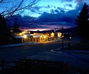
Historic Restaurant and Saloon Laguna Vista Lodge
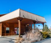
Econo Lodge Eagle Nest
Videos from this area
These are videos related to the place based on their proximity to this place.
The Annual Cimarron River Dance & BBQ
Come dance under the moon and stars on the banks of the Cimarron River below Eagle Nest Dam. This place is so spectacular and special that we call it simply "The Holy Water."
Ultralights over the Clouds
Thick fog over Eagle Nest Lake, near Taos, New Mexico. The lake is located at 8200 feet. Few of us flew around over the morning fog hanging above the lake.
Videos provided by Youtube are under the copyright of their owners.
Attractions and noteworthy things
Distances are based on the centre of the city/town and sightseeing location. This list contains brief abstracts about monuments, holiday activities, national parcs, museums, organisations and more from the area as well as interesting facts about the region itself. Where available, you'll find the corresponding homepage. Otherwise the related wikipedia article.
Eagle Nest, New Mexico
For other uses, see Eagle's Nest. Eagle Nest is a village in Colfax County, New Mexico, United States. The population was 306 at the 2000 census. Situated on the Enchanted Circle Highway, Eagle Nest is a small summer-home and resort area. Originally named Therma, the village was renamed Eagle Nest in the 1930s.


