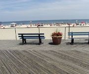
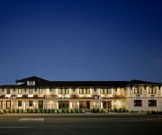
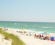
Safety Score: 2,7 of 5.0 based on data from 9 authorites. Meaning we advice caution when travelling to United States.
Travel warnings are updated daily. Source: Travel Warning United States. Last Update: 2024-08-13 08:21:03
Delve into Surf City
Surf City in Ocean County (New Jersey) with it's 1,204 habitants is located in United States about 162 mi (or 261 km) east of Washington DC, the country's capital town.
Current time in Surf City is now 09:35 AM (Thursday). The local timezone is named America / New York with an UTC offset of -5 hours. We know of 8 airports close to Surf City, of which 4 are larger airports. The closest airport in United States is Atlantic City International Airport in a distance of 26 mi (or 42 km), South-West. Besides the airports, there are other travel options available (check left side).
There are two Unesco world heritage sites nearby. The closest heritage site in United States is Independence Hall in a distance of 41 mi (or 67 km), North-West. Also, if you like playing golf, there are some options within driving distance. We encountered 3 points of interest near this location. If you need a hotel, we compiled a list of available hotels close to the map centre further down the page.
While being here, you might want to pay a visit to some of the following locations: Toms River, Mays Landing, Freehold, Mount Holly and Trenton. To further explore this place, just scroll down and browse the available info.
Local weather forecast
Todays Local Weather Conditions & Forecast: 8°C / 46 °F
| Morning Temperature | 10°C / 50 °F |
| Evening Temperature | 6°C / 43 °F |
| Night Temperature | 4°C / 40 °F |
| Chance of rainfall | 15% |
| Air Humidity | 83% |
| Air Pressure | 995 hPa |
| Wind Speed | Fresh Breeze with 16 km/h (10 mph) from East |
| Cloud Conditions | Overcast clouds, covering 98% of sky |
| General Conditions | Heavy intensity rain |
Thursday, 21st of November 2024
4°C (40 °F)
3°C (37 °F)
Light rain, moderate breeze, overcast clouds.
Friday, 22nd of November 2024
7°C (44 °F)
9°C (48 °F)
Light rain, moderate breeze, few clouds.
Saturday, 23rd of November 2024
10°C (50 °F)
6°C (44 °F)
Broken clouds, moderate breeze.
Hotels and Places to Stay
BUOY 16 MOTEL
Daddy O Hotel
SPRAY BEACH INN
Videos from this area
These are videos related to the place based on their proximity to this place.
Long Beach Island Timelapse Sunset Ship Bottom Boat Dock 2015
Two Timelapse sunsets this past winter in 2015 at the Ship Bottom Boat dock. More sunset and sunrises on Instagram @lbibeachrental and on Facebook lbibeachrentalNJ.
311 W 12th St Ship Bottom NJ 08008
http://homesite.obeo.com/728628?refURL=youtube Contact: Willy Kahl LBI Realty Group 609-494-8900 willykahl@gmail.com http://www.lbisales.com for more information about this home.
Alanna, Anna & Al Mozzer, Barnegat Light & Ship Bottom, NJ, 1954
My sister Alanna, and parents Anna & Al Mozzer, vacationing on Long Beach Island, New Jersey, summer 1954. Silent regular 8mm film by my father, Al Mozzer.
House Lifting Companies in Ship Bottom | 855-5-JACKIT | House Lifting Companies Ship Bottom, NJ
http://www.smartjack4u.com - House Lifting Companies in Ship Bottom, NJ 08008 855-5-JACKIT House Lifting Companies in Ship Bottom, 08008 Whether or not your home needs to be elevated to...
First time catching fish on a Party Boat! [HD]
NJ Partyboat fishing! A fishing hottie takes a deep sea trip off the coast of NJ to catch ling, cod, and sharks! Reeling in these fish from 180ft deep is a real challenge!!!!! During an early...
www.vrbo.com/182837 April 2015 LBI Beachfront House Tour
Tour our beautiful beach house in this 2015 full video of the 4 bedroom, beachfront vacation house rental in Surf City on the Jersey Shore's Long Beach Island. Learn more: http://www.vrbo.com/1828...
LBI Vacation: Family Friendly Beaches on Long Beach Island, NJ
Do you want to vacation on family friendly beaches? Visit Long Beach Island, one of my favorite destinations. (This video is featured in my article on HubPages about LBI. All images are mine.)
Peter John Sullivan live @ Gallery 1603 - Wizard In Virginia
Peter John Sullivan live @ Gallery 1603 Surf City LBI, New Jersey. 10/24/09 (1603 Long Beach Blvd Surf City, NJ, 08008) ...
2012 Orange Coffee Pot Regatta
A few highlight clips from the 2012 Orange Coffee Pot Regatta at Surf City Yacht Club. Racing Laser sailboats in 10-17 with 31 boats on the line for 7 races. Filmed with 3 GoPro Hero2 cameras....
Videos provided by Youtube are under the copyright of their owners.
Attractions and noteworthy things
Distances are based on the centre of the city/town and sightseeing location. This list contains brief abstracts about monuments, holiday activities, national parcs, museums, organisations and more from the area as well as interesting facts about the region itself. Where available, you'll find the corresponding homepage. Otherwise the related wikipedia article.
Ship Bottom, New Jersey
Ship Bottom is a borough in Ocean County, New Jersey, United States. As of the 2010 United States Census, the borough's population was 1,156, reflecting a decline of 228 (-16.5%) from the 1,384 counted in the 2000 Census, which had in turn increased by 32 (+2.4%) from the 1,352 counted in the 1990 Census. The borough is located on Long Beach Island and borders the Atlantic Ocean.
Surf City, New Jersey
Surf City is a borough in Ocean County, New Jersey, United States. As of the 2010 United States Census, the borough's population was 1,205, reflecting a decline of 237 (-16.4%) from the 1,442 counted in the 2000 Census, which had in turn increased by 67 (+4.9%) from the 1,375 counted in the 1990 Census. The borough borders the Atlantic Ocean on Long Beach Island.
Long Beach Island
Long Beach Island (colloquially known as LBI or simply The Island) is a barrier island and summer colony along the Atlantic Ocean coast of Ocean County, New Jersey in the United States. Aligned north-south, the northern portion is generally slightly higher end, low-density residential; whereas the southern portion possesses more economical, higher-density housing and considerable commercial development.
Long Beach Island Consolidated School District
The Long Beach Island Consolidated School District is a regional consolidated public school district which serves students in kindergarten through sixth grade from five communities bordering the Atlantic Ocean on Long Beach Island, in Ocean County, New Jersey. Communities served by the district are Barnegat Light, Harvey Cedars, Long Beach Township, Ship Bottom and Surf City. The district's Board of education consists of a total of nine members.
Harvey Cedars Hotel
Harvey Cedars Hotel is the last remaining historic hotel of its size located on Long Beach Island, NJ in the town of Harvey Cedars (although at the time it was built, it was known as High Point). It was begun in the 1830s as a fishing and hunting hotel on the then, scarcely inhabited Long Beach Island. Originally a small hotel, it was built expanded in the 1870s and 1880s.
Harvey Cedars Bible Conference
Harvey Cedars Bible Conference is a building complex of the Presbyterian denomination, in Harvey Cedars, New Jersey, including a hotel, a dock and sport facilities.
Manahawkin Bay
Manahawkin Bay is a bay in the U.S. state of New Jersey in Ocean County, located between Long Beach Island and Manahawkin, on the mainland. It is a part of the Intracoastal Waterway.
Manahawkin Bay Bridge
The Dorland J. Henderson Memorial Bridge, familiarly known as the Manahawkin Bay Bridge or (while technically inaccurate) The Causeway, is a steel girder bridge that spans Manahawkin Bay, carrying traffic along Route 72 between Long Beach Island (LBI) and the Manahawkin section of Stafford Township, in Ocean County, New Jersey. The bridge starts at Manahawkin and ends at Ship Bottom on Long Beach Island.


!['First time catching fish on a Party Boat! [HD]' preview picture of video 'First time catching fish on a Party Boat! [HD]'](https://img.youtube.com/vi/htN783eMtWI/mqdefault.jpg)


