Safety Score: 2,7 of 5.0 based on data from 9 authorites. Meaning we advice caution when travelling to United States.
Travel warnings are updated daily. Source: Travel Warning United States. Last Update: 2024-08-13 08:21:03
Explore Earle
Earle in Monmouth County (New Jersey) is located in United States about 180 mi (or 289 km) north-east of Washington DC, the country's capital.
Local time in Earle is now 04:47 AM (Saturday). The local timezone is named America / New York with an UTC offset of -5 hours. We know of 9 airports in the wider vicinity of Earle, of which 4 are larger airports. The closest airport in United States is Lakehurst NAES /Maxfield Field in a distance of 17 mi (or 28 km), South-West. Besides the airports, there are other travel options available (check left side).
There are two Unesco world heritage sites nearby. The closest heritage site in United States is Statue of Liberty in a distance of 34 mi (or 54 km), North. Also, if you like golfing, there are multiple options in driving distance. We found 4 points of interest in the vicinity of this place. If you need a place to sleep, we compiled a list of available hotels close to the map centre further down the page.
Depending on your travel schedule, you might want to pay a visit to some of the following locations: Freehold, Toms River, Staten Island, New Brunswick and Elizabeth. To further explore this place, just scroll down and browse the available info.
Local weather forecast
Todays Local Weather Conditions & Forecast: 8°C / 46 °F
| Morning Temperature | 5°C / 41 °F |
| Evening Temperature | 7°C / 45 °F |
| Night Temperature | 9°C / 48 °F |
| Chance of rainfall | 2% |
| Air Humidity | 61% |
| Air Pressure | 1002 hPa |
| Wind Speed | Fresh Breeze with 15 km/h (9 mph) from South-East |
| Cloud Conditions | Scattered clouds, covering 25% of sky |
| General Conditions | Light rain |
Saturday, 23rd of November 2024
10°C (50 °F)
6°C (44 °F)
Overcast clouds, fresh breeze.
Sunday, 24th of November 2024
7°C (45 °F)
9°C (49 °F)
Sky is clear, gentle breeze, clear sky.
Monday, 25th of November 2024
14°C (57 °F)
7°C (45 °F)
Light rain, moderate breeze, broken clouds.
Hotels and Places to Stay
COLTS NECK INN HOTEL
DoubleTree by Hilton Tinton Falls - Eatontown
Courtyard Wall at Monmouth Shores Corporate Park
Hampton Inn Neptune-Wall NJ
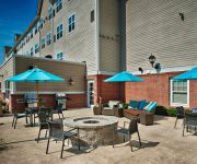
Residence Inn Neptune at Gateway Centre
VILLAGE INN COLTS NECK
Holiday Inn Express NEPTUNE
Courtyard Tinton Falls Eatontown
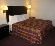
Executive Inn and Suites
CRYSTAL INN EATONTO
Videos from this area
These are videos related to the place based on their proximity to this place.
Skydive in Farmingdale, NJ
Dia 11 Setembro de 2007.... Meu primeiro pulooo. Nao tem palavras pra descrever a adrenalina daquele dia!!!
GE Repair, Farmingdale, NJ, (732) 893-2584
(732) 893-2584 Main St, Farmingdale, NJ 07727, GE Repair, Farmingdale, NJ, provides appliance repair services at affordable prices. Offering Ge Repair, Mayta...
I'll Be Frank Trio - Come Fly With Me
July 8, 2012 - I'll Be Frank vocalist Jonni Drue sings "Come Fly With Me" with jazz trio, Gary Haberman (piano), Brian Glassman (bass) and Jimmie Young (drums), at the Eagle Oaks Country Club...
Norfolk Southern Train Cars Ignore Signal System
This is a video I made in Farmingdale New Jersey on Asbury Road of the Norfolk Southern local from Red Bank to Lakewood New Jersey on Conrail shared tracks. The line is about 40 miles long...
2103 Pomerton 035.MOV
Four Bedroom, 2 bath home for sale in Wall Township, NJ $413000 Call Charles Wooley RE/MAX Shore and Country 732 306-1513 732 449-7200 ext 224 www.charleswo...
Pure Temptation Zazz
2005 Bay 15.3H Thoroughbred Gelding for sale in NJ. Zazz has shown successfully in the 3' hunters and is currently for sale to the right home. Alive by Ryan Huston.
Quad racers Travis Spader, Harold Goodman Big Air NJ Track
Pro Super atv Quad 450 Racers Travis Spader, Pat Brown, Harold Goodman and Cody Miller Big Air jumps Nj track.
Videos provided by Youtube are under the copyright of their owners.
Attractions and noteworthy things
Distances are based on the centre of the city/town and sightseeing location. This list contains brief abstracts about monuments, holiday activities, national parcs, museums, organisations and more from the area as well as interesting facts about the region itself. Where available, you'll find the corresponding homepage. Otherwise the related wikipedia article.
Farmingdale, New Jersey
Farmingdale is a borough in Monmouth County, New Jersey, United States. As of the 2010 United States Census, the borough's population was 1,329, reflecting a decline of 258 (-16.3%) from the 1,587 counted in the 2000 Census, which had in turn increased by 125 (+8.5%) from the 1,462 counted in the 1990 Census. Farmingdale was incorporated as a borough by an act of the New Jersey Legislature on April 8, 1903, from portions of Howell Township.
Tinton Falls, New Jersey
Tinton Falls is a borough in Monmouth County, New Jersey, United States. As of the 2010 United States Census, the borough's population was 17,892, an increase of 2,839 (+18.9%) from the 15,053 counted in the 2000 Census, which had in turn increased by 2,692 (+21.8%) from the 12,361 counted in the 1990 Census.
Naval Weapons Station Earle
Naval Weapons Station Earle is a United States Navy base in New Jersey. Its distinguishing feature is a 2.9-mile pier in Sandy Hook Bay where ammunition can be loaded and unloaded from warships at a safe distance from heavily-populated areas.
Howell High School (New Jersey)
Howell High School (HHS) is a four-year comprehensive public high school located in Howell Township, New Jersey, operating as part of the Freehold Regional High School District. The school serves all students from Farmingdale and those from some portions of Howell Township. The school has been accredited by the Middle States Association of Colleges and Schools Commission on Secondary Schools since 1970.
Monmouth Executive Airport
Monmouth Executive Airport is a public-use airport located in Monmouth County, New Jersey, United States. The airport is located in Wall Township, 5 miles west of the central business district of Belmar and east of Farmingdale. It is privately owned by the Brown family, and was formerly known as Allaire Airport.
Farmingdale School District
The Farmingdale School District is a community public school district that serves students in Kindergarten through eighth grade from Farmingdale, New Jersey, United States. As of the 2007-08 school year, the district's one school had an enrollment of 143 students and 16.0 classroom teachers (on an FTE basis), for a student–teacher ratio of 8.9. The district is classified by the New Jersey Department of Education as being in District Factor Group "DE", the fifth highest of eight groupings.
Tinton Falls Solar Farm
The Tinton Falls Solar Farm is a 20-megawatt solar photovoltaic power plant, being built in Tinton Falls, New Jersey. The farm contains 85,000 ground-mounted solar panels, and at the time of its construction, it was one of the largest solar farms in the northeast United States. The solar farm is being developed by Jiangsu Zongyi (a Chinese company) under a subsidiary named Zongyi Solar Energy (America). Zongyi acquired the undeveloped Tinton Falls site from Effisolar Energy Corporation in 2011.


