Safety Score: 2,7 of 5.0 based on data from 9 authorites. Meaning we advice caution when travelling to United States.
Travel warnings are updated daily. Source: Travel Warning United States. Last Update: 2024-08-13 08:21:03
Explore Georgetown
Georgetown in Burlington County (New Jersey) is a city in United States about 151 mi (or 243 km) north-east of Washington DC, the country's capital.
Local time in Georgetown is now 06:40 AM (Tuesday). The local timezone is named America / New York with an UTC offset of -5 hours. We know of 10 airports in the vicinity of Georgetown, of which 4 are larger airports. The closest airport in United States is Lakehurst NAES /Maxfield Field in a distance of 16 mi (or 26 km), East. Besides the airports, there are other travel options available (check left side).
There are two Unesco world heritage sites nearby. The closest heritage site in United States is Independence Hall in a distance of 14 mi (or 22 km), South-West. Also, if you like golfing, there are multiple options in driving distance. We found 2 points of interest in the vicinity of this place. If you need a place to sleep, we compiled a list of available hotels close to the map centre further down the page.
Depending on your travel schedule, you might want to pay a visit to some of the following locations: Mount Holly, Trenton, Freehold, New Brunswick and Toms River. To further explore this place, just scroll down and browse the available info.
Local weather forecast
Todays Local Weather Conditions & Forecast: 21°C / 69 °F
| Morning Temperature | 11°C / 51 °F |
| Evening Temperature | 21°C / 69 °F |
| Night Temperature | 18°C / 64 °F |
| Chance of rainfall | 0% |
| Air Humidity | 59% |
| Air Pressure | 1024 hPa |
| Wind Speed | Moderate breeze with 10 km/h (6 mph) from North-East |
| Cloud Conditions | Broken clouds, covering 58% of sky |
| General Conditions | Broken clouds |
Tuesday, 5th of November 2024
24°C (75 °F)
18°C (64 °F)
Scattered clouds, moderate breeze.
Wednesday, 6th of November 2024
18°C (64 °F)
10°C (50 °F)
Broken clouds, gentle breeze.
Thursday, 7th of November 2024
15°C (59 °F)
12°C (53 °F)
Broken clouds, gentle breeze.
Hotels and Places to Stay
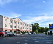
Comfort Inn Bordentown
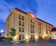
Hampton Inn Bordentown NJ
Home2 Suites by Hilton Bordentown
RED CARPET INN AND SUITES WRIGHTSTOWN
SCOTTISH INNS WRIGHTSTOWN
PASSPORT INN FORT DIX
BEST WESTERN BORDENTOWN INN
Candlewood Suites BORDENTOWN-TRENTON
DAYS INN WRIGHTSTOWN
RAMADA BORDENTOWN
Videos from this area
These are videos related to the place based on their proximity to this place.
Buy My House Fort Dix NJ 609-389-9403 We can Quickly Buy Your Fort Dix House
http://www.iwantmyoffer.com 609-389-9403 Buy My House Fort Dix 08640 Sell Your House Fast? We can Help! We are local all Cash House buyers! We take care of all repairs, its an EASY...
1994 Ford F-250 XL Pickup Truck on GovLiquidation.com
http://www.GovLiquidation.com - This 1994 Ford F-250 XL Pickup Truck has been sold. It went for 85% off the original retail value! This Ford Truck was located in Fort Dix, NJ. It's powered...
15,003 lbs of 50 Caliber Fired Brass Casings on GovLiquidation.com
http://www.GovLiquidation.com - This 15003 lbs of 50 Caliber Fired Brass Shell Casings has been sold. It was located in Fort Dix, NJ. The majority of the brass casings were contained in 6...
Shopping Cart Solution
Footage of Robert W. Horan, a motor vehicle operator for the 99th Regional Support Command, constructing filters out of shopping carts donated by the Fort Dix commissary in Fort Dix, N.J. In...
144 Metal Ammo Cans on GovLiquidation.com
http://www.GovLiquidation.com - These 144 Metal Ammo Cans have been sold. The Ammo Cans were located in Fort Dix, NJ. hey come on one pallet and they have their lids. Each can measures 11"...
8 GTA Container Inc. 500 Gallon Fabric Tanks on GovLiquidation.com
http://www.GovLiquidation.com - These 8 GTA Container Inc. 500 Gallon Fabric Tanks have been sold. They went for 95% off the original retail value! The Tanks were located in Fort Dix, NJ. ...
1-111th BN 81 Mortar Live Fire
81 Mortar Live fire at Fort Dix, NJ. Charlie Company is in the role of Base gun in a 3 gun section.
Videos provided by Youtube are under the copyright of their owners.
Attractions and noteworthy things
Distances are based on the centre of the city/town and sightseeing location. This list contains brief abstracts about monuments, holiday activities, national parcs, museums, organisations and more from the area as well as interesting facts about the region itself. Where available, you'll find the corresponding homepage. Otherwise the related wikipedia article.
Chesterfield Township, New Jersey
Chesterfield Township is a township in Burlington County, New Jersey, United States. As of the 2010 United States Census, the township's population was 7,699, reflecting an increase of 1,744 (+29.3%) from the 5,955 counted in the 2000 Census, which had in turn increased by 803 (+15.6%) from the 5,152 counted in the 1990 Census. Chesterfield was originally formed on November 6, 1688.
Rancocas Farm
Rancocas Farm was an American thoroughbred horse racing stud farm and racing stable located on Monmouth Road in the Jobstown, section of Springfield Township, Burlington County, New Jersey. The farm was founded in the 1870s by the wealthy tobacco manufacturer Pierre Lorillard IV (1833-1901) who had a home in the town of Rancocas, now a part of Westampton Township, New Jersey. Lorillard built his stable into one of the premier thoroughbred breeding and training operations in the United States.
Northern Burlington County Regional School District
The Northern Burlington County Regional School District is a comprehensive regional school district serves children in grades 7 through 12 from four communities in Burlington County, New Jersey, United States. Students are served from Chesterfield Township, Mansfield Township, North Hanover Township and Springfield Township, along with children of USAF personnel based at McGuire Air Force Base.
New Hanover Township School District
The New Hanover Township School District is a consolidated public school district that serves students in pre-Kindergarten through eighth grade from two communities in Burlington County, New Jersey, United States. The district serves students from New Hanover Township and Wrightstown.
Mansfield Public Schools
The Mansfield Public Schools are a comprehensive community public school district, serving students in kindergarten through sixth grade from Mansfield Township, in Burlington County, New Jersey, United States.
Mount Pleasant (Burlington County, New Jersey)
Mount Pleasant is a historic community located within the southeastern range of Mansfield Township and the northeastern range of Springfield Township, Burlington County, New Jersey. Mount Pleasant encompasses the intersection of Mount Pleasant Road (running east-west) and Gaunt's Bridge Road (running north-south), {{#invoke:Coordinates|coord}}{{#coordinates:40|3|56|N|74|40|4|W| | |name=Mount Pleasant intersection }}.
Northern Burlington County Regional High School
Northern Burlington County Regional High School is a four-year comprehensive public high school that serves students in ninth through twelfth grade from four communities in Burlington County, New Jersey, United States, as part of the Northern Burlington County Regional School District. Students are served from Chesterfield Township, Mansfield Township, North Hanover Township and Springfield Township, along with children of USAF personnel based at McGuire Air Force Base.
Jobstown, New Jersey
Jobstown is an unincorporated community within Springfield Township in Burlington County, New Jersey, United States. The area is served as United States Postal Service ZIP code 08041. As of the 2000 United States Census, the population for ZIP Code Tabulation Area 08041 was 877. Rancocas Stable was an American thoroughbred horse racing stable and stud farm located in Jobstown. Redwing Airport is a general aviation airport located 1 mile south of the central business district.


