Safety Score: 2,7 of 5.0 based on data from 9 authorites. Meaning we advice caution when travelling to United States.
Travel warnings are updated daily. Source: Travel Warning United States. Last Update: 2024-08-13 08:21:03
Touring Conleys Grove
Conleys Grove in Rockingham County (New Hampshire) is a town located in United States about 409 mi (or 659 km) north-east of Washington DC, the country's capital place.
Time in Conleys Grove is now 01:49 AM (Tuesday). The local timezone is named America / New York with an UTC offset of -5 hours. We know of 9 airports nearby Conleys Grove, of which 3 are larger airports. The closest airport in United States is Manchester Airport in a distance of 13 mi (or 20 km), North-West. Besides the airports, there are other travel options available (check left side).
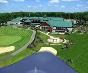
Also, if you like the game of golf, there are several options within driving distance. We collected 1 points of interest near this location. Need some hints on where to stay? We compiled a list of available hotels close to the map centre further down the page.
Being here already, you might want to pay a visit to some of the following locations: Brentwood, Allenstown, Dover, Concord and Boston. To further explore this place, just scroll down and browse the available info.
Local weather forecast
Todays Local Weather Conditions & Forecast: 19°C / 67 °F
| Morning Temperature | 11°C / 52 °F |
| Evening Temperature | 17°C / 63 °F |
| Night Temperature | 17°C / 63 °F |
| Chance of rainfall | 0% |
| Air Humidity | 56% |
| Air Pressure | 1021 hPa |
| Wind Speed | Gentle Breeze with 8 km/h (5 mph) from North-East |
| Cloud Conditions | Overcast clouds, covering 89% of sky |
| General Conditions | Overcast clouds |
Tuesday, 5th of November 2024
23°C (74 °F)
16°C (61 °F)
Sky is clear, moderate breeze, clear sky.
Wednesday, 6th of November 2024
16°C (61 °F)
8°C (47 °F)
Sky is clear, gentle breeze, clear sky.
Thursday, 7th of November 2024
13°C (55 °F)
11°C (52 °F)
Sky is clear, moderate breeze, clear sky.
Hotels and Places to Stay
Atkinson Resort & Country Club
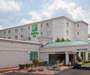
Holiday Inn SALEM (I-93 AT EXIT 2)
La Quinta Inn and Suites Salem
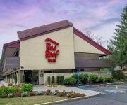
Red Roof Inn Salem
Videos from this area
These are videos related to the place based on their proximity to this place.
Salem NH Farmer's Market - Quick Tour
Salem New Hampshire Farmer's Market 37 Lake Street Salem, NH 03079 open every Sunday from 12-4 through September 30 Providing families in Southern New Hampshire an opportunity to purchase...
253 Shore Dr Salem NH
http://www.exite-listings.com/85061 WOW! Waterfront on 2 sides! Beautiful Arlington Pond in Salem NH is large enough to waterski walk on down to the water to sandy swimming and your private...
Blizzard 2015 Salem, NH Webcam video from January 27, 2015 05:54 PM (UTC)
Snow blower fail towards the end.
7 Dennison Ave Salem NH with Debbie Kruzel
Debbie Kruzel introduces 7 Dennison Ave, Salem NH: 2 bedroom, 2 bath colonial home just 5 minutes to 93! This home has almost 1400 sf living area including large bright open concept kitchen/livin...
12 Haydn Drive | Atkinson NH | Real Estate Marketing Video
http://catherinezerba.com/view_property/233 12 Haydn Drive is a Four Bedroom, 3763 square foot, Colonial located on a Cul-de-Sac with an Attached 3 Car Garage. This home also features...
Discover Diving Atkinson
There's a beautiful and mystical world to explore under water... Let Discover Diving in Atkinson take you there. From the pristine waters of New England to exciting dive trips in the Caribbean......
American Black Bear Sighting (the story) in Atkinson NH - USA
American black bear sighting in Atkinson NH - USA. Backyard stories with mom. This one tells a tale of a black bear who visited their back yard in southern new hampshire back in 2010 or so....
2012 OI Golf Classic - Technical Needs
6th Annual 2012 OI (Osteogenesis Imperfecta - Brittle bone disease) Golf Classic. This fundraiser event is hosted every year by Technical Needs at the Atkinson Country Club. All proceeds go...
Driving in the Blizzard of 2010 - snow storm in New Hampshire
Blizzard footage on the roads in Atkinson, NH -- We take a drive during the last hours of the blizzard of 2010 which socked the east coast, closing airports and grinding traffic from the Carolina's...
Videos provided by Youtube are under the copyright of their owners.
Attractions and noteworthy things
Distances are based on the centre of the city/town and sightseeing location. This list contains brief abstracts about monuments, holiday activities, national parcs, museums, organisations and more from the area as well as interesting facts about the region itself. Where available, you'll find the corresponding homepage. Otherwise the related wikipedia article.
America's Stonehenge
America's Stonehenge is an archaeological site consisting of a number of large rocks and stone structures scattered around roughly 30 acres within the town of Salem, New Hampshire in the northeast United States. America's Stonehenge is open to the public for a fee. Part of a recreational area that includes snowshoe trails and an alpaca farm, it is a tourist attraction, with particular appeal to believers in New Age systems.
Camp Tel Noar
Camp Tel Noar is a Jewish summer camp for children ages 8 through 15. It is located in Hampstead, New Hampshire, in the United States, which is about 1 hour north of Boston. The camp sits on Sunset Lake (Wash Pond) and has about 275 campers.
Arlington Mill Reservoir
Arlington Mill Reservoir, known locally as Arlington Pond, is a 269 acres impoundment located in Rockingham County in southern New Hampshire, United States, in the town of Salem. It is located along the Spicket River, a small stream that flows south to the Merrimack River in Lawrence, Massachusetts.
Island Pond (Rockingham County, New Hampshire)
Island Pond (sometimes referred to locally as Big Island Pond) is a 532-acre water body located in Rockingham County in southern New Hampshire, in the towns of Derry, Hampstead and Atkinson. The pond is near the head of the Spicket River watershed, which feeds the Merrimack River in Lawrence, Massachusetts. The pond is named for Governor's Island, a 200-acre island that lies within it.
North Salem, New Hampshire
North Salem is a section of the town of Salem in Rockingham County, New Hampshire. It occupies the northernmost portion of the town and is located at the northern end of Arlington Mill Reservoir. The community is bypassed by New Hampshire Route 111, which travels northeast to Hampstead and Kingston, and southwest to Windham and Hudson. North Salem has a separate ZIP code (03073, P.O. boxes only) from other areas in the town of Salem.
Ballard State Forest
Ballard State Forest is a state forest of New Hampshire located in Derry, Rockingham County, in the southeast part of the state. The area of the park is 71 acres . It includes the Taylor Mill Historic Site, an old sawmill, and Ballard Pond, which provides water for the mill. The forest is located on Island Pond Road, east of the downtown of Derry. The pond drains via Taylor Brook and Island Pond into the Spicket River, a tributary of the Merrimack River.


