Safety Score: 2,7 of 5.0 based on data from 9 authorites. Meaning we advice caution when travelling to United States.
Travel warnings are updated daily. Source: Travel Warning United States. Last Update: 2024-08-13 08:21:03
Delve into Rumsey
Rumsey in Sarpy County (Nebraska) is located in United States about 1,013 mi (or 1,630 km) west of Washington DC, the country's capital town.
Current time in Rumsey is now 06:07 AM (Thursday). The local timezone is named America / Chicago with an UTC offset of -6 hours. We know of 9 airports close to Rumsey, of which 3 are larger airports. The closest airport in United States is Eppley Airfield in a distance of 12 mi (or 19 km), North-East. Besides the airports, there are other travel options available (check left side).
Also, if you like playing golf, there are some options within driving distance. If you need a hotel, we compiled a list of available hotels close to the map centre further down the page.
While being here, you might want to pay a visit to some of the following locations: Papillion, Omaha, Plattsmouth, Council Bluffs and Glenwood. To further explore this place, just scroll down and browse the available info.
Local weather forecast
Todays Local Weather Conditions & Forecast: 4°C / 38 °F
| Morning Temperature | -1°C / 30 °F |
| Evening Temperature | 2°C / 35 °F |
| Night Temperature | -1°C / 31 °F |
| Chance of rainfall | 0% |
| Air Humidity | 53% |
| Air Pressure | 1024 hPa |
| Wind Speed | Fresh Breeze with 14 km/h (9 mph) from South-East |
| Cloud Conditions | Clear sky, covering 6% of sky |
| General Conditions | Sky is clear |
Thursday, 21st of November 2024
6°C (43 °F)
4°C (39 °F)
Broken clouds, light breeze.
Friday, 22nd of November 2024
10°C (49 °F)
8°C (46 °F)
Overcast clouds, gentle breeze.
Saturday, 23rd of November 2024
12°C (54 °F)
3°C (38 °F)
Overcast clouds, moderate breeze.
Hotels and Places to Stay
Holiday Inn OMAHA SOUTHWEST
Courtyard Omaha Bellevue at Beardmore Event Center
Hampton Inn Bellevue
Suburban Extended Stay Hotel Omaha
Fairfield Inn & Suites Omaha Papillion
BAYMONT INN & SUITES OMAHA NE
RAMADA OMAHA CONVENTION CTR
Holiday Inn Express & Suites BELLEVUE (OMAHA AREA)
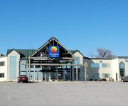
Comfort Inn at the Zoo
Americas Best Value Inn Omaha
Videos from this area
These are videos related to the place based on their proximity to this place.
City Happenings for the Week of April 13, 2015
Meet Papillion's new police chief; the city's annual Spring Clean Up begins near the end of this week; the local school district again qualifies for prestigious recognition.
Papillion Mayor's Youth Leadership Council presents Papillion Idol 2014
It's time to register for Papillion Idol. There are a limited amount of places available, so don't wait!
City Happenings for the Week of November 18, 2013
Papillion held a park renaming; Winter Wonderland is Saturday, November 30th; the annual Fall Cleanup gets high praise.
City Happenings for the Week of May 9, 2011
Angelman Syndrome is a rare disease and a little Papillion girl does her best to raise awareness and research money; Market Faire is coming back to City Park; our police continue to find ways...
City Happenings for the Week of December 8, 2014
The city's annual Winter Wonderland is held the Saturday following Thanksgiving; a local elementary school principal tells why D.A.R.E. is important; the city's art gallery features a local...
City Happenings: for the Week of December 22, 2014
The city's Finance Department says good bye to a trusted and long time employee; a local pet emergency clinic makes a great donation to the city's fire department; a new apartment complex on...
Videos provided by Youtube are under the copyright of their owners.
Attractions and noteworthy things
Distances are based on the centre of the city/town and sightseeing location. This list contains brief abstracts about monuments, holiday activities, national parcs, museums, organisations and more from the area as well as interesting facts about the region itself. Where available, you'll find the corresponding homepage. Otherwise the related wikipedia article.
Daniel J. Gross Catholic High School
Daniel J. Gross Catholic High School is a Marianist Catholic High school in Bellevue, Nebraska, United States. It is located in the Roman Catholic Archdiocese of Omaha. Gross promotes a traditional high school education while emphasizing Marianist traditions and values. The school motto is "Dux Esto" which means "Be a Leader. " The school mascot is a cougar and the school colors are burnt orange and royal blue.
KOIL
KOIL 1290 AM is an Omaha, Nebraska area Talk Station that airs national talk shows such as Don Imus, Laura Ingraham, Dave Ramsey, Jerry Doyle, and local radio personality Tom Becka. It is owned by NRG Media headquartered in Cedar Rapids, Iowa. This frequency was originally occupied by KOIL, one of Omaha's leading top 40 stations, until September 2, 1976, when station owner Don Burden had his station licenses revoked due to misconduct.
KFAB
KFAB is a 50,000 watt clear channel news and talk radio station licensed to Omaha, Nebraska. The station is owned by Clear Channel Communications. It provides a strong signal to most of eastern Nebraska during the day, and at least grade B coverage as far as Kansas City, Topeka, Sioux City and Des Moines. KFAB's transmission towers are located southeast of the town of Papillion, Nebraska. At night, the station's signal reaches most of the Western U.S.
Omaha Bryan High School
Omaha Bryan High School is a public high school located in Bellevue, Nebraska, United States. It is a part of Omaha Public Schools.
KOZN
KOZN is a sports talk station in Omaha, Nebraska. The station broadcasts at 1620 kHz on the AM dial. It is owned by NRG Media, headquartered in Cedar Rapids, Iowa. The station originally signed on as KAZP, an expanded band station of KOIL 1180, owned by Mitchell Broadcasting, in September 1999. KOZN carries Creighton University Baseball, Dial Global NFL Football and NCAA Basketball and University of Nebraska-Omaha Basketball.
Fisher Farm Cemetery
Fisher Farm Cemetery, including the B'nai Abraham Cemetery, the Hrabik Cemetery, the Beth Hamedrosh Hagadol Cemetery (also called Mt. Sinai Cemetery), and Bnai Abraham Cemetery, is located at 8600 South 42 Street in Bellevue, Nebraska.


