Safety Score: 2,7 of 5.0 based on data from 9 authorites. Meaning we advice caution when travelling to United States.
Travel warnings are updated daily. Source: Travel Warning United States. Last Update: 2024-08-13 08:21:03
Explore Carrol Junction
Carrol Junction in Laclede County (Missouri) is located in United States about 847 mi (or 1,362 km) west of Washington DC, the country's capital.
Local time in Carrol Junction is now 02:07 PM (Thursday). The local timezone is named America / Chicago with an UTC offset of -6 hours. We know of 11 airports in the wider vicinity of Carrol Junction, of which 5 are larger airports. The closest airport in United States is Waynesville-St. Robert Regional Forney field in a distance of 25 mi (or 41 km), East. Besides the airports, there are other travel options available (check left side).
Also, if you like golfing, there are multiple options in driving distance. If you need a place to sleep, we compiled a list of available hotels close to the map centre further down the page.
Depending on your travel schedule, you might want to pay a visit to some of the following locations: Lebanon, Camdenton, Waynesville, Hartville and Buffalo. To further explore this place, just scroll down and browse the available info.
Local weather forecast
Todays Local Weather Conditions & Forecast: 4°C / 40 °F
| Morning Temperature | 4°C / 40 °F |
| Evening Temperature | 4°C / 40 °F |
| Night Temperature | 1°C / 34 °F |
| Chance of rainfall | 0% |
| Air Humidity | 50% |
| Air Pressure | 1022 hPa |
| Wind Speed | Fresh Breeze with 15 km/h (9 mph) from South-East |
| Cloud Conditions | Clear sky, covering 2% of sky |
| General Conditions | Sky is clear |
Thursday, 21st of November 2024
6°C (43 °F)
3°C (37 °F)
Scattered clouds, gentle breeze.
Friday, 22nd of November 2024
10°C (51 °F)
7°C (44 °F)
Overcast clouds, gentle breeze.
Saturday, 23rd of November 2024
17°C (62 °F)
14°C (57 °F)
Light rain, moderate breeze, scattered clouds.
Hotels and Places to Stay
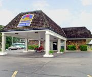
Econo Lodge Lebanon
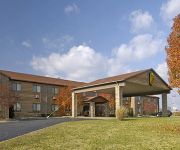
SUPER 8 LEBANON
Videos from this area
These are videos related to the place based on their proximity to this place.
Hail - Lebanon, Missouri March 24, 2015
Taken on the southern side of town in Lebanon, Missouri. At around 6:50 p.m..
02/29/2012 Tornado Damage in Lebanon, Missouri
Photography Slideshow by Dustin Holmes of the 02/29/2012 Leap Year Tornado damage to Lebanon, Missouri.
Lighting Storm - Lebanon, Mo March 27, 2014
March 27, 2014 about 5 minutes after shooting these videos the tornado sirens went off. It was only rotation spotted on the radar, but I chased after it. Lots of rain and dime size hail and...
Midwest Extreme Dirt Track Series Lebanon, MO C Class Winner Nathan James
Rider: Nathan James Quad: YFZ 450 Feature Position: 1st.
Harvesting Wholesale Koi
Harvesting wholesale koi out of our fish ponds is not an easy process. But over the years, we have developed a very good strategy to successfully grow, cull out and harvest our koi and butterfly...
Wagons For Warriors
On Saturday May 27 2012 in Lebanon Missouri the Wagons For Warriors event fed over 500 people, and generated Thousands of dollars for the returning soldiers who have been wounded in battle....
Videos provided by Youtube are under the copyright of their owners.
Attractions and noteworthy things
Distances are based on the centre of the city/town and sightseeing location. This list contains brief abstracts about monuments, holiday activities, national parcs, museums, organisations and more from the area as well as interesting facts about the region itself. Where available, you'll find the corresponding homepage. Otherwise the related wikipedia article.
Sleeper, Missouri
Sleeper is an unincorporated community in Laclede County, Missouri, United States. It is located about one mile north of Interstate 44 on Missouri Supplemental Route F, or about five miles northeast of Lebanon. Several homes and a fire station are located here.


