Safety Score: 2,7 of 5.0 based on data from 9 authorites. Meaning we advice caution when travelling to United States.
Travel warnings are updated daily. Source: Travel Warning United States. Last Update: 2024-08-13 08:21:03
Explore Boise De Sioux Mobile Estates
Boise De Sioux Mobile Estates in Wilkin County (Minnesota) is located in United States about 1,113 mi (or 1,791 km) north-west of Washington DC, the country's capital.
Local time in Boise De Sioux Mobile Estates is now 11:51 AM (Thursday). The local timezone is named America / Chicago with an UTC offset of -6 hours. We know of 8 airports in the wider vicinity of Boise De Sioux Mobile Estates. The closest airport in United States is Hector International Airport in a distance of 47 mi (or 76 km), North. Besides the airports, there are other travel options available (check left side).
Also, if you like golfing, there are multiple options in driving distance. If you need a place to sleep, we compiled a list of available hotels close to the map centre further down the page.
Depending on your travel schedule, you might want to pay a visit to some of the following locations: Breckenridge, Wahpeton, Wheaton, Fergus Falls and Moorhead. To further explore this place, just scroll down and browse the available info.
Local weather forecast
Todays Local Weather Conditions & Forecast: -4°C / 24 °F
| Morning Temperature | -4°C / 25 °F |
| Evening Temperature | -7°C / 19 °F |
| Night Temperature | -10°C / 15 °F |
| Chance of rainfall | 0% |
| Air Humidity | 89% |
| Air Pressure | 1026 hPa |
| Wind Speed | Moderate breeze with 12 km/h (7 mph) from South-East |
| Cloud Conditions | Broken clouds, covering 81% of sky |
| General Conditions | Broken clouds |
Thursday, 21st of November 2024
-4°C (25 °F)
-7°C (20 °F)
Overcast clouds, light breeze.
Friday, 22nd of November 2024
-6°C (21 °F)
-7°C (20 °F)
Overcast clouds, light breeze.
Saturday, 23rd of November 2024
-1°C (30 °F)
-3°C (26 °F)
Light snow, light breeze, overcast clouds.
Hotels and Places to Stay
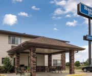
Rodeway Inn Wahpeton
Baymont Inn & Suites Wahpeton
Select Inn Breckenridge
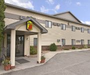
SUPER 8 WAHPETON ND
BAYMONT INN & SUITES WAHPETON
AmericInn Wahpeton
Videos from this area
These are videos related to the place based on their proximity to this place.
8/6/2013 Breckenridge MN Storm Damage
High winds and a possible tornado caused extensive damage to parts of Breckenridge, MN this evening. Shot 1: Building missing roof with roof pieces and flooded street Shot 2: Part of a roof...
MN2020: Broadband Disparities in Breckenridge
Broadband internet connectivity is a dynamic tool for economic development and widespread broadband access and adoption is essential for Minnesota. Calculating broadband potential isn't always...
BNSF Trains
While visiting Breckenridge, MN and Wahpeton ND. I caught this grain train heading into Breckenridge and right after the crossing you can see a signal post indicating light was amber, so that...
Red River Valley & Western Railroad Ride-Along
The video clips in this were recorded awhile ago. We took a trip to Breckenridge, MN and they let us hop aboard with the crew and take a train out to go drop off some cars and dump some ties....
Riding the RRVW
Riding the Red River Valley & Western Rialroad from Breckenridge, Minnesota, to Colfax, North Dakota See: Travel on the Gravel, ...
ND Family Business Surprises 40-Year Employee With 1972 Corvette
Wahpeton, North Dakota, December 1st, 2012 - On December 1st, 1972, Mr. Mike Boock accepted a new job offer. Forty years later at the 2012 WCCO Belting Holiday Social in Wahpeton, which was...
Dr Hans Kandel talking salinity reduction via tile drainage
Dr Hans Kandel using some simple but effective demonstration methods to show how tile drainage works to reduce salinity in the soil over time and also how water can travel uphilll through wicking....
WL WarBirds play Basketball against Underwood at NDSCS Part 1
The WarBirds lose this holiday tournament game to Underwood after having a 15 point lead. Dec. 22, 2009.
WL WarBirds play Basketball against Underwood at NDSCS Part 2
The WarBirds lose this holiday tournament game to Underwood after having a 15 point lead. Dec. 22, 2009.
40-Year Employee Surprised with Corvette
WCCO Belting, Inc. Christmas Social Honoring 40-Year Employee - Mike Boock Wahpeton, North Dakota, Dec 1st, 2012 In 1954, Ed Shorma opened a one-man shoe repair shop in Wahpeton, North ...
Videos provided by Youtube are under the copyright of their owners.
Attractions and noteworthy things
Distances are based on the centre of the city/town and sightseeing location. This list contains brief abstracts about monuments, holiday activities, national parcs, museums, organisations and more from the area as well as interesting facts about the region itself. Where available, you'll find the corresponding homepage. Otherwise the related wikipedia article.
Breckenridge, Minnesota
Breckenridge is a city in Wilkin County, Minnesota, United States. The population was 3,386 at the 2010 census. It is the county seat of Wilkin County. Breckenridge's twin city is Wahpeton, North Dakota. It is part of the Wahpeton, ND–MN Micropolitan Statistical Area. The Bois de Sioux River and the Otter Tail River join at Breckenridge and Wahpeton to form the Red River of the North.
Wahpeton, North Dakota
Wahpeton is a city in Richland County, North Dakota, United States. It is the county seat of Richland County and had a population of 7,766 at the 2010 census. The U.S. Census Bureau estimated 2011 population is 7,731. Wahpeton was founded in 1869 and is the principal city of the Wahpeton Micropolitan Statistical Area, which includes all of Richland County, North Dakota and Wilkin County, Minnesota. Wahpeton's twin city is Breckenridge, Minnesota.
North Dakota State College of Science
The North Dakota State College of Science (NDSCS) is a 2-year public college in Wahpeton, North Dakota and part of the North Dakota University System. Founded in 1903 by provision of the state constitution, the State College of Science offers degrees, certificates and diplomas in more than 80 academic options in traditional career and technical studies as well as the liberal arts. The college also offers a variety of distance education and online courses.
Bois de Sioux River
The Bois de Sioux River drains Lake Traverse, the southernmost body of water in the Hudson Bay watershed of North America. It is a tributary of the Red River of the North and defines part of the western border of the U.S. state of Minnesota, and the eastern borders of North Dakota and South Dakota. It is about 41 miles in length.
Chahinkapa Zoo
Chahinkapa Zoo is an 18-acre zoo in Wahpeton, North Dakota. Opened in 1933 on land that had been purchased in 1903, it is the first zoo built in North Dakota. It is open May through October and by appointment during the winter. It features over 200 animals ranging from Gibbon apes to Bengal Tigers. Chahinkapa Zoo has been accredited by the Association of Zoos and Aquariums (AZA) since 1995.
Otter Tail River
The Otter Tail River is a 192-mile-long river in the west-central portion of the U.S. state of Minnesota. It begins in Clearwater County, 40 miles southwest of Bemidji. It then flows through a number of lakes and cities in Minnesota, including Elbow Lake, Many Point Lake, Chippewa Lake, Height of Land Lake, Frazee, the Pine lakes, Rush Lake, Otter Tail Lake and Ottertail, West Lost Lake, Fergus Falls, and Orwell Lake.
KBMW
KBMW is a radio station broadcasting a country format. Licensed to Breckenridge, Minnesota, it serves the Wahpeton-Breckenridge area. The station is located in downtown Wahpeton and is currently owned by Triad Broadcasting, which owns several radio stations in nearby Fargo, North Dakota.
Harry Stern Airport
Harry Stern Airport is a public use airport in Richland County, North Dakota, United States. It is located one nautical mile (1.85 km) south of the central business district of Wahpeton, North Dakota and owned by the Wahpeton Airport Authority. Although most U.S. airports use the same three-letter location identifier for the FAA and IATA, Enterprise Municipal Airport is assigned BWP by the FAA and WAH by the IATA.


