Safety Score: 2,7 of 5.0 based on data from 9 authorites. Meaning we advice caution when travelling to United States.
Travel warnings are updated daily. Source: Travel Warning United States. Last Update: 2024-08-13 08:21:03
Explore Glendale
Glendale in Saint Louis County (Minnesota) is located in United States about 1,009 mi (or 1,625 km) north-west of Washington DC, the country's capital.
Local time in Glendale is now 02:39 PM (Thursday). The local timezone is named America / Chicago with an UTC offset of -6 hours. We know of 8 airports in the wider vicinity of Glendale, of which two are larger airports. The closest airport in United States is Chisholm Hibbing Airport in a distance of 45 mi (or 72 km), South. Besides the airports, there are other travel options available (check left side).
If you need a place to sleep, we compiled a list of available hotels close to the map centre further down the page.
Depending on your travel schedule, you might want to pay a visit to some of the following locations: International Falls, Grand Rapids, Carlton, Duluth and Superior. To further explore this place, just scroll down and browse the available info.
Local weather forecast
Todays Local Weather Conditions & Forecast: 3°C / 37 °F
| Morning Temperature | 0°C / 33 °F |
| Evening Temperature | 2°C / 36 °F |
| Night Temperature | 1°C / 34 °F |
| Chance of rainfall | 0% |
| Air Humidity | 85% |
| Air Pressure | 1016 hPa |
| Wind Speed | Moderate breeze with 10 km/h (6 mph) from South-East |
| Cloud Conditions | Broken clouds, covering 71% of sky |
| General Conditions | Broken clouds |
Thursday, 21st of November 2024
1°C (35 °F)
-3°C (27 °F)
Overcast clouds, gentle breeze.
Friday, 22nd of November 2024
-2°C (29 °F)
-4°C (25 °F)
Overcast clouds, gentle breeze.
Saturday, 23rd of November 2024
-1°C (30 °F)
-3°C (27 °F)
Light snow, light breeze, overcast clouds.
Hotels and Places to Stay
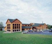
AmericInn Orr
Videos from this area
These are videos related to the place based on their proximity to this place.
My First Day with a GoPro
I got my gopro in the mail the other day and just wanted to record everything I did so I made a little video and here's what I got. Hopefully much more comin...
Cabin O' Pines Reel Fishing
Fishing Saunders Bay mid June on Pelican Lake in Orr, MN. Courtesy of Cabin O' Pines Resort, "The perfect place to start tradition".
Videos provided by Youtube are under the copyright of their owners.
Attractions and noteworthy things
Distances are based on the centre of the city/town and sightseeing location. This list contains brief abstracts about monuments, holiday activities, national parcs, museums, organisations and more from the area as well as interesting facts about the region itself. Where available, you'll find the corresponding homepage. Otherwise the related wikipedia article.
Orr, Minnesota
Orr is a city in Saint Louis County, Minnesota, United States. The population was 267 at the 2010 census. U.S. Highway 53 serves as a main arterial route in the city. Orr is best known as an entry point for the Boundary Waters and Voyageurs National Park. Orr is located within the Kabetogama State Forest in Saint Louis County.
Elbow River (Minnesota)
The Elbow River (Minnesota) is a river of Minnesota.
Orr Regional Airport
Orr Regional Airport is a city-owned public-use airport located three nautical miles (6 km) southwest of the central business district of Orr, a city in St. Louis County, Minnesota, United States. Although most U.S. airports use the same three-letter location identifier for the FAA and IATA, this airport is assigned ORB by the FAA but has no designation from the IATA.


