Safety Score: 2,7 of 5.0 based on data from 9 authorites. Meaning we advice caution when travelling to United States.
Travel warnings are updated daily. Source: Travel Warning United States. Last Update: 2024-08-13 08:21:03
Delve into Lilydale
Lilydale in Dakota County (Minnesota) with it's 872 habitants is a city located in United States about 924 mi (or 1,487 km) north-west of Washington DC, the country's capital town.
Current time in Lilydale is now 07:24 AM (Thursday). The local timezone is named America / Chicago with an UTC offset of -6 hours. We know of 11 airports closer to Lilydale, of which 5 are larger airports. The closest airport in United States is St Paul Downtown Holman Field in a distance of 3 mi (or 6 km), East. Besides the airports, there are other travel options available (check left side).
Also, if you like playing golf, there are some options within driving distance. We saw 1 points of interest near this location. In need of a room? We compiled a list of available hotels close to the map centre further down the page.
Since you are here already, you might want to pay a visit to some of the following locations: Saint Paul, Minneapolis, Hastings, Stillwater and Hudson. To further explore this place, just scroll down and browse the available info.
Local weather forecast
Todays Local Weather Conditions & Forecast: 4°C / 39 °F
| Morning Temperature | -0°C / 31 °F |
| Evening Temperature | 4°C / 40 °F |
| Night Temperature | 3°C / 38 °F |
| Chance of rainfall | 0% |
| Air Humidity | 70% |
| Air Pressure | 1016 hPa |
| Wind Speed | Moderate breeze with 13 km/h (8 mph) from South-East |
| Cloud Conditions | Broken clouds, covering 61% of sky |
| General Conditions | Broken clouds |
Thursday, 21st of November 2024
4°C (40 °F)
2°C (36 °F)
Broken clouds, gentle breeze.
Friday, 22nd of November 2024
3°C (38 °F)
1°C (34 °F)
Light snow, light breeze, overcast clouds.
Saturday, 23rd of November 2024
3°C (37 °F)
1°C (34 °F)
Light snow, gentle breeze, overcast clouds.
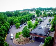
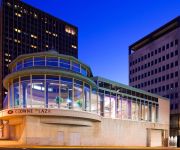
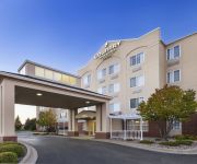
Hotels and Places to Stay
Holiday Inn MINNEAPOLIS AIRPORT SE - EAGAN
InterContinental Hotels SAINT PAUL RIVERFRONT
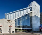
DoubleTree by Hilton St Paul Downtown
Embassy Suites by Hilton St Paul Downtown
Courtyard Minneapolis-St. Paul Airport
Sonesta ES Minneapolis St Paul
Hampton Inn Minneapolis-Eagan
Holiday Inn ST. PAUL DOWNTOWN
MN Eagan Country Inn and Suites by Radisson
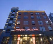
Hampton Inn and Suites by Hilton Downtown St Paul MN
Videos from this area
These are videos related to the place based on their proximity to this place.
The Best Downtown Restaurant St. Paul | (651) 224-5715
http://www.wafrost.com - Downtown Restaurant St. Paul - (651) 224-5715 - W. A. Frost and Company, Inc. This is a favorite Saint Paul downtown restaurant destination since 1975. The restaurant...
Red Bull Crashed Ice Fans in St. Paul
What happens when the City of Saint Paul and Red Bull host a free ice cross downhill competition? 80000 fans show up and have a great time!
Lady Gaga - Scheiße - Saint Paul Xcel Energy Center - Born This Way Ball Tour 2013 Live
"Scheiße" Clip performed by Lady Gaga on February 6, 2013 at the Xcel Energy Center in Saint Paul, Minnesota during the "Born This Way Ball" Tour. .. *NO COPYRIGHT INFRINGEMENT INTENDED...
St. Paul Fire Dept. Open House, Oct. 11, 2014
Saturday, October 11, 12:00 - 3:00 PM at Station 1 (1000 W 7th St.), Station 4 (505 Payne Ave.), and Station 6 (33 Cesar Chavez St.). Exhibits and live demonstrations of firefighting and rescue...
Lady Gaga - Government Hooker - Saint Paul Xcel Energy Center - Born This Way Ball Tour 2013 Live
"Government Hooker" performed by Lady Gaga on February 6, 2013 at the Xcel Energy Center in Saint Paul, Minnesota during the "Born This Wayl Ball" Tour. .. *NO COPYRIGHT INFRINGEMENT ...
Tommy Cross(Mendota Heights, MN) - Cat 4/5 - Sun. Oct 26th, 2014
Rider: Aaron Collins http://topnatchezracing.com Finish - 10th.
Highway Tour of Saint Paul
A trip through the capital city of Minnesota showing off the highways and byways. Views of 35E, 94, and 52 can be seen along the way. As well as some pretty awesome views of downtown St Paul....
VISIA Complexion Analysis at Sedona Skin Spa Edina and Mendota Heights MN 952-929-4404
http://www.sedonaskinspa.com/ The VISIA complexion analysis is an excellent tool to use on every individual that comes into Sedona Skin Spa because everyone 's skin is different and everyone...
Welcome from your Mendota Heights dentist
Recorded on February 14, 2010 using a Flip Video camcorder.
Videos provided by Youtube are under the copyright of their owners.
Attractions and noteworthy things
Distances are based on the centre of the city/town and sightseeing location. This list contains brief abstracts about monuments, holiday activities, national parcs, museums, organisations and more from the area as well as interesting facts about the region itself. Where available, you'll find the corresponding homepage. Otherwise the related wikipedia article.
Lilydale, Minnesota
Lilydale is a city in Dakota County, Minnesota, United States. The population was 623 at the 2010 census.
High Bridge (St. Paul)
The High Bridge is a bridge that carries Minnesota State Highway 149 over the Mississippi River in St. Paul, Minnesota. The bridge is a two-lane street setup over the river. The original bridge, built in 1895, was damaged by a storm in 1904. The southernmost five spans were rebuilt. Due to deterioration over the years, the old bridge was demolished in 1985. A new bridge was built and opened in 1987 at a cost of $20 million.
Omaha Road Bridge Number 15
Omaha Road Bridge Number 15 is a swing bridge that spans the Mississippi River in St. Paul, Minnesota. It was built in 1915 by the Chicago, St. Paul, Minneapolis and Omaha Railway (Omaha Road), though it, and the line from St. Paul to Mendota, was jointly owned with the Chicago, Milwaukee and St. Paul Railway. The bridge was designed by I.F. Stern of Chicago. It is unusually shaped, because the swing span is asymmetrical.
Lexington Bridge (Mississippi River)
Lexington Bridge is a plate girder bridge that spans the Mississippi River between St. Paul, Minnesota and Lilydale, Minnesota. It was built in 2004 by the Minnesota Department of Transportation. The original Lexington Bridge was built in 1965 as part of the proposed construction of Interstate 35E. However, the bridge did not see much use for a while, because I-35E was not completed between Lilydale and Burnsville until the mid-1980s.
Island Station Power Plant
Island Station Power Plant is a decommissioned coal power plant on the Mississippi River less than a mile up-river from downtown Saint Paul, Minnesota. St. Paul Gas & Light Company commissioned construction of the plant in 1921. In 1923, before construction was even complete, a more efficient technology for burning coal was developed, rendering the plant obsolete before it even opened.
North High Bridge Park
North High Bridge Park is a 0.85-acre city park located on the east bank bluffs above the Mississippi River in Saint Paul, Minnesota. The park is adjacent to the High Bridge and was created when the new High Bridge was finished in 1987. The park includes gardens, sculptures and an overlook of the Mississippi River.
Summit Avenue (St. Paul)
Summit Avenue is a street in Saint Paul, Minnesota, United States, known for having a number of historic houses, churches, synagogues, and schools. The street starts just west of downtown Saint Paul and continues four and a half miles west to the Mississippi River where Saint Paul meets Minneapolis. Other cities have similar streets, such as Prairie Avenue in Chicago, Euclid Avenue in Cleveland, and Fifth Avenue in New York City.
West Seventh, Saint Paul
West Seventh is a neighborhood in Saint Paul, Minnesota. This area is colloquially known as the West End, and is not to be confused with the West Side, a different neighborhood. The West End lies at the base of Summit Hill and along the western bluffs of the Mississippi River, spanning the entire length of West Seventh Street, or Old Fort Road; it is also known as the Fort Road area.


