Safety Score: 2,7 of 5.0 based on data from 9 authorites. Meaning we advice caution when travelling to United States.
Travel warnings are updated daily. Source: Travel Warning United States. Last Update: 2024-08-13 08:21:03
Delve into Wetmore
Wetmore in Alger County (Michigan) is a city located in United States about 709 mi (or 1,142 km) north-west of Washington DC, the country's capital town.
Current time in Wetmore is now 02:42 PM (Tuesday). The local timezone is named America / Detroit with an UTC offset of -5 hours. We know of 8 airports closer to Wetmore, of which one is a larger airport. The closest is airport we know is Sault Ste Marie Airport in Canada in a distance of 101 mi (or 162 km). The closest airport in United States is Chippewa County International Airport in a distance of 103 mi (or 162 km), East. Besides the airports, there are other travel options available (check left side).
Also, if you like playing golf, there are some options within driving distance. We saw 1 points of interest near this location. In need of a room? We compiled a list of available hotels close to the map centre further down the page.
Since you are here already, you might want to pay a visit to some of the following locations: Munising, Manistique, Escanaba, Marquette and Newberry. To further explore this place, just scroll down and browse the available info.
Local weather forecast
Todays Local Weather Conditions & Forecast: 9°C / 48 °F
| Morning Temperature | 11°C / 51 °F |
| Evening Temperature | 9°C / 49 °F |
| Night Temperature | 9°C / 48 °F |
| Chance of rainfall | 18% |
| Air Humidity | 95% |
| Air Pressure | 1007 hPa |
| Wind Speed | Moderate breeze with 12 km/h (7 mph) from South-East |
| Cloud Conditions | Overcast clouds, covering 100% of sky |
| General Conditions | Heavy intensity rain |
Tuesday, 5th of November 2024
8°C (46 °F)
5°C (42 °F)
Light rain, fresh breeze, overcast clouds.
Wednesday, 6th of November 2024
9°C (48 °F)
7°C (45 °F)
Few clouds, moderate breeze.
Thursday, 7th of November 2024
10°C (50 °F)
7°C (44 °F)
Sky is clear, moderate breeze, clear sky.
Hotels and Places to Stay
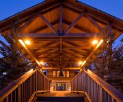
Comfort Inn Munising
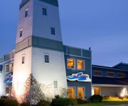
Holiday Inn Express MUNISING-LAKEVIEW
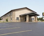
SUPER 8 MUNISING WETMORE AREA
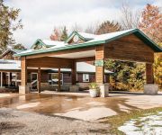
Econo Lodge Inn & Suites Munising Area
AmericInn Munising
DAYS INN MUNISING
Videos from this area
These are videos related to the place based on their proximity to this place.
Munising Trout & Salmon Classic 2014
The 25th annual Munising Trout & Salmon Classic brought to you by the Munising Fire Department; visit http://www.fishmunising.com. - Film crews did not access or enter any contestant boats...
Sledheads trip from Frederic, Michigan to the Upper Penninsula
This is part 1 of a 3 part video of our snowmobile trip from Frederic Michigan to the U.P. and back. A 3 day 700 mile trip. Riding with the group, Chubby Roger Pontious, Husky Mel Schadler,...
Pictured Rocks Cruise - Munising, MI
LeClair Photography went out on the Pictured Rocks Cruise, shot a little bit of video, and made this short film of some of the natural beauty right here in the Upper Peninsula. http://www.pictured...
2014 Fourth of July Munising Fire Dept Water Fights #RooftopShot
Rooftop shot of the 2014 Fourth of July Water Fights. An annual tradition for the Munising Fire Department as part of the Munising, Michigan community celebration. #MunisingFD.
Cruising across Munising bay to the city docks where the Pictured Rocks Boat tours dock
Towing my son Tristan in his Kayak we went all over the eastern half of Munising bay Michigan.
Testing out my new KaBoat SK396 on Lake Superior in Munising Bay Michigan. Watch it HD
My son was filming me from his kayak which will explain the shaky camera work. We had ball out there.
Munising MI water fight
This is a clip of a fire department water fight that the Munising MI fire department has every 4th of July.
Cruising on Lake Superior in Munising Bay Michigan in my new KaBoat Sk396. Watch it HD
Was the perfect morning to get out and cruise around the bay. My son was filming from his Kayak that explains the shaky camera. We cruised around the entire eastern half of Munising bay.
Upper MIchigan waterfalls
Waterfalls we found along our route while on Vacation heading for Munising Michigan,Had the most perfect weather the entire week we stayed in the Munising area.
A Change in Season
Take a visual adventure through a change in seasons around Munising, as summer fades to fall. Several 'lesser-known' falls are featured in this video; Silver Falls, Potato Patch Falls, Elliot's...
Videos provided by Youtube are under the copyright of their owners.
Attractions and noteworthy things
Distances are based on the centre of the city/town and sightseeing location. This list contains brief abstracts about monuments, holiday activities, national parcs, museums, organisations and more from the area as well as interesting facts about the region itself. Where available, you'll find the corresponding homepage. Otherwise the related wikipedia article.
Anna River (Michigan)
The Anna River is a 7.1-mile-long river on the Upper Peninsula of the U.S. state of Michigan. The mouth of the river is at {{#invoke:Coordinates|coord}}{{#coordinates:46|24|40|N|86|38|26|W|region:US-MI_type:river_source:GNIS | |name=Anna River (mouth) }} in the city of Munising on the South Bay of Grand Island Harbor on Lake Superior.
WQXO
WQXO (1400 AM) is a radio station licensed to Munising, Michigan. It broadcasts an oldies music format. WQXO signed on in the late 1950s as WMAB "Munising Alger Broadcasting" operating from studios above the First National Bank building (now City Hall). Owned by The Munising News, WMAB operated daytime only at first, later staying on the air until 10pm nightly. The call letters were changed to WGON "Wagon Radio" (similar to Menominee's WAGN).
Wagner Falls Scenic Site
The Wagner Falls Scenic Site is a Michigan State Park, located in central Alger County, Upper Michigan. The 23-acre (0.1 km²) state scenic area protects Wagner Falls.
Munising Falls
Munising Falls is a waterfall located in Munising in the western-most portion of the Pictured Rocks National Lakeshore in Alger County. The falls drops about 50 feet over a sandstone cliff. With the exception of the spring thaw, the amount of water falling is relatively small. There are trails leading to multiple viewpoints around the falls. In the winter, the falls freeze forming an ice column.
Alger Falls
Alger Falls is a waterfall located along highway M-28 (Michigan highway) in Alger County, Michigan near Munising at the junction with M-94. The falls consist of a series of drops, the highest of which is about 15 feet . The falls can be seen from the highway. The level of water coming over the falls can vary greatly depending on snow melt or rainfall.
Tannery Falls
Tannery Falls is a waterfall on Tannery Creek located near the city of Munising, Michigan. The Falls are also sometimes called the Rudy M. Olson Memorial Falls. The grave site of Rudolf Olsen can be seen on the path leading to the falls alongside a set of stairs. Tannery Creek flows behind a small residential area before reaching The falls which drop 40 feet into an impressive sandstone canyon. There is a cave behind the falls.
Memorial Falls
Memorial Falls are actually two similar waterfalls in adjacent gorges on small streams near the city of Munising Michigan. The larger falls drop approximately 40 feet. There is a cave behind both falls. There is a small natural arch in the sandstone between the two gorges near the top of the falls. The level of water coming over the falls can vary greatly depending on snow melt or rainfall and the smaller of the two falls are often dry.
Wagner Falls
Wagner Falls is a waterfall on Wagner Creek near Munising, in Alger County, Upper Michigan. They are in the Wagner Falls Scenic Site, a Michigan State Park of the Michigan Department of Natural Resources. The falls are located near the junction of M-28 and M-94 and can be reached by a short trail and boardwalk. Water flowing over the falls joins the Anna River below the falls, and flows into Lake Superior near Munising.


