Safety Score: 2,7 of 5.0 based on data from 9 authorites. Meaning we advice caution when travelling to United States.
Travel warnings are updated daily. Source: Travel Warning United States. Last Update: 2024-08-13 08:21:03
Delve into West Leominster
West Leominster in Worcester County (Massachusetts) is located in United States about 374 mi (or 602 km) north-east of Washington DC, the country's capital town.
Current time in West Leominster is now 09:32 AM (Thursday). The local timezone is named America / New York with an UTC offset of -5 hours. We know of 9 airports close to West Leominster, of which 3 are larger airports. The closest airport in United States is Worcester Regional Airport in a distance of 20 mi (or 32 km), South. Besides the airports, there are other travel options available (check left side).
Also, if you like playing golf, there are some options within driving distance. If you need a hotel, we compiled a list of available hotels close to the map centre further down the page.
While being here, you might want to pay a visit to some of the following locations: Worcester, Keene, Dedham, Concord and Allenstown. To further explore this place, just scroll down and browse the available info.
Local weather forecast
Todays Local Weather Conditions & Forecast: 7°C / 44 °F
| Morning Temperature | 7°C / 45 °F |
| Evening Temperature | 7°C / 45 °F |
| Night Temperature | 8°C / 47 °F |
| Chance of rainfall | 28% |
| Air Humidity | 95% |
| Air Pressure | 1001 hPa |
| Wind Speed | Moderate breeze with 11 km/h (7 mph) from West |
| Cloud Conditions | Overcast clouds, covering 100% of sky |
| General Conditions | Moderate rain |
Thursday, 21st of November 2024
8°C (46 °F)
4°C (40 °F)
Moderate rain, gentle breeze, overcast clouds.
Friday, 22nd of November 2024
5°C (42 °F)
5°C (41 °F)
Light rain, moderate breeze, overcast clouds.
Saturday, 23rd of November 2024
6°C (43 °F)
3°C (38 °F)
Broken clouds, moderate breeze.
Hotels and Places to Stay
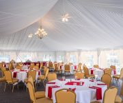
DoubleTree by Hilton Leominster
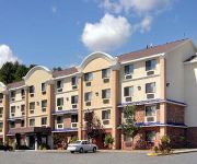
SUPER 8 LEOMINSTER FITCHBURG
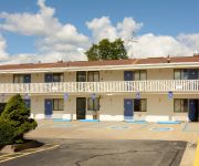
MOTEL 6 LEOMINSTER MA
Videos from this area
These are videos related to the place based on their proximity to this place.
Leominster: Car Wash @ Mr. Mike's Mobil, Main Street: Winter Run
We get another car wash at Mr. Mike's, Main Street, Leominster, Massachusetts. This is a Laserwash system. The wash does operate differently during the Winter season. Usually, both doors...
Leominster: Mr. Mike's Laserwash, After Renovations (A Bit Overdue)
A couple years ago, the Laserwash at Mr. Mike's Mobil, downtown Leominster, Massachusetts, was shut down for about a year, apparently in need of repair, or overhaul of some sort, not 100% sure....
Leominster: Columbia Hotel Building Fire
FIRST, AND FOREMOST: All residents got out safely. 2 firefighters were injured durring a roof collapse, but were treated and released. Recorded November 25, 2012 This is footage of the 9-Alarm...
Rockin' the Gauntlet: Downtown Leominster (MA)
Now that GOOD STANDING accounts get UNLIMITED VIDEO LENGTH, I am starting a new series, called "Rockin' the Gauntlet", where I (try to) ride every public elevator and escalator at any given...
Leominster: BRAND NEW G5 Laserwash (Needs LOTS of help!) @ Mr. Mike's Mobil
NOTE: Pardon the camera noise, as I'm new to using the Olympus with car washes. They got rid of the Laserwash 4000 system a couple weeks ago, and now sports a G5 wash, so we give it a test...
Leominster: 2014 Christmas Ride for Andrew, on a Dover Elevator @ City Hall
Recorded December 13, 2014, during the Winter Stroll. For Christmas Day, I saved the best of the three public municipal elevators in Leominster, Massachusetts, and it's especially for one...
Leominster: Columbia Demolition: Unstable Wall Removal (1 of 2)
This is a video of a wrecking crew taking down the unstable part of the 3rd story wall, that survived the big roof collapse, during the 9-Alarm fire. This wall is on the Merriam Ave. side of...
Leominster: Hiking the Doyle Estate/Community Park
Recorded July 19, 2014 My friend and I decided to hike the trails of the former Doyle Estate, sandwiched between Merriam Avenue, Lindell Avenue, and Route 2, Leominster, Massachusetts. While...
Leominster: Holiday Stroll 2013 (Demo)
This is a shot of the 2013 Holiday Stroll being taken down, getting the roads ready for normal traffic flow. Due to good timing, for the most part, we get to watch the Berry Go Round ride being...
Leominster: Columbia Demolition: Third Floor
As of Mid-December, the Columbia is now being demolished, at a slow rate, as to not cause damage to nearby buildings, to passing traffic, nor to cause a catastrophic event. Before these points,...
Videos provided by Youtube are under the copyright of their owners.
Attractions and noteworthy things
Distances are based on the centre of the city/town and sightseeing location. This list contains brief abstracts about monuments, holiday activities, national parcs, museums, organisations and more from the area as well as interesting facts about the region itself. Where available, you'll find the corresponding homepage. Otherwise the related wikipedia article.
Fitchburg Municipal Airport
Fitchburg Municipal Airport is a public airport located three miles (5 km) southeast of the central business district of Fitchburg, a city in Worcester County, Massachusetts, United States. This airport is owned by the City of Fitchburg. Occasionally the airport serves as a home for rock festivals such as The Warped Tour and Locobazooka.
Leominster High School
Leominster High School (also known as Leominster High or LHS) is a public high school located in Leominster, Massachusetts. It is the only secondary educational institution found in Leominster. It is situated 26-acre in the western area of Leominster. As of September 2002, Leominster High School had an enrollment of 1802 students, in grades 9 through 12.
Wachusett Potato Chip Company
Wachusett Potato Chip Company in Fitchburg, Massachusetts was founded in 1939. It was originally started in Clinton, Massachusetts by the children of a Polish immigrant family. In the 1940s the company purchased the former Worcester County jail building and grounds. The company converted the property and it has served as a manufacturing and distribution facility for snack products since that time.
The Mall at Whitney Field
The Mall at Whitney Field, formerly Searstown Mall, is a shopping center located in Leominster, Massachusetts, United States. The mall features jcpenney, Macy's, Sears, and Old Navy as anchor stores, as well as another vacant anchor originally held by Circuit City. It sat vacant for a while following their bankruptcy, until Ultimate Electronics occupied the space in March 2010, only to close with their own bankruptcy only a year later, in March 2011, which left the anchor vacant once again.
North Leominster (MBTA station)
North Leominster is a station on MBTA Commuter Rail's Fitchburg Line. The station is located at 34 Nashua Street, east of Main Street in Leominster, Massachusetts. The station, which is fully handicapped accessible, has two side platforms to serve the line's two tracks. There is a small freight yard adjacent to the parking lot and mainline tracks on the south end of the inbound platform.
WCMX
WCMX is a radio station broadcasting a Christian radio format. Licensed to Leominster, Massachusetts, USA. The station is currently owned by Twin City Baptist Temple, Inc. and features programing from Salem Communications. WCMX began operations in November, 1967 as MOR station WLMS. The station was founded and established by Clarance Allain.
Doyle Reservation
The Doyle Reservation, located in the city of Leominster, Massachusetts, is a 170-acre landscaped urban park and open space reservation managed by The Trustees of Reservations (TTOR), a non-profit conservation organization. It is also the location of TTOR's Doyle Center: a conservation education center, regional office, and green building initiative. The property consists of three main areas: Pierce Meadow, a landscaped urban park and former estate of Harry W.
WQPH
WQPH is a Catholic radio station, licensed to Shirley, Massachusetts, USA and serving the Fitchburg area. The station is owned by Prayers for Life, Inc. , and is an affiliate of EWTN Radio.


