Safety Score: 2,7 of 5.0 based on data from 9 authorites. Meaning we advice caution when travelling to United States.
Travel warnings are updated daily. Source: Travel Warning United States. Last Update: 2024-08-13 08:21:03
Touring Mill Street
Mill Street in Worcester County (Massachusetts) is a town located in United States about 358 mi (or 576 km) north-east of Washington DC, the country's capital place.
Time in Mill Street is now 01:59 PM (Tuesday). The local timezone is named America / New York with an UTC offset of -5 hours. We know of 9 airports nearby Mill Street, of which 3 are larger airports. The closest airport in United States is Worcester Regional Airport in a distance of 1 mi (or 2 km), West. Besides the airports, there are other travel options available (check left side).
Also, if you like the game of golf, there are several options within driving distance. We collected 1 points of interest near this location. Need some hints on where to stay? We compiled a list of available hotels close to the map centre further down the page.
Being here already, you might want to pay a visit to some of the following locations: Worcester, Johnston, North Providence, Providence and Cranston. To further explore this place, just scroll down and browse the available info.
Local weather forecast
Todays Local Weather Conditions & Forecast: 1°C / 34 °F
| Morning Temperature | -6°C / 22 °F |
| Evening Temperature | -3°C / 27 °F |
| Night Temperature | -4°C / 25 °F |
| Chance of rainfall | 0% |
| Air Humidity | 44% |
| Air Pressure | 1022 hPa |
| Wind Speed | Gentle Breeze with 6 km/h (4 mph) from South-East |
| Cloud Conditions | Few clouds, covering 18% of sky |
| General Conditions | Few clouds |
Tuesday, 3rd of December 2024
1°C (33 °F)
0°C (32 °F)
Snow, gentle breeze, few clouds.
Wednesday, 4th of December 2024
3°C (37 °F)
-4°C (26 °F)
Snow, fresh breeze, overcast clouds.
Thursday, 5th of December 2024
-3°C (26 °F)
-7°C (19 °F)
Broken clouds, moderate breeze.
Hotels and Places to Stay
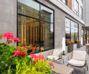
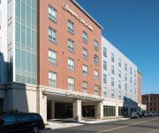
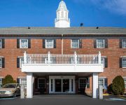
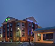
AC Hotel Worcester
Courtyard Worcester
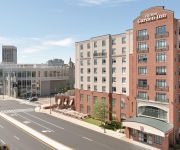
Hilton Garden Inn Worcester
MA Hampton Inn & Suites-Worcester
Holiday Inn Express WORCESTER DOWNTOWN
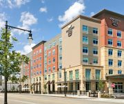
Homewood Suites By Hilton Worcester
Comfort Inn Auburn-Worcester
La Quinta Inn Auburn Worcester
Holiday Inn Express & Suites AUBURN
The Beechwood Hotel-Worldhotel
Videos from this area
These are videos related to the place based on their proximity to this place.
20140614200514 Bridgewater-Raynham vs Holy Name D1 softball game
Highlights of the Bridgewater-Raynham vs Holy Name MIAA D1 State Final Softball game played on 6/14/14 at Worcester State University. B-R won big 9-0.
Worcester Institute for Senior Education
Assumption College is proud to sponsor the Worcester Institute for Senior Education (W.I.S.E.), a lifelong learning institute open to older adults in Central Massachusetts who are interested...
2012 Worcester Marathon
2012 Worcester Marathon - Corner of June and Chandler Streets. These would be 5K, 13.1 mile and 26.2 mile runners going outbound approximately two miles from downtown.
Firefighters battle 4-alarm blaze in Worcester
A four-alarm blaze has destroyed an under-renovation Worcester apartment building and damaged three occupied buildings, but there were no reports of tenant injuries.
3 alarms struck on bitter, cold night in Worcester
Heavy fire was showing from this typical New England 3 decker, shortly after 6pm on Dec 6, 2010 on Bluff St. Fire extended to the 2nd and 3rd floors before being brought under control over...
19 Maple Tree Lane, Worcester, MA Presented by Jim Gatos.
Click to see more: http://www.searchallproperties.com/listings/2039535/19-Maple-Tree-Lane-Worcester-MA/auto?reqpage=video 19 Maple Tree Lane Worcester, MA 01...
2012 Worcester St. Patrick's Day Parade Bands
Some of the bands at the 2012 Worcester St. Patrick's Day Parade on March 11, 2012. The video was shot from Elm Park near the end of the parade route.
Videos provided by Youtube are under the copyright of their owners.
Attractions and noteworthy things
Distances are based on the centre of the city/town and sightseeing location. This list contains brief abstracts about monuments, holiday activities, national parcs, museums, organisations and more from the area as well as interesting facts about the region itself. Where available, you'll find the corresponding homepage. Otherwise the related wikipedia article.
Worcester State University
For other "Worcester Colleges," see Worcester College (disambiguation). Worcester State University {{#invoke:InfoboxImage|InfoboxImage|image=Worcester_State_University_logo. png|size=200px|sizedefault=frameless|alt=}}Established 1874Type PublicPresident Barry M.
Worcester Regional Airport
Worcester Regional Airport with a proposed new name, Worcester/Metrowest Boston Regional Airport is a public airport located three miles (5 km) west of the central business district of Worcester, a city in Worcester County, Massachusetts, United States. The main airport property lies within Worcester and Leicester, with substantial supporting facilities in Paxton.
WVEI (AM)
WVEI is an AM radio station in Worcester, Massachusetts, operating on 1440 kHz with 5,000 watts. The station is owned by Entercom Communications, and has an all-sports format. Most programming is provided by Boston sister station WEEI-FM.
Notre Dame Academy (Worcester, Massachusetts)
Notre Dame Academy is a private, all-girls Roman Catholic high school in Worcester, Massachusetts. It is located in the Roman Catholic Diocese of Worcester.
Doherty Memorial High School
Doherty Memorial High School is a public high school located in Worcester, Massachusetts, in the United States. It opened its doors in the fall of 1966, replacing two closing schools: Worcester Classical High School and Worcester Commerce High School.
WNEB
WNEB is a Catholic radio station broadcasting religious programming. Licensed to Worcester, Massachusetts, USA, the station serves the Worcester area. The station is currently owned by Emmanuel Communications, Inc. and features EWTN programming.
Hadwen Arboretum
Hadwen Arboretum is an arboretum in Worcester, Massachusetts. Located in Worcester's West Side, it is owned and protected by nearby Clark University. The arboretum was bequeathed to Clark by Obadiah Hadwen for historical and ecological purposes upon his death in 1907. A 1978 report by Clark students cataloged 40 different types of trees in the area.
Commerce Bank Field at Foley Stadium
Commerce Bank Field at Foley Stadium is an historic sports venue in Worcester, Massachusetts. It was built in 1927 and was renovated in 2007. It is primarily a stadium used for high school football teams in the city and is owned and operated by the City of Worcester.


