Safety Score: 2,7 of 5.0 based on data from 9 authorites. Meaning we advice caution when travelling to United States.
Travel warnings are updated daily. Source: Travel Warning United States. Last Update: 2024-08-13 08:21:03
Discover Winthrop Highlands
Winthrop Highlands in Suffolk County (Massachusetts) is a place in United States about 399 mi (or 642 km) north-east of Washington DC, the country's capital city.
Current time in Winthrop Highlands is now 01:33 PM (Tuesday). The local timezone is named America / New York with an UTC offset of -5 hours. We know of 9 airports near Winthrop Highlands, of which 3 are larger airports. The closest airport in United States is General Edward Lawrence Logan International Airport in a distance of 2 mi (or 4 km), South-West. Besides the airports, there are other travel options available (check left side).
Also, if you like playing golf, there are a few options in driving distance. We encountered 5 points of interest in the vicinity of this place. If you need a hotel, we compiled a list of available hotels close to the map centre further down the page.
While being here, you might want to pay a visit to some of the following locations: Boston, Dedham, Taunton, Brentwood and Providence. To further explore this place, just scroll down and browse the available info.
Local weather forecast
Todays Local Weather Conditions & Forecast: 2°C / 36 °F
| Morning Temperature | -3°C / 27 °F |
| Evening Temperature | 2°C / 35 °F |
| Night Temperature | 0°C / 32 °F |
| Chance of rainfall | 0% |
| Air Humidity | 41% |
| Air Pressure | 1021 hPa |
| Wind Speed | Gentle Breeze with 6 km/h (3 mph) from South-East |
| Cloud Conditions | Few clouds, covering 11% of sky |
| General Conditions | Few clouds |
Tuesday, 3rd of December 2024
1°C (34 °F)
3°C (38 °F)
Light rain, gentle breeze, few clouds.
Wednesday, 4th of December 2024
4°C (39 °F)
-0°C (31 °F)
Rain and snow, fresh breeze, overcast clouds.
Thursday, 5th of December 2024
-1°C (31 °F)
-3°C (27 °F)
Sky is clear, fresh breeze, clear sky.
Hotels and Places to Stay
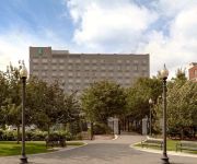
Embassy Suites by Hilton Boston at Logan Airport
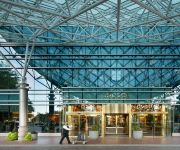
Renaissance Boston Waterfront Hotel
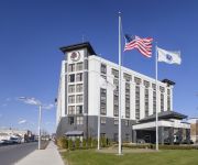
DoubleTree by Hilton Boston Logan Airport Chelsea
Hilton Boston Logan Airport
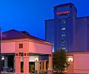
Four Points by Sheraton Boston Logan Airport Revere
Herbivorian House
SEAPORT BOSTON HOTEL
Quality Inn Revere
Global Luxury Suites at Seaport East
Homewood Suites by Hilton Boston Logan Airport Chelsea
Videos from this area
These are videos related to the place based on their proximity to this place.
Broadway Revere, Ma 2 days after the Valentine's Blizzard 2015
Broadway Revere and other streets (Payson St and Central Ave,) 2 days after the second blizzard in 2 weeks.
Dramatic Sailboat Rescue Winthrop (Mass) Yacht Club
Dramatic Sailboat Recuse Winthrop (Mass) Yacht Club.
Old Winthrop MA
Video of Winthrop Massachusetts compiled from old pictures and postcards featuring the Narrow Guage Railroad and many old sights and scenes of Winthrop.
2009-2010 Winthrop Vikings Basketball part 1 of 3.wmv
2009-2010 Winthrop Vikings Basketball pt 1 of 3, Winthrop Highschool, Winthrop Massachusetts.
Blizzard 2015 Time Lapse - Winthrop, MA
Approximately 29 hours of winter storm Juno, compressed down to about 2 1/2 minutes. Watch the white pile up and the winds howl. Shot looking out onto Winthrop Beach in Winthrop, MA. 27-28...
Horribles Parade - Winthrop, MA 2007
yearly horribles parade held in Winthrop, MA July 4, 2007. the parade is a yearly tradition amongst the residents of Winthrop. People come from all over to celebrate with the residents and...
Winthrop Taxi | Winthrop MA Taxi | Winthrop Cab | 02152 taxi 781-284-5555
Winthrop Taxi | Winthrop MA Taxi | Winthrop Cab | 02152 taxi 781-284-5555 http://luckytaxicab.com Winthrop taxi is the premier WinthropTaxi service for the neighborhood of Winthrop. It has...
Nemo Blizzard, Winthrop MA, time lapse.
Time lapse video taken out our window using an old webcam from the morning of the 8th to the afternoon of the 9th. Drifts close to 6 feet are all over the place, the road has over 2 feet of...
Winthrop Massachusetts (MA) Real Estate Tour
http://www.winthropmarealestate.com -- Tour Winthrop, MA neighborhoods, condominium developments, subdivisions, schools, landmarks, recreational areas, and town offices. Winthrop ...
Videos provided by Youtube are under the copyright of their owners.
Attractions and noteworthy things
Distances are based on the centre of the city/town and sightseeing location. This list contains brief abstracts about monuments, holiday activities, national parcs, museums, organisations and more from the area as well as interesting facts about the region itself. Where available, you'll find the corresponding homepage. Otherwise the related wikipedia article.
Beachmont, Massachusetts
Beachmont is a relatively insular community within Revere, Massachusetts and is referred to as the Capital of the city by locals. This Boston area neighborhood is diverse with some charming turn-of-the-century homes overlooking the Atlantic Ocean. East Boston and Winthrop border Beachmont on the South.
Beachmont (MBTA station)
Beachmont is an above-ground rapid-transit station located on the MBTA Blue Line. It serves the Beachmont neighborhood of Revere, Massachusetts. The station, located on an overpass above Winthrop Avenue, is one of a small number of elevated rapid transit stations remaining in the MBTA system.
Suffolk Downs (MBTA station)
Suffolk Downs is a station on the Massachusetts Bay Transportation Authority's Blue Line, named for the nearby Suffolk Downs racetrack. The station is on the surface section of the Blue Line, the only part of the MBTA's heavy rail lines that uses overhead lines instead of third rail. Suffolk Downs station was originally built on April 21, 1952, on the site of a former Boston, Revere Beach and Lynn Railroad depot called Belle Isle.
Snake Island (Massachusetts)
Snake Island, also known as Bare Island, is an island in Boston Harbor. The island is part of the Boston Harbor Islands National Recreation Area and is situated in the inner harbor between the town of Winthrop and the reclaimed land that forms Logan International Airport. It is part of the Town of Winthrop. It is named for its serpentine shape, and has a permanent size of 3 acres, and rises to a height of 10 feet above sea level.
Winthrop Beach
Winthrop Beach is the main beach of Winthrop, Massachusetts. It is located along Winthrop Shore Drive, spanning the roadway. The beach begins off Crest Ave. at an area known as the "Green Bars", named for the green railings along the seawall. The beach ends at the base of Water Tower Hill. The ocean has five wave breakers called the "Five Sisters" off shore to protect nearby neighborhoods from the large swells that occur during storms.
Yirrell Beach
Yirrell Beach is a main beach of Winthrop, Massachusetts. The southern part is also known as Point Shirley Beach, as the neighborhood is Point Shirley. Farther north is Winthrop Beach.
Fort Heath
Fort Heath was a US seacoast military installation for defense of the Boston and Winthrop Harbors with an early 20th century Coast Artillery fort, a 1930s USCG radio station, prewar Navy research facilities, World War II batteries, and a Cold War radar station. The fort's military structures have been replaced by a residential complex (parking areas, 3 apartment buildings, etc. ) and recreation facilities of Small Park, which has both a commemorative wall and an historical marker for Fort Heath.
Broad Sound (Massachusetts)
Broad Sound is a bay on the Massachusetts coast north of Boston. It lies on the west of Massachusetts Bay, between Nahant and Deer Island; Lynn harbor is at its north end. The main channel of Boston Harbor empties into the sound.


