Safety Score: 2,7 of 5.0 based on data from 9 authorites. Meaning we advice caution when travelling to United States.
Travel warnings are updated daily. Source: Travel Warning United States. Last Update: 2024-08-13 08:21:03
Discover Point Shirley
Point Shirley in Suffolk County (Massachusetts) is a city in United States about 398 mi (or 640 km) north-east of Washington DC, the country's capital city.
Local time in Point Shirley is now 01:35 PM (Tuesday). The local timezone is named America / New York with an UTC offset of -5 hours. We know of 9 airports in the vicinity of Point Shirley, of which 3 are larger airports. The closest airport in United States is General Edward Lawrence Logan International Airport in a distance of 2 mi (or 3 km), West. Besides the airports, there are other travel options available (check left side).
Also, if you like golfing, there are a few options in driving distance. We discovered 5 points of interest in the vicinity of this place. Looking for a place to stay? we compiled a list of available hotels close to the map centre further down the page.
When in this area, you might want to pay a visit to some of the following locations: Boston, Dedham, Taunton, Brentwood and Providence. To further explore this place, just scroll down and browse the available info.
Local weather forecast
Todays Local Weather Conditions & Forecast: 2°C / 36 °F
| Morning Temperature | -3°C / 27 °F |
| Evening Temperature | 2°C / 35 °F |
| Night Temperature | 0°C / 32 °F |
| Chance of rainfall | 0% |
| Air Humidity | 41% |
| Air Pressure | 1021 hPa |
| Wind Speed | Gentle Breeze with 6 km/h (3 mph) from South-East |
| Cloud Conditions | Few clouds, covering 11% of sky |
| General Conditions | Few clouds |
Tuesday, 3rd of December 2024
1°C (34 °F)
3°C (38 °F)
Light rain, gentle breeze, few clouds.
Wednesday, 4th of December 2024
4°C (39 °F)
-0°C (31 °F)
Rain and snow, fresh breeze, overcast clouds.
Thursday, 5th of December 2024
-1°C (31 °F)
-3°C (27 °F)
Sky is clear, fresh breeze, clear sky.
Hotels and Places to Stay
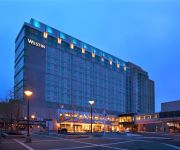
The Westin Boston Waterfront
The Envoy Hotel Autograph Collection
Hilton Boston Logan Airport
Element Boston Seaport
Aloft Boston Seaport
Embassy Suites by Hilton Boston at Logan Airport
Renaissance Boston Waterfront Hotel
Residence Inn Boston Logan Airport/Chelsea
Global Luxury Suites at Seaport East
Residence Inn Boston Downtown/Seaport
Videos from this area
These are videos related to the place based on their proximity to this place.
Dramatic Sailboat Rescue Winthrop (Mass) Yacht Club
Dramatic Sailboat Recuse Winthrop (Mass) Yacht Club.
Old Winthrop MA
Video of Winthrop Massachusetts compiled from old pictures and postcards featuring the Narrow Guage Railroad and many old sights and scenes of Winthrop.
2009-2010 Winthrop Vikings Basketball part 1 of 3.wmv
2009-2010 Winthrop Vikings Basketball pt 1 of 3, Winthrop Highschool, Winthrop Massachusetts.
Blizzard 2015 Time Lapse - Winthrop, MA
Approximately 29 hours of winter storm Juno, compressed down to about 2 1/2 minutes. Watch the white pile up and the winds howl. Shot looking out onto Winthrop Beach in Winthrop, MA. 27-28...
Yirrell Beach, Winthrop, Massachusetts
Foggy day at Yirrell Beach in Winthrop Massachusetts. Yirrell Beach is located at the tip of Winthrop right next to Deer Island.
Horribles Parade - Winthrop, MA 2007
yearly horribles parade held in Winthrop, MA July 4, 2007. the parade is a yearly tradition amongst the residents of Winthrop. People come from all over to celebrate with the residents and...
Winthrop Taxi | Winthrop MA Taxi | Winthrop Cab | 02152 taxi 781-284-5555
Winthrop Taxi | Winthrop MA Taxi | Winthrop Cab | 02152 taxi 781-284-5555 http://luckytaxicab.com Winthrop taxi is the premier WinthropTaxi service for the neighborhood of Winthrop. It has...
Nemo Blizzard, Winthrop MA, time lapse.
Time lapse video taken out our window using an old webcam from the morning of the 8th to the afternoon of the 9th. Drifts close to 6 feet are all over the place, the road has over 2 feet of...
Winthrop Massachusetts (MA) Real Estate Tour
http://www.winthropmarealestate.com -- Tour Winthrop, MA neighborhoods, condominium developments, subdivisions, schools, landmarks, recreational areas, and town offices. Winthrop ...
Videos provided by Youtube are under the copyright of their owners.
Attractions and noteworthy things
Distances are based on the centre of the city/town and sightseeing location. This list contains brief abstracts about monuments, holiday activities, national parcs, museums, organisations and more from the area as well as interesting facts about the region itself. Where available, you'll find the corresponding homepage. Otherwise the related wikipedia article.
Boston Harbor
Boston Harbor is a natural harbor and estuary of Massachusetts Bay, and is located adjacent to the city of Boston, Massachusetts. It is home to the Port of Boston, a major shipping facility in the northeast.
Apple Island (Massachusetts)
Apple Island was an island in Boston Harbor in Massachusetts, one of five islands that were integrated with landfill over the years to form East Boston and Logan International Airport. Noddle's Island, Hog Island, Bird's Island and Governor's Island were the others.
Deer Island (Massachusetts)
Deer Island is a peninsula in Boston Harbor, Massachusetts. Since 1996 it is part of the Boston Harbor Islands National Recreation Area. Although still an island by name, Deer Island has been connected to the mainland since the former Shirley Gut channel, which once separated the island from the town of Winthrop, was filled in by the New England Hurricane of 1938.
Snake Island (Massachusetts)
Snake Island, also known as Bare Island, is an island in Boston Harbor. The island is part of the Boston Harbor Islands National Recreation Area and is situated in the inner harbor between the town of Winthrop and the reclaimed land that forms Logan International Airport. It is part of the Town of Winthrop. It is named for its serpentine shape, and has a permanent size of 3 acres, and rises to a height of 10 feet above sea level.
Eastern Air Lines Flight 375
Eastern Air Lines Flight 375, registration N5533, was a Lockheed L-188 Electra aircraft that crashed on takeoff from Logan International Airport in Boston, Massachusetts on 4 October 1960. 62 of 72 on board were killed in the accident; ten survived, nine with serious injuries. N5533 and its crew came into Logan that day as Flight 444 from New York City's LaGuardia Airport.
Winthrop Beach
Winthrop Beach is the main beach of Winthrop, Massachusetts. It is located along Winthrop Shore Drive, spanning the roadway. The beach begins off Crest Ave. at an area known as the "Green Bars", named for the green railings along the seawall. The beach ends at the base of Water Tower Hill. The ocean has five wave breakers called the "Five Sisters" off shore to protect nearby neighborhoods from the large swells that occur during storms.
Yirrell Beach
Yirrell Beach is a main beach of Winthrop, Massachusetts. The southern part is also known as Point Shirley Beach, as the neighborhood is Point Shirley. Farther north is Winthrop Beach.
Deer Island Prison
The Deer Island Prison (c. 1880–1991) in Suffolk County, Massachusetts was located on Deer Island in Boston Harbor. Also known as the Deer Island House of Industry and later, House of Correction, it held people convicted of drunkenness, illegal possession of drugs, disorderly conduct, larceny, and other crimes subject to relatively short-term sentencing. When it closed in 1991, some 1,500 inmates were being held at Deer Island.


