Safety Score: 2,7 of 5.0 based on data from 9 authorites. Meaning we advice caution when travelling to United States.
Travel warnings are updated daily. Source: Travel Warning United States. Last Update: 2024-08-13 08:21:03
Explore Neponset
Neponset in Suffolk County (Massachusetts) is located in United States about 392 mi (or 631 km) north-east of Washington DC, the country's capital.
Local time in Neponset is now 02:19 PM (Tuesday). The local timezone is named America / New York with an UTC offset of -5 hours. We know of 11 airports in the wider vicinity of Neponset, of which 5 are larger airports. The closest airport in United States is General Edward Lawrence Logan International Airport in a distance of 6 mi (or 9 km), North. Besides the airports, there are other travel options available (check left side).
Also, if you like golfing, there are multiple options in driving distance. We found 3 points of interest in the vicinity of this place. If you need a place to sleep, we compiled a list of available hotels close to the map centre further down the page.
Depending on your travel schedule, you might want to pay a visit to some of the following locations: Boston, Dedham, Taunton, Providence and North Providence. To further explore this place, just scroll down and browse the available info.
Local weather forecast
Todays Local Weather Conditions & Forecast: 2°C / 36 °F
| Morning Temperature | -3°C / 27 °F |
| Evening Temperature | 1°C / 34 °F |
| Night Temperature | -1°C / 31 °F |
| Chance of rainfall | 0% |
| Air Humidity | 41% |
| Air Pressure | 1022 hPa |
| Wind Speed | Light breeze with 5 km/h (3 mph) from South-East |
| Cloud Conditions | Few clouds, covering 12% of sky |
| General Conditions | Few clouds |
Tuesday, 3rd of December 2024
1°C (34 °F)
3°C (38 °F)
Light rain, gentle breeze, few clouds.
Wednesday, 4th of December 2024
4°C (40 °F)
-1°C (30 °F)
Rain and snow, fresh breeze, overcast clouds.
Thursday, 5th of December 2024
-1°C (31 °F)
-3°C (26 °F)
Sky is clear, fresh breeze, clear sky.
Hotels and Places to Stay
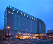
The Westin Boston Waterfront
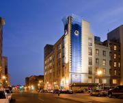
AC Hotel Boston Downtown
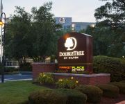
DoubleTree by Hilton Boston Downtown
DoubleTree Club by Hilton Boston Bayside
Boston Marriott Quincy
Renaissance Boston Waterfront Hotel
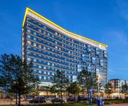
Aloft Boston Seaport
Element Boston Seaport
Residence Inn Boston Downtown/Seaport
SEAPORT BOSTON HOTEL
Videos from this area
These are videos related to the place based on their proximity to this place.
PCC Cars: Cabview Boston Ashmont - Mattapan High Speed Line 2012
The Boston Ashmont - Mattapan High Speed Line is one of the very few lines in the world still served by the old PCC streetcars.
MBTA Mattapan PCC Departing Ashmont Loop
A surviving MBTA PCC trolley departs the Ashmont station on the new flyover loop.
Henderson School Outdoor Classroom Ribbon Cutting
Mayor Menino participates in the official ribbon cutting of the Henderson Inclusion Elementary School's new outdoor classroom. Watch the full video: http://www.cityofboston.gov/cable/video_library...
Dorchester Board of Trade Luncheon
Mayor Thomas M. Menino gives his annual address to the members of the Dorchester Board of Trade. Full video available at: http://www.cityofboston.gov/cable/video_library.asp?id=3022.
Dorchester Day Parade 2011
Hey Guys!!! This is a different video where Today (refer to June 5th) is the Dorchester Day Parade and it only involves in my area... on that afternoon it was about cultures, political in Massachus...
KONE Hydraulic Elevator East Elevator (Inbound Platform) in Ashmont T Station in Boston, MA
Installed in 2009.
Boston Fire Commissioner Joseph Finn Swearing-In Ceremony
Mayor Walsh attends the swearing-in ceremony of Boston's new Fire Commissioner, Joseph Finn, at Engine 20 Firehouse. Watch the full event: ...
2 Hancock Street, Quincy, MA - Neponset Landing
A video tour of 2 Hancock Street, Quincy, MA provided by Jonathan Bowen of Jonathan Bowen Real Estate, LLC. Call 855-879-4663 or go to http://www.bowenboston.com in order to get more ...
This train is bound for.......ASHMONT!! PL 4/4
Final in a series of the Shmont route of the Red Line in Boston shot entirely by an amateur (me) out then front window.
Videos provided by Youtube are under the copyright of their owners.
Attractions and noteworthy things
Distances are based on the centre of the city/town and sightseeing location. This list contains brief abstracts about monuments, holiday activities, national parcs, museums, organisations and more from the area as well as interesting facts about the region itself. Where available, you'll find the corresponding homepage. Otherwise the related wikipedia article.
WMKI
WMKI is a children's radio station in the Boston market. It is owned by The Walt Disney Company, and runs their Radio Disney programming.
North Quincy (MBTA station)
North Quincy is a station on the MBTA Red Line rapid transit line, located at East Squantum Street between Hancock Street and Newport Avenue in Quincy, Massachusetts. It serves North Quincy High School, the State Street Bank complex, and the North Quincy and Montclair neighborhoods. Its other facilities include bus connections at street level and a 1,200-space parking lot.
Eire Pub
The Eire Pub is a pub in Dorchester, Massachusetts. During their respective presidential campaigns, future U.S. Presidents Ronald Reagan and Bill Clinton both visited the pub; since then, stopping at Eire Pub has become a superstition for political candidates hoping to follow in Reagan and Clinton's footsteps. Bertie Ahern, the then-Prime Minister of Ireland, visited the pub in 2008. Martin Nicholson, bartender at the Eire Pub for 45 years, retired in 2010.
North Quincy High School
North Quincy High School (NQHS) is a public secondary school located in the North Quincy neighborhood of Quincy, Massachusetts. The school's mascot is known as "Yakoo", and their school colors are Red & Black.
Neponset, Boston
Neponset, Massachusetts is a district in the southeast corner of Dorchester, Massachusetts which is the most populous neighborhood of Boston.
Naval Air Station Squantum
Naval Air Station Squantum was an active naval aviation facility during 1917 and from 1923 until 1953. The original civilian airfield that preceded it, the Harvard Aviation Field, dates back to 1910. The base was sited on Squantum Point in the city of Quincy, Massachusetts. It also abutted Dorchester Bay, Quincy Bay, and the Neponset River.
Montclair (Quincy, Massachusetts)
Montclair is a neighborhood of Quincy, Massachusetts. The neighborhood is separated from Boston by the Neponset River, and roughly follows West Squantum Street from Newport Avenue to the Milton town line, and extends approximately to Hobart Street.
Squantum Point Park
Squantum Point Park is a park located on the Squantum peninsula of Quincy, Massachusetts. It is located on the site of the former Squantum Naval Air Station. All that remains of the former air station is part of a runway which runs for 2,700 feet.
Cedar Grove (MBTA station)
Cedar Grove is a station on MBTA's Ashmont–Mattapan High Speed Line, a branch of the Red Line. The station is located at Adams Street and Milton Street in the Dorchester neighborhood of Boston, Massachusetts. Cedar Grove consists of two side platforms which serve the Ashmont–Mattapan High Speed Line's two tracks. It is located near Cedar Grove Cemetery, which the Ashmont–Mattapan High Speed Line runs through. The station was opened in 1929, as was the rest of the line.
Rainbow Swash
The Rainbow Swash is a work by Corita Kent in the Dorchester neighborhood of Boston, Massachusetts. The rainbow design painted on a 140-foot tall LNG storage tank is the largest copyrighted work of art in the world. Highly visible from daily commuters drives on Interstate 93, the landmark is considered one of the major landmarks of Boston, akin to the Citgo sign.
Marina Bay (Quincy, Massachusetts)
Marina Bay is a mixed-use development neighborhood of condominium, commercial and entertainment facilities in Quincy, Massachusetts. It includes five housing complexes and one assisted living complex, office complexes, numerous restaurants, a 685-slip marina and a seaside boardwalk. It is situated on the northwestern part of Squantum Peninsula at the mouth of the Neponset River where it meets Dorchester Bay in Boston Harbor.
Morrissey Boulevard
Morrissey Boulevard is a six-lane divided coastal road in the Dorchester neighborhood of Boston, Massachusetts. It is owned and maintained by the Massachusetts Department of Conservation and Recreation (DCR).


