Safety Score: 2,7 of 5.0 based on data from 9 authorites. Meaning we advice caution when travelling to United States.
Travel warnings are updated daily. Source: Travel Warning United States. Last Update: 2024-08-13 08:21:03
Explore Court Park
Court Park in Suffolk County (Massachusetts) is a city in United States about 397 mi (or 640 km) north-east of Washington DC, the country's capital.
Local time in Court Park is now 09:21 AM (Thursday). The local timezone is named America / New York with an UTC offset of -5 hours. We know of 9 airports in the vicinity of Court Park, of which 3 are larger airports. The closest airport in United States is General Edward Lawrence Logan International Airport in a distance of 1 mi (or 1 km), South-West. Besides the airports, there are other travel options available (check left side).
Also, if you like golfing, there are multiple options in driving distance. We found 4 points of interest in the vicinity of this place. If you need a place to sleep, we compiled a list of available hotels close to the map centre further down the page.
Depending on your travel schedule, you might want to pay a visit to some of the following locations: Boston, Dedham, Taunton, Brentwood and Providence. To further explore this place, just scroll down and browse the available info.
Local weather forecast
Todays Local Weather Conditions & Forecast: 9°C / 48 °F
| Morning Temperature | 9°C / 48 °F |
| Evening Temperature | 9°C / 48 °F |
| Night Temperature | 10°C / 50 °F |
| Chance of rainfall | 20% |
| Air Humidity | 86% |
| Air Pressure | 1002 hPa |
| Wind Speed | Fresh Breeze with 15 km/h (9 mph) from South-West |
| Cloud Conditions | Overcast clouds, covering 100% of sky |
| General Conditions | Moderate rain |
Thursday, 21st of November 2024
11°C (51 °F)
7°C (45 °F)
Moderate rain, moderate breeze, broken clouds.
Friday, 22nd of November 2024
6°C (43 °F)
7°C (44 °F)
Moderate rain, fresh breeze, overcast clouds.
Saturday, 23rd of November 2024
8°C (46 °F)
6°C (42 °F)
Scattered clouds, fresh breeze.
Hotels and Places to Stay
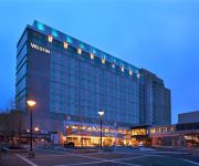
The Westin Boston Waterfront
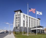
DoubleTree by Hilton Boston Logan Airport Chelsea
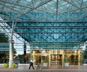
Renaissance Boston Waterfront Hotel
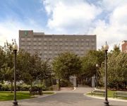
Hilton Boston Logan Airport
Embassy Suites by Hilton Boston at Logan Airport
Château sur Mer Bed & Breakfast
Oakwood Watermark Seaport
Homewood Suites by Hilton Boston Logan Airport Chelsea
Residence Inn Boston Logan Airport/Chelsea
Global Luxury Suites at Seaport East
Videos from this area
These are videos related to the place based on their proximity to this place.
Lufthansa 747-400 Winter Takeoff Boston Logan Airport LH423
SOCIAL* Twitter: https://twitter.com/IrishPlaneVids Facebook: https://www.facebook.com/ShamrockGoldCircle Google+: https://plus.google.com/+ShamrockGoldCircle Please rate, comment and for...
2009-2010 Winthrop Vikings Basketball part 1 of 3.wmv
2009-2010 Winthrop Vikings Basketball pt 1 of 3, Winthrop Highschool, Winthrop Massachusetts.
Horribles Parade - Winthrop, MA 2007
yearly horribles parade held in Winthrop, MA July 4, 2007. the parade is a yearly tradition amongst the residents of Winthrop. People come from all over to celebrate with the residents and...
Winthrop Massachusetts (MA) Real Estate Tour
http://www.winthropmarealestate.com -- Tour Winthrop, MA neighborhoods, condominium developments, subdivisions, schools, landmarks, recreational areas, and town offices. Winthrop ...
02 North Suffolk CEO Jackie Moore
North Suffolk Mental Health Association President and CEO Jackie K. Moore spoke at an event honoring Speaker of the House Robert DeLeo on Friday, September 28 at Winthrop Middle School in ...
Speaker DeLeo accepts award from Providers' Council
Providers' Council President and CEO Michael Weekes and North Suffolk Mental Health Association President and CEO Jackie K. Moore present Speaker of the House Robert DeLeo with an award at...
Alaska Airlines 737 Beautiful Morning Landing at BOS
The end of a red eye from SEA. Landing on 27 with clear skies. Approach over BOS and looping back around provides for a great view of the harbor and the town of Winthrop at the end.
Boston Logan International Airport | KBOS Spotting Compilation
Camera used: Nikon D60 (Gold Edition) with Nikkor 55-300 VR AF-S Lens About halfway through I switch locations and get taxi action, with two special visitors - an Alaskan 737 with Split-Scimitar...
Videos provided by Youtube are under the copyright of their owners.
Attractions and noteworthy things
Distances are based on the centre of the city/town and sightseeing location. This list contains brief abstracts about monuments, holiday activities, national parcs, museums, organisations and more from the area as well as interesting facts about the region itself. Where available, you'll find the corresponding homepage. Otherwise the related wikipedia article.
Suffolk Downs
Suffolk Downs is a thoroughbred race track in East Boston, Massachusetts, United States. The track opened in 1935 after being built by Joseph A. Tomasello for a cost of $2 million. A number of famous horses have since raced at this track including Seabiscuit, Whirlaway, Funny Cide, and Cigar. The Massachusetts Handicap or MassCap is an annual event held at the track, but has not been held since 2008. The track is a 1-mile dirt oval with a seven-furlong inner turf track.
Apple Island (Massachusetts)
Apple Island was an island in Boston Harbor in Massachusetts, one of five islands that were integrated with landfill over the years to form East Boston and Logan International Airport. Noddle's Island, Hog Island, Bird's Island and Governor's Island were the others.
Constitution Beach
Constitution Beach is a man-made crescent-shaped, sandy beach located in the Orient Heights section of East Boston, a neighborhood in Boston, Massachusetts, United States. Opened in 1952 and known to locals as "Shays Beach," its most distinctive feature is that looks directly onto the runways of Logan International Airport, so that airplanes taking off and landing on Runways 22L and 22R are about 2,000 feet away, making them prominent both visibly and audibly.
Bennington Street
Bennington Street is one of the main thoroughfares in the neighborhood of East Boston in Boston, Massachusetts. The street runs almost the length of the residential section of the community, as distinguished from Logan International Airport, which makes up almost half of the community's landmass. Bennington Street, one of several local streets named after battles of the American Revolution, namely the Battle of Bennington.
Orient Heights (MBTA station)
Orient Heights is a station on the MBTA Blue Line in East Boston, MA. It is located on the above-ground section of the line that uses overhead lines instead of third rail. The 1952-built was closed in March 2013 for a complete rebuilding to provide full handicapped accessibility. The new station will reopen in October 2013. Orient Heights station is the primary rapid transit connection for the Orient Heights neighborhood of East Boston, as well as for Winthrop.
2005 Logan Airport runway incursion
The 2005 Logan Airport runway incursion was a near runway collision that occurred at approximately 7:40 p.m. Eastern Daylight Time on 9 June 2005 between US Airways Flight 1170 (US1170) and Aer Lingus Flight 132 (EI132). EI132 was an Airbus A330-300 aircraft, owned and operated by the Irish airline Aer Lingus, destined for Shannon, Ireland, and carrying 12 crew members and 260 passengers.
Snake Island (Massachusetts)
Snake Island, also known as Bare Island, is an island in Boston Harbor. The island is part of the Boston Harbor Islands National Recreation Area and is situated in the inner harbor between the town of Winthrop and the reclaimed land that forms Logan International Airport. It is part of the Town of Winthrop. It is named for its serpentine shape, and has a permanent size of 3 acres, and rises to a height of 10 feet above sea level.
Eastern Air Lines Flight 375
Eastern Air Lines Flight 375, registration N5533, was a Lockheed L-188 Electra aircraft that crashed on takeoff from Logan International Airport in Boston, Massachusetts on 4 October 1960. 62 of 72 on board were killed in the accident; ten survived, nine with serious injuries. N5533 and its crew came into Logan that day as Flight 444 from New York City's LaGuardia Airport.


