Safety Score: 2,7 of 5.0 based on data from 9 authorites. Meaning we advice caution when travelling to United States.
Travel warnings are updated daily. Source: Travel Warning United States. Last Update: 2024-08-13 08:21:03
Discover Clarendon Hills
Clarendon Hills in Suffolk County (Massachusetts) is a place in United States about 388 mi (or 625 km) north-east of Washington DC, the country's capital city.
Current time in Clarendon Hills is now 12:49 AM (Tuesday). The local timezone is named America / New York with an UTC offset of -5 hours. We know of 11 airports near Clarendon Hills, of which 5 are larger airports. The closest airport in United States is General Edward Lawrence Logan International Airport in a distance of 9 mi (or 14 km), North-East. Besides the airports, there are other travel options available (check left side).
Also, if you like playing golf, there are a few options in driving distance. We encountered 2 points of interest in the vicinity of this place. If you need a hotel, we compiled a list of available hotels close to the map centre further down the page.
While being here, you might want to pay a visit to some of the following locations: Dedham, Boston, Taunton, Providence and North Providence. To further explore this place, just scroll down and browse the available info.
Local weather forecast
Todays Local Weather Conditions & Forecast: 18°C / 64 °F
| Morning Temperature | 12°C / 54 °F |
| Evening Temperature | 19°C / 66 °F |
| Night Temperature | 17°C / 63 °F |
| Chance of rainfall | 0% |
| Air Humidity | 63% |
| Air Pressure | 1022 hPa |
| Wind Speed | Moderate breeze with 9 km/h (6 mph) from North-East |
| Cloud Conditions | Overcast clouds, covering 94% of sky |
| General Conditions | Overcast clouds |
Tuesday, 5th of November 2024
23°C (74 °F)
18°C (64 °F)
Sky is clear, moderate breeze, clear sky.
Wednesday, 6th of November 2024
17°C (62 °F)
12°C (53 °F)
Sky is clear, gentle breeze, clear sky.
Thursday, 7th of November 2024
13°C (56 °F)
13°C (55 °F)
Sky is clear, gentle breeze, clear sky.
Hotels and Places to Stay
Northeast Suites at Longwood
Northeast Suites at The Tremont
Global Luxury Suites at Longwood
AC Hotel Boston Cleveland Circle
Hilton Boston-Dedham
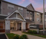
Residence Inn Boston Dedham
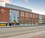
Homewood Boston-Longwood Medical
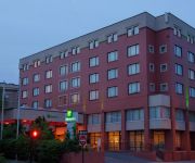
Holiday Inn BOSTON-BROOKLINE
Hotel Boston
Courtyard Boston Dedham/Westwood
Videos from this area
These are videos related to the place based on their proximity to this place.
5 Reasons to Shop at Roslindale Village Farmers Market
http://www.roslindale.net 5 Reasons to Shop at Roslindale Village Farmers' Market in Adams Park in Roslindale.
Scootin' in Boston - to Roslindale Village
The Poor Student scoots from Franklin Park in Jamaica Plain (JP) to Roslindale Village (and then back to JP), a nice little shopping area with a diverse selection of restaurants and shops....
15 Mendelssohn St Roslindale MA 02131 - Celdra Allen-Harding - Prudential Unlimited -Jamaica Plain
http://homesite.obeo.com/780936?refurl=youtube Contact: Celdra Allen-Harding Prudential Unlimited -Jamaica Plain 617-522-2200 charding@prudentialunlimited.co...
National Night Out 2014
Mayor Walsh joins Police Commissioner Evans, local law enforcement officials, and Boston residents for the City's recognition of National Night Out.
New Mission High School Graduation Rates Increase
Graduation rates released on Thursday, January 24th, show the four year BPS graduation rate has risen for the 6th year in a row to an all-time high of 65.9%. Perhaps the most impressive gains...
The Ambulatory Surgical Center at Hyde Park Pain Management
Hyde Park Pain Management is a full service pain management clinic offering the highest quality pain care in one convenient location, providing patients with relief as quickly as possible....
Jay McHugh Presents 1101 Hyde Park Ave Hyde Park MA 02136 - Jay McHugh -
http://homesite.obeo.com/viewer/default.aspx?tourid=877299&refURL=youtube Contact: Jay McHugh RE/MAX UNLIMITED 617-566-0300 Jay@JayMcHugh.com http://www.JayMcHugh.com for more ...
Hyde Park Pain Management: Relief is Here
Suffering from pain? The board certified physicians at Hyde Park Pain Management are experts in treating a wide variety of conditions and helping patients find relief. Watch the video to learn...
93 Victoria Heights Road, Hyde Park, MA
A video tour of 93 Victoria Heights Road, Hyde Park, MA provided by Jonathan Bowen of Jonathan Bowen Real Estate, LLC. Call 855-879-4663 or go to http://www.bowenboston.com in order to get...
Hyde Park Ribbon Cuttings
Mayor Thomas M. Menino and the Department of Neighborhood Development join local business owners and residents to celebrate the grand openings of two businesses in Hyde Park- ZAZ Restaurant ...
Videos provided by Youtube are under the copyright of their owners.
Attractions and noteworthy things
Distances are based on the centre of the city/town and sightseeing location. This list contains brief abstracts about monuments, holiday activities, national parcs, museums, organisations and more from the area as well as interesting facts about the region itself. Where available, you'll find the corresponding homepage. Otherwise the related wikipedia article.
Roslindale
Roslindale is a primarily residential neighborhood of Boston, Massachusetts, bordered by Jamaica Plain, Hyde Park, West Roxbury and Mattapan. It is served by an MBTA Commuter Rail line, several MBTA bus lines and the MBTA Orange Line in nearby Jamaica Plain.
George Wright Golf Course
George Wright Golf Course is a public golf course in Boston, Massachusetts. The course was designed by the great Donald Ross as one of President Franklin Delano Roosevelt's Works Progress Administration (WPA) projects in the 1930s. The course opened in 1938. The course is named for George Wright, who was a Hall of Fame baseball player with the Cincinnati Reds, along with being one of the leaders of introducing golf to the Boston area around the turn of the 20th century.
Bellevue Hill, Boston
Bellevue Hill is the highest natural point in the city of Boston and Suffolk County. It rises to a height of 330 feet (101m) above sea level. Located in the West Roxbury neighborhood of Boston, the closest major intersection is that of Washington Street and West Roxbury Parkway. On it lies the Bellevue Standpipe, which is on the Boston Register of Historic Places. {{#invoke:Coordinates|coord}}{{#coordinates:42|16|32.77|N|71|8|37.67|W|type:landmark |primary |name= }}
Roslindale Village (MBTA station)
Roslindale Village is a MBTA commuter rail station serving the Needham Line. It was originally built by the Boston and Providence Railroad, and contained two station houses. Currently, it is located across the tracks from Roslindale Village/Roslindale Square itself, near the Boston School of Modern Languages, the Bay State Society of Model Engineers, and various local businesses.
Hyde Park High School (Massachusetts)
Hyde Park High School was a Boston public school located at 655 Metropolitan Ave, in the neighborhood of Hyde Park in Boston, Massachusetts. Hyde Park High taught students in 9th through 12th grade.
Forest Hills disaster
The Forest Hills Disaster (also called The Forest Ridge Disaster and The Bussey Bridge Disaster) was a railroad bridge accident that occurred on March 14, 1887, in the Roslindale section of West Roxbury, Massachusetts, at that time a separate town from the City of Boston.
Boston Trinity Academy
Boston Trinity Academy (BTA) is a private Christian school in Hyde Park, Boston, Massachusetts, United States. It currently enrolls roughly 220 students (as of 2009-10 school year) in grades 6-12. BTA was founded in 2002 with 54 students from grades 6-9 in a rented building in Brookline, Massachusetts. Boston Trinity Academy has a diverse student body that is 34% white, 30% black, 19% Asian, 10% Hispanic, 4% multi-racial, 2% Middle Eastern, and 1% Native American.
Mount Hope (MBTA station)
Mount Hope was a railroad station on the Northeast Corridor in Roslindale, Massachusetts. The station consisted of two separate depots on opposite sides of the tracks. The brick outbound depot was located just north of the Blakemore Street bridge, while the wooden inbound depot was located south of the overpass.


