Safety Score: 2,7 of 5.0 based on data from 9 authorites. Meaning we advice caution when travelling to United States.
Travel warnings are updated daily. Source: Travel Warning United States. Last Update: 2024-08-13 08:21:03
Discover City Point
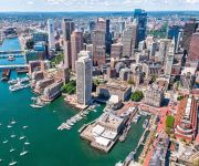
City Point in Suffolk County (Massachusetts) is a place in United States about 395 mi (or 635 km) north-east of Washington DC, the country's capital city.
Current time in City Point is now 01:44 PM (Tuesday). The local timezone is named America / New York with an UTC offset of -5 hours. We know of 11 airports near City Point, of which 5 are larger airports. The closest airport in United States is General Edward Lawrence Logan International Airport in a distance of 2 mi (or 4 km), North-East. Besides the airports, there are other travel options available (check left side).
Also, if you like playing golf, there are a few options in driving distance. We encountered 3 points of interest in the vicinity of this place. If you need a hotel, we compiled a list of available hotels close to the map centre further down the page.
While being here, you might want to pay a visit to some of the following locations: Boston, Dedham, Taunton, Providence and Brentwood. To further explore this place, just scroll down and browse the available info.
Local weather forecast
Todays Local Weather Conditions & Forecast: 2°C / 35 °F
| Morning Temperature | -3°C / 27 °F |
| Evening Temperature | 2°C / 35 °F |
| Night Temperature | -0°C / 31 °F |
| Chance of rainfall | 0% |
| Air Humidity | 41% |
| Air Pressure | 1021 hPa |
| Wind Speed | Light breeze with 5 km/h (3 mph) from South-East |
| Cloud Conditions | Few clouds, covering 12% of sky |
| General Conditions | Few clouds |
Tuesday, 3rd of December 2024
1°C (34 °F)
3°C (37 °F)
Light rain, gentle breeze, few clouds.
Wednesday, 4th of December 2024
4°C (39 °F)
-1°C (31 °F)
Rain and snow, fresh breeze, overcast clouds.
Thursday, 5th of December 2024
-1°C (31 °F)
-3°C (27 °F)
Sky is clear, fresh breeze, clear sky.
Hotels and Places to Stay
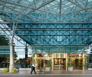
The Envoy Hotel Autograph Collection
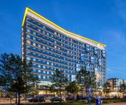
The Westin Boston Waterfront
Marriott Vacation Club Pulse at Custom House Boston
The Langham Boston
Boston Harbor Hotel
Hilton Boston Logan Airport
Renaissance Boston Waterfront Hotel
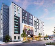
Aloft Boston Seaport
Element Boston Seaport
Boston Marriott Long Wharf
Videos from this area
These are videos related to the place based on their proximity to this place.
BOSTON SKYLINE FROM A SOUTH SHORE CONDO WITH POOL AND AWESOME GREEN AREA WITH GRILL.MOD
http://www.youtube.com/watch?v=0Ggk3ysgiu4 BOSTON SKYLINE FROM A SOUTH SHORE CONDO WITH POOL AND AWESOME GREEN AREA WITH GRILL.MOD day korea fish edge east charlotte ...
South Boston Vietnam Memorial Ceremony
Mayor Martin J. Walsh attends the South Boston Vietnam Memorial Ceremony.
South Boston: Hurricane Irene arrives as a Tropical Storm
Hurricane Irene arrived in South Boston as a tropical storm. As of 3 PM, we've lost a few pilings at Boston Harbor Yacht Club (BHYC) and our docks are ripped up. A few boats were lost from...
South End Apartments Real Estate
http://www.southendpads.com/ South End Pads has more than 80000 listings, more than any of our competitors, there's no wonder South End Pads has so many gre...
South End Apartments Real Estate
http://www.southendpads.com/ South End Pads has more than 80000 listing apartments, there's no wonder South End Pads has so many great options. If you are s...
South Boston #2: Hurricane Irene arrives as a Tropical Storm
At Boston Harbor Yacht Club in South Boston, 5 PM. Our dock ripped off one piling and the other piling split in two. Shored up the dock to keep it from twisting around and breaking off with...
Boston Blizzard Timelapse 2/15-2/16
Time-lapse of Boston's fourth storm, starting at 5:30am on 2/15 and shooting on 1-minute interval through 11:46am on 2/16. - In the foreground is Boston's Drydock Number 3 where ships come...
Feadship 200' Yacht and Boston Harbor Hotel harbor walk Labor day www.willbegin.com.MOD
http://www.youtube.com/watch?v=HKWm11bPZmc Feadship 200' Yacht and Boston Harbor Hotel harbor walk Labor day www.willbegin.com.MOD.
Sullivan's in South Boston
http://www.hotdogstories.com Day three of Natioanl Hot Dog Month 2012 found me and special guest dogger Aaron Socrat at Aaron's favorite childhood hot dog stand, Sullivan's in South Boston.
Videos provided by Youtube are under the copyright of their owners.
Attractions and noteworthy things
Distances are based on the centre of the city/town and sightseeing location. This list contains brief abstracts about monuments, holiday activities, national parcs, museums, organisations and more from the area as well as interesting facts about the region itself. Where available, you'll find the corresponding homepage. Otherwise the related wikipedia article.
Harpoon Brewery
Harpoon Brewery is an American microbrewery, with plants in Boston, Massachusetts and Windsor, Vermont. Founded in 1986, the brewery was the first company to obtain a permit to manufacture and sell alcohol in the Commonwealth of Massachusetts in over 25 years. In 2000 it purchased the former Catamount Brewery plant in Windsor VT. Harpoon has played an important part in the rebirth of the microbrewery system in the United States.
Ted Williams Tunnel
The Ted Williams Tunnel, also known as the Williams Tunnel, is the name of the third highway tunnel under Boston Harbor in Boston, Massachusetts, the Sumner and Callahan Tunnels being the other two. It connects South Boston with Logan International Airport, carrying the final leg of the Massachusetts Turnpike under Boston Harbor allowing direct access to Route 1A in East Boston. The tunnel is named after the former Boston Red Sox baseball player and U.S. Marine air corps veteran Ted Williams.
Boston Convention and Exhibition Center
The Boston Convention and Exhibition Center (BCEC) is the largest exhibition center in the Northeast United States, with some 516,000 square feet of contiguous exhibition space. It is located on Summer Street near the South Boston waterfront, Boston's World Trade Center, and across the harbor from Logan International Airport. The main exhibition floor comprises three bays which can be isolated for separate shows or linked into one large space.
World Trade Center (MBTA station)
The World Trade Center station is a transportation station in Boston, Massachusetts, on the MBTA's bus rapid transit (BRT) Silver Line. The station is located on Congress Street at C Street/World Trade Center Avenue on the South Boston Waterfront. It is between Boston's World Trade Center and Boston Convention and Exhibition Center (BCEC), and near Commonwealth Pier and a seasonal ferry to Provincetown, Massachusetts.
Silver Line Way (MBTA station)
Silver Line Way is a surface station in Boston, Massachusetts, on the MBTA's bus rapid transit (BRT) Silver Line. It is located on Silver Line Way, at Pumphouse Road between Massport Haul Road (Trilling Street) and D Street, near the South Boston Waterfront.
Bank of America Pavilion
Bank of America Pavilion is a Live Nation-owned outdoor amphitheater located in Boston, Massachusetts, USA. The seating capacity is approximately 5,000. It was originally known as Harbor Lights Pavilion until 1999 when Live Nation purchased the venue and sold the naming rights to FleetBoston Financial, renaming the venue; FleetBoston Pavilion. In 2004 FleetBoston merged with Bank of America; the pavilion was then renamed, Bank of America Pavilion.
Seaport Hotel and Seaport World Trade Center
The Seaport Boston Hotel and the neighboring Seaport World Trade Center is located on the Boston waterfront at Commonwealth Pier, in the South Boston neighborhood of Boston, Massachusetts. The South Boston Waterfront is also known unofficially at the Boston Seaport District. The Seaport Boston Hotel opened in 1998. Renovations were completed in 2009 by the New York architects BBG-BBGM.
Day Boulevard
William J. Day Boulevard, or Day Boulevard, is a coastal parkway in Boston, Massachusetts. Beginning at Morrissey Boulevard and Kosciuszko Circle at the northern extent of the Dorchester section of the city, it travels in a gently curving northeasterly direction 2.6 miles through South Boston along beaches around the west and north shore of Dorchester Bay.
Massachusetts Convention Center Authority
The Massachusetts Convention Center Authority (MCCA) owns and oversees the operation of the Boston Convention & Exhibition Center (BCEC), the John B. Hynes Veterans Memorial Convention Center, the MassMutual Center in Springfield, Massachusetts, and the Boston Common Garage.
South Boston Naval Annex
The South Boston Naval Annex, was a 167 acre United States Navy shipyard annex located in South Boston. It was the annex of the Boston Navy Yard, and was operational from the 1920s, to 1974, when it was closed along with the shipyard. The annex is also home to Dry Dock Number 3, the one of the largest dry docks on the East Coast.
South Boston Army Base
The South Boston Army Base, was a 58 acre United States Army annex located in South Boston. During World War II, it was used as the Boston Port of Embarkation. It was operational from the 1920s, to 1974.
Commonwealth Flats
Commonwealth Flats is a region of former mud flats in South Boston. It has been used over the years as the site of the South Boston Naval Annex, the South Boston Army Base, the Black Falcon Cruise Terminal and various other entities over the years.


