Safety Score: 2,7 of 5.0 based on data from 9 authorites. Meaning we advice caution when travelling to United States.
Travel warnings are updated daily. Source: Travel Warning United States. Last Update: 2024-08-13 08:21:03
Delve into Riverside
Riverside in Plymouth County (Massachusetts) is located in United States about 390 mi (or 627 km) north-east of Washington DC, the country's capital town.
Current time in Riverside is now 04:39 AM (Saturday). The local timezone is named America / New York with an UTC offset of -5 hours. We know of 11 airports close to Riverside, of which 4 are larger airports. The closest airport in United States is New Bedford Regional Airport in a distance of 16 mi (or 26 km), West. Besides the airports, there are other travel options available (check left side).
Also, if you like playing golf, there are some options within driving distance. We encountered 3 points of interest near this location. If you need a hotel, we compiled a list of available hotels close to the map centre further down the page.
While being here, you might want to pay a visit to some of the following locations: Barnstable, Edgartown, Taunton, Dedham and Nantucket. To further explore this place, just scroll down and browse the available info.
Local weather forecast
Todays Local Weather Conditions & Forecast: 5°C / 41 °F
| Morning Temperature | 5°C / 40 °F |
| Evening Temperature | 7°C / 44 °F |
| Night Temperature | 6°C / 42 °F |
| Chance of rainfall | 16% |
| Air Humidity | 96% |
| Air Pressure | 993 hPa |
| Wind Speed | Fresh Breeze with 15 km/h (10 mph) from South-East |
| Cloud Conditions | Overcast clouds, covering 100% of sky |
| General Conditions | Moderate rain |
Saturday, 23rd of November 2024
8°C (46 °F)
4°C (38 °F)
Sky is clear, fresh breeze, clear sky.
Sunday, 24th of November 2024
6°C (43 °F)
5°C (40 °F)
Sky is clear, moderate breeze, clear sky.
Monday, 25th of November 2024
11°C (52 °F)
10°C (49 °F)
Light rain, moderate breeze, overcast clouds.
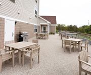
Hotels and Places to Stay
Wood Duck Inn
TownePlace Suites Wareham Buzzards Bay
Inn on Onset Bay
Atlantic Motel
All Seasons Inn and Suites
Rosewood Motel
Quality Inn Bourne
Videos from this area
These are videos related to the place based on their proximity to this place.
Wareham Buzzards Bay Onset Rochester MA Nursing Home Abuse Neglect Negligence Accident Lawyer
Kevin P Landry Law Offices 3193 Cranberry Highway Suite 102 East Wareham MA 02538 (508) 291-0900 http://klandrylaw.com kevin@klandrylaw.com If you have been injured in a car wreck, slip and.
Onset Illumination Night 2012
Onset Illumination Night - August 25, 2012. Shot from my boat out in Onset Bay, Massachusetts.
13-Pine-Tree-Drive-Onset-MA.wmv
Enter through private gate and park-like setting to this magnificent waterfront estate with tennis court, in-ground pool and private sandy beach. A contemporary, light-filled Cape with expansive...
The Rub - Rosemary's Baby Blues
August 2, 2014 - Onset Blues Festival - Rosemary's Baby Blues band plays Delbert McClinton's "The Rub".
Dividing a State PowerPoint Map in Half to Make 2 Sales Territories, Video 2 • MapsForDesign.com
http://www.mapsfordesign.com How to divide a state, county, or country PowerPoint Map in half. This video shows you a simple technique to divide one of our downloadable, editable ...
Dr Jazz
Dr. Jazz by the Bourbon Street Paraders, on the Jazz Boat out of Onset Bay, Cape Cod, June through Labor Day.
Videos provided by Youtube are under the copyright of their owners.
Attractions and noteworthy things
Distances are based on the centre of the city/town and sightseeing location. This list contains brief abstracts about monuments, holiday activities, national parcs, museums, organisations and more from the area as well as interesting facts about the region itself. Where available, you'll find the corresponding homepage. Otherwise the related wikipedia article.
Onset, Massachusetts
Onset is a census-designated place (CDP) in the town of Wareham, Massachusetts, United States. The population was 1,573 at the 2010 census.
Agawam River
The Agawam River is a 10.7-mile-long stream in southeastern Massachusetts, USA, that is part of the Wareham River estuary watershed.
Spectacle Pond (Wareham, Massachusetts)
Spectacle Pond is a 42-acre pond in Wareham, Massachusetts. The pond is located east and south of Mill Pond, west of Sandy Pond and southwest of Glen Charlie Pond. A small stream connects this pond to the Agawam River.
Sandy Pond (Wareham, Massachusetts)
Sandy Pond is an 18-acre pond in Wareham, Massachusetts. The pond is located east of Spectacle Pond and Mill Pond, and south of Glen Charlie Pond.
Mill Pond (Wareham, Massachusetts)
Mill Pond, also known unofficially as Agawam Mill Pond, is a 150-acre pond in Wareham, Massachusetts. The pond is located northwest of Union Pond, west and north of Spectacle Pond, west of Sandy Pond, and southwest of Glen Charlie Pond. The Agawam River runs through the pond. Route 25 runs through the southwestern part of the pond, and the Exit 2 off-ramp from Route 25 eastbound lies along the shore en route to Glen Charlie Road, which runs along the pond's eastern shore.
Union Pond (Massachusetts)
Union Pond is a 25-acre pond in Wareham, Massachusetts. The pond is located southeast of Mill Pond. Route 25 runs north of the pond, Routes 6 and 28 runs south of the pond, and Glen Charlie Road runs west of the pond.
Lyman Reserve
The Lyman Reserve is a 210-acre nature reserve in Bourne, Plymouth and Wareham, Massachusetts and is managed by the Trustees of Reservations. There are 1.5 miles of hiking trails, a beach and is in proximity to the Red Brook Reserve and Red Brook Wildlife Management Area. The area was formerly as private fishing camp, which sits at the mouth of Red Brook at Buttermilk Bay. It is home to one of the last remaining groups of sea-run brook trout ("salters") in the Eastern United States.
Water Wizz
Water Wizz, touted as being “Cape Cod’s Only Waterpark", is a water park located in East Wareham, Massachusetts. The attractions include many slides and kiddie attractions. In the summer of 2009, the park was used as a filming location for the movie Grown Ups. Water Wizz doesn't have the zipline that was shown in the movie.


