Safety Score: 2,7 of 5.0 based on data from 9 authorites. Meaning we advice caution when travelling to United States.
Travel warnings are updated daily. Source: Travel Warning United States. Last Update: 2024-08-13 08:21:03
Delve into Reservoir
Reservoir in Norfolk County (Massachusetts) is a city located in United States about 389 mi (or 627 km) north-east of Washington DC, the country's capital town.
Current time in Reservoir is now 09:17 AM (Thursday). The local timezone is named America / New York with an UTC offset of -5 hours. We know of 11 airports closer to Reservoir, of which 5 are larger airports. The closest airport in United States is General Edward Lawrence Logan International Airport in a distance of 8 mi (or 12 km), East. Besides the airports, there are other travel options available (check left side).
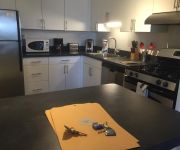
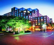
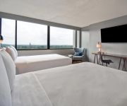
Also, if you like playing golf, there are some options within driving distance. We saw 2 points of interest near this location. In need of a room? We compiled a list of available hotels close to the map centre further down the page.
Since you are here already, you might want to pay a visit to some of the following locations: Boston, Dedham, Taunton, Providence and North Providence. To further explore this place, just scroll down and browse the available info.
Local weather forecast
Todays Local Weather Conditions & Forecast: 9°C / 48 °F
| Morning Temperature | 9°C / 48 °F |
| Evening Temperature | 9°C / 48 °F |
| Night Temperature | 10°C / 50 °F |
| Chance of rainfall | 23% |
| Air Humidity | 88% |
| Air Pressure | 1002 hPa |
| Wind Speed | Moderate breeze with 12 km/h (8 mph) from South-West |
| Cloud Conditions | Overcast clouds, covering 100% of sky |
| General Conditions | Moderate rain |
Thursday, 21st of November 2024
11°C (51 °F)
6°C (44 °F)
Light rain, moderate breeze, broken clouds.
Friday, 22nd of November 2024
6°C (43 °F)
6°C (43 °F)
Light rain, moderate breeze, overcast clouds.
Saturday, 23rd of November 2024
8°C (46 °F)
5°C (41 °F)
Few clouds, moderate breeze.
Hotels and Places to Stay
AC Hotel Boston Cleveland Circle
Northeast Suites at Longwood
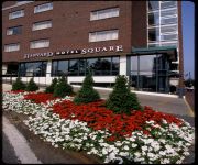
Charles Hotel Harvard Square
Crowne Plaza BOSTON - NEWTON
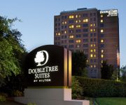
DoubleTree Suites by Hilton Boston - Cambridge
Beacon Inn 1750
Harvard Square
Chesley Road Bed and Breakfast
The Inn at Longwood Medical
Courtyard Boston Cambridge
Videos from this area
These are videos related to the place based on their proximity to this place.
Fr. Pavlos of Sinai in Brookline MA, at Holy Cross Greek Orthodox school of theology
Fr. Pavlos is an Elder, a monk from a very famous monastery in Egypt. St. Katherine's Monastery is new to the mountains where Moses reseved the ten commandments, where he spoke with God face...
Route 9 from Route 128 to Brookline in February 2015.
Route 9 from Route 128 to Brookline, MA in February 2015.
Brookline Ma | Flat Roof | Shingled Roof | Ice Dam | Call 781-455-0556 | GF Sprague
Here's a recent job G.F. Sprague completed in Brookline Massachusetts (http://www.gfsprague.com/roofing-brookline/). The project involved repairing and replacing a flat roof and a shingle...
Cabot Estate in Jamaica Plain
Cabot Estate in Jamaica Plain is located at 241 Perkins Street, across the Jamaica Pond. Take a look at the beautiful grounds and amenities it offers.
Chestnut Hill Dentist - Meet Dr. Adam Polivy
At Shaff & Polivy Dental Associates, located in Chestnut Hill, MA we strive to provide the highest quality of dental care to our patients. Our patients oral health is our number one priority...
Dentist Chestnut Hill - Welcome to Shaff and Polivy Dental Associates
Shaff & Polivy Dental Associates, located in Chestnut Hill, MA strives to provide the highest quality of dental care to our patients. Our patients oral health is our number one priority and...
Chestnut Hill Website Video
A tour of the Chestnut Hill Benevolent Association, focusing on new renovations that have been made.
Cod fillet with a parasite worm @Wegmans
I was going to grab a cod fillet for dinner at local Wegmans (Boston/Chestnut Hill, MA) when I saw this. After filming it for a while I handed the fillet to workers in the seafood section who...
Videos provided by Youtube are under the copyright of their owners.
Attractions and noteworthy things
Distances are based on the centre of the city/town and sightseeing location. This list contains brief abstracts about monuments, holiday activities, national parcs, museums, organisations and more from the area as well as interesting facts about the region itself. Where available, you'll find the corresponding homepage. Otherwise the related wikipedia article.
Cleveland Circle and Reservoir (MBTA stations)
Cleveland Circle and Reservoir are adjacent stops on different branches of the Massachusetts Bay Transportation Authority's Green Line, located at Beacon Street and Chestnut Hill Avenue at Cleveland Circle, in the Brighton neighborhood of Boston. Cleveland Circle is the terminus of the "C" branch, whilst Reservoir is an intermediate stop on the "D" branch, although Reservoir is sometimes used as a terminus.
Brigham and Women's Hospital
Brigham and Women's Hospital (BWH, "The Brigham") is the largest hospital of the Longwood Medical and Academic Area in Boston, Massachusetts. It is directly adjacent to Harvard Medical School of which it is the second largest teaching affiliate with 793 beds. With Massachusetts General Hospital, it is one of the two founding members of Partners HealthCare, the largest healthcare provider in Massachusetts.
Beaconsfield (MBTA station)
Beaconsfield is a stop on the "D" Branch of the MBTA's Green Line in Massachusetts, United States. It is located on Beaconsfield Road in Brookline, a short walk away from the Dean Road stop on the "C" branch. Beaconsfield is adjacent to the Jean Waldstein Playground in Brookline.
Heath School
Heath School is part of Public Schools of Brookline and is located in Brookline, USA in the Chestnut Hill, Massachusetts area. It is an elementary and middle school that serves the Chestnut Hill neighborhoods and educates students in grades K-8. As of the 2005-06 school year, the school had an enrollment of 377 students and 32.8 classroom teachers (on an FTE basis), for a student-teacher ratio of 11.5. 65% of the students are White and 23% Asian-Pacific Islander.
Chestnut Hill Reservoir
Chestnut Hill Reservoir is a reservoir created in 1870 on existing marshes and meadowland to supplement the city of Boston's water needs. It is surrounded by Chestnut Hill, a neighborhood which consists of parts of Boston, Brookline, and Newton. The reservoir, though, is located entirely within the city limits of Boston A 1.56 mile jogging loop abuts the reservoir.
Dean Road (MBTA station)
Dean Road is the twelfth stop (starting from the beginning of the line at Kenmore) on the "C" Branch of the Green Line, which is a light rail line belonging to the MBTA. It is located in the median of Beacon Street, in the Boston suburb of Brookline. Additionally, like Cleveland Circle and Reservoir, Dean Road offers an easy transfer point between the "C" Branch and "D" Branch, as it is a 45 second walk south down Dean Road to the Beaconsfield stop.
John D. Runkle School
The John D. Runkle School is a primary school located in Brookline, Massachusetts. The school currently teaches around 600 students in a three-story red brick school building, which includes a computer lab and is adjacent to a playground of about 1-acre . Usually, there are two or three classes at each grade level. The school is currently undergoing a renovation.
Chestnut Hill Reservoir Historic District
Chestnut Hill Reservoir Historic District is located between Beacon Street and Commonwealth Avenue in Boston, Massachusetts, just east of the Boston College Main Campus Historic District and the Boston-Newton city line. On February 18, 1990, it was added to the National Register of Historic Places.
Englewood Avenue (MBTA station)
Englewood Avenue is a station on the MBTA Green Line "C" Branch in Brookline, Massachusetts. The station is located on Beacon Street at Englewood Avenue. Englewood Avenue consists of two side platforms which serve the "C" Branch's two tracks. The travel time from the station to Park Street is 31 minutes.
Sutherland Street (MBTA station)
Sutherland Street is a station on the MBTA Green Line "B" Branch located in Brighton, Massachusetts. Although the MBTA website lists the stop as "Sutherland Street", both street signage and onboard announcements refer to the cross-street and stop as "Sutherland Road". The station is located at Sutherland and Commonwealth Avenue. The stop consists of two side platforms which serve the "B" Branch's two tracks.
Chiswick Road (MBTA station)
Chiswick Road is a station on the MBTA Green Line "B" Branch located in Brighton, Massachusetts. The station is located at Commonwealth Avenue and Chiswick Road. Chiswick Road consists of two side platforms which serve the "B" Branch's two tracks.
Boston Camera Club
The Boston Camera Club is the leading amateur photographic organization serving Boston, Massachusetts and vicinity. Founded in 1881, it offers activities of interest to amateur photographers, particularly digital photography. It meets weekly and is open to the public.


