Safety Score: 2,7 of 5.0 based on data from 9 authorites. Meaning we advice caution when travelling to United States.
Travel warnings are updated daily. Source: Travel Warning United States. Last Update: 2024-08-13 08:21:03
Discover Needham Heights
Needham Heights in Norfolk County (Massachusetts) is a town in United States about 384 mi (or 619 km) north-east of Washington DC, the country's capital city.
Current time in Needham Heights is now 10:02 AM (Thursday). The local timezone is named America / New York with an UTC offset of -5 hours. We know of 11 airports near Needham Heights, of which 5 are larger airports. The closest airport in United States is Laurence G Hanscom Field in a distance of 12 mi (or 20 km), North. Besides the airports, there are other travel options available (check left side).
Also, if you like playing golf, there are a few options in driving distance. We discovered 1 points of interest in the vicinity of this place. Looking for a place to stay? we compiled a list of available hotels close to the map centre further down the page.
When in this area, you might want to pay a visit to some of the following locations: Dedham, Boston, Taunton, North Providence and Providence. To further explore this place, just scroll down and browse the available info.
Local weather forecast
Todays Local Weather Conditions & Forecast: 8°C / 47 °F
| Morning Temperature | 8°C / 47 °F |
| Evening Temperature | 8°C / 47 °F |
| Night Temperature | 9°C / 49 °F |
| Chance of rainfall | 27% |
| Air Humidity | 90% |
| Air Pressure | 1002 hPa |
| Wind Speed | Moderate breeze with 10 km/h (6 mph) from West |
| Cloud Conditions | Overcast clouds, covering 100% of sky |
| General Conditions | Heavy intensity rain |
Thursday, 21st of November 2024
10°C (50 °F)
5°C (41 °F)
Light rain, moderate breeze, broken clouds.
Friday, 22nd of November 2024
6°C (42 °F)
6°C (42 °F)
Overcast clouds, moderate breeze.
Saturday, 23rd of November 2024
8°C (46 °F)
5°C (40 °F)
Scattered clouds, moderate breeze.
Hotels and Places to Stay
Crowne Plaza BOSTON - NEWTON
Hilton Boston-Dedham
AC Hotel Boston Cleveland Circle
Boston Marriott Newton
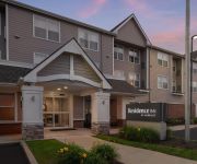
Residence Inn Boston Needham
Residence Inn Boston Watertown
Residence Inn Boston Dedham
Fairfield Inn Boston Dedham
Homewood Suites by Hilton Needham Boston
CRESCENT SUITES HOT
Videos from this area
These are videos related to the place based on their proximity to this place.
Newton Chiropractic & Wellness Centre - Short | Newton Upper Falls, MA
http://www.WellAdjusted.com - "Call us today at (617) 964-3332. At Newton Chiropractic & Wellness Centre, we specialize in Chiropracitc, Massage, and Nutrition. In addition our facility is...
Cleaning Services Needham MA - 978.712.8611 - The Maids
Looking for Cleaning Services in Needham MA? With our 22-Step Healthy Touch Deep Cleaning System, we provide you and your family with the healthiest living environment possible! Want A Free...
Needham Ma - Replacement Windows - Vinyl Replacement Windows - Review - GF Sprague - Reviews
G.F. Sprague (http://www.gfsprague.com/) is the replacement windows company for Needham Ma. For this project in Needham, GF Sprague installed new replacement windows. In addition to ...
Bay Colony Railroad Needham MA Needham Heights Part 1.
Once the rail line clears the raging torrent of 128, it has an ever more placid quality.
July 4th Needham Grand Parade
Grand Parade -- Bands, Floats, Musical Groups, Antique Cars and Much More The parade started on Green Field, then Chapel St, May st, Webster st, Hunnwell st, Highland ave Police on motor,...
Needham vs Walpole Girls Lacrosse
This game was broadcasted as part of the Needham Channel's "Game of the Week" coverage. The Needham Lady Rockets hosted Walpole in the only regular season matchup between these two ...
Bay Colony Railroad Needham MA Upper Falls.
This covers the point where the rail line met the Newton border on the Charles River. The old highway bridge is slated to be removed soon as part of a project to widen the highway.
Needham Ma - Roof Repair Roofing Contractor - Review - GF Sprague - Roof Shingles
G.F. Sprague (http://www.gfsprague.com/) is the roofing company for Needham Ma. For this project in Needham, GF Sprague performed a new shingled roof and gutters project. In addition to roofing...
Needham Ma | How To | Roofing | Ice Dam Prevention | GF Sprague | 781-455-0556 | Part ll
Bob Scribner, with G.F. Sprague (http://www.gfsprague.com) is onsite in Needham Ma at a customer's home where the GF Sprague crew is installing a soffit vent in the eave of the roof. The soffitt...
Needham Ma | How To | Roofing | Ice Dam Prevention | GF Sprague | 781-455-0556
Bob Scribner, with G.F. Sprague (http://www.gfsprague.com) is onsite in Needham Ma at a customer's home where the GF Sprague crew is installing a soffit vent in the eave of the roof. The...
Videos provided by Youtube are under the copyright of their owners.
Attractions and noteworthy things
Distances are based on the centre of the city/town and sightseeing location. This list contains brief abstracts about monuments, holiday activities, national parcs, museums, organisations and more from the area as well as interesting facts about the region itself. Where available, you'll find the corresponding homepage. Otherwise the related wikipedia article.
WBUR
WBUR refers to two radio stations in Massachusetts, WBUR-FM in Boston and WBUR in West Yarmouth, both owned by Boston University. WBUR is the largest of three NPR member stations in Boston, along with WGBH and WUMB-FM, and the only one to focus exclusively on news and talk. WBUR produces several nationally distributed programs, including Car Talk, On Point, Only A Game and Here and Now and previously produced The Connection (which was canceled on August 5, 2005).
WJMN (FM)
Not to be confused with WJMN-TV, a CBS affiliate licensed to Escanaba, Michigan.
WBPX-TV
WBPX-TV, digital channel 32, is the Ion Television station owned by ION Media Networks (formerly Paxson Communications), serving the Boston, Massachusetts, United States market. The station is also simulcast on two full-power and two low-power satellites each, WPXG-TV channel 21 (digital 33) in Concord, New Hampshire, WDPX-TV channel 58 (digital 40) in Vineyard Haven, Massachusetts, WMPX-LP channel 33 in Dennis, Massachusetts, and W40BO, also in Boston.
WODS
WODS, known on-air as "103.3 AMP Radio", is a radio station in Boston, Massachusetts. WODS airs a Top 40 format, and is under the ownership of CBS Radio.
WKLB-FM
WKLB-FM (102.5 FM, "Country 102.5") is a radio station licensed to Waltham, Massachusetts and serving Greater Boston. WKLB currently has a country music radio format. WKLB's transmitter is located in Newton, Massachusetts.
WMFP
WMFP is a television station in the Boston market. The station is licensed to Lawrence, Massachusetts, and is owned by NRJ TV, LLC. The station has been affiliated with Me-TV on their main channel and the Retro Television Network their subchannel. WMFP is carried on Metrocast channel 20, Comcast channel 20, RCN Cable channel 21 (no longer), and Verizon FiOS channel 23. Effective October 1 WMFP will carry the Plum TV Network.
WYDN
WYDN is a television station in the Boston market. The station, which is licenced to the nearby city of Worcester, is an owned-and-operated station of Daystar.
WFXZ-CD
WFXZ-CD is the MundoFox and Azteca América affiliate for Boston, Massachusetts. The station is owned by Prime Time Partners and broadcasts on digital channel 25. WFXZ-CD operates at a low-power, but is licensed as a class A station. Comcast carries the station in Boston on both channel 298 on the basic service and channel 721 on the Hispanic tier. Verizon carries the channel on channel 20.
Needham High School
Needham High School is a public high school in Needham, Massachusetts, USA, educating grades 9 through 12. Its principal is Dr. Johnathan Pizzi, who was previously the Assistant Academic Superintendent in the Boston Public Schools System. Its two assistant principals are Mr. Jonathan Bourn and Ms. Alison Coubrough Argentieri. By 2012, the school had 1512 students and over 90 part-time and full-time instructional staff members, plus support staff employees.
Needham Center (MBTA station)
Needham Center is the penultimate MBTA Commuter Rail station serving the Needham Line. It was originally built in 1870 (although some sources claim it was built in 1887), and was much larger than it is today. Needham Center Station was built on a line that originally ran between Medfield Junction and what is today Newton Highlands station on the "D" Branch of the MBTA Green Line.
Needham Heights (MBTA station)
Needham Heights is a MBTA Commuter Rail station serving the Needham Line. It is the terminus of the line, although this wasn't the case. Needham Heights Station was built on a line that originally ran between Medfield Junction and what is today Newton Highlands station on the "D" Branch of the MBTA Green Line.
WBZ-FM
WBZ-FM is a sports radio station known as "98.5 The Sports Hub" and broadcasting on 98.5 MHz in Boston, Massachusetts. Owned by CBS Radio, the current WBZ-FM began on August 13, 2009 and competes with AM and FM sports talk station WEEI. WBZ-FM is home to the Boston Bruins, New England Patriots, and New England Revolution radio networks.


