Safety Score: 2,7 of 5.0 based on data from 9 authorites. Meaning we advice caution when travelling to United States.
Travel warnings are updated daily. Source: Travel Warning United States. Last Update: 2024-08-13 08:21:03
Discover Tower Hill
Tower Hill in Middlesex County (Massachusetts) is a town in United States about 383 mi (or 616 km) north-east of Washington DC, the country's capital city.
Current time in Tower Hill is now 10:42 PM (Monday). The local timezone is named America / New York with an UTC offset of -5 hours. We know of 9 airports near Tower Hill, of which 3 are larger airports. The closest airport in United States is Laurence G Hanscom Field in a distance of 7 mi (or 12 km), North. Besides the airports, there are other travel options available (check left side).
Also, if you like playing golf, there are a few options in driving distance. We discovered 2 points of interest in the vicinity of this place. Looking for a place to stay? we compiled a list of available hotels close to the map centre further down the page.
When in this area, you might want to pay a visit to some of the following locations: Dedham, Boston, Worcester, Taunton and North Providence. To further explore this place, just scroll down and browse the available info.
Local weather forecast
Todays Local Weather Conditions & Forecast: 19°C / 66 °F
| Morning Temperature | 12°C / 53 °F |
| Evening Temperature | 18°C / 65 °F |
| Night Temperature | 17°C / 62 °F |
| Chance of rainfall | 0% |
| Air Humidity | 59% |
| Air Pressure | 1021 hPa |
| Wind Speed | Gentle Breeze with 9 km/h (5 mph) from North-East |
| Cloud Conditions | Overcast clouds, covering 86% of sky |
| General Conditions | Overcast clouds |
Tuesday, 5th of November 2024
24°C (74 °F)
17°C (62 °F)
Sky is clear, moderate breeze, clear sky.
Wednesday, 6th of November 2024
17°C (62 °F)
9°C (48 °F)
Sky is clear, gentle breeze, clear sky.
Thursday, 7th of November 2024
13°C (56 °F)
12°C (53 °F)
Sky is clear, gentle breeze, clear sky.
Hotels and Places to Stay
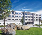
Element Lexington
Aloft Lexington
Embassy Suites by Hilton Boston Waltham
Boston Marriott Newton
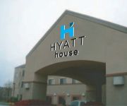
HYATT house Boston/Waltham
Crowne Plaza BOSTON-NATICK
Courtyard Boston Waltham
Hotel Indigo BOSTON - NEWTON RIVERSIDE
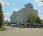
Hilton Garden Inn Boston-Waltham
Holiday Inn Express BOSTON-WALTHAM
Videos from this area
These are videos related to the place based on their proximity to this place.
Central Massachusetts Railroad Wayland MA Glen Road to Route 27 Part 1.
This covers the portion of the line that meets the Bay Circuit Trail. This part passes through wetlands alongside a fill.
Wayland Ma - Best Roofing Reviews - Roofing Contractor - Review - GF Sprague - Roofing
G.F. Sprague (http://www.gfsprague.com/) is the roofing company for Wayland Ma. For this project in Wayland, GF Sprague performed a roof repair. In addition to roofing homes in Wayland, GF...
Bay Circuit Trail Wayland MA Wayside Rail Part 1.
A small charming old depot marks the spot where the Bay Circuit Trail is carried by the old Central Massachusetts Railroad. http://www.mass.gov/eea/agencies/dcr/conservation/planning-and-resource-.
The State of Wayland Massachusetts RE Assessments 2009
A presentation by the Wayland Massachusetts Board of Assessors to the Board of Selectmen and the public on the 'State of Wayland Assessments' as of 12/8/09. The video starts out with public...
Central Massachusetts Railroad Wayland MA Concord Rd to Plain Rd Part 4.
A short stretch of the rail segment between Concord Road and Plain Road is in Wayland.
Community Video: Wayland, MA
Take a video tour through the community of Wayland, MA. http://www.coldwellbanker.com/real_estate/neighborhood_info.
Game 125, Round 1 - Davis/Broomstones vs Van Epps/Albany - 2015 GNCC Dykes Bonspiel
Game 125, Round 1, Sheet 3, Wednesday, February 25, 10:45pm Jake Davis of Broomstones 7 vs Geoff Van Epps of Albany 1 76th Francis Dykes Memorial Bonspiel Live from Broomstones Curling ...
D26 Sheet 2 - Fountain/Norfolk vs Barnes/Cape Cod - 2015 GNCC Dykes Bonspiel
Game 222, Second event, Saturday 2/28, 6:15pm, Draw 26, Sheet 2 Bob Fountain of Norfolk vs Chuck Barnes of Cape Cod 76th Francis Dykes Memorial Bonspiel Live from Broomstones Curling Club ...
Videos provided by Youtube are under the copyright of their owners.
Attractions and noteworthy things
Distances are based on the centre of the city/town and sightseeing location. This list contains brief abstracts about monuments, holiday activities, national parcs, museums, organisations and more from the area as well as interesting facts about the region itself. Where available, you'll find the corresponding homepage. Otherwise the related wikipedia article.
Weston, Massachusetts
Weston is a town in Middlesex County, Massachusetts, United States in the Boston metro area. The population of Weston, as of the 2010 U.S. Census, was 11,261. Weston is the wealthiest suburb in the Boston area and has the highest per capita income in Massachusetts. Weston is among the 100 most affluent towns with 1,000 or more households in the United States. Weston also has the number one public school system in Massachusetts, according to Boston Magazine (2009).
Regis College
Regis College is a small private Roman Catholic liberal arts college located in Weston, Massachusetts. Founded as a women’s college in 1927. In 2007, Regis became co-educational, being the last Catholic women's college in the Boston area to allow men. U.S. News and World Report consistently ranks Regis College among the top tier of universities which also offer master's programs in the North. Regis College is also ranked by the Princeton Review as one of the best Northeastern colleges.
Old Connecticut Path
The Old Connecticut Path was the Native American trail that led westward from the area of Massachusetts Bay to the Connecticut River Valley, the very first of the North American trails that led west from the settlements close to the Atlantic seacoast, towards the interior. The earliest colonists of Massachusetts Bay Colony used it, and rendered it wider by driving cattle along it. The old route is still followed, for part of its length, by Massachusetts Route 9.
Vokes Theatre
The Vokes Theater, also known as Beatrice Herford's Vokes Theater, is a 1904 miniature of a London theater in Wayland, Massachusetts built by and named for Beatrice Herford. The theater is located on the estate of Herford and her husband, Sidney Hayward and has been designated as a Massachusetts Historical Site.
Claypit Hill School
Claypit Hill School is an elementary school in Wayland, Massachusetts, United States. Claypit Hill has an enrollment of 600 students in grades 1 through 5. There are 30 classrooms with an average of 22 students per class.
Spellman Museum of Stamps & Postal History
The Spellman Museum of Stamps & Postal History, also commonly known as the Cardinal Spellman Philatelic Museum, is a non-for-profit organization dedicated to the appreciation of diversity through the medium of postage stamps and postal history.
Broomstones Curling Club
Broomstones Curling Club is the largest curling club in the Boston area, with a membership of over 200 active curlers, four sheets, and curling leagues every day of the week during the winter curling season. Broomstones is affiliated with the Grand National Curling Club. A unique feature of the club is its origin by and separate maintenance of three separate curling clubs in the area that combined to share resources, but maintain individual identity for national competition purposes.
Weston Observatory (Boston College)
Weston Observatory is a geophysical research laboratory of the Department of Geology and Geophysics at Boston College. The Observatory is located in the town of Weston, Massachusetts, about 13 miles west of downtown Boston. The Observatory houses seismic instruments for the World-Wide Standardized Seismic Network (WWSSN) and for the New England Seismic Network (NESN) as well as office and lab space and a geophysics library.


