Safety Score: 2,7 of 5.0 based on data from 9 authorites. Meaning we advice caution when travelling to United States.
Travel warnings are updated daily. Source: Travel Warning United States. Last Update: 2024-08-13 08:21:03
Explore Pawtucketville
Pawtucketville in Middlesex County (Massachusetts) is located in United States about 396 mi (or 637 km) north-east of Washington DC, the country's capital.
Local time in Pawtucketville is now 05:14 PM (Saturday). The local timezone is named America / New York with an UTC offset of -5 hours. We know of 9 airports in the wider vicinity of Pawtucketville, of which 3 are larger airports. The closest airport in United States is Laurence G Hanscom Field in a distance of 13 mi (or 21 km), South. Besides the airports, there are other travel options available (check left side).
Also, if you like golfing, there are multiple options in driving distance. If you need a place to sleep, we compiled a list of available hotels close to the map centre further down the page.
Depending on your travel schedule, you might want to pay a visit to some of the following locations: Boston, Brentwood, Dedham, Allenstown and Concord. To further explore this place, just scroll down and browse the available info.
Local weather forecast
Todays Local Weather Conditions & Forecast: 6°C / 43 °F
| Morning Temperature | 6°C / 44 °F |
| Evening Temperature | 6°C / 43 °F |
| Night Temperature | 7°C / 44 °F |
| Chance of rainfall | 17% |
| Air Humidity | 81% |
| Air Pressure | 991 hPa |
| Wind Speed | Fresh Breeze with 13 km/h (8 mph) from South-East |
| Cloud Conditions | Overcast clouds, covering 100% of sky |
| General Conditions | Heavy intensity rain |
Saturday, 23rd of November 2024
8°C (46 °F)
3°C (37 °F)
Scattered clouds, moderate breeze.
Sunday, 24th of November 2024
8°C (47 °F)
6°C (43 °F)
Broken clouds, gentle breeze.
Monday, 25th of November 2024
10°C (49 °F)
4°C (39 °F)
Light rain, moderate breeze, overcast clouds.
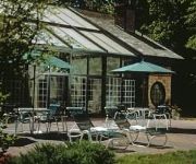
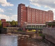
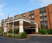
Hotels and Places to Stay
The Stonehedge Hotel and Spa
UMASS LOWELL INN AND CONFERENCE CENTER
Courtyard Boston Lowell/Chelmsford
BEST WESTERN PLUS CHELMSFORD
MA Radisson Hotel and Suites Chelmsford
HAWTHORN SUITES BY WYNDHAM CHE
MOTEL 6 BOSTON
Videos from this area
These are videos related to the place based on their proximity to this place.
Ballpark America visits the Lowell Spinners.
Ballpark America ballpark video #1 Lelacheur Park in Lowell, MA. Home of the Lowell Spinners, Single-A affiliate of the Boston Red Sox.
Michael Aquino Catholic Mem VS Chris Derosa Billerica 113 Finals Lowell Holiday Tourney
Michael Aquino Catholic Mem VS Chris Derosa Billerica 113 Finals Lowell Holiday Tourney 2014.
UMass Lowell Afternoon Commencement 2014, Speaker: Howard Koh (1:56:54)
The Afternoon Graduation Ceremony for undergraduates in the College of Health Sciences and all Master's & Doctoral students in all colleges was be held on May 17, 2014. Howard Koh was the ...
Lowell, MA - Rent to Own
Lowell, MA - For Sale "Rent to Own" 3 Bed 2 Bath - 2314sf - 2 Car Garage 36 month Lease w/ Option to Buy $2100/mo with $735/mo Rent Credit Move in with as little as 5% down and...
Baystate Half Marathon Lowell Massachusetts Half Marathon.mov
http://viewtherace.com http://www.facebook.com/ViewTheRace This is a flat half marathon with just a few rolling hills. This course starts at the Tsongas Arena in downtown Lowell, Massachusetts...
Videos provided by Youtube are under the copyright of their owners.
Attractions and noteworthy things
Distances are based on the centre of the city/town and sightseeing location. This list contains brief abstracts about monuments, holiday activities, national parcs, museums, organisations and more from the area as well as interesting facts about the region itself. Where available, you'll find the corresponding homepage. Otherwise the related wikipedia article.
University of Massachusetts Lowell
The University of Massachusetts Lowell (also known as UMass Lowell or UML) is a public university in Lowell, Massachusetts, United States, and part of the University of Massachusetts system. With more than 1100 faculty members and more than 16,000 students, it is the largest university in the Merrimack Valley, the second-largest state institution behind UMass Amherst.
WUML
WUML is a non-commercial College radio station licensed to Lowell, Massachusetts, USA. The station is owned by University of Massachusetts Lowell.
Paul E. Tsongas Center at UMass Lowell
The Paul E. Tsongas Center at UMass Lowell (formerly the Paul E. Tsongas Arena) is a multi-purpose facility, on the campus of the University of Massachusetts Lowell, in Lowell, Massachusetts. The Arena was opened and dedicated to the memory of prominent local and national politician Paul Tsongas (who died in 1997) on January 27, 1998.
Edward A. LeLacheur Park
Edward A. LeLacheur Park is a baseball park located on the banks of the Merrimack River in Lowell, Massachusetts. It is home to the New York-Penn League Lowell Spinners, the Class A Short Season Affiliate of the Boston Red Sox. LeLacheur Park is also home to the University of Massachusetts Lowell River Hawks baseball team, which competes in the Northeast 10 Conference at the NCAA Division II level.
Mammoth Road
Mammoth Road is a north–south road in Massachusetts and New Hampshire. The road runs from its origin in Lowell, Massachusetts to its northern end in Hooksett, New Hampshire, a suburb of Manchester. The total length of the road is 29.3 miles . It was named "Mammoth" in the hope that the convenience of its directness and elimination of smaller connecting roads between thoroughfares would result in sufficient use and prestige as to "kill all the other roads."
WLLH
WLLH (1400 AM; "La Nueva Mega") is a radio station in the Merrimack Valley region of Massachusetts, licensed to Lowell, Massachusetts. The station is owned by Gois Broadcasting, LLC, and airs a tropical music format. In addition to a transmitter in Lowell, there is a synchronous transmitter in Lawrence, together forming the two Ls in the callsign. (There were once plans for a transmitter in Haverhill, — the H — but it was not built. ) Both WLLH transmitters operate on 1400 kHz.
Beaver Brook (Merrimack River)
Beaver Brook is a 30.7-mile-long river located in New Hampshire and Massachusetts in the United States. It is a tributary of the Merrimack River, part of the Gulf of Maine watershed. Beaver Brook rises in Chester, New Hampshire, and flows south into Derry, passing through Harantis Lake, Adams Pond, and Beaver Lake. Continuing south, the brook forms the boundary between Londonderry and Windham, then flows through Pelham.
Lowell General Hospital
Founded in 1891, Lowell General Hospital is an independent, not-for-profit community hospital serving the Greater Lowell area and surrounding communities. With two primary campuses located in Lowell, Massachusetts, Lowell General Hospital offers a full range of medical and surgical services for patients. Lowell General Hospital is a member of the Voluntary Hospitals of America.
Lowell Technological Institute
The Lowell Technological Institute was a public college located in Lowell, Massachusetts, United States. It was founded in 1895 as the Lowell Textile School.
Lowell State College
Lowell State College was a public college located in Lowell, Massachusetts, United States. It was founded in 1894 as the Lowell Normal School.
Dracut High School
Dracut Senior High School is the public senior high school in the Merrimack Valley town of Dracut, Massachusetts. The high school's colors are Columbia blue, navy blue, silver and white. The team name is the Middies and the symbol is an anchor, except for in Football where the logo is a "Lightning Sword". These are references to midshipmen, as historically, the town was a place where U.S. Navy uniforms were created.
Pawtucket Falls (Massachusetts)
Pawtucket Falls is the name of a waterfall on the Merrimack River at Lowell, Massachusetts. The waterfall and rapids below it drop a total of 32 feet in a little under a mile. , and was an important fishing ground for the Pennacook Indians in pre-colonial times. This location was used as a benchmark for delineating the Northern boundary of Massachusetts, which was frequently disputed between the Province of Massachusetts Bay and the Province of New Hampshire.


