Safety Score: 2,7 of 5.0 based on data from 9 authorites. Meaning we advice caution when travelling to United States.
Travel warnings are updated daily. Source: Travel Warning United States. Last Update: 2024-08-13 08:21:03
Delve into Upper Hill
Upper Hill in Hampden County (Massachusetts) is located in United States about 324 mi (or 521 km) north-east of Washington DC, the country's capital town.
Current time in Upper Hill is now 10:32 PM (Friday). The local timezone is named America / New York with an UTC offset of -5 hours. We know of 12 airports close to Upper Hill, of which 5 are larger airports. The closest airport in United States is Westover ARB/Metropolitan Airport in a distance of 6 mi (or 9 km), North. Besides the airports, there are other travel options available (check left side).
There is one Unesco world heritage site nearby. It's Statue of Liberty in a distance of 122 mi (or 196 km), South-West. Also, if you like playing golf, there are some options within driving distance. If you need a hotel, we compiled a list of available hotels close to the map centre further down the page.
While being here, you might want to pay a visit to some of the following locations: Hartford, Worcester, Keene, Newfane and Johnston. To further explore this place, just scroll down and browse the available info.
Local weather forecast
Todays Local Weather Conditions & Forecast: 13°C / 55 °F
| Morning Temperature | 2°C / 35 °F |
| Evening Temperature | 9°C / 49 °F |
| Night Temperature | 5°C / 41 °F |
| Chance of rainfall | 0% |
| Air Humidity | 28% |
| Air Pressure | 1009 hPa |
| Wind Speed | Gentle Breeze with 9 km/h (5 mph) from South-East |
| Cloud Conditions | Few clouds, covering 10% of sky |
| General Conditions | Sky is clear |
Saturday, 16th of November 2024
13°C (56 °F)
6°C (42 °F)
Sky is clear, gentle breeze, clear sky.
Sunday, 17th of November 2024
9°C (48 °F)
7°C (45 °F)
Light rain, moderate breeze, overcast clouds.
Monday, 18th of November 2024
11°C (51 °F)
6°C (42 °F)
Sky is clear, gentle breeze, clear sky.
Hotels and Places to Stay
Sheraton Springfield Monarch Place Hotel
Springfield Marriott
Hampton Inn - Suites - Springfield-Downtown MA
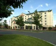
Hilton Garden Inn Springfield
La Quinta Inn and Suites Springfield
Naomi's Inn Bed & Breakfast
Hampton Inn West-Springfield
Tru by Hilton Chicopee Springfield
REGENCY INN AND SUITES
Residence Inn Springfield Chicopee
Videos from this area
These are videos related to the place based on their proximity to this place.
HOBART HIGHLIGHTS: Football dominates Springfield 49-21
Watch highlights from #5/7 Hobart's 49-21 Liberty League win at Springfield. Senior running back Steven Webb ran for 203 yards and three touchdowns and junior defensive end Tyre Coleman broke...
Springfield College Women's Soccer 2014
In the final season with the "Pride" nickname as well as the last season for Dr. Cathie Schweitzer as athletic director, Springfield earns it's third straight NEWMAC title and fifth in seven...
Burned kitten found in Springfield
When animal control officers got a call for an injured kitten in Springfield, they weren't prepared for what they found.
Virginia earthquake felt in Boston
500 miles away from her home in Springfield, Virginia, Kelly Miller was sightseeing in Boston when her family members told her about the 5.9 earthquake that hit close to their home.
Tearing down to build State St. back up
There is now one less building on State Street in Springfield. The first of several buildings was ripped down as a part of the first phase of the city's Eastern Gateway project.
Money secured for Springfield school
Springfield City Councior Amaad Rivera secured assurances the city would pay fair value for property taken for the Forest park Middle School renovation.
Springfield coping, surveying damage
Residents in Springfield and other communities in the path of a deadly tornado are trying to cope with the damage left behind. In Springfield's Six Corners neighborhood, 22News spoke with residents...
Speech at Roger L Putnam Vocational Technical Academy ribbon cutting
Kate Putnam spoke at the ribbon cutting of the Roger L Putnam Vocational Technical Academy about her grandfather, for whom the school is named. Roger Putnam was the CEO of the original Package ...
Cathedral, St. Michael's students moved
After being heavily damaged in the June 1 tornado, Springfield's Cathedral High School and St. Michael's Academy will have their students temporarily moved to separate schools.
Videos provided by Youtube are under the copyright of their owners.
Attractions and noteworthy things
Distances are based on the centre of the city/town and sightseeing location. This list contains brief abstracts about monuments, holiday activities, national parcs, museums, organisations and more from the area as well as interesting facts about the region itself. Where available, you'll find the corresponding homepage. Otherwise the related wikipedia article.
Springfield, Massachusetts
Springfield is the most populous city in Western New England, and the seat of Hampden County, Massachusetts, United States. Springfield sits on the eastern bank of the Connecticut River near its confluence with three rivers; the western Westfield River, the eastern Chicopee River, and the eastern Mill River. As of the 2010 Census, the city's population was 153,060.
Cathedral High School (Springfield, Massachusetts)
Cathedral High School is a Catholic co-educational college-preparatory High School in Springfield, Massachusetts. Opened in 1883 by the Sisters of Saint Joseph at the diocese's Saint Michael's Cathedral, its current facility has been at 260 Surrey Road since 1959 in one of the city's residential neighborhoods. It is one of four Catholic High Schools within the Springfield Roman Catholic Diocese.
Springfield College (Massachusetts)
Springfield College is a private, coeducational college located in Springfield, Massachusetts. Springfield College is most famous as the site where the sport of basketball was invented. Instructor and graduate student James Naismith invented the game in 1891, when Springfield College was known as the International Young Men's Christian Association Training School. The College approximately two miles from downtown Springfield, the site of its central business and entertainment districts.
WSCB
WSCB 89.9 FM is a student run campus radio station at Springfield College in Springfield, Massachusetts. It features an eclectic mix of music as well as news and sports talk from a variety of disc jockeys. WSCB, or The Birthplace, offerings programming seven days a week and broadcasts 24 hours a day. Programming comes from students, faculty, and staff on the Springfield College campus.
Stagg Field (Springfield College)
Stagg Field (formerly known as "Benedum Field") is an athletic field on the campus of Springfield College in Springfield, Massachusetts. It has bleacher seating for 3,867, is the competition field for football, field hockey, and men’s and women’s lacrosse. It is also used for physical education classes and intramural sports. The Springfield College men's and women's soccer teams formerly played on the field. Benedum Field also hosts central vs.
WAIC
WAIC is the college radio station of American International College in Springfield, Massachusetts. It currently serves as a repeater of Connecticut Public Radio.
Bay, Springfield, Massachusetts
The Bay neighborhood is located in Springfield, Massachusetts, near the city's geographic center, approximately two miles east of Metro Center, Springfield, Massachusetts. It contains 556 acres of land, plus streets and railroads. Bay is one of the smallest of the city's seventeen neighborhoods. Its boundaries are well defined: the Boston & Albany Railroad to the north; State Street to the south; Roosevelt Avenue to the east; and the former Highland Division Railroad and part of St.
Old Hill, Springfield, Massachusetts
Old Hill is one of the seventeen neighborhoods of Springfield, Massachusetts. It is composed, almost entirely, of Victorian architecture overlooking Springfield's Metro Center. The Old Hill neighborhood is located approximately one mile east of Metro Center. Old Hill is one of the smallest of the city's seventeen neighborhoods. It contains 240 acres of land, plus streets and railroads.
Upper Hill, Springfield, Massachusetts
The Upper Hill neighborhood is located towards the center of the city of Springfield, Massachusetts, about 2 miles from downtown. This neighborhood contains 329 acres, plus streets and the former rail right-of-way. It numbers among the smallest of Springfield's seventeen neighborhoods. Its principal boundaries are State Street to the north; the former Highland Division Rail Line to the west; Watershops Pond on the east. http://www. springfieldcityhall. com/planning/neighborhood-upper-hill.0.
Watershops Pond
Watershops Pond (or Lake Massasoit) is a lake in the City of Springfield, Massachusetts. It is located in the Upper Hill neighborhood. The City of Springfield's second largest body of water, following the Connecticut River. Watershops Pond features 7 miles of shorelines and 186 acres. It is a major site for fishing, featuring species ranging from Black Crappie, Bluegill, Brown Trout, Chain Pickerel, Channel Catfish, Common Carp, Largemouth Bass, Pumpkinseed, Rainbow Trout, and Yellow Bass.
Roger L Putnam Vocational-Technical High School
Roger L. Putnam Vocational Technical Academy (formerly Roger L. Putnam Vocational-Technical High School) is an American vocational high school located in Springfield, Massachusetts, next to the Springfield High School of Science and Technology. Lead by principal Gilbert Traverso and operating under the authority of the Springfield School Committee, Putnam Vocational provides academic and vocational instruction to students in grades nine through twelve throughout the Springfield area.
Mill River (Springfield, Massachusetts)
The Mill River is a 1.25-mile long tributary of the Connecticut River in Springfield, Massachusetts. It flows from Watershops Pond (also known as Lake Massasoit) to its confluence with the Connecticut River. It is referred to as "The Miracle Mile" in a 2009 master's thesis that outlines possibilities for reclaiming the river's mouth as a recreational area. As of 2011, the final 350 feet of the river, including its mouth, is confined in a pipe underneath Interstate 91 and a car dealership.


