Safety Score: 2,7 of 5.0 based on data from 9 authorites. Meaning we advice caution when travelling to United States.
Travel warnings are updated daily. Source: Travel Warning United States. Last Update: 2024-08-13 08:21:03
Discover Riverdale
Riverdale in Hampden County (Massachusetts) is a city in United States about 321 mi (or 517 km) north-east of Washington DC, the country's capital city.
Local time in Riverdale is now 12:53 AM (Saturday). The local timezone is named America / New York with an UTC offset of -5 hours. We know of 12 airports in the vicinity of Riverdale, of which 5 are larger airports. The closest airport in United States is Westover ARB/Metropolitan Airport in a distance of 7 mi (or 11 km), North-East. Besides the airports, there are other travel options available (check left side).
There is one Unesco world heritage site nearby. It's Statue of Liberty in a distance of 120 mi (or 194 km), South-West. Also, if you like golfing, there are a few options in driving distance. Looking for a place to stay? we compiled a list of available hotels close to the map centre further down the page.
When in this area, you might want to pay a visit to some of the following locations: Hartford, Worcester, Newfane, Keene and Johnston. To further explore this place, just scroll down and browse the available info.
Local weather forecast
Todays Local Weather Conditions & Forecast: 12°C / 54 °F
| Morning Temperature | 2°C / 36 °F |
| Evening Temperature | 9°C / 49 °F |
| Night Temperature | 5°C / 41 °F |
| Chance of rainfall | 0% |
| Air Humidity | 28% |
| Air Pressure | 1009 hPa |
| Wind Speed | Moderate breeze with 9 km/h (6 mph) from South-East |
| Cloud Conditions | Clear sky, covering 8% of sky |
| General Conditions | Sky is clear |
Saturday, 16th of November 2024
13°C (56 °F)
6°C (42 °F)
Sky is clear, gentle breeze, clear sky.
Sunday, 17th of November 2024
9°C (49 °F)
7°C (45 °F)
Light rain, moderate breeze, overcast clouds.
Monday, 18th of November 2024
10°C (51 °F)
6°C (43 °F)
Sky is clear, moderate breeze, clear sky.
Hotels and Places to Stay
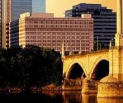
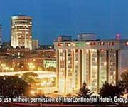
Sheraton Springfield Monarch Place Hotel
Springfield Marriott
Fairfield Inn & Suites Springfield Holyoke
REGENCY INN AND SUITES
HOLYOKE HOTEL AND CONFERENCE CENTER
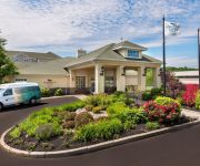
Homewood Suites by Hilton Holyoke-Springfield-North
Hampton Inn - Suites - Springfield-Downtown MA
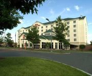
Hilton Garden Inn Springfield
La Quinta Inn and Suites Springfield
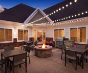
Residence Inn West Springfield
Videos from this area
These are videos related to the place based on their proximity to this place.
West Springfield MA, A Great Place
This is a marketing video that Jx2 Productions produced for the Town of West Springfield, MA. Utilizing some footage and photos provided by the town and in only 6 days, we conceptualized,...
Dental Implants West Springfield MA | Tel: 413-241-3263
Dental Implants West Springfield Massachusetts http://bit.ly/Dental-Implants-West-Springfield With modern technology, the ability to create a more permanent solution for missing teeth has...
General Dentistry West Springfield MA 413-241-3263
General Dentistry West Springfield MA http://bit.ly/General-Dentistry-West-Springfield If you're searching for general dentistry in the West Springfield Massachusetts area, please call the...
City Tire Hunks
City Tire - the best place by far for your car! 11 locations through out New England.
West Springfield, MA Tesla Supercharger
Brief video showing the West Springfield, MA Tesla Supercharger location.
15 04 04 Allie West Springfield Show
Allie at the West Springfield MA show. Even though I had to hide from Allie so that she would not know I was there, I managed to get some decent video of her. It's a little hard when you...
Mini Dental Implants West Springfield MA | Tel: 413-241-3263
Mini Dental Implants West Springfield Massachusetts http://bit.ly/Mini-Dental-Implants-Springfield Mini dental implants provide a secure base and better fit for dentures. Please call Taylor...
Hail Storm In West Springfield Ma.
My First Experience To A Hail Storm, Scary As Fuck I Couldn't Stop Shakingg.
Northeast IT - West Springfield, MA. Corporate video productions for Springfield, Massachusetts
Produced by eTown Videos http://www.etownvideos.com/blog for the Easthampton Chamber of Commerce Northeast IT tailors technology solutions for specific business and residential needs, using...
West Springfield Massachusetts Dentist | 413-241-3263 | Dentist in West Springfield
West Springfield Massachusetts Dentist http://bit.ly/West-Springfield-Massachusetts-Dentist For the latest technology and expertise in dental services we invite you to call Taylor Street Dental...
Videos provided by Youtube are under the copyright of their owners.
Attractions and noteworthy things
Distances are based on the centre of the city/town and sightseeing location. This list contains brief abstracts about monuments, holiday activities, national parcs, museums, organisations and more from the area as well as interesting facts about the region itself. Where available, you'll find the corresponding homepage. Otherwise the related wikipedia article.
West Springfield High School (Massachusetts)
West Springfield High School is the city of West Springfield's high school. It is located near West Springfield Middle School and John R. Fausey Elementary, one of the city's five elementary schools. The school's mascot is the terrier. The high school houses many different sports teams, whose motto is We Bleed the Blue and White, referring to the school's colors. The school and town is known for their exceptional Wrestling and Football programs.
WMAS-FM
WMAS-FM is an Adult Contemporary music formatted radio station licensed to Enfield, Connecticut. In the late 1960s WMAS-FM was an "underground" radio station. Advertising revenue came from the hippie boutiques, head shops, concert venues, and music stores that catered to the counter-cultural youth of the day. This format ended in September 1969 after complaints were made about expletives in a Wild Man Fischer song. A protest movement, in part organized by the DJs, failed to save the format.
WHLL
WHLL (1450 AM, "1450 The Hall") is a radio station broadcasting a sports format. Licensed to Springfield, Massachusetts, it serves the Springfield metropolitan area. It first began broadcasting under the call sign WMAS. Primarily, the station is formatted as a sports station, with programming from CBS Sports Radio. Saturday programming includes more locally-oriented talk shows, including a food show.
WACM (AM)
WACM (1490 AM, "Radio Popular") is a radio station licensed to serve West Springfield, Massachusetts. The station is owned by Davidson Media Station WACM Licensee, LLC. It airs a Spanish language format. The station was assigned the WACM call letters by the Federal Communications Commission on September 15, 1983.
Immaculate Conception Parish, Springfield
Immaculate Conception Parish - designated for Polish immigrants in Springfield, Massachusetts, United States. Founded 1905. It is one of the Polish-American Roman Catholic parishes in New England in the Diocese of Springfield in Massachusetts. Citing insufficient parishioners the diocese had planned to close the parish in 2009. Following closure it would have merged with Christ the King Parish in Ludlow.
Mittineague Elementary
Mittineague Elementary is an elementary school in the neighborhood of Mittineague on Second Street in the city of West Springfield, Massachusetts. It is about 1 mile from Town Hall in downtown. The school offers Grade 1, Grade 2, Grade 3, Grade 4, and Grade 5.
Memorial Square, Springfield, Massachusetts
Memorial Square is a neighborhood located in the northwest corner of Springfield, Massachusetts. Memorial Square is geographically one of the smallest of the city's seventeen neighborhoods. It contains 274 acres, plus street and railroads. Its boundaries are the B & M Railroad to the west; the Chicopee city line to the north; Chestnut, Narragansett, and Bartlett Streets to the east; and Interstate 291 to the south.
Brightwood, Springfield, Massachusetts
The Brightwood neighborhood of Springfield, Massachusetts is located in the northwest corner of the city, along the Connecticut River; however, it is separated from the rest of Springfield by the Interstate 91 elevated highway. Many recent academic papers at the University of Massachusetts Amherst' School of Urban Design have focused on the detrimental physical and sociological effects that Interstate 91 has had on the Brightwood neighborhood, and on Springfield in general.


